The Benefits of LiDAR Technology in Commercial Property Inspections
Modern commercial property inspections require high-precision, efficient, and data-driven approaches. LiDAR (Light Detection and Ranging) technology is a cutting-edge solution for detailed building assessments, structural integrity evaluations, and geospatial mapping.
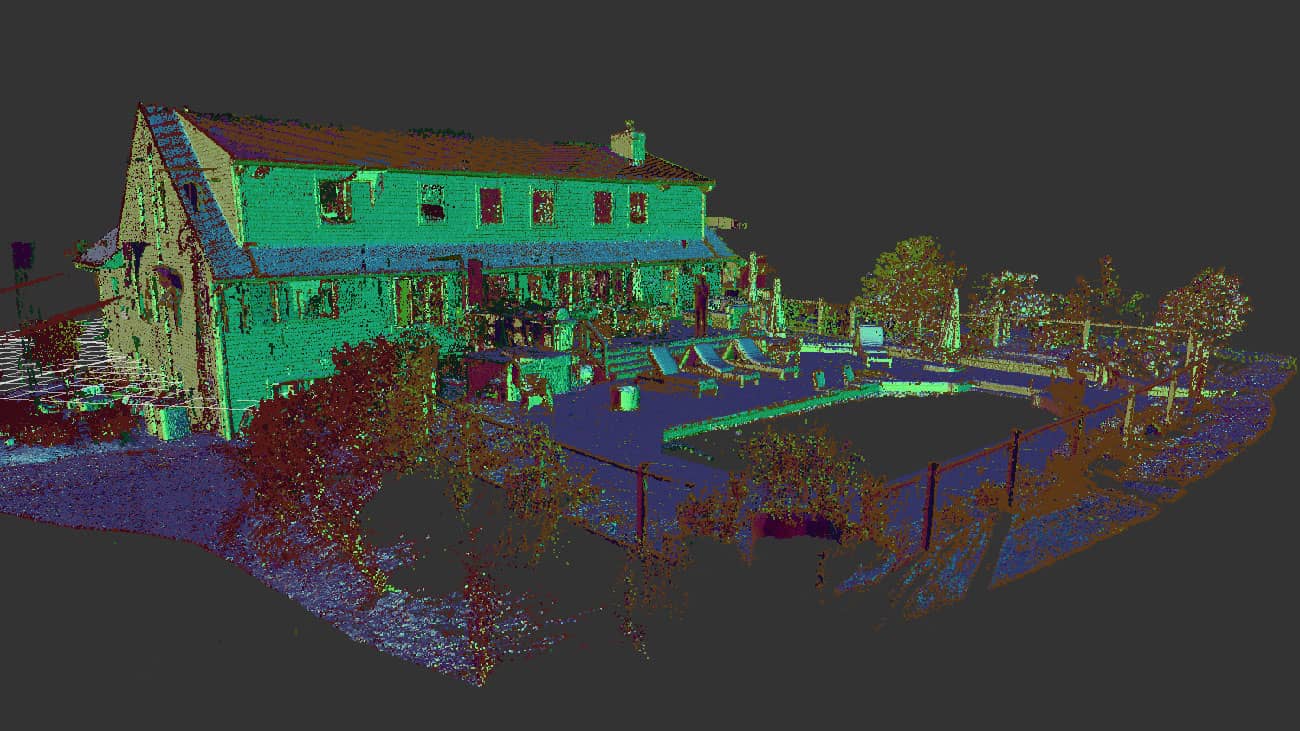
This method allows for the creation of accurate 3D models of commercial buildings, offering valuable insights for real estate developers, property managers, engineers, and urban planners. With LiDAR scanning, professionals can analyze properties with unprecedented detail, helping to prevent structural failures, optimize space utilization, and streamline maintenance planning.
Understanding LiDAR Technology and How It Works
LiDAR is a remote sensing technology that utilizes laser pulses to measure distances and create highly detailed 3D representations of physical structures. This technology works by:
- Emitting laser pulses that bounce off surfaces to capture precise spatial data.
- Measuring the time-of-flight of the laser as it returns to the sensor for precise distance calculations.
- Calculating precise distances and generating point cloud data.
- Processing the data to create high-resolution 3D models.
These 3D models can then be used for structural analysis, property condition assessments, and integration into Building Information Modeling (BIM) systems.
Key Benefits of LiDAR Technology in Commercial Property Inspections
Unparalleled Accuracy & Precision
One of the biggest advantages of LiDAR in commercial inspections is its ability to provide millimeter-accurate measurements. Unlike traditional inspection methods, which rely on manual data collection, LiDAR eliminates errors by capturing every structural detail in high resolution.
This level of accuracy is particularly useful for:
- Pre-construction site analysis
- Post-construction quality control
- Historical building preservation
- Detecting structural deformations
Rapid Data Collection & Reduced Inspection Time
Traditional property inspections can take days or even weeks, especially for large-scale commercial buildings. With LiDAR scanning, entire structures can be mapped within hours, drastically reducing the time required for surveying and data analysis.
This efficiency is beneficial for:
- Real estate transactions requiring quick property assessments
- Time-sensitive building inspections
- Large-scale infrastructure evaluations
Non-Intrusive & Safe Inspection Methods
For older buildings, high-rise structures, or hazardous sites, manual inspections can be dangerous. LiDAR scanning eliminates the need for physical access to hard-to-reach areas, allowing inspectors to safely evaluate building conditions without disrupting operations.
This is particularly useful for:
- Industrial plants with restricted access zones
- Historical landmarks that require preservation
- Structural assessments in disaster-affected areas
Comprehensive Structural Integrity Analysis
LiDAR enables professionals to detect early signs of structural weaknesses, such as:
- Foundation shifts
- Cracks and material degradation
- Load-bearing deficiencies
By integrating LiDAR scans with BIM software, engineers can predict potential failures and plan maintenance strategies accordingly.
LiDAR Applications in Commercial Property Inspections
Real Estate & Property Management
In real estate, LiDAR helps professionals conduct precise property evaluations by providing:
- Detailed 3D floor plans for leasing and renovations
- Accurate square footage measurements for property valuation
- Condition assessments before buying or selling a property
Construction & Facility Maintenance
LiDAR plays a crucial role in construction planning by offering:
- As-built documentation for architects and engineers
- Quality control checks during construction phases
- Monitoring of structural movements over time
Urban Planning & Development
For city planners and developers, LiDAR facilitates:
- Topographic surveys for land use planning
- Geospatial mapping for smart city projects
- Environmental impact assessments
LiDAR vs. Traditional Inspection Methods: A Comparison
| Feature | LiDAR Scanning | Traditional Inspection |
|---|---|---|
| Accuracy | ±2 mm | ±5-10 cm |
| Speed | Hours | Days to weeks |
| Safety | Non-intrusive | Requires physical access |
| Data Format | 3D Point Cloud | 2D sketches/reports |
| Integration | BIM, GIS, CAD | Limited digital compatibility |
LiDAR technology surpasses traditional methods in nearly every aspect, making it a critical tool for modern commercial property inspections.
Future of LiDAR scanning in Commercial Property Inspections
With advancements in drone-based LiDAR scanning, AI-driven analysis, and cloud computing, the future of commercial property inspections is heading toward fully automated, real-time data processing. In the coming years, we can expect:
- AI-powered anomaly detection to identify structural risks.
- Enhanced Cloud-Based Processing for real-time property reports and faster data analysis.
- Seamless Integration with Smart Building Systems for real-time monitoring and data-driven insights.
These innovations will make property inspections more efficient, cost-effective, and data-driven than ever before.
Conclusion
The adoption of LiDAR technology in commercial property inspections represents a significant leap forward in building assessment accuracy, efficiency, and safety. By leveraging high-resolution 3D scanning, property managers, engineers, and real estate developers can make more informed decisions regarding property investments, renovations, and maintenance.
As LiDAR continues to evolve, its role in structural monitoring, smart cities, and real estate analytics will only become more prominent.