TLS, LiDAR, and Photogrammetry: Which 3D Scanning Technology Is Right for Your Project?
For interior designers and architects, understanding 3D scanning methods is essential not only for accurate documentation but also for creating stunning visual presentations. At SCANM2, we pride ourselves on offering next-day on-site service, highly competitive pricing, and unmatched documentation accuracy. In this article, we’ll demystify three major 3D scanning technologies—TLS, LiDAR, and Photogrammetry—by comparing their accuracy, speed, point cloud density, image quality, cost, and average performance metrics. We’ll also show you which method suits various project types, so you can confidently decide on the best solution for your next design venture.
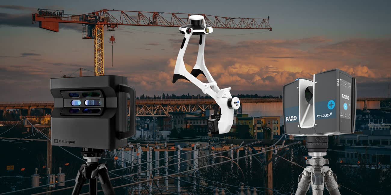
Understanding the 3D Scanning Technologies
1. TLS (Terrestrial Laser Scanning)
What It Is:
TLS is a ground-based laser scanning method renowned for its ultra-high precision. The scanner is placed on a tripod or mounted on a mobile platform, emitting laser beams that measure distances to every point on the object’s surface. This technique is ideal for capturing detailed geometry—making it perfect for precise interior spaces, historical building documentation, or any project where measurement accuracy is paramount.
Key Advantages:
- Maximum Precision: TLS is the go-to method for projects demanding sub-millimeter accuracy. For instance, while LiDAR might deliver measurements with about 6 millimeters of precision, TLS routinely offers even finer details—often within ±1–3 millimeters under optimal conditions.
- Detail-Rich Data: With extremely dense point clouds, TLS can capture every minute architectural feature.
Real-World Example:
Luxury Estate in Los Angeles Transformed with 3D Laser Scanning and As-Built Services.
We partnered with an elite interior design and home remodeling firm to generate a detailed digital plan for a magnificent Mediterranean estate in Los Angeles. The precision provided by TLS empowered our client to achieve a visionary redesign with unparalleled accuracy, ensuring every curve and contour of the structure was faithfully documented.
2. LiDAR (Light Detection And Ranging)
What It Is:
LiDAR uses laser pulses to measure distances and is typically deployed from mobile platforms like drones, vehicles, or aircraft. This technology is especially valuable for covering large areas quickly, making it popular in landscape mapping, resort planning, and urban development.
Key Advantages:
- Rapid Data Collection: Thanks to its high-speed scanning capability, LiDAR can gather hundreds of thousands of points per second. This makes it highly efficient for large-scale projects where time is of the essence.
- High Precision for Wide Areas: With an accuracy level around 6 millimeters, LiDAR provides reliable data for many outdoor applications. Though it may not reach the ultra-high precision of TLS, it offers a solid balance between speed and accuracy.
- Scalability: LiDAR is the method of choice for vast areas—like a 100-hectare resort development—where moderate accuracy (typically within 2–3 centimeters) is sufficient for planning and design.
Real-World Example:
LiDAR Scanning for Resort Planning: Precision Mapping with SCANM2.
For a resort planning project, SCANM2 conducted an extensive LiDAR scanning across 100 hectares using drone-mounted LiDAR technology. This method not only reduced time and costs significantly but also delivered the precise mapping needed for an optimized layout plan.
3. Photogrammetry (Including Matterport Systems)
What It Is:
Photogrammetry involves capturing multiple overlapping photographs from different angles to create 3D models. Unlike TLS and LiDAR, which primarily focus on geometric accuracy, photogrammetry excels at producing photo-realistic textures and visual details. However, because it relies on images, there isn’t a direct way to measure physical accuracy as precisely as with laser-based systems.
Key Advantages:
- Stunning Visuals: Photogrammetry is unbeatable when it comes to capturing the aesthetic essence of a space. It generates stunning, high-resolution images perfect for presentations and marketing materials.
- Cost-Effectiveness: Generally, photogrammetry is less expensive because it only requires a high-quality camera and specialized processing software.
- User-Friendly: Its process is accessible and doesn’t always demand high-end technical expertise to yield visually impressive results.
Real-World Example:
3D Laser Scanning and Yacht Restoration Project.
Commissioned by a prestigious design bureau, this project involved the comprehensive scanning and modeling of a private yacht. While the primary goal was to create accurate 3D models for precise restoration and repair, photogrammetry was employed to capture detailed textures and visual details, resulting in a stunning, realistic representation of the yacht’s interior and exterior.
Comparative Analysis of 3D Scanning Technologies
Below is a comparison table that highlights the key parameters for each technology, making it easy for you to see the differences at a glance.
| Parameter | TLS (Terrestrial Laser Scanning) | LiDAR | Photogrammetry / Matterport |
|---|---|---|---|
| Accuracy | Ultra-high: ±1–3 mm (ideal for critical measurements) | High: approximately ±6 mm (suitable for large area projects with moderate accuracy requirements, typically within 2–3 cm for some applications) | Not directly measurable; typically offers accuracy in the range of ±1–5 cm, depending on processing and conditions |
| Data Collection Speed | Moderate: Each scan takes time due to sequential point capture | Very high: Capable of collecting hundreds of thousands of points per second; optimal for quickly covering extensive areas | Variable: Depends on the number of photos and processing time; can be slower for large objects |
| Point Cloud Density | Extremely high: Millions of points for detailed models | High: Density depends on flight altitude and pulse frequency; ideal for comprehensive mapping | Moderate to high: Depends on camera resolution and shot overlap |
| Image Quality / Texture | Lacks color data; focuses on geometric accuracy | Often captured in grayscale, but can be enhanced with RGB data when combined with photogrammetry | Exceptional: Produces photorealistic textures and detailed imagery |
| Cost (Equipment & Labor) | Higher-end: Requires specialized equipment and software | Moderate to high: Cost varies based on platform (drones, aircraft) and project scope | Lower to moderate: Uses standard cameras and accessible software solutions |
| Average Figures | Scanning speed: ~5–20 points/sec (depending on settings and environment) | Scanning speed: Up to hundreds of thousands of points/sec in flight conditions | Accuracy: ±1–5 cm (subject to environmental conditions and processing quality) |
Note: The figures provided below are based on reputable sources and are approximate. Actual values may vary depending on equipment and scanning conditions.
Choosing the Right Technology for Your Project
Each scanning method offers its own set of strengths and limitations. The key is to match the technology to the project’s requirements:
- For Large-Scale Projects. When dealing with vast areas such as resort developments or urban planning, LiDAR is the clear choice. Its rapid data acquisition and sufficient accuracy (typically within 2–3 centimeters) make it ideal for broad mapping efforts where speed is essential and ultra-high precision is not mandatory.
- For Precision Industrial Measurements. When the project demands maximum accuracy—such as intricate interior detailing or historical building preservation—TLS is unrivaled. Its ability to capture minute details with a precision of ±1–3 mm is critical for ensuring that every aspect of the structure is documented accurately.
- For Aesthetic-Driven Projects. If your primary focus is on the visual appeal of a space—say, for marketing or design presentations—Photogrammetry is your best bet. While it may not provide the measurement precision of TLS or LiDAR, its strength lies in delivering high-quality, photorealistic images that truly bring your vision to life.
It’s essential to note that no one technology fits every scenario perfectly. The optimal approach is often a customized blend that balances both the technical requirements and aesthetic goals of the project. At SCANM2, we’re proud to offer expertise across all three technologies. This allows us to guide you in selecting the best method—or a tailored combination—to guarantee your project’s success.
SCANM2: Your One-Stop 3D Scanning Partner
At SCANM2, our commitment is to deliver precision, speed, and cost-effective solutions without compromise. Here’s why partnering with us makes a difference:
- Next-Day On-Site Service. We understand that time is money. That’s why our team is ready to mobilize and be on-site the very next day after your order.
- Competitive Pricing. High-quality documentation doesn’t have to break the bank. Our solutions are built for cost efficiency, delivering top-quality service at a competitive price.
- Unmatched Accuracy. Whether it’s a small interior space or a sprawling outdoor area, we use the right technology for the job. With TLS for precise measurements, LiDAR for speedy large-area mapping, and photogrammetry for beautiful visual documentation, we have the expertise to meet every project need.
We invite you to explore our portfolio and see firsthand how our state-of-the-art scanning technologies can elevate your next project. Whether your focus is on precision measurements, expansive area mapping, or creating stunning visual presentations, SCANM2 has the solution for you.
Final Thoughts
In an industry where precision meets creativity, the right 3D scanning technology can make all the difference. By recognizing the strengths and limitations of TLS, LiDAR, and Photogrammetry, you can make well-informed decisions that align with your design vision and project needs.
- Large objects? Consider LiDAR for its rapid data capture and sufficient precision.
- Need ultra-high accuracy? TLS is your best choice.
- Want to showcase beautiful imagery? Turn to photogrammetry for photorealistic visuals.
At SCANM2, our comprehensive expertise in all three methods means we can tailor our approach to your unique needs. Contact us today to discuss how we can bring your design projects to life with next-day service, competitive pricing, and the highest level of documentation accuracy available.
Feel free to reach out or visit our website to learn more about how our 3D scanning solutions can transform your next project.