Revolutionizing Landscape Architecture with 3D Laser Scanning
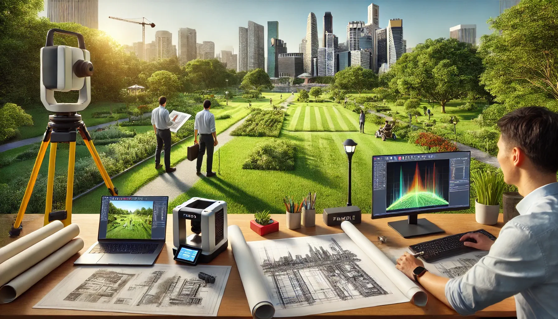
Our company, ScanM2, provide high-resolution, accurate digital models that are crucial for landscape architects, designers, and engineers working on complex projects. Our services extend beyond traditional surveying techniques. Using advanced 3D laser scanners like Faro, Leica, and Trimble, we offer unrivaled accuracy at a competitive price. Whether it’s a building, infrastructure, or an intricate landscape design, we ensure that your project has a solid digital foundation.
The Power of 3D Laser Scanning in Landscape Architecture
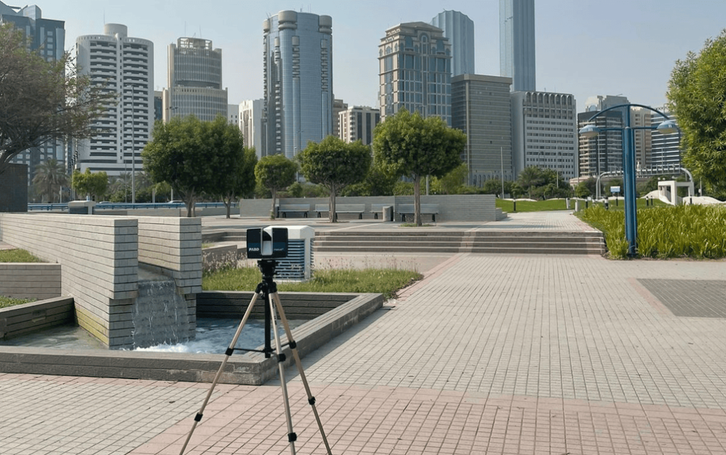
The process of landscape architecture demands exactitude. Every tree, building, slope, and feature must be perfectly measured and documented. Traditionally, manual methods of surveying were prone to error and consumed valuable time. However, 3D laser scanning revolutionizes this process, allowing landscape architects to capture data with millimeter precision.
Our 3D landscape scanning services can provide detailed scans of large areas or focused scans of specific sites, delivering point cloud data that can be seamlessly integrated into your Building Information Modelling (BIM) workflows. This technology is not only significantly faster but also far more accurate than traditional manual methods. With us, the margin for error is practically non-existent.
The Benefits of 3D Laser Scanning for Landscape Architecture Firms
- Accuracy: Our 3D landscape design models offer unmatched accuracy. Whether you’re planning urban parks, commercial properties, or residential landscapes, precise measurements are crucial to avoid costly mistakes during construction.
- Speed: 3D laser scanning is far faster than traditional surveying methods. Instead of days or weeks, projects can be scanned and digitized in mere hours, allowing landscape architecture companies to work on tighter deadlines without sacrificing quality.
- Integration with BIM: Our scans can easily be integrated into Scan to BIM workflows, providing a seamless transition from the real-world environment to the virtual model. This guarantees that any modifications or design iterations are grounded in the most precise data available.
- Cost-Effective: Contrary to common belief, our 3D scanning services are affordable. We use professional-grade scanners, which provide more accurate results than handheld scanners, and offer a pricing structure that is competitive and transparent. For clients with ongoing projects, we also offer a bonus program with exclusive discounts for repeat business.
How 3D Scanning Helps Landscape Architecture Companies Deliver Quality
Landscape architecture firms must work in harmony with existing structures, natural elements, and engineering constraints. Any small error in measurements can result in delays, budget overruns, or poor design outcomes. Our 3D laser surveys capture every detail of your project site, ensuring that the landscape architects and designers can trust the accuracy of their data.
By employing 3D landscape scanning, designers can visualize not just how a site looks, but how it interacts with its surroundings—elevation changes, vegetation, infrastructure, and more. This enables more informed decision-making during the design phase, ultimately leading to higher-quality project outcomes.
Why Choose ScanM2 for Your Landscape Architecture Project?
At ScanM2, we’re not just another scanning company. We are proud to offer customized services that are specifically designed to address the unique requirements of landscape architecture firms. From small residential projects to large-scale urban landscapes, we provide data that can guide every phase of design and construction. Here’s why we’re the right choice for your next project:
- High-Precision Scanning: With equipment from Faro, Leica, and Trimble, we offer 3D surveys that capture every detail, from the smallest architectural feature to vast landscapes.
- Affordability: Unlike competitors who rely on handheld scanners, our professional-grade equipment allows us to offer a cost-effective service with superior accuracy. We make 3D scanning accessible for firms of all sizes.
- Versatility: Our scans are not limited to landscapes alone. We also specialize in scanning buildings, infrastructure, and mechanical systems, allowing you to capture a complete picture of your project environment.
- Bonus Programs for Repeat Clients: We value long-term relationships. That’s why we offer exclusive bonuses and discounts for returning clients.
Use Cases for 3D Laser Scanning in Landscape Architecture
- As-Built Documentation: Capturing existing conditions is a critical part of any landscape architecture project. Our as-built scans provide a precise digital representation of the site as it exists, ensuring that your designs align with reality.
- Historical Preservation: When working on historic sites or sensitive environments, accuracy is paramount. Our laser surveys can capture every detail of a site without invasive techniques, preserving its integrity while providing the data you need.
- Site Planning and Analysis: Understanding the terrain is essential for effective design. With 3D laser scanning, you can obtain accurate topographical data, ensuring that your designs work with, rather than against, the natural landscape.
- Urban Development: For landscape architecture companies involved in urban planning, we offer the ability to scan entire city blocks, capturing every building and open space. This data enables precise, comprehensive planning that fully considers the existing infrastructure.
The Future of Landscape Architecture with 3D Laser Scanning
As the demand for more sustainable, accurate, and efficient designs grows, the role of 3D laser scanning in landscape architecture will only increase. Firms that embrace this technology are better positioned to deliver superior projects faster, under budget, and with fewer errors. From urban parks to rural estates, our 3D models and 2D drawings give designers the insights they need to make informed decisions.
Our expertise in scanning to BIM also ensures that your digital assets are ready for future use, allowing for easier updates, modifications, or even expansions of your designs over time. At ScanM2, we are dedicated to pushing the boundaries of what’s possible with 3D laser scanning technology, constantly enhancing its capabilities to better serve our clients.
Contact Us Today
Ready to transform your next landscape architecture project? Our team is ready to deliver the data you need for accurate, efficient, and cutting-edge designs. Fill out the form below to get started with our 3D laser scanning services and see how we can help you elevate your work.
FAQs
How does 3D laser scanning benefit landscape architecture firms?
3D laser scanning offers precise, accurate data that is crucial for creating detailed landscape designs. It speeds up the data collection process, reduces errors, and integrates easily into BIM workflows, allowing for better design outcomes.
What is the difference between 3D laser scanning and traditional surveying methods?
Traditional surveying methods depend on manual measurements, which are often time-consuming and susceptible to errors and inaccuracies. In contrast, 3D laser scanning collects millions of data points in seconds, providing a significantly more detailed and accurate representation of the site.
Is 3D laser scanning expensive?
Not at ScanM2. We offer highly competitive pricing, often more affordable than companies using handheld scanners. Additionally, our bonus program for returning clients makes our services increasingly cost-effective over time.
What kind of equipment do you use for 3D scanning?
We use professional-grade scanners from Faro, Leica, and Trimble. These devices ensure the highest level of accuracy and detail in our scans.
Can 3D scans be integrated into BIM?
Yes, our scans are fully compatible with Building Information Modeling (BIM) workflows, ensuring seamless integration into your projects. This allows landscape architects to seamlessly incorporate real-world data into their designs.
Do you offer services for urban landscape projects?
Absolutely. Our 3D laser scanning services are ideal for large-scale urban projects, providing the precision and detail necessary for successful urban planning and development. We have the capability to scan entire city blocks, delivering comprehensive data for urban planning and development initiatives.