How 3D Laser Scanning Improves Land Surveying and Site Analysis


Land surveying is a fundamental step in planning and construction projects, providing critical insights into site conditions, topography, and property boundaries. Traditional methods, while effective, often require significant time and resources, and they can be limited by environmental challenges and human error.
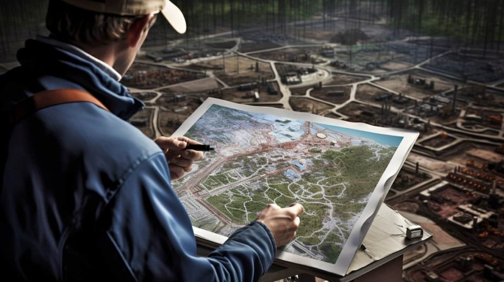
With the advent of 3D laser scanning for land surveying, the industry is experiencing a significant transformation. Advanced scanning technologies allow for highly accurate and detailed site analysis, reducing survey time while increasing precision. This article explores how topographic survey 3D scanning and digital site mapping are redefining land development and terrain analysis.
The Evolution of Land Surveying: From Traditional Methods to 3D Laser Scanning
Land surveying has historically relied on manual measurements, total stations, theodolites, and GPS technology. While these tools provide valuable data, they can be time-consuming and are often dependent on the skill of the surveyor. A site survey with 3D scanning, on the other hand, streamlines data collection by capturing millions of precise data points in seconds, creating a highly detailed digital terrain model.
How 3D Laser Scanning Works:
- A laser scanner emits pulses of light that bounce off surfaces and return to the device.
- The scanner calculates distances based on the time it takes for the pulses to return, generating a dense point cloud.
- These data points are processed into a highly accurate 3D model of the landscape, including natural and man-made features.
- The resulting digital site mapping allows for comprehensive terrain analysis without extensive manual labor.
By shifting from manual to terrain mapping with 3D laser scanning, professionals can work with unparalleled accuracy while eliminating the potential for human error.
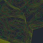
Our LiDAR Scanning Results


Key Benefits of 3D Laser Scanning in Land Surveying and Site Analysis
1. Unmatched Accuracy and Detail
One of the greatest advantages of 3D laser scanning for land surveys is its ability to capture incredibly detailed measurements. Unlike traditional surveying techniques that rely on discrete data points, 3D scanning generates a dense dataset, ensuring that no critical terrain feature is overlooked.
This precision is especially beneficial for topographic mapping technology, where every slope, elevation change, and obstruction is recorded with sub-millimeter accuracy. It allows engineers and architects to work with highly reliable data when making design decisions.
2. Faster Data Collection
Speed is a game-changer in the world of surveying. Where traditional methods might require days or weeks to complete a land development site survey, 3D scanning for construction sites can capture the necessary data in just a few hours.
This efficiency is particularly useful for large-scale infrastructure projects where time-sensitive decision-making is crucial. Contractors and developers can start working with survey data almost immediately, allowing for streamlined project execution.
3. Enhanced Safety
Surveying hazardous environments—such as active construction zones, steep terrains, or remote locations—can be risky. Site surveys with 3D scanning minimize exposure to danger by allowing surveyors to collect data from a safe distance. Drones equipped with LiDAR sensors can further enhance this process by scanning difficult-to-reach areas, ensuring comprehensive terrain mapping without putting personnel at risk.
4. Comprehensive Digital Documentation
With topographic survey 3D scanning, the collected data is stored digitally, creating a permanent and detailed record of the site. This digital documentation is useful for:
- Project planning and design
- Legal boundary verification
- Historical site analysis and conservation
- Ongoing site monitoring and progress tracking
The ability to revisit and analyze site data at any time without requiring additional on-site visits improves efficiency and minimizes the risk of disputes or errors.
5. Better Integration with BIM and CAD
Modern 3D scanning for land surveying seamlessly integrates with Building Information Modeling (BIM) and Computer-Aided Design (CAD) software. This compatibility ensures that engineers, surveyors, and architects have access to the same precise dataset, reducing discrepancies and enhancing collaboration across disciplines.
By importing high-resolution 3D scans into design software, professionals can generate accurate terrain models, zoning plans, and infrastructure designs that align with the actual site conditions.
6. Seamless Terrain Analysis for Planning and Design
Topographic and geospatial analysis is crucial for urban planning, infrastructure projects, and environmental studies. With topographic mapping technology, professionals can evaluate terrain conditions, water drainage patterns, soil stability, and elevation changes before initiating construction. This information helps in avoiding costly mistakes and ensures that the site is well-prepared for development.
Practical Applications of 3D Laser Scanning in Land Surveying
Urban Planning and Infrastructure Development
City planners rely on digital site mapping to optimize space utilization and plan future expansions. Whether designing new highways, railways, or commercial developments, accurate terrain mapping with 3D laser scanning ensures that proposed projects are aligned with existing landscapes and infrastructure.
Environmental and Geological Studies
3D laser scanning for land surveys is also widely used in environmental monitoring. Geologists and conservationists use it to study erosion, landslides, flood zones, and natural formations, helping decision-makers develop sustainable land-use strategies.
Construction and Land Development
For land development site surveys, accurate data collection is essential for zoning approvals, excavation planning, and infrastructure placement. Builders and engineers rely on precise 3D models to assess site feasibility and prevent costly errors during development.
Archaeological and Historical Site Preservation
Preserving historical sites requires non-invasive documentation methods. 3D scanning for construction sites can be applied to archaeological studies, capturing intricate details of ancient structures and artifacts without causing physical damage.
Future Trends in 3D Laser Scanning for Land Surveying
The future of topographic mapping technology is advancing rapidly. Emerging trends include:
- AI-powered terrain analysis, which can automate feature recognition and streamline data interpretation.
- Drone-based LiDAR scanning, which enables large-scale aerial mapping with enhanced efficiency.
- Cloud-based 3D data storage, allowing for real-time sharing and collaboration among project teams.
As technology continues to evolve, 3D scanning for land surveys will become even more accessible, accurate, and integrated into everyday surveying practices.
Conclusion
From site surveys with 3D scanning to digital site mapping, laser scanning has revolutionized land surveying by providing unparalleled precision, efficiency, and safety. With advancements in topographic survey 3D scanning, professionals can work with highly detailed and accurate data, ensuring better project outcomes.
Companies like ScanM2.com are at the forefront of this revolution, delivering state-of-the-art 3D scanning solutions that empower architects, engineers, and land developers to build smarter, faster, and more efficiently.