

Professional LiDAR Scanning Services in USA for Mapping, Construction & 3D Modeling
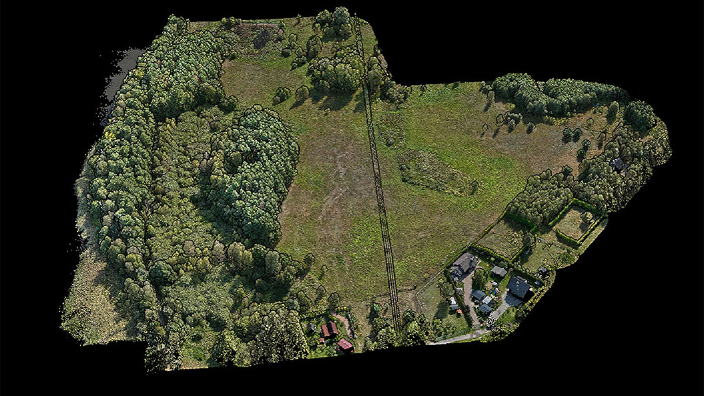
We provide professional LiDAR scanning services for construction, engineering, and mapping projects across the USA. Using aerial, mobile, and terrestrial LiDAR systems, we deliver high-density, BIM-ready point clouds with millimeter-level accuracy.
✔ Nationwide coverage
✔ Fast turnaround
✔ Survey-grade accuracy
✔ Construction-ready deliverables
Contact Us Now for a Free Consultation!
Why Choose ScanM2 for LiDAR Scanning Services?
Millimeter-Level Accuracy
Our LiDAR scanning technology delivers precise measurements for buildings, infrastructure, terrain, and complex environments.
Fast Project Delivery
High-speed data capture and optimized LiDAR data processing reduce field time and overall project schedules by up to 70%.
Any Terrain, Any Conditions
We operate drone, mobile, and terrestrial LiDAR scanning systems for urban areas, highways, forests, industrial sites, and heritage structures.
Full LiDAR Data Processing Services
From raw point clouds to classified, structured datasets, CAD drawings, BIM models, DEM/DTM, and GIS outputs.
End-to-End Support
From consultation and scanning strategy to final delivery and QA — one LiDAR service provider for the entire workflow.
LiDAR Scanning and Scan-to-BIM Workflow
This video shows LiDAR point cloud data captured from laser scanning and its transformation into a structured 3D model. The workflow demonstrates how LiDAR data is processed and prepared for BIM and engineering applications.
LiDAR Services We Provide
Drone LiDAR Scanning Services
Aerial LiDAR scanning for large territories, corridors, highways, pipelines, mining areas, and urban environments.
Terrestrial LiDAR Scanning Services
High-precision ground-based LiDAR scanning for buildings, interiors, façades, industrial facilities, and heritage sites.
LiDAR Mapping Services
Topographic mapping, DEM/DTM generation, contour lines, surface models, and geospatial analysis.
LiDAR for 3D Modeling & BIM
Scan-to-BIM workflows, as-built documentation, 3D models, digital twins for construction and architecture.
LiDAR Data Processing Services
Point cloud registration, cleaning, classification, segmentation, surface modeling, CAD drawings, and BIM integration.
How LiDAR Scanning Works
Our LiDAR Scanning Workflow:
1. Consultation & Project Planning
Defining project goals, accuracy requirements, site conditions, and optimal LiDAR scanning methods.
2. On-Site LiDAR Scanning
Drone, mobile, or terrestrial LiDAR systems capture millions of 3D points per second.
3. LiDAR Data Processing
Registration, noise removal, georeferencing, classification, and modeling.
4. Data Delivery
Point clouds, CAD drawings, BIM models, DEM/DTM, GIS data, or digital twins in required formats.
LiDAR Scanning Applications (Industries We Serve)
Construction & Engineering
- As-built models
- Clash detection
- Structural monitoring
- Site progress verification
Topographic Mapping & Land Surveying
- Digital terrain models (DTM/DEM)
- Contour generation
- Earthwork calculations
- Corridor mapping
Architecture & Heritage Preservation
- Facade and historic building scanning
- Deformation analysis
- Restoration planning
Infrastructure & Urban Planning
- Roads, bridges, railways
- Utility corridors
- Smart city planning
- Drainage and flood modeling
Forestry & Environmental Studies
- Vegetation analysis
- Canopy and biomass estimation
- Flood risk modeling
Advantages of LiDAR Scanning Over Traditional Surveying
| Feature | Traditional Surveying | LiDAR Scanning |
|---|---|---|
| Speed | Slow, manual | Up to 10× faster |
| Accuracy | Depends on manual work | Millimeter-accurate |
| Coverage | Limited | Large areas captured in minutes |
| Safety | Requires physical access | Remote scanning, drones |
| Deliverables | 2D only | Full 3D, CAD, BIM, GIS |
| Cost Efficiency | Higher field cost | 40–70% lower field time |
| Complexity Handling | Low | Works in forests, tunnels, roofs |
📌 Source: McKinsey Global Institute, Autodesk AEC Report, USGS LiDAR Program.
Why LiDAR Scanning Is Transforming Modern 3D Mapping
- Captures millions of points per second
- Works in dense forests and complex environments
- Penetrates vegetation
- Ideal for slope modeling, road analysis, flooding, and terrain mapping
- Integrates seamlessly with BIM, CAD, and GIS workflows
According to USGS, LiDAR improves elevation model accuracy by up to 500% compared to traditional photogrammetry.
LiDAR Scanning Examples
Our LiDAR Scanning Results


- Aerial LiDAR mapping of a 247-acre resort site
- High-density point cloud of industrial facilities
- Terrestrial LiDAR of heritage buildings
- Drone LiDAR corridor mapping
- LiDAR-based terrain modeling for engineering
Frequently Asked Questions
What is LiDAR scanning used for?
How accurate is LiDAR scanning?
How long does a LiDAR scanning project take?
Can LiDAR scanning be used for historical sites?
What industries benefit from LiDAR scanning?
Is drone LiDAR better than photogrammetry?
Do you provide BIM or CAD models from LiDAR?
Get a Free LiDAR Consultation
Looking for a reliable LiDAR service provider in the USA?
Contact ScanM2 to discuss your project requirements, accuracy needs, and deliverables.

