LiDAR vs Laser Scanning: What’s the Real Difference?


The terms LiDAR, laser scanning, and laser scanners are often used interchangeably — even within the construction and engineering industry. This confusion leads to poor technology choices, inflated budgets, and mismatched deliverables.
At ScanM2, we work daily with laser scanning and LiDAR-based workflows for construction, BIM, and as-built documentation. In this article, we clarify the real difference between LiDAR vs laser, explain where confusion comes from, and help you understand which approach actually fits your project — without overselling or technical myths.
Laser Scanner vs LiDAR: Clearing Up the Terminology
A laser scanner is a physical device. It emits laser pulses and measures the distance to surrounding objects.
LiDAR (Light Detection and Ranging) is a technology and measurement methodology. It combines:
- laser emission,
- distance measurement,
- positioning and orientation data,
- and software processing
to generate spatial datasets, typically point clouds.
In short:
- A laser scanner is the tool
- LiDAR is the technology and workflow behind it
That’s why comparing laser scanner vs LiDAR without context often creates confusion.
LiDAR vs Laser Scanning: Why These Terms Are Mixed Up
The reason LiDAR vs laser scanning is so often misunderstood is simple:
most modern terrestrial laser scanners use LiDAR technology internally.
As a result:
- Laser scanning describes how data is captured
- LiDAR describes how the measurement works
They are closely related, but not interchangeable terms.
Terrestrial Laser Scanning vs LiDAR: Are They the Same?
This is where the distinction becomes practical.
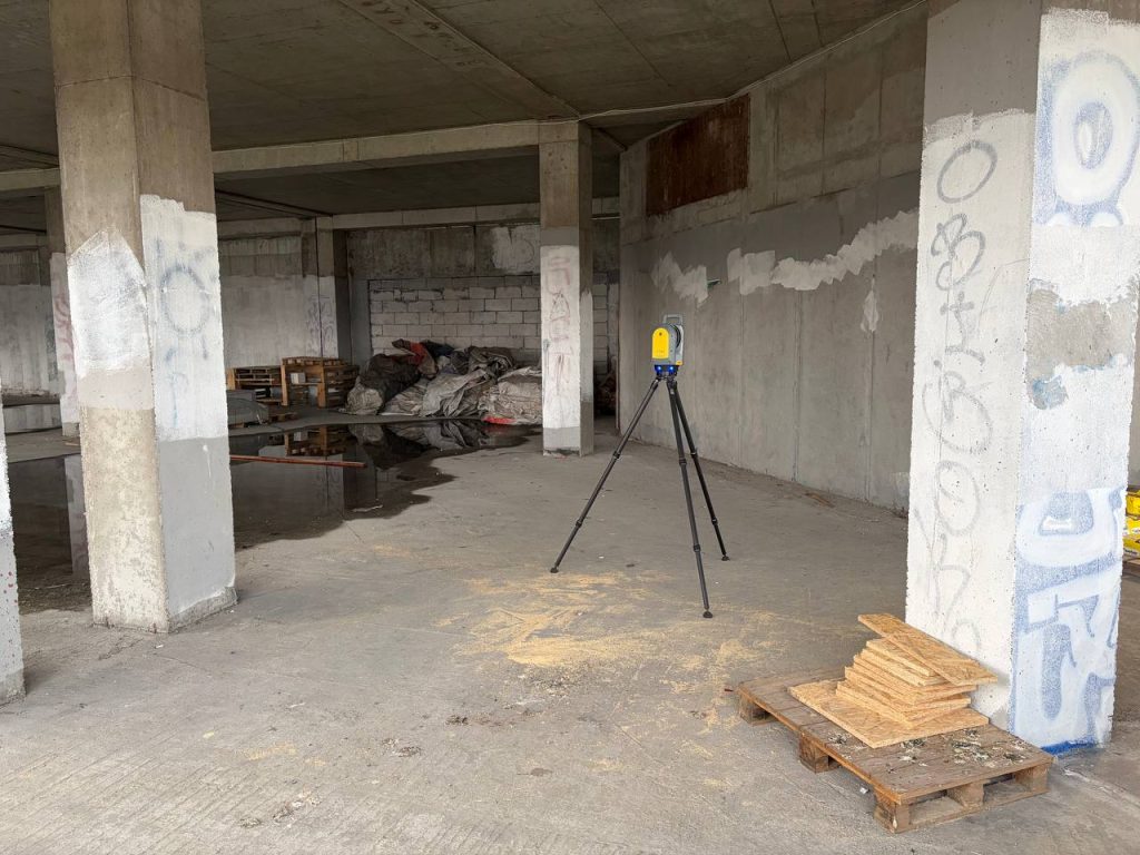
Terrestrial Laser Scanning (TLS) is one specific application of LiDAR, optimized for ground-based, high-precision measurement of buildings and structures.
When comparing terrestrial laser scanning vs LiDAR, the correct interpretation is:
- TLS is a subset of LiDAR
- LiDAR also includes other platforms with very different accuracy levels
Main LiDAR system types:
- Terrestrial LiDAR (TLS) — stationary, ground-based scanners
- Mobile LiDAR (MLS) — vehicle-mounted systems
- Aerial LiDAR (ALS) — drones or aircraft
Only TLS delivers the precision required for BIM and engineering-grade as-built documentation.
LiDAR vs Laser Scanning: Accuracy Comparison
Accuracy is the single most important factor when choosing a scanning method. This table summarizes the real-world differences and is especially useful for quick decision-making.
LiDAR Accuracy Comparison Table
| Scanning Method | Typical Accuracy | Common Use Cases |
| Terrestrial Laser Scanning (TLS) | ±2–3 mm | BIM, as-built drawings, MEP coordination, renovations |
| Mobile LiDAR (MLS) | ±10–30 mm | Roads, corridors, infrastructure surveys |
| Aerial LiDAR (ALS) | ±50–150 mm | Terrain mapping, urban planning, large areas |
This is why asking “laser vs LiDAR” without specifying the platform almost always leads to the wrong conclusion.
LiDAR vs Laser Scanning in Construction and BIM
For construction and renovation projects, terrestrial laser scanning is the only LiDAR-based method that provides sufficient accuracy for engineering workflows.
At SсanM2, TLS data is commonly used for:
- As-built documentation
- Scan to BIM projects
- Structural verification
- MEP clash detection
- Retrofit and renovation planning
Deliverables typically include:
Other LiDAR platforms are valuable for large-scale mapping, but they are not designed for building-level precision.

When Full LiDAR Is Overkill
Not every project needs the highest possible level of reality capture.
In some cases, full terrestrial laser scanning may be unnecessary when:
- The project is conceptual
- Existing drawings are reliable
- Only approximate geometry is required
- BIM integration is not planned
Choosing the right level of detail, rather than the most advanced technology, often saves both time and budget.
How ScanM2 Approaches LiDAR and Laser Scanning Projects
We don’t push technology for its own sake. Every project starts with a technical assessment to determine:
- required accuracy,
- intended deliverables,
- BIM or non-BIM workflow,
- and actual project constraints.
This approach ensures that laser scanning and LiDAR are used where they add value, not where they create unnecessary complexity.
Not sure which scanning method fits your project? Our engineers can help you choose the right level of reality capture — without overengineering.
FAQ
Is LiDAR the same as laser scanning?
What is the difference between laser scanner and LiDAR?
Which LiDAR type is best for BIM?
Is aerial LiDAR suitable for building documentation?
Do all projects need full LiDAR scanning?
Final Takeaway
The discussion around lidar vs laser often misses the real question: what accuracy and deliverables does your project require?
LiDAR is not a single solution — it’s a family of technologies. Terrestrial laser scanning is simply the most precise branch, designed specifically for buildings and engineering workflows.
Choosing the right approach starts with understanding the difference.
Rear more:
- What is LiDAR Scanning and How Does It Work?
- How LiDAR Technology Transforms Commercial Real Estate Inspections
- The Benefits of LiDAR Technology in Commercial Property Inspections
- Can LiDAR See Through Ground or Walls?
- How LiDAR Assists in Designing Shopping Malls
- Integrating LiDAR with CAD and BIM Software
- LiDAR Scanning in BIM Modeling
- LiDAR in Civil Engineering: Applications and Advantages
- TLS, LiDAR, and Photogrammetry: Which 3D Scanning Technology

ScanM2 at INTERGEO 2026 in Munich – Meet Us at the World’s Leading Geospatial Technology Exhibition
10.07.2026
This September, ScanM2 will participate as an exhibitor at INTERGEO 2026, the world’s leading trade fair for geodesy, surveying, laser scanning, mapping, BIM, GIS, and ...

When a Point Cloud Should Become CAD and When It Should Become BIM
11.05.2026
Laser scanning technology allows project teams to capture highly accurate information about existing buildings. After scanning is completed, the result is typically a point cloud — ...

Point Cloud to CAD: How Laser Scan Data Becomes Technical Drawings
07.05.2026
Laser scanning technology has changed the way existing buildings are documented for renovation, reconstruction, and design projects. Instead of relying only on manual measurements, architects ...

ScanM2 at Salone del Mobile.Milano
27.04.2026
ScanM2 proudly took part in the Milan Furniture Fair — one of the world’s most influential events where global trends in architecture, interior design, and ...