3D Laser Scanning, Point Cloud Processing, CAD Drafting, BIM, and 3D Modeling Services

preview image

3D Laser Scanning Services for Architecture and Construction in the USA

ScanM2 provides high-precision 3D scanning services in the USA, delivering accurate LiDAR capture, as-built documentation, Scan-to-BIM modeling, and CAD outputs for architecture, construction, and industrial ...

preview image

As-Built Electrical Plans USA — Accurate Electrical Drawings for Residential and Commercial Projects

Professional Scan to BIM services for architects, engineers, and construction professionals. Convert point cloud data into accurate BIM models for efficient planning and execution.

preview image

Professional Reverse Engineering — Prices, Cost & 3D Scanning Services | SCANM2 USA

Professional Scan to BIM services for architects, engineers, and construction professionals. Convert point cloud data into accurate BIM models for efficient planning and execution.

preview image

Revit Drawing Services in USA for Architectural, Structural & MEP Documentation

Professional Revit drawing services from ScanM2. Affordable, accurate 3D laser scanning for construction, MEP, HVAC, and electrical systems. Contact us for a quote!

preview image

CAD to BIM Conversion Services

Professional Scan to BIM services for architects, engineers, and construction professionals. Convert point cloud data into accurate BIM models for efficient planning and execution.

preview image

3D Laser Scan to BIM & Point Cloud to BIM Modeling Services at Competitive Cost

Professional Scan to BIM services for architects, engineers, and construction professionals. Convert point cloud data into accurate BIM models for efficient planning and execution.

preview image

Professional LiDAR Scanning Services in USA for Mapping, Construction & 3D Modeling

Get high-precision LiDAR scanning services for construction, engineering, and infrastructure projects. Fast, accurate, and cost-effective 3D laser scanning solutions.

preview image

Professional MEP Drawings – Accurate Mechanical, Electrical & Plumbing Documentation

Professional MEP Drawings with 3D laser scanning for accurate Mechanical, Electrical, and Plumbing designs. Get your building plans today!

preview image

3D modeling company in the USA for Architecture, Construction, and Engineering

We create a detailed 3D models to implement architectural and design solutions.

preview image

Professional As-Built Drawings Services: Architectural & Construction Documentation in USA

Whether you need 2D As-Built Floor Plans or comprehensive As-Built Documentation, we provide exceptional quality at some of the most competitive prices in the market.

preview image

BIM Outsourcing Services for Architecture, Modeling & Design | BIM Services Near Me in USA

Our BIM services enable visualization of the entire building lifecycle, from design through construction to maintenance, ensuring optimal efficiency and accuracy.

preview image

Point Cloud Services – Scanning, Modeling & 3D Conversion

Point cloud modeling is the process of transforming point clouds—dense arrays of data points gathered through 3D laser scanning—into 3D models.

3D Laser Scanning Surveys, As-Built and Measured Building Services for Construction and Architecture

SCANM2 provides professional 3D laser scanning and as-built survey services for construction and architecture projects.

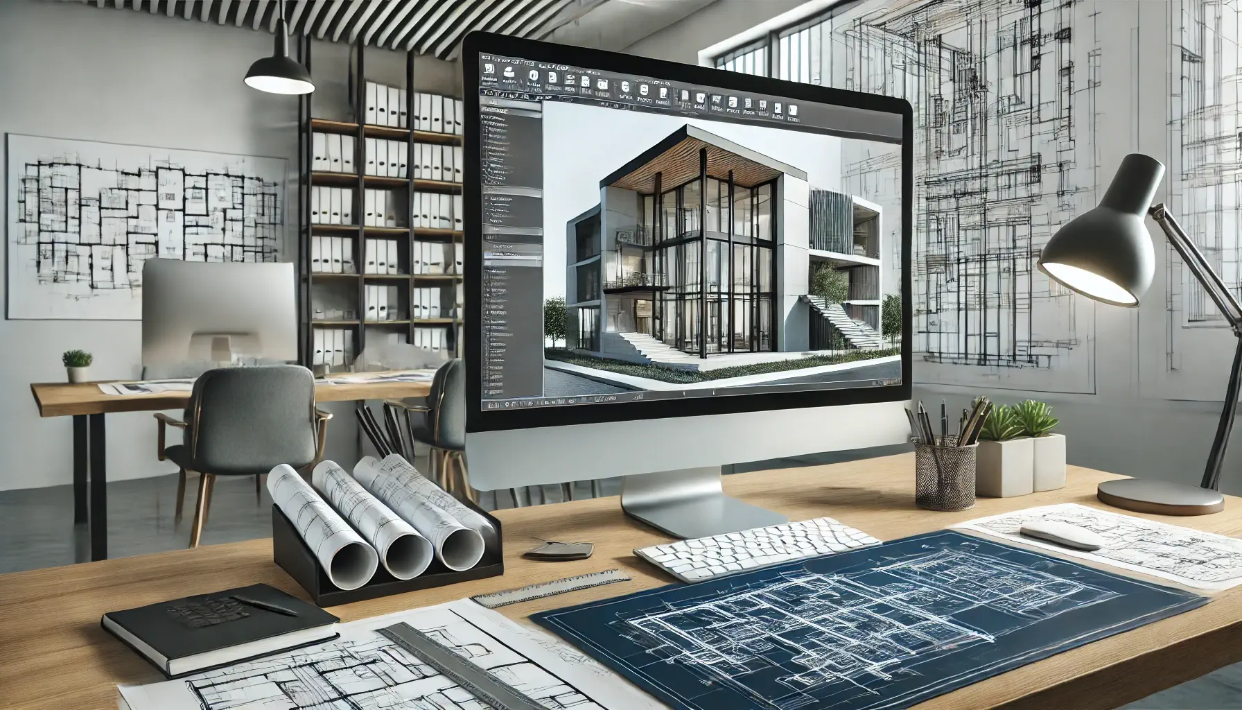
Using advanced LiDAR and terrestrial laser scanning systems, we capture millions of spatial data points to produce accurate as-built documentation, CAD drawings, and BIM-ready models.

Our precise digital surveys help architects, engineers, and contractors eliminate uncertainty, reduce costs, and make informed design and construction decisions.

What Is a 3D Laser Scanning Survey?

A 3D laser scanning survey captures millions of points in three-dimensional space, forming a detailed digital representation — or point cloud — of any structure.

This data provides an exact record of real-world conditions, allowing precise analysis and integration into CAD and BIM environments.

Key advantages:

  • Exceptional measurement accuracy (up to ±2 mm);
  • Safe, contactless data collection;
  • Rapid scanning of complex or inaccessible areas;
  • Reliable foundation for architectural and engineering documentation.

📊 According to Trimble’s Geospatial Report 2025, 3D laser scanning reduces on-site measurement time by up to 70% and improves accuracy by more than 90% compared to traditional methods.

Applications of 3D Laser Scanning

3D Laser Scanning Services for Construction Projects

In construction, 3D laser scanning ensures accuracy at every project stage — from initial site surveys to final as-built documentation.

Contractors use it for BIM verification, clash detection, and progress monitoring, preventing costly design deviations and minimizing rework.

ApplicationResult
Structural verificationEarly detection of deviations
As-built documentationCertified digital record of the site
BIM coordinationSeamless comparison between model and reality
Progress monitoringAccurate visual tracking of construction stages

Architectural 3D Laser Scanning Services

For architects and designers, architectural 3D scanning services deliver reliable geometry for both new and historic structures.

Data obtained through scanning supports measured building surveys, detailed façade modeling, and heritage restoration projects.

Every architectural element — from ornate details to full interiors — can be accurately captured and integrated into Revit or ArchiCAD.

3D Laser Scanning Services for Restoration and Heritage Projects

3D laser scanning is invaluable in restoration and heritage documentation, offering a non-invasive way to preserve and reproduce architectural features.

It allows conservation experts to document fragile façades, model complex ornamentation, and archive historic buildings digitally for future generations.

Measured Building and As-Built Surveys

Measured building surveys document the existing condition of structures before design or renovation, while as-built surveys verify the completed work after construction.
Both are crucial for precision, regulatory compliance, and long-term asset management.

Deliverables include:

  • 2D CAD drawings (plans, elevations, sections);
  • 3D Revit / ArchiCAD models (LOD 200–400);
  • Point clouds in RCP, E57, or LAS format;
  • BIM-ready documentation for architects and engineers.

Type of SurveyWhen ConductedPrimary Purpose
Measured Building SurveyBefore designBase for planning and renovation
As-Built SurveyAfter constructionVerification and handover documentation

ScanM2 performs both survey types in full compliance with RICS and ISO 17123 accuracy standards.

Workflow and Deliverables

Our workflow covers every stage of project documentation:

  1. On-site scanning – data capture using Leica, Trimble, or FARO laser systems.
  2. Point cloud processing – cleaning, alignment, and registration.
  3. CAD/BIM modeling – creating accurate Revit, AutoCAD, or IFC deliverables.
  4. Quality assurance – verification, error analysis, and secure data delivery.

Output formats: RCP, E57, DWG, DXF, RVT, IFC, PDF.

ScanM2 transforms real-world data into high-accuracy 3D models and documentation tailored to each client’s workflow — architectural, structural, or MEP.

Benefits of 3D Laser Scanning Surveys

  • Up to ±2 mm accuracy in real-world conditions;
  • Significant time and cost savings during fieldwork;
  • Safe scanning without the need for scaffolding or direct contact;
  • Reduced human error and reliable digital archiving;
  • Seamless integration with BIM, CAD, and GIS systems.

The cost of 3D laser scanning depends on project size, complexity, and required deliverables.

Learn more and request a quote here: 👉 How much does 3D laser scanning cost.

Why Choose SCANM2 for 3D Laser Scanning Surveys

With years of expertise in architecture and construction, ScanM2 offers end-to-end 3D scanning solutions — from data capture to BIM integration.

We combine advanced technology with deep industry experience to deliver reliable, measurable, and actionable results.

Why professionals choose SCANM2:

  • Certified specialists operating Leica, Trimble, and FARO scanners;
  • Fast project turnaround and guaranteed accuracy;
  • Expertise in Revit, AutoCAD, and ArchiCAD environments;
  • Compliance with global survey and BIM standards;
  • Proven portfolio of international projects.

At ScanM2, we connect the physical and digital worlds — transforming buildings and infrastructure into intelligent, data-driven assets.

FAQ

What is the difference between a measured building survey and an as-built survey?

A measured survey documents the existing conditions of a building before design or renovation, while an as-built survey records the final constructed state to verify compliance and produce official documentation.

How accurate is 3D laser scanning?

3D laser scanning can achieve accuracy of up to ±2 mm, depending on the equipment, environment, and size of the project area.

What file formats can you deliver?

SCANM2 provides deliverables in all major industry formats — Revit (RVT), AutoCAD (DWG, DXF), IFC, and point cloud files (RCP, E57, LAS) for seamless integration into your design workflow.

How long does a 3D laser scanning project take?

Project duration depends on site size and complexity.

For example, scanning a medium-sized building (up to 2,000 m²) typically takes 1–2 days on site, with 3–5 days for processing and modeling.

Can 3D laser scanning be used for heritage or historical buildings?

Absolutely. Laser scanning is ideal for heritage documentation, restoration, and conservation projects.

It allows safe, non-contact data capture from fragile or inaccessible areas without disturbing the original materials.

What are the main benefits of using 3D laser scanning over traditional surveying?

Compared to manual surveying, laser scanning offers:

  • Up to 10x faster data collection;

  • Higher accuracy and completeness;

  • Safer data capture from a distance;

  • Comprehensive digital record for reuse in BIM or CAD.

How is the scanned data processed and delivered?

After scanning, the point cloud is cleaned, registered, and aligned.

Then SCANM2’s specialists create 2D CAD drawings, 3D BIM models, or IFC datasets, depending on your project requirements.

All deliverables go through internal QA/QC verification before delivery.

What industries can benefit from 3D laser scanning?

3D laser scanning is widely used in:

  • Architecture and interior design;

  • Construction and civil engineering;

  • Industrial facilities and energy plants;

  • Heritage and restoration projects;

  • Real estate and asset management.

Why choose SCANM2 for your 3D laser scanning needs?

Because SCANM2 combines state-of-the-art equipment (Leica, Trimble, FARO) with experienced CAD/BIM engineers.

We guarantee accuracy, fast turnaround, and deliverables aligned with RICS and ISO standards — trusted by architects and contractors across Europe and North America.