Accurate Elevation Drawings Based on 3D Scanning

Elevation drawings are crucial architectural plans that illustrate a building’s exterior or interior vertical surfaces, providing a detailed representation of dimensions, materials, and structural features. Conventional approaches to generating elevation plans rely on manual measurements, which often require significant time and may lead to inaccuracies.
With our advanced 3D laser scanning technology, we offer a more accurate, efficient, and cost-effective solution. Our service provides highly detailed architectural elevation drawings, ensuring precision for architects, engineers, and construction professionals.
At ScanM2, we specialize in creating accurate elevation plans for buildings using high-resolution 3D scanning with industry-leading devices such as Faro, Leica, and Trimble. We deliver models in all essential formats, including .rvt, .dwg, .pln, and .pla, making integration into your workflow seamless.
Our 3D Scanning & As-Built Services Examples


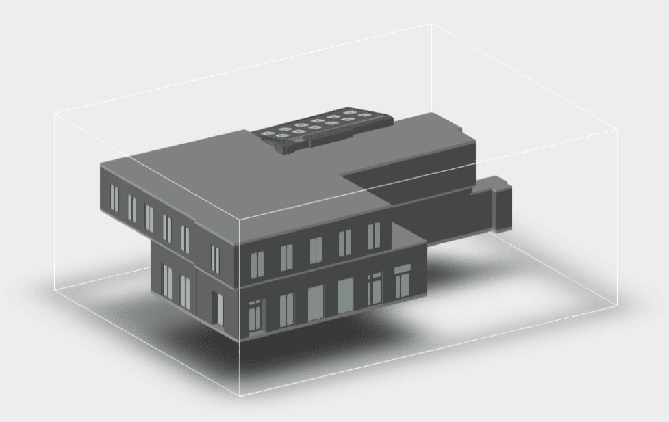


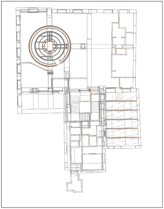
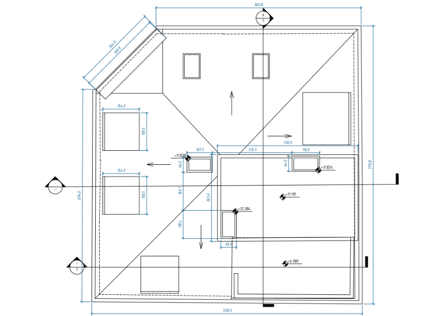
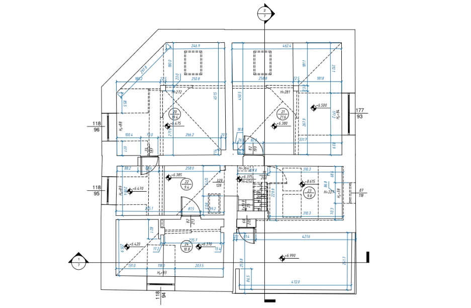


Get High-Precision Elevation Plans for Buildings with Advanced Laser Scanning Technology
Benefits of Our 3D Scanning-Based Elevation Drawings
By choosing our building elevation design services, you gain numerous advantages:
- Unmatched Accuracy: Traditional measurement methods are prone to human error. Our 3D scanning technology ensures millimeter-level precision, capturing even the smallest details.
- Time Efficiency: Manual surveys take days or even weeks, while 3D laser scanning allows us to complete a full site scan in just a few hours.
- Cost Savings: Many believe that 3D scanning is expensive, but our automated laser scanning solutions are more cost-effective than traditional manual scanning methods.
- Detailed Documentation: We provide house elevation blueprints that include every architectural and structural element, including windows, doors, and facades.
- Compatibility with Modern Software: We deliver CAD-ready and BIM-compatible models in multiple file formats such as .rvt, .dwg, .ifc, and .pln for easy integration into Revit, AutoCAD, and ArchiCAD.
- Applicable to Various Projects: Whether you need architectural elevation drawings for renovations, restorations, new construction, or compliance documentation, our services meet your needs.
Our Process – How We Deliver Precise Elevation Plans
We follow a streamlined and efficient workflow to ensure the highest level of accuracy in our elevation plans for buildings:
- Consultation & Project Assessment: We discuss your project’s scope, requirements, and deliverables to provide a customized solution.
- On-Site 3D Laser Scanning: Our experts use Faro, Leica, and Trimble scanners to capture millions of data points, creating an ultra-precise digital representation of the structure.
- Processing the Data & Generating a Point Cloud: The collected scan data is refined and converted into a high-resolution point cloud, forming the basis for your elevation drawings.
- CAD & BIM Modeling: Using the point cloud, we develop elevation plans, 3D models, and 2D documentation in AutoCAD, Revit, and ArchiCAD.
- Final Review & Delivery: We ensure that every elevation plan meets your specifications before delivering the final files in your preferred format.
Why Choose ScanM2 Over Competitors?
- Affordable Pricing: Unlike companies that rely on manual scanning, our high-tech approach reduces labor costs, making our services more affordable.
- High-Level Accuracy: We guarantee a level of precision unmatched by traditional surveying methods.
- Fast Turnaround Times: Get elevation drawings quickly, without compromising quality.
- Comprehensive Service Range: From house elevation blueprints to large-scale industrial elevation plans, we handle all project sizes.
- Service Across the U.S.: We operate nationwide, delivering both on-site and remote solutions to meet your needs.
Frequently Asked Questions
How much does 3D scanning-based elevation drawing service cost?
Which formats do you provide the final elevation drawings in?
How soon can you receive elevation drawings?
Can you scan both the interior and exterior of a building?
Is 3D laser scanning better than traditional surveying?
Can I use your elevation drawings for permit applications?
Get Started with Accurate Elevation Drawings Today!
Looking for precise elevation drawings based on 3D scanning? Our expert team at ScanM2 is ready to help.
Complete the form to receive a free consultation and personalized quote.