Drone Survey As-Built Services: High-Precision Solutions
Are you looking for accurate and cost-effective Drone As-Built Services? At ScanM2, we provide top-tier aerial As-Built documentation by integrating advanced drone technology with professional-grade 3D laser scanning. Our services include the creation of detailed As-Built drawings, point clouds, and 3D models in formats like .rvt, .dwg, .pln, and more. Whether you’re documenting buildings, industrial plants, or outdoor spaces, we ensure precision and efficiency at competitive pricing.
What Are Drone As-Built Services?
Drone As-Built Services utilize drone-mounted laser scanners and cameras to capture high-resolution data of physical structures. This advanced method is faster, safer, and more comprehensive compared to traditional surveying. The collected data is processed into detailed 3D models, 2D documentation, and As-Built drawings, providing an accurate representation of an asset’s current state.
At ScanM2, we offer end-to-end Drone As-Built surveys tailored to your project’s needs. Whether for construction, renovation, or facility management, our aerial surveys ensure you get reliable and actionable data every time.
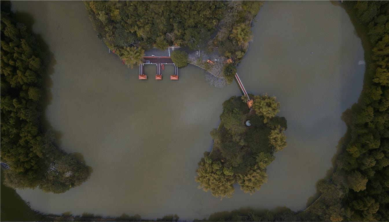
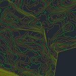
Our LiDAR Scanning Results


Why Choose Aerial As-Built documentation?
- Speed and Efficiency: Drone surveys drastically cut down the time required for data collection, particularly on large or complex sites. Traditional methods can take days, while drones capture precise data within hours.
- Enhanced Safety: For hazardous or hard-to-reach areas, drones provide a safer alternative. There’s no need for scaffolding or manual climbing, minimizing risks.
- Unmatched Precision: With advanced scanners like Faro, Leica, and Trimble, we produce models and drawings with millimeter-level precision. This level of detail helps in informed decision-making and effective project planning.
- Cost Savings: Our drone services are more affordable than traditional manual scanning, especially for large-scale projects. By reducing labor costs and expediting the process, we help you save money without compromising quality.
Applications of Drone As-Built Surveys
Drone As-Built services are versatile and can be applied across various industries:
- Construction and Renovation: Monitor project progress, verify work accuracy, and update As-Built documentation.
- Industrial Plants: Document complex facilities, including pipelines, ventilation, and utilities, for maintenance and upgrades.
- Architectural Documentation: Capture exterior and interior data for architectural planning and heritage preservation.
- Infrastructure Projects: Ideal for bridges, highways, railways, and large-scale civil engineering projects.
How Our Drone Work
- Initial Consultation: We review your project’s scope, goals, and required deliverables. Key details like the type of structure, required formats, and specific areas of focus are noted.
- On-Site Data Collection: Using drones equipped with high-resolution scanners, we capture detailed aerial and surface data. This process is quick, safe, and non-invasive.
- Data Processing: Our team processes the raw data into accurate deliverables, including point clouds, 3D models, and 2D drawings. We can also integrate utilities like lighting, plumbing, and ventilation systems as required.
- Delivery: The finalized documentation is delivered in the format of your choice, ready for integration into your workflow or project management tools.
Why Choose ScanM2 for Drone As-Built Services?
At ScanM2, we go above and beyond to provide exceptional service. Why Clients Choose Us:
- Cutting-Edge Technology: We use industry-leading equipment like Faro, Leica, and Trimble scanners, ensuring unparalleled accuracy and detail.
- Flexible Deliverables: Whether you need a simple point cloud or a fully detailed 3D model, we tailor our services to your needs.
- Cost-Effective Solutions: Our drone-based services are more affordable than manual scanning, with no compromise on quality. We break the myth that high-precision scanning is expensive.
- Experienced Team: With extensive experience in laser scanning and As-Built documentation, our team delivers professional and dependable results.
- Fast Turnaround: Our streamlined process ensures timely delivery of your project, helping you stay on schedule.
Frequently Asked Questions
What are Drone As-Built surveys, and how are they different from traditional surveys?
What Types of Deliverables Do You Offer?
How much do Drone As-Built services cost?
Are drones suitable for indoor surveys?
How accurate are the models and drawings?
Can you include utilities like plumbing and HVAC in the documentation?
Get Started with Drone As-Built Surveys Today
Ready to experience the precision and efficiency of our Drone As-Built Services? Complete the form below to request a consultation or receive a personalized quote. Let ScanM2 transform your project with reliable, cost-effective, and high-quality documentation.
By partnering with ScanM2, you’re securing a dedicated ally committed to the success of your project. Reach out to us today and experience the difference.