Precise Documentation of an Industrial Building in Germany – 3D Survey of a 2,530 m² Facility
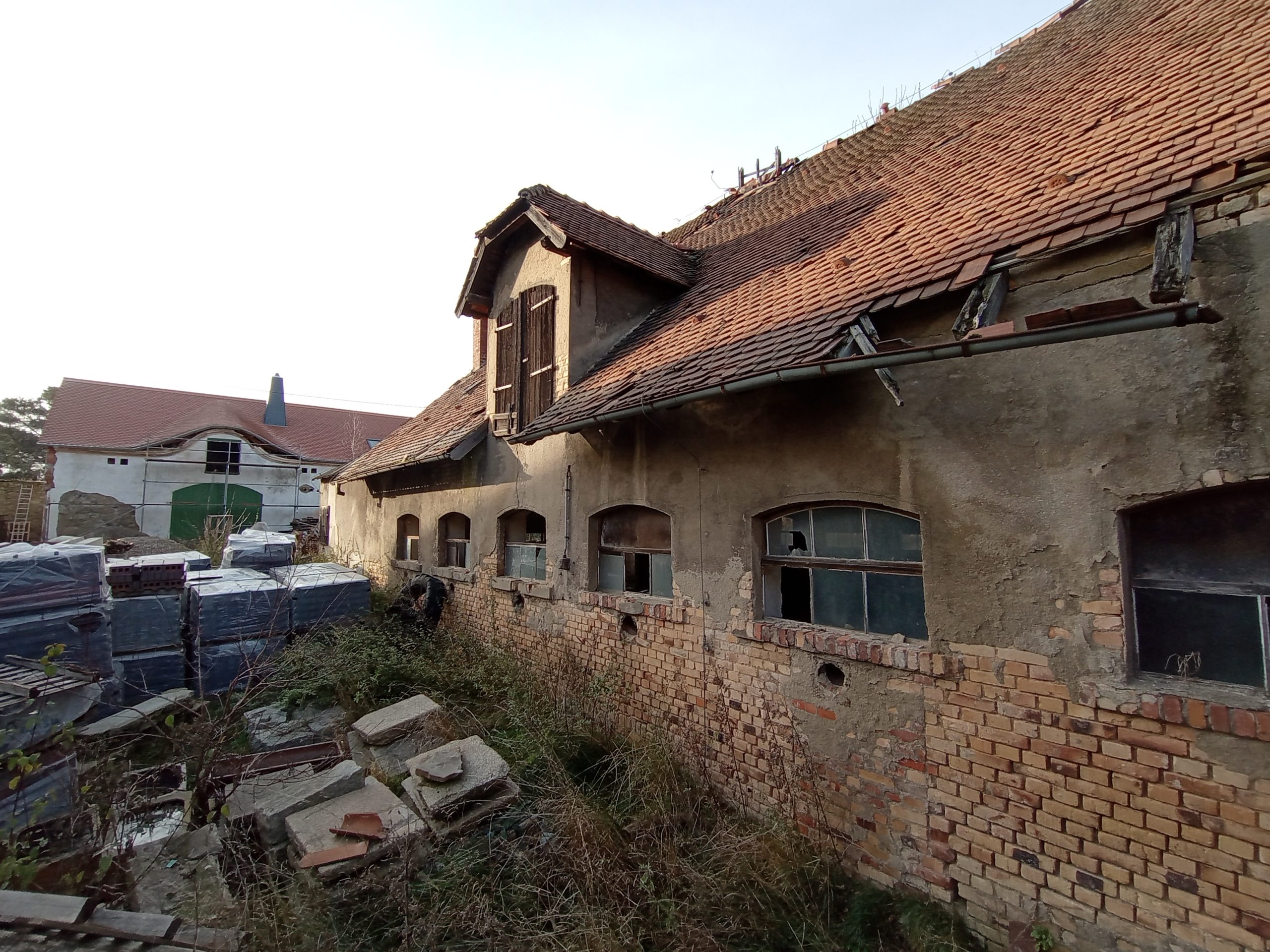
We carried out a comprehensive architectural survey of an industrial facility located in Germany with a total area of 2,530 m².
The building is used for industrial and technical operations and contains complex internal layouts including production spaces, technical rooms, corridors, and engineering infrastructure.
To ensure accurate documentation of the facility, the project required the use of high-precision 3D laser scanning technology. This approach allowed us to capture the entire geometry of the building, including structural elements, installation systems, and spatial relationships between different areas of the facility.
The collected data was processed into a registered point cloud and a complete set of 2D architectural drawings, providing the client with reliable documentation for further renovation and engineering planning.
Project Overview
Project Type: Architectural and technical survey of an industrial building using 3D laser scanning
Location: Germany
Total Area: approximately 2,530 m²
Objective: Preparation of accurate architectural documentation including point cloud data and 2D drawings for future design and modernization works
Key Requirement: Precise capture of the building geometry and engineering infrastructure with millimeter-level accuracy
Project Challenges
Industrial Facility Geometry
Industrial buildings often contain irregular structural elements, installation networks, and large open spaces that require careful scanning planning and multiple scan positions.
Operational Environment
Measurements had to be carried out in an environment containing industrial equipment and technical installations while maintaining safety and data accuracy.
High Accuracy Requirements
The documentation had to reflect the actual geometry of walls, structural elements, and installations in order to support precise architectural and engineering planning.
Technical Data & Accuracy
• Terrestrial 3D laser scanning of the entire facility
• Creation of a high-density point cloud as the main project dataset
• Preparation of 2D architectural documentation based on the point cloud
• Measurement accuracy: ±4 mm
Methodology
1. Field Data Acquisition
Terrestrial laser scanning of interior spaces and key external building elements.
2. Data Processing
Registration and alignment of scanning data to create a unified point cloud model.
3. Documentation Development
Preparation of architectural documentation including floor plans and technical drawings based on the point cloud.
4. Quality Control
Internal verification of geometry, alignment accuracy, and completeness of the documentation.
5. Data Delivery
Export of final files in formats agreed with the client, including:
- DWG
- E57 / RCP point cloud formats
Results
Laser Scanning Results and Architectural Documentation


Complete Point Cloud Dataset
A precise digital representation of the entire industrial facility ready for use in architectural and engineering software.
2D Architectural Documentation
Accurate floor plans and technical drawings reflecting the real condition of the building.
Reliable Project Base
The delivered documentation allows designers and engineers to carry out modernization, renovation, and technical planning based on verified measurements.
Time Efficiency
The use of laser scanning significantly reduced the time required for field measurements and eliminated the need for repeated site visits.