In the fast-paced world of airport construction, expansion, and renovation, accuracy and data integrity are crucial. ScanM2 is dedicated to supporting airports across the U.S. with state-of-the-art BIM Airport services and 3D scanning solutions that streamline the complexities of large-scale airport infrastructure projects. Our unique approach combines Building Information Modeling (BIM), 3D scanning, and as-built documentation to deliver an efficient, cost-effective, and scalable service for airports of all sizes.
Why BIM and 3D Scanning Are Essential for Airports
Airports are complex, dynamic environments that require precision in every aspect of design, construction, and maintenance. Traditional methods of site measurement and documentation can be costly and imprecise, often leading to delays and unexpected expenses. By integrating BIM and 3D scanning, ScanM2 provides accurate, real-time data that supports:
- Design and Renovation: BIM models help architects and engineers visualize and plan expansions or refurbishments without disrupting operations.
- Facility Management: Our 3D scanning captures intricate details of existing structures, enabling effective asset management and maintenance planning.
- Compliance and Safety: Comprehensive as-built documentation meets industry standards, aiding in regulatory compliance and safety assessments.
Our Core BIM Airport Services
1. High-Definition 3D Scanning for Airports
Using industry-leading equipment such as Faro, Leica, and Trimble scanners, we capture highly accurate, detailed point clouds that reflect the existing conditions of an airport. This technology allows us to create a precise digital representation of any airport structure, which can then be transformed into actionable BIM models.
Advantages of Our 3D Scanning:
- Unmatched Detail: Our scanners produce millimeter-level accuracy, far surpassing manual or handheld scanners.
- Faster Project Turnaround: Digital scans reduce the time spent on-site and eliminate the need for return visits, accelerating project timelines.
- Cost Savings: By avoiding manual measurements and using advanced equipment, we offer affordable 3D scanning solutions without sacrificing detail.
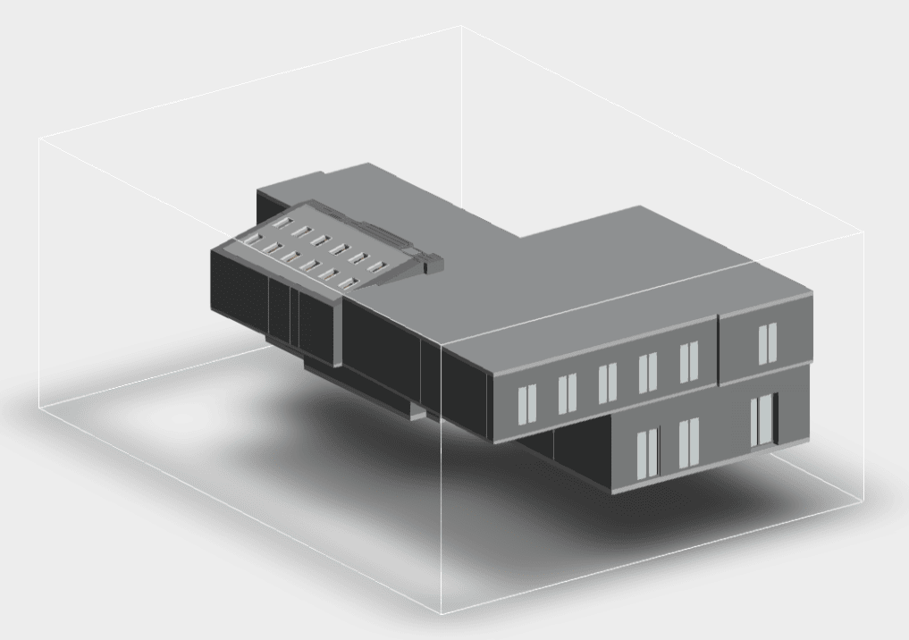
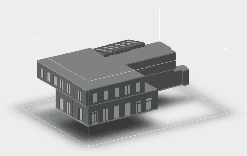
2. Building Information Modeling (BIM) for Airport Design and Management
Our BIM services create a collaborative platform that combines all aspects of an airport’s structural, architectural, and mechanical data into one comprehensive model. This model is a valuable tool for both ongoing operations and future renovations, enabling stakeholders to visualize structural components, anticipate maintenance needs, and plan efficiently.
Benefits of BIM Modeling for Airports:
- Enhanced Collaboration: BIM serves as a single source of truth for everyone involved, from architects and engineers to facility managers.
- Data-Driven Insights: With our BIM models, teams can analyze data trends, simulate future conditions, and plan preventive maintenance, extending the lifecycle of airport facilities.
- Reduction in Rework: By catching design conflicts early, BIM minimizes costly on-site rework, reducing expenses and ensuring project continuity.
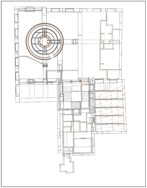
3. Detailed As-Built Documentation
Once scanning is complete, we provide as-built documentation that reflects the current state of the airport facility. This documentation is crucial for maintaining compliance, conducting safety inspections, and facilitating future renovations or expansions.
Our as-built documentation includes:
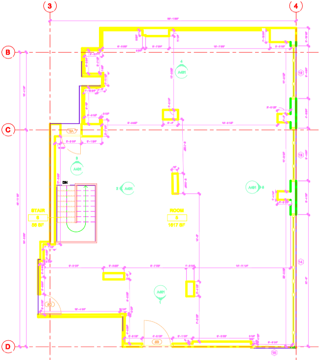
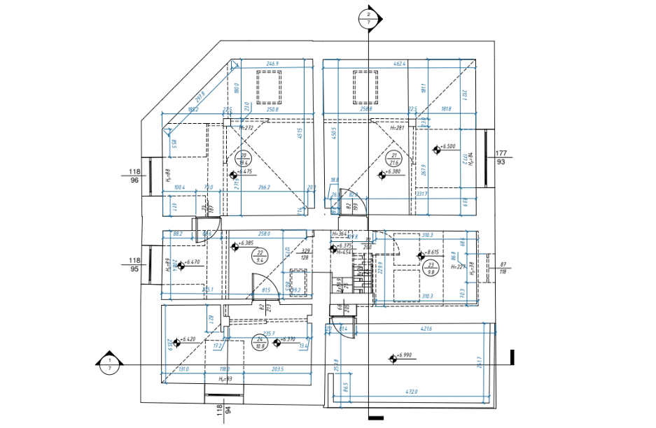
- Comprehensive 2D Drawings: Accurate floor plans, elevations, and sectional views that help with everything from regulatory submissions to routine maintenance.
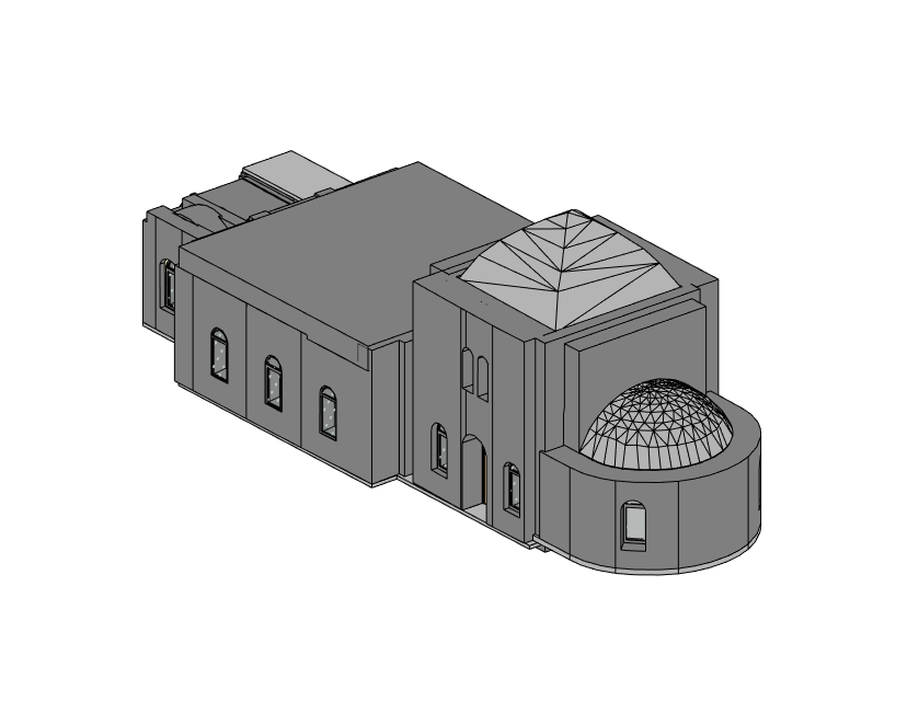
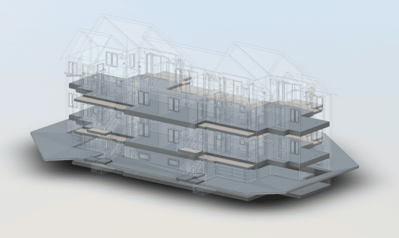
- Interactive 3D Models: High-resolution models that allow teams to explore every detail, enhancing understanding and collaboration.
- Updated Asset Records: As-built records help in tracking and managing infrastructure assets across an airport’s lifecycle.
Applications of BIM and 3D Scanning in Airport Projects
Airports can use BIM and 3D scanning across various scenarios, from initial design and expansion to ongoing maintenance. Here are some specific applications where ScanM2’s services can make a difference:
- New Terminal and Gate Expansions: As airports grow, BIM and 3D scanning provide the precision necessary to add new gates, lounges, and terminals that integrate seamlessly with existing structures.
- Runway and Taxiway Enhancements: With high-definition scans, airport teams can plan and manage runway expansions, ensuring minimal disruption and maximum safety.
- Mechanical and Electrical Upgrades: ScanM2’s 3D models assist with the placement and upgrading of HVAC systems, electrical conduits, and piping systems.
- Security and Emergency Planning: Detailed BIM models are invaluable for designing and updating security protocols and emergency evacuation routes.
Why Choose ScanM2’s BIM Airport Services?
At ScanM2, we understand the unique challenges that airports face, including high traffic, strict safety regulations, and the need to minimize disruption to passengers. Our BIM and 3D scanning services are designed with these needs in mind, and we go the extra mile to ensure precision, efficiency, and cost-effectiveness.
1. Affordable, Professional-Grade Scanning
One of the most common misconceptions about 3D scanning is that it’s too expensive. However, ScanM2 uses professional-grade scanners that are faster, more reliable, and more accurate than handheld scanners, allowing us to keep costs low while delivering unparalleled detail.
2. Experienced Technicians and Advanced Equipment
Our team of certified technicians uses industry-leading equipment, including Faro, Leica, and Trimble scanners. This ensures that every scan we deliver meets the highest standards of accuracy and quality.
3. Bonus Program for Regular Clients
We believe in rewarding loyalty. Our bonus program offers exclusive discounts and benefits for repeat clients, making ScanM2 an even more cost-effective choice for large-scale and long-term airport projects.
Frequently Asked Questions (FAQ)
How does BIM benefit airport operations?
BIM offers a central platform for all structural and operational data, facilitating efficient maintenance, planning, and compliance efforts, ultimately extending the life of airport facilities.
Is 3D scanning necessary for all types of airport projects?
While not required for every project, 3D scanning is invaluable for large-scale renovations, expansions, and upgrades where precision is essential.
Can ScanM2’s services be used in other structures besides airports?
Yes, our BIM and 3D scanning services are adaptable to commercial buildings, manufacturing facilities, and complex industrial sites.
What are as-built models?
As-built models represent the current state of a structure, which is essential for accurate planning, regulatory compliance, and asset management.
Take the First Step Toward High-Quality BIM Airport Solutions
Discover how ScanM2 can bring precision, efficiency, and cost savings to your airport project with our specialized BIM and 3D scanning services. Fill out the form below to request a custom proposal, and our experts will guide you through the process of leveraging BIM for your airport’s design, renovation, or maintenance needs.
Services
- High-Quality Scan to BIM in Los Angeles
- Professional Scan to BIM in Illinois
- Professional Scan to BIM Services in Houston
- Professional Scan to BIM in Florida
- Professional Scan to BIM in Dallas
- Professional Scan to BIM Services in Chicago
- Professional BIM in Washington
- Professional BIM Services in Tampa
- Expert BIM Services in St Louis
- Professional BIM Services in Seattle
- BIM Services in San Francisco
- BIM Services in Portland
- Professional BIM Services in Phoenix
- Professional BIM Services in Orlando
- High-Quality BIM Services in Omaha
- BIM Services in NYC for Architects, Designers, and Builders
- BIM Services in Nashville
- Leading Minnesota BIM Services
- BIM Services in Minneapolis
- BIM Services in Milwaukee
- BIM services in Miami
- BIM Services in Massachusetts
- BIM Services in Los Angeles
- BIM Services in Las Vegas
- BIM Services in Jersey City
- Innovative BIM Services in Irvine
- BIM Services in Connecticut
- BIM Services in Illinois
- BIM Services in Florida
- BIM services in Dallas
- BIM Services in Colorado
- BIM Services in Chicago
- BIM Services in California
- BIM Services in Boston
- BIM Services in Austin
- BIM Services in Atlanta
- BIM Services in San Diego
- BIM Services in San Antonio
- BIM Services in Denver