Projects In the world of interior design, precision and detail are non-negotiable. Whether it’s redesigning a home, planning a commercial space, or transforming an office, accurate floor plans serve as the foundation for successful interior design projects. Leveraging modern technologies like 3D laser scanning and 3D modeling allows designers to craft spaces with unparalleled precision, creativity, and functionality.
This article explores five impactful ways precise floor plans can elevate your interior design projects, ensuring a smooth transition from initial concept to final execution.
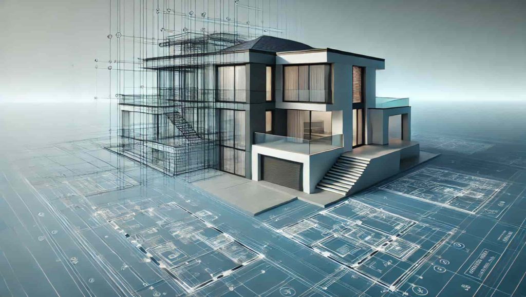
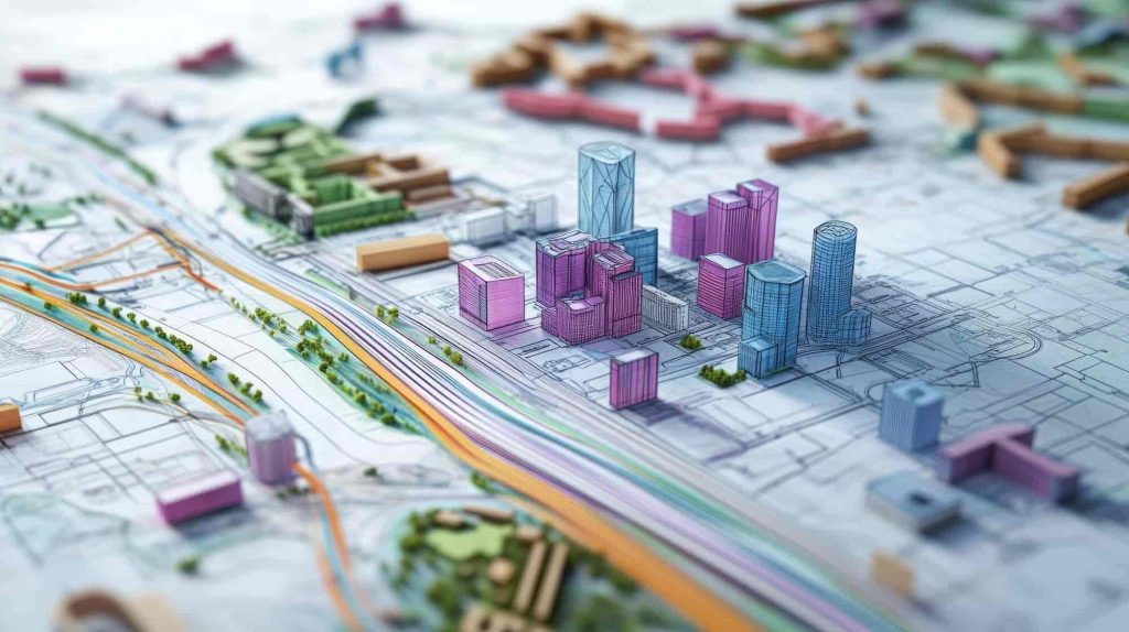
1. Enhanced Project Visualization with 3D Modeling
Accurate floor plans allow designers and clients to visualize a space with incredible clarity. By integrating 3D modeling and architectural visualization, designers can create lifelike representations of the finished project. This technology offers:
- Realistic Previews: With 3D modeling, you can explore every detail of the design—from furniture placement to color schemes—before any physical changes are made.
- Client Collaboration: Precise visualizations enable clients to give clear feedback, ensuring their vision is accurately reflected in the final design.
- Reduced Errors: A detailed floor plan minimizes the risk of errors during the execution phase, as every element is meticulously planned.
Using tools like 3D laser scanning, designers can capture every corner, angle, and dimension of a space to create a flawless base for their interior designs. Additionally, this approach enables the exploration of multiple design options quickly, offering clients a more personalized experience.
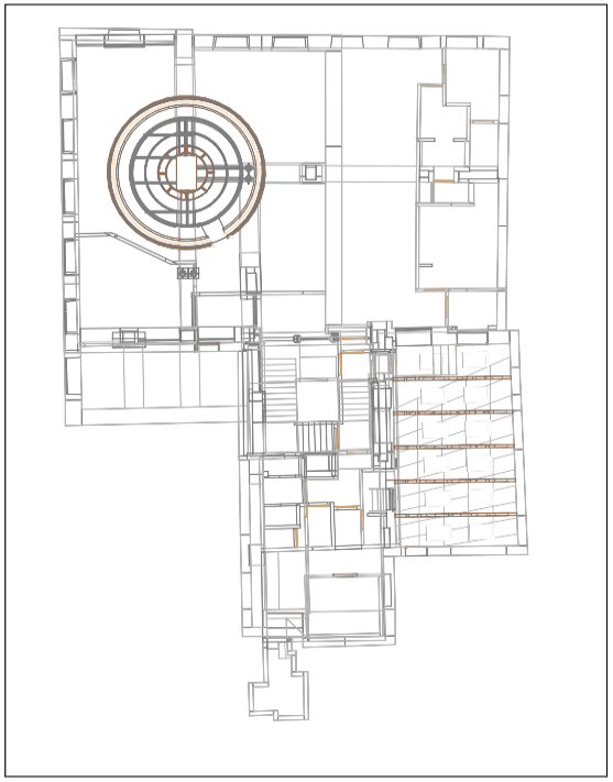
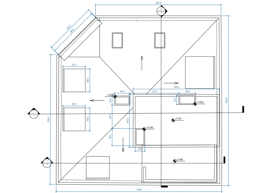
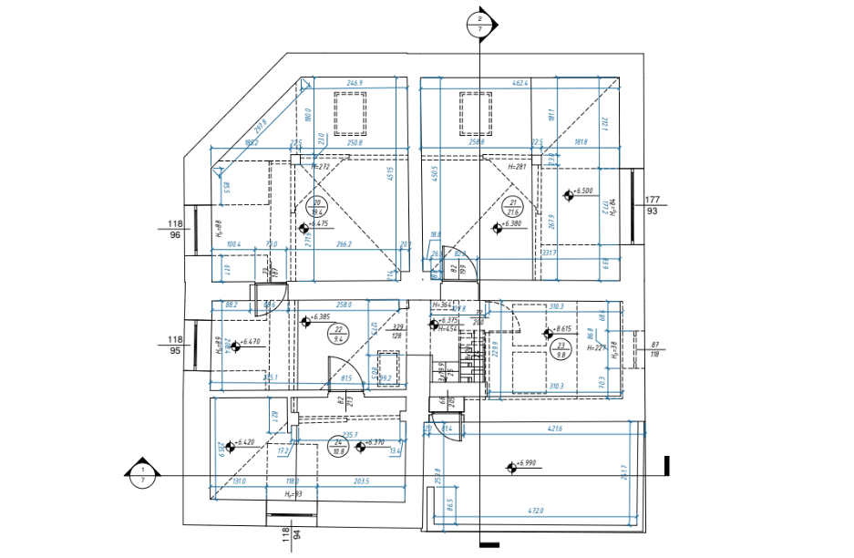
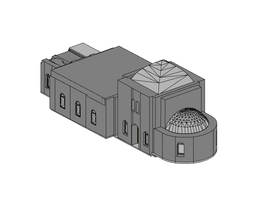
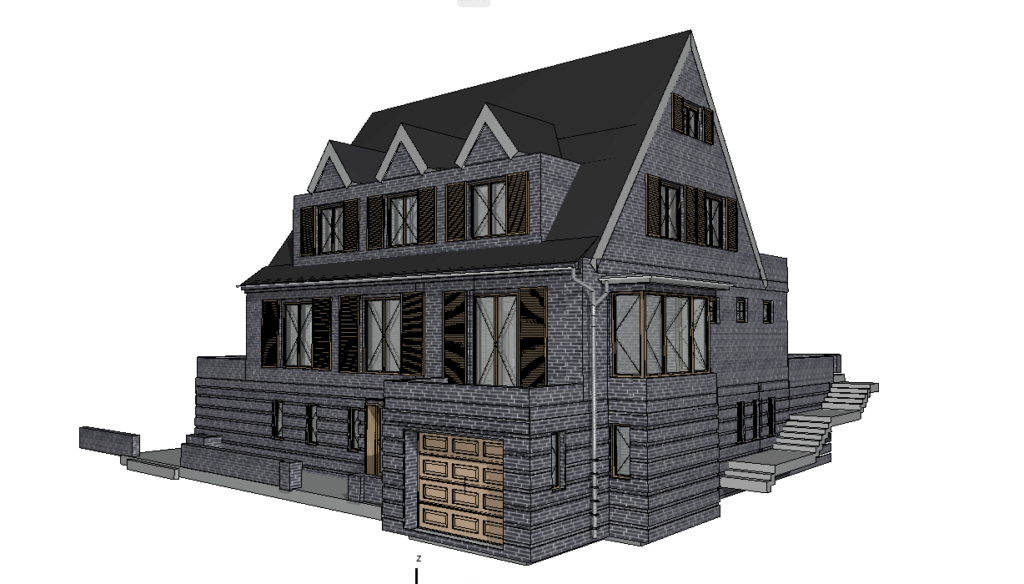
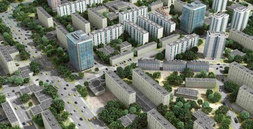
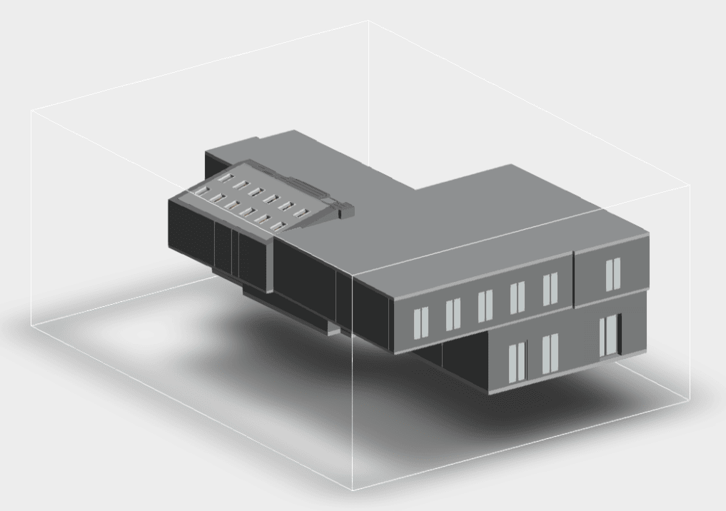
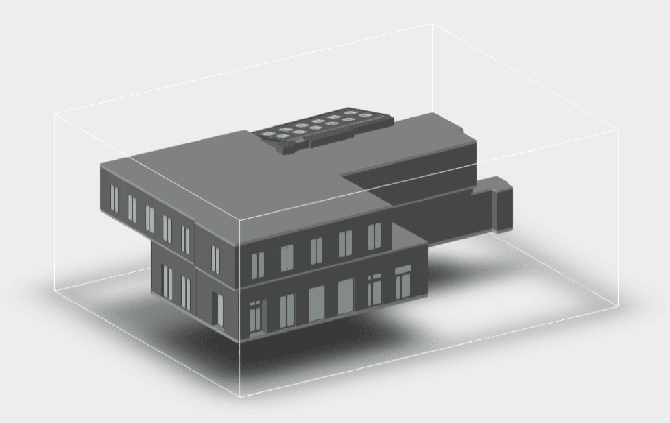
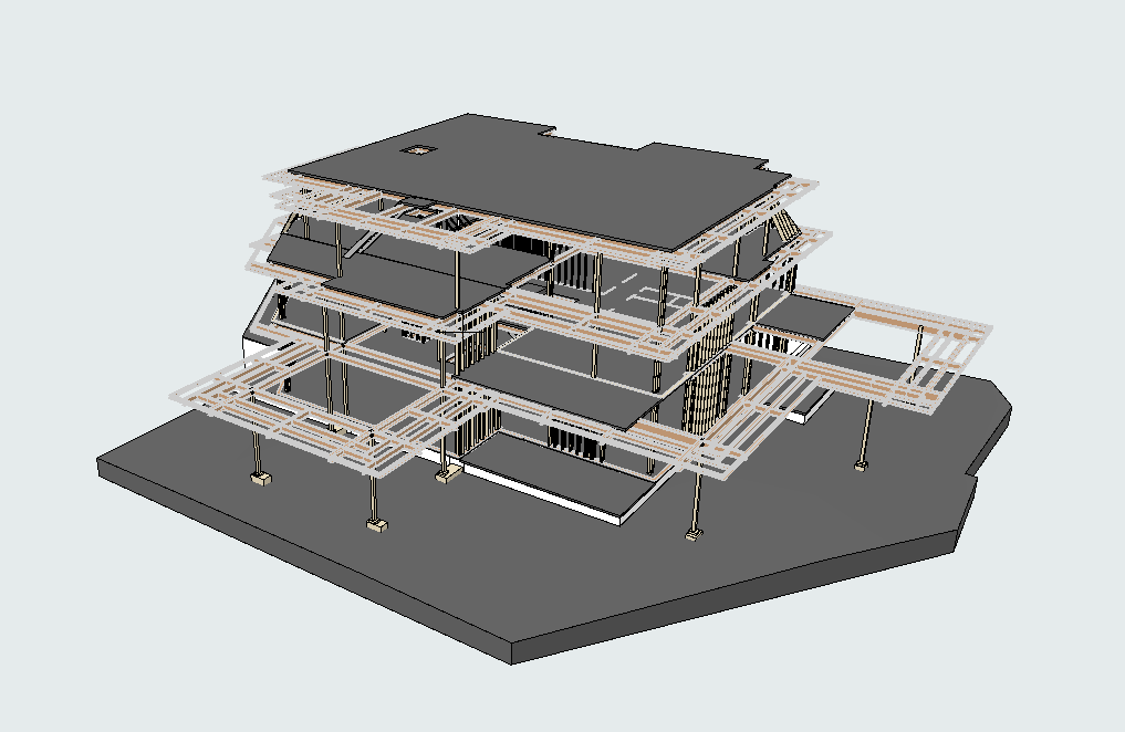
Our 3D Models Examples


2. Streamlined Space Planning and Furniture Arrangement
Effective space planning is a cornerstone of interior design. With accurate floor plans, designers can:
- Maximize Space Efficiency: Precise layouts help identify ways to optimize space, ensuring every square foot is utilized effectively.
- Perfect Furniture Placement: With precise measurements, designers can test different furniture arrangements digitally, finding the perfect fit for aesthetics and functionality.
- Adapt to Challenges: Unique features like curved walls or irregular spaces can be accounted for accurately, allowing for creative and tailored solutions.
By incorporating accurate data into 3D floor plans, designers can save time and avoid costly revisions during the furniture placement phase. This level of precision ensures a harmonious balance between practicality and style, resulting in spaces that are both functional and visually appealing.
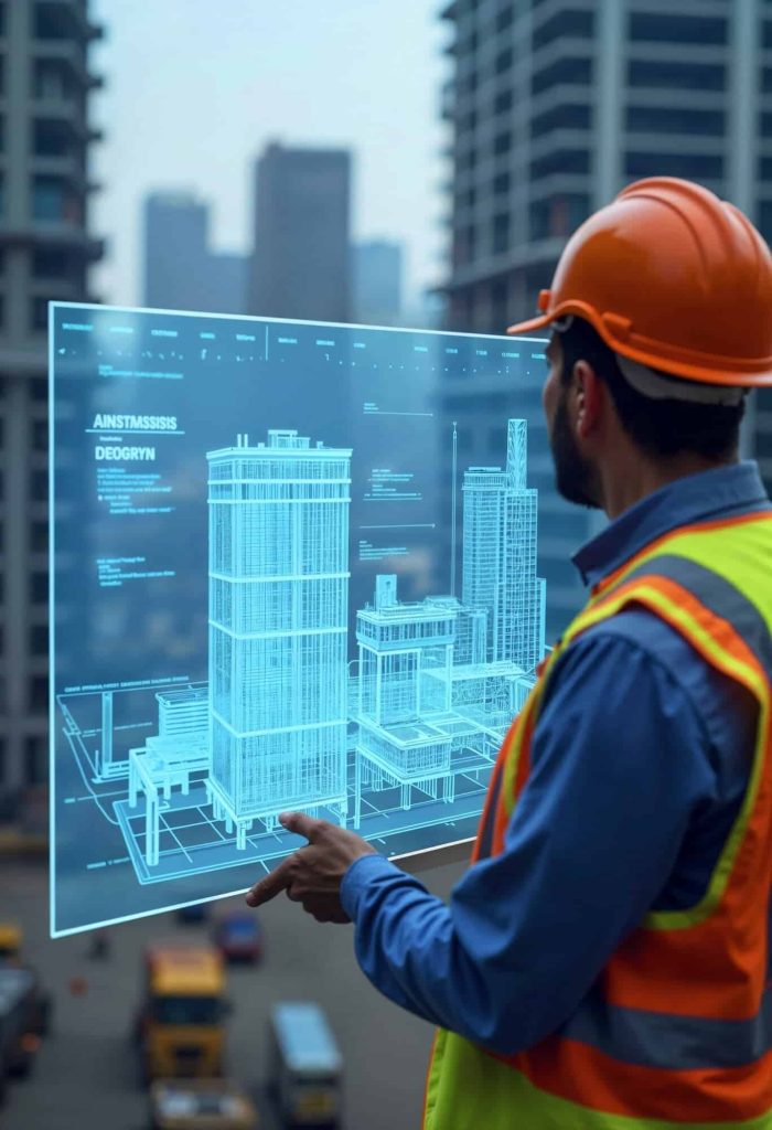
3. Improved Communication with Contractors and Stakeholders
Clear communication is key to any successful project, and accurate floor plans serve as a universal language between designers, contractors, and stakeholders. Here’s how they help:
- Detailed Instructions: Contractors receive clear blueprints, reducing misinterpretations during construction or remodeling.
- Project Transparency: Accurate visuals and data ensure that everyone involved—from clients to builders—understands the project’s scope and goals.
- Consistency Across Teams: With precise documentation, all team members stay aligned, minimizing delays and misunderstandings.
3D laser scanning takes communication to the next level by delivering detailed point cloud data that can be easily shared and understood by all stakeholders. These detailed scans create a solid foundation for decision-making, fostering smoother collaboration and reducing the likelihood of costly mistakes.
4. Time and Cost Efficiency
Investing in accurate floor plans at the beginning of an interior design project can lead to significant time and cost savings. Here’s how:
- Fewer Revisions: A precise floor plan eliminates guesswork, reducing the need for last-minute changes and rework.
- Optimized Budgeting: Designers can calculate materials, furniture, and labor costs more accurately, ensuring the project stays within budget.
- Quicker Turnaround: By starting with a detailed plan, the execution phase becomes faster and smoother, as all potential challenges have been addressed in advance.
Technologies like 3D laser scanning provide the accurate measurements needed to avoid costly mistakes, making them a valuable investment for any interior design project. Additionally, identifying potential challenges early allows designers to prioritize innovation and creativity, free from concerns about logistical obstacles.
5. Future-Proofing Designs for Renovations and Upgrades
Accurate floor plans aren’t just valuable for the current project—they also serve as a lasting resource for future renovations or upgrades. Here’s why:
- Comprehensive Documentation: A detailed floor plan provides a permanent record of the space’s dimensions, features, and design elements.
- Ease of Updates: When it’s time to renovate or redecorate, having accurate plans on hand saves time and effort.
- Increased Property Value: Accurate documentation adds value to the property, as future owners or tenants can use the plans for their projects.
By combining 3D laser scanning with digital documentation, designers create a legacy of precision that benefits clients for years to come. Future-proofing ensures that any changes, whether minor updates or major overhauls, can be implemented seamlessly without the need for extensive rework.
Why Accurate Floor Plans Matter

The success of any interior design project hinges on its foundation, and accurate floor plans provide just that. They not only elevate the creative process but also promote efficiency, foster collaboration, and deliver lasting value.
With cutting-edge tools like 3D laser scanning and 3D modeling, companies like scanm2.com are transforming the way interior design projects are executed, offering unmatched precision and innovation.
Whether you’re an interior designer, architect, or property owner, embracing accurate floor plans is the key to unlocking your project’s full potential. At scanm2.com, we specialize in creating detailed, precise, and reliable floor plans to bring your vision to life. Begin your next interior design project with complete confidence.
Visit scanm2.com to learn more about our services in 3D laser scanning, 3D modeling, and architectural visualization.