Drone-Based As-Built Surveys for Large Commercial Properties

Imagine standing in the middle of a sprawling commercial complex—a place so vast that traditional surveyors would need days or even weeks to gather all the necessary data. Now, picture a drone soaring overhead, capturing every detail in mere hours. This is the power of drone-based as-built surveys. They are not just a technological innovation; they are a revolution in how we approach property documentation, construction, and management.
But why are drones creating such a buzz in the world of surveying? And what does this mean for large commercial properties? In this article, we will explore how drone-based surveys are reshaping the industry, delivering accuracy, efficiency, and stunning visuals that were unimaginable just a decade ago.
The Growing Role of Drones in As-Built Surveys
Once considered futuristic gadgets, drones have rapidly evolved into essential tools across various industries, from agriculture to filmmaking. Yet, their impact has been most transformative in the field of as-built surveys. These flying marvels combine state-of-the-art sensors, cameras, and software to provide a bird’s-eye view of properties, creating detailed 3D models and maps.
For large commercial properties like shopping centers, office parks, and industrial facilities, the ability to gather comprehensive data quickly and accurately is a game-changer. But it’s not just about speed—it’s about creating a level of detail and accuracy that surpasses traditional methods.
Did You Know? The use of drones in construction and surveying has grown by over 200% in the last five years, with companies reporting significant cost and time savings.
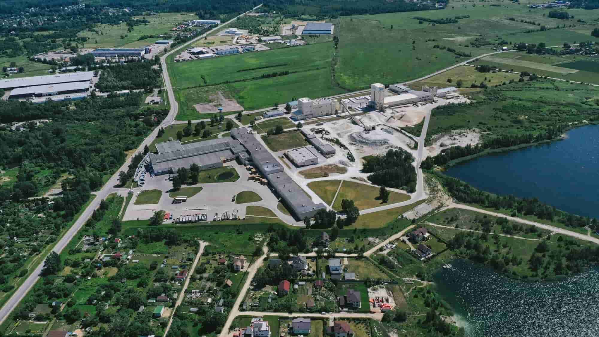
Our LiDAR Scanning Results


What Makes Drone-Based As-Built Surveys Special?
Let’s break down why drone technology is becoming the go-to solution for large-scale surveys:
Seeing the Big Picture and the Fine Details
Traditional surveys often require piecing together fragmented data collected from different parts of a property. Drones eliminate this issue by capturing the entire site in a single, seamless operation. High-resolution imagery and 3D point clouds provide both macro and micro perspectives, ensuring nothing is overlooked.
Imagine trying to measure a sprawling commercial warehouse manually. The task would involve countless hours, numerous measurements, and potential errors. With a drone, you get a detailed scan of the entire structure in minutes, with millimeter-level accuracy.
Efficiency Without Compromising Precision
In industries like construction and real estate, time is a critical factor. Drone surveys allow for the coverage of vast areas in significantly less time compared to traditional methods. For example, a large office complex that might take weeks to survey manually can be scanned in just a few hours.
Reaching the Unreachable
Some parts of commercial properties, such as rooftops, towers, or hazardous areas, are difficult and dangerous to access. Drones excel in these scenarios, effortlessly flying to heights and tight spaces where human surveyors cannot go.

A Deeper Dive: How Drone Surveys Work
The process of conducting a drone-based as-built survey is a fascinating blend of technology and strategy:
- Initial Planning
Every survey starts with a detailed plan. Flight paths are designed to maximize coverage and minimize overlaps, ensuring that no part of the property is missed. Advanced software predicts the optimal routes for data collection. - The Flight
Equipped with cameras, LiDAR sensors, or thermal imaging tools, drones take to the skies. They capture a wealth of data, from high-definition images to 3D scans, often in a matter of minutes. - Data Processing
Once the flight is complete, the real magic begins. Cutting-edge software processes raw data into practical insights, producing precise 3D models, comprehensive maps, and accurate measurements. This step is crucial for generating the as-built documentation that architects, engineers, and property managers rely on. - Deliverables
The processed data is delivered in formats tailored to the project’s needs. This could include digital floor plans, 3D renderings, or even virtual walkthroughs of the property.
Real-World Applications of Drone-Based Surveys
Construction Progress Tracking
Imagine being able to monitor the progress of a large commercial construction project from your office. Drones make this possible by providing regular, real-time updates through aerial imagery and 3D scans. These insights help project managers spot potential issues early and keep timelines on track.
Renovation and Retrofitting
Renovating a commercial property often requires understanding its current state down to the smallest detail. Drone surveys provide architects and engineers with a complete, accurate picture of existing structures, enabling precise planning for renovations or retrofits.
Maintenance and Inspection
Regular maintenance of large properties can be daunting. Drones streamline this process by conducting thorough inspections of roofs, facades, and other inaccessible areas. With thermal imaging, they can even uncover hidden problems such as water leaks or insulation deficiencies.
Marketing and Real Estate
Aerial images and 3D models created by drones are powerful tools for marketing large commercial properties. Potential buyers and tenants can virtually tour the property, obtaining a detailed understanding of its layout and features without needing to visit in person.
The Benefits: More Than Just Convenience
- Unmatched Accuracy: With drones, you’re not just getting speed; you’re getting precision. Advanced sensors and photogrammetry ensure every measurement is accurate to the millimeter.
- Cost Efficiency: Drone-based surveys minimize the need for extensive labor and equipment, making them a more cost-effective option compared to traditional methods. They also help avoid costly mistakes by providing reliable data from the start.
- Enhanced Collaboration: The detailed outputs of drone surveys—such as 3D models and point clouds—are invaluable for fostering collaboration among stakeholders. These deliverables serve as a shared foundation for decision-making, whether you are an architect, engineer, or property owner.
- Eco-Friendly Operations: Traditional surveying often involves significant machinery and manpower, both of which have environmental impacts. Drones offer a greener alternative by reducing the need for on-site vehicles and equipment.
The Future of Drone Surveys in Commercial Properties
The future of drone-based surveys is brimming with potential, as upcoming advancements promise to elevate their capabilities to new heights.
- AI Integration for Smarter Surveys
Artificial intelligence is set to revolutionize drone operations by enabling autonomous flight planning, real-time obstacle detection, and intelligent data analysis. This means drones will not only collect data but also process and interpret it, delivering actionable insights faster than ever before. - Enhanced LiDAR and Imaging Technologies
As LiDAR sensors and imaging tools become more advanced, drones will be able to capture even more precise data. This includes ultra-detailed 3D scans, thermal imaging with higher resolutions, and better performance in challenging weather conditions. - Real-Time Data Sharing
Imagine a construction site where drone data is streamed in real-time to project managers, engineers, and architects. This level of connectivity will enable immediate decision-making, minimizing delays and improving collaboration across teams. - Integration with Digital Twins
Digital twins—virtual replicas of physical properties—are becoming a vital part of property management. Drone surveys will play a key role in maintaining and updating these digital twins, ensuring they remain accurate and useful for predictive maintenance, energy optimization, and long-term planning. - Increased Accessibility
As drone technology becomes more affordable, smaller businesses and projects will gain access to its benefits. This democratization of drone surveys will further expand their adoption across industries.
The potential for drones in commercial property management and construction is limitless. As these technologies continue to advance, they will revolutionize efficiency, precision, and sustainability within the built environment.

Conclusion
Drone-based as-built surveys are no longer just a technological innovation; they have become an essential tool for modern commercial property management.By delivering unparalleled accuracy, speed, and cost savings, they are reshaping the industry and setting new standards for what’s possible.
At ScanM2, we take pride in leading the way with cutting-edge solutions. Our drone-based surveying services combine cutting-edge technology with expert insights, ensuring that you receive the most accurate and comprehensive documentation possible. Whether you’re embarking on a new construction project, overseeing an existing property, or planning renovations, our team is ready to assist you.
Don’t get left behind. Embrace the power of drones and discover how they can revolutionize your next project. With companies like ScanM2 leading the charge, the future of commercial property surveys has never looked brighter.

How Existing Building Documentation Is Created Using 3D Laser Scanning
23.07.2026
From Reality Capture to Accurate CAD Drawings and BIM Models Accurate Existing Building Documentation is the foundation of every successful renovation, modernization and adaptive reuse ...

BIM Coordination for Data Centers: Preventing Costly Conflicts Before Construction
15.07.2026
Coordinated BIM Models for Mission-Critical Facilities, MEP Systems, and Data Center Expansion Modern data centers are among the most technically demanding building types in the ...

ScanM2 at INTERGEO 2026 in Munich – Meet Us at the World’s Leading Geospatial Technology Exhibition
10.07.2026
This September, ScanM2 will participate as an exhibitor at INTERGEO 2026, the world’s leading trade fair for geodesy, surveying, laser scanning, mapping, BIM, GIS, and ...

Digital Twin vs BIM: What’s the Difference?
30.06.2026
Why Are BIM and Digital Twins Often Confused? The terms Building Information Modeling (BIM) and Digital Twin are frequently used interchangeably. Both involve digital representations ...