LiDAR Services in Dubai
ScanM2 provides professional LiDAR Services in Dubai for architecture, construction, engineering, development, and site documentation projects. We help project teams capture measured spatial data and prepare it for mapping, analysis, planning, and digital documentation workflows.
Contact Us Now for a Free Consultation!
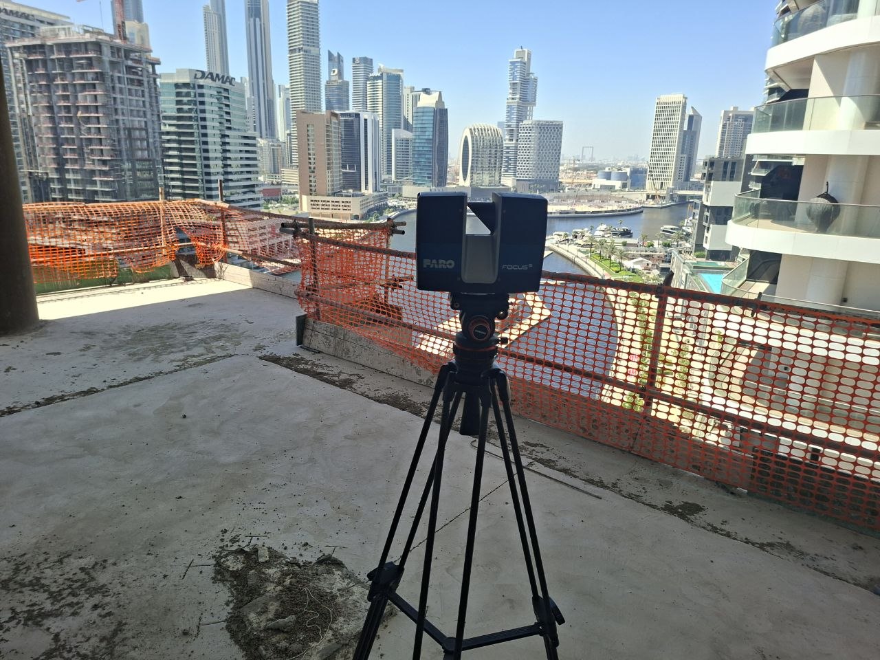
In Dubai, LiDAR workflows are especially relevant for large-scale developments, infrastructure-related environments, industrial sites, complex building exteriors, and projects that require reliable spatial data across extensive areas. In a market where many projects involve both vertical development and broad site coordination, LiDAR helps teams work from measured information rather than fragmented records or limited manual surveys.
LiDAR Services for Dubai Projects
Many projects in Dubai require reliable spatial data before design, planning, or coordination begins. This is especially important where teams need information across larger sites, building envelopes, complex external conditions, or technically demanding environments.
This service is particularly useful for:
- large commercial developments
- mixed-use and master-planned projects
- industrial and logistics sites
- infrastructure-related environments
- building exterior documentation
- site mapping and redevelopment planning
- renovation and retrofit projects
For these types of projects, LiDAR Services in Dubai provide a structured basis for scanning, mapping, and data processing workflows.
Where LiDAR Is Used in Dubai
LiDAR Scanning Services in Dubai are commonly used when project teams need measured site information that supports planning, design review, and spatial analysis across buildings or broader project areas.
Typical applications include:
- site scanning for development and redevelopment planning
- building envelope and exterior condition capture
- support for infrastructure and utility-related environments
- mapping of industrial and logistics properties
- spatial documentation for mixed-use and commercial projects
- preparation of measured data for drafting or model-based workflows
- support for large areas that require structured digital mapping
Where a project also requires interior building capture or more detailed documentation of existing spaces, teams may use 3D Scanning Services alongside LiDAR workflows.
Who This Service Is For
Our LiDAR Services in Dubai are relevant for professionals who need reliable measured information for mapping, scanning, documentation, and planning.
This service is commonly used by:
- architects
- engineers
- contractors
- developers
- property owners
- infrastructure teams
- real estate and planning teams
For projects that move from measured conditions into drawing documentation, LiDAR-based workflows may also connect with As-Built drawings where formal documentation is required.
What Clients Receive
Depending on project scope, clients may receive:
- LiDAR scan data
- site-based spatial datasets
- mapped and structured digital information
- processed data for documentation and planning
- measured information for design and coordination workflows
- prepared outputs for downstream digital use
The purpose of this service is not only to collect measured data, but to prepare it for practical use across project workflows. Where structured data preparation is needed after capture, teams may also use Point cloud processing to organize and prepare the information for documentation, review, or model development.
Why LiDAR Services Matter in Dubai
In Dubai, many projects involve large sites, broad development footprints, and technically complex environments that require dependable measured information before planning moves forward. LiDAR supports project teams by providing spatial data that can be used more consistently across mapping, scanning, and coordination workflows.
This helps project teams:
- verify site and building conditions
- support planning and redevelopment workflows
- improve coordination across larger project areas
- reduce issues caused by incomplete spatial information
- create a clearer basis for scanning, mapping, and documentation
- support design and project preparation with measured data
Where projects move from mapped conditions into wider digital coordination, teams may also use BIM services as part of broader project development workflows.
LiDAR Data for Site and Building Workflows
Many projects in Dubai involve environments that extend beyond standard interior documentation. This makes LiDAR especially useful where teams need structured data across larger sites, exterior conditions, industrial areas, or infrastructure-related properties.
This is particularly relevant for:
- industrial site mapping
- mixed-use development planning
- commercial property documentation
- building exterior capture
- redevelopment and land-use planning
- support for infrastructure-related project environments
For these projects, LiDAR Mapping Services in Dubai provide measured information that can be used in a more structured way than fragmented survey records alone.
LiDAR Workflows for Mapping and Data Processing
Once a site has been captured, the next step is preparing the information so it can support mapping, analysis, documentation, and digital coordination. LiDAR workflows are often used where teams need a reliable measured reference before moving into later project phases.
This helps project teams:
- organize spatial information more clearly
- prepare data for mapping and documentation
- support planning across larger or more complex sites
- improve coordination before design and development work begins
- create a stronger basis for downstream digital workflows
For Dubai projects involving large-scale or technically demanding environments, this kind of workflow is especially useful when multiple teams need to work from the same measured reference.
FAQ
What are LiDAR Services in Dubai used for?
Can LiDAR be used for large sites and development areas?
What do clients receive after a LiDAR scanning project?
Can LiDAR data support BIM and documentation workflows?
Is LiDAR useful for building exteriors and industrial properties?
Get a Quote for LiDAR Services in Dubai
If your project requires measured LiDAR data, structured mapping information, or a reliable basis for planning, documentation, and coordination, ScanM2 can support your team with professional LiDAR Services in Dubai. Contact us to discuss your project scope and request a quote.