

How Scan Data Helps Detect Geometry Conflicts Before Design Begins
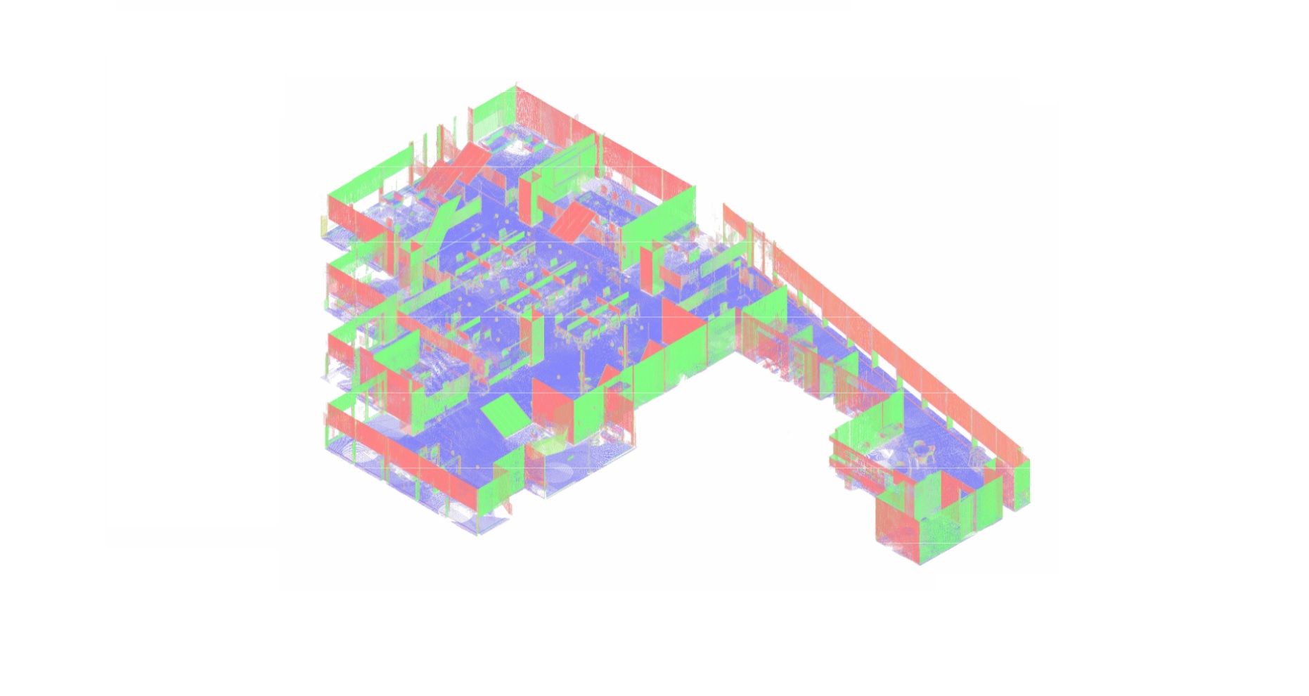

One of the most common reasons for design revisions and construction rework is inaccurate information about existing building conditions. Architects and engineers often begin projects using outdated drawings, incomplete surveys, or documentation that no longer reflects the actual geometry of the building.
As buildings evolve over time, walls are relocated, openings are modified, ceilings are lowered, and MEP systems are rerouted. These changes are not always documented, creating hidden conflicts that may only become visible once design work is already underway.
This is why many renovation and reconstruction projects now begin with 3D laser scanning services and detailed geometry verification before design starts.
Accurate scan data allows project teams to identify potential issues early and build design decisions on verified information rather than assumptions.
Why Geometry Conflicts Appear in Existing Buildings
Most existing buildings differ from their original documentation in some way. Even relatively new buildings may contain deviations caused by construction tolerances, site adjustments, or later modifications.
Common causes of geometry conflicts include:
- undocumented renovations;
- relocated partitions;
- modified openings;
- structural alterations;
- outdated floor plans;
- changed ceiling configurations;
- rerouted MEP systems;
- incomplete as-built documentation.
The longer a building has been in operation, the greater the likelihood that archived drawings no longer represent actual site conditions.
For renovation projects, these discrepancies can create significant design and coordination challenges.
What Scan Data Reveals Before Design Starts

Laser scanning captures the actual geometry of a building and provides a complete digital record of existing conditions.
This allows architects and engineers to identify issues that may not be visible in traditional drawings.
Scan data commonly reveals:
- wall deviations;
- floor level differences;
- ceiling height changes;
- shifted openings;
- structural irregularities;
- façade distortions;
- visible MEP infrastructure;
- alignment issues between building elements.
Many of these discrepancies remain unnoticed until construction begins if only traditional documentation is used.
Detecting them early significantly improves project reliability.
How Point Cloud Data Supports Geometry Verification
The result of a laser scanning survey is a point cloud containing millions of accurate measurements of the building.
Unlike traditional surveys that capture selected dimensions, point clouds document the entire visible environment and provide a highly detailed reference for design teams.
Using point cloud to CAD services, architects and engineers can compare existing documentation against actual building geometry and verify:
- wall positions;
- floor elevations;
- ceiling conditions;
- structural elements;
- openings and penetrations;
- technical infrastructure.
This process helps eliminate uncertainty before design decisions are made.
Point cloud verification is particularly valuable for renovation, adaptive reuse, and reconstruction projects where existing conditions directly influence the design process.
Common Geometry Conflicts Found in Renovation Projects
Geometry conflicts can affect almost every discipline involved in a renovation project.
| Conflict Type | Why It Matters |
|---|---|
| Wall position mismatch | Affects layouts and dimensions |
| Incorrect ceiling heights | Impacts MEP and interior design |
| Floor level differences | Affects installation and accessibility |
| Opening misalignment | Creates coordination issues |
| MEP route conflicts | Increases redesign risk |
| Structural offsets | Impacts project feasibility |
| Façade irregularities | Affects architectural detailing |
Even small deviations may lead to significant coordination problems when multiplied across a large project.
Why Detecting Conflicts Early Reduces Rework
The earlier geometry conflicts are identified, the easier and less expensive they are to resolve.
When discrepancies are discovered during design, teams can adjust layouts and engineering solutions before procurement or construction begins.
Benefits of early conflict detection include:
- fewer design revisions;
- reduced construction rework;
- improved coordination;
- fewer site clarifications;
- lower project risk;
- more accurate budgeting;
- faster decision-making.
By contrast, geometry issues discovered during construction often lead to delays, change orders, and additional costs.
This is one of the primary reasons why accurate existing conditions documentation has become a standard requirement for many renovation projects.
When CAD Is Enough and When BIM Is Better

Not every project requires a BIM model.
For smaller renovation projects, verified CAD drawings may provide all necessary information for design development.
CAD workflows are often sufficient for:
- simple architectural renovations;
- floor plan updates;
- interior modifications;
- basic documentation projects.
However, BIM becomes significantly more valuable when projects involve:
- multiple disciplines;
- MEP coordination;
- complex reconstruction;
- clash detection;
- phased construction;
- facility management requirements.
Professional Scan to BIM services allow project teams to transform verified scan data into coordinated digital models that support more advanced workflows.
Choosing the appropriate deliverable depends on project goals rather than technology preferences alone.
How Architects and Engineers Use Scan Data
Accurate scan data supports a wide range of design and coordination activities.
Architects commonly use scan data to:
- verify existing drawings;
- develop renovation layouts;
- check room dimensions;
- analyze ceiling conditions;
- prepare technical documentation.
Engineers often use scan data to:
- coordinate MEP systems;
- verify structural geometry;
- identify potential clashes;
- assess equipment locations;
- plan infrastructure upgrades.
Because scan data reflects actual conditions, it provides a much more reliable foundation for design development than archived drawings alone.
Best Practice Before Starting Design
A structured workflow helps ensure that design begins with accurate and verified information.
Typical best-practice steps include:
- Review existing documentation;
- Identify critical project areas;
- Perform laser scanning;
- Register and validate the point cloud;
- Compare scan data with existing drawings;
- Define CAD or BIM deliverables;
- Begin design using verified geometry.
This process reduces uncertainty and helps teams make informed decisions throughout the project lifecycle.
Conclusion
Many design problems originate long before design work begins. Inaccurate drawings, undocumented modifications, and incomplete surveys often introduce geometry conflicts that remain hidden until later project stages.
Laser scan data provides an accurate representation of existing conditions and allows architects and engineers to identify these conflicts before design decisions are finalized.
Technologies such as:
- 3D laser scanning;
- point cloud documentation;
- geometry verification;
- CAD documentation;
- BIM modeling;
help create more reliable renovation workflows while reducing design risk, construction rework, and coordination problems.
For existing building projects, verified geometry is often one of the most valuable resources a design team can have.
Ready to Verify Existing Building Geometry?
ScanM2 provides laser scanning, point cloud processing, geometry verification, CAD documentation, and BIM modeling services for renovation and reconstruction projects.
We help architects, engineers, contractors, and developers work with accurate existing conditions data before design begins.
Contact ScanM2 to discuss your building survey, point cloud, or Scan-to-BIM project.
FAQ
What are geometry conflicts in renovation projects?
How does scan data help before design begins?
Can point cloud data replace old drawings?
When should geometry verification be performed?
Is BIM required to detect geometry conflicts?

Architectural Documentation of Heritage Buildings with 3D Laser Scanning
06.04.2026
Architectural documentation of heritage buildings is the process of recording the geometry, structure, visible condition, and key architectural features of historic properties in a form ...

How Point Clouds Are Used in Architecture
23.03.2026
Point clouds have become one of the most valuable data sources in modern architectural practice. In projects involving existing buildings, renovation, adaptive reuse, restoration, or ...

Benefits of Using Revit MEP for BIM Coordination and Engineering Design
16.03.2026
Modern construction and engineering projects involve increasingly complex building systems. Mechanical, electrical, and plumbing infrastructure must be designed, coordinated, and installed with high precision. This ...

Structural Design of Buildings Under Real Project Constraints
28.01.2026
In real projects, the structural design process breaks down when layout decisions are made before architectural grids, shafts, and major openings are stable. Most structural ...

