
Drone Orthomosaic Mapping Services
An orthomosaic is a single, geometrically corrected aerial image of your site, assembled from hundreds of overlapping drone photos. Unlike an ordinary aerial photo, it has a uniform scale: distances and areas can be measured on it, and it sits in a real coordinate system, so it lines up with your CAD drawings, GIS layers and BIM models. ScanM2 provides drone orthomosaic mapping services for architects, engineers, contractors and property owners who need an up-to-date, measurable picture of a site as a base for design and planning.
Contact Us Now for a Free Consultation!
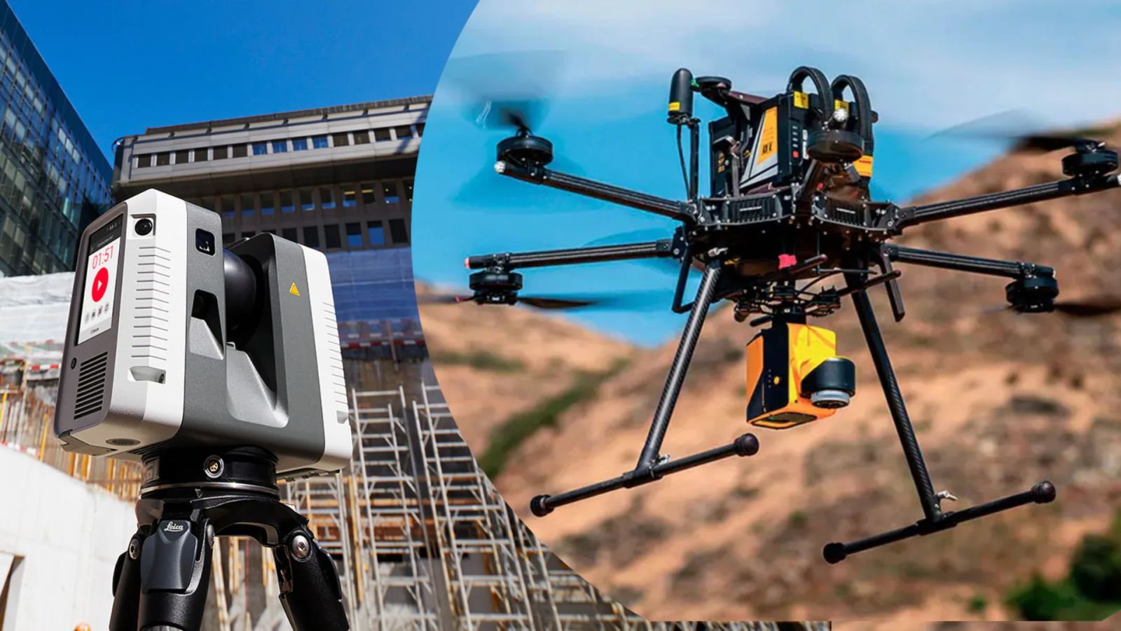
We treat the orthomosaic as a working document, not a pretty picture. That means agreeing on the coordinate system first, explaining honestly what accuracy depends on, and delivering files your team can open in its own software. When the project needs more than a view from above, we combine the drone flight with terrestrial laser scanning and deliver one consistent dataset.
What an Orthomosaic Is and How It Is Made
A normal photo taken from the air is distorted: objects at the edges lean outward, taller objects appear displaced, and the scale changes across the frame. Orthorectification removes these distortions using a 3D surface model of the site, so every pixel is shown as if seen from directly above. The corrected images are then stitched into one seamless map.
Our workflow:
- Scope and coordinate system. We agree on the area, the purpose of the map and the coordinate system: State Plane, UTM or the local site grid your project already uses.
- Flight planning. Flight height and image overlap are chosen for the level of detail you need. The flight is planned around site access, buildings, trees and other obstacles.
- Ground control. Ground control points are placed on site and their coordinates measured, or we use the control established by your surveyor. Ground control is what ties the map to real coordinates.
- Capture. The drone flies an automated grid pattern and takes overlapping photos of the whole area.
- Processing. Photogrammetry software aligns the images, builds a surface model and produces the orthomosaic. We check the result against the control points.
- Delivery. You receive the orthomosaic and agreed derivatives in the formats your team uses, with a short report on the coordinate system and control used.
If you want to understand how photo-based mapping differs from laser-based capture, read TLS, LiDAR and photogrammetry compared.
What Accuracy Depends On
Many providers promise a fixed accuracy for every project. In practice, the quality of an orthomosaic depends on three things, and we discuss them with you before the flight.
| Factor | What it means | How it affects the map |
|---|---|---|
| Flight height | How high the drone flies above the ground | Lower flights capture more detail but take longer to cover the same area |
| GSD (ground sample distance) | The size of one image pixel on the ground | A smaller GSD shows finer details such as curbs, markings and manholes |
| Ground control points | Marked points with measured coordinates | Tie the map to the real coordinate system and control positional accuracy |
| Site conditions | Light, wind, vegetation, reflective or uniform surfaces | Shadows, trees and water reduce what can be reliably mapped |
So the honest answer to “how accurate is your orthomosaic” is that it depends on flight height, GSD and ground control points. We agree on these parameters for your purpose – a context map for a design proposal needs a different setup than a base map for site layout – and report what was achieved against the control points.
An important note: a drone orthomosaic is a mapping product. If your project needs a legal boundary survey, a certified topographic survey or any document that must be signed and sealed, that is the responsibility of a licensed surveyor. We can provide georeferenced capture and processing for projects where the client’s licensed surveyor reviews the data and signs the official documents.
Deliverables and Formats
| Deliverable | Format | Typical use |
|---|---|---|
| Orthomosaic | GeoTIFF with coordinate system information | GIS, site analysis, design base map |
| Lightweight image | JPG or PDF | Presentations, reports, sharing with stakeholders |
| Google Earth overlay | KMZ | Quick viewing by clients and project teams |
| CAD base map | DWG with the orthomosaic attached in project coordinates | Site plans and design in AutoCAD |
| Surface model | DSM as GeoTIFF | Heights of roofs, trees and terrain from above |
| Photogrammetric point cloud | LAS / E57 | Import into CAD, Revit or point cloud software |
| Report | Coordinate system, ground control and processing notes |
Topographic products such as terrain models, contour lines and earthwork volumes are covered on our page about drone site and property survey services. This page is focused on the orthomosaic itself and how it fits into design work.
Orthomosaics in CAD and BIM Workflows
Our core work is scan to BIM and as-built documentation, so we prepare orthomosaics with design teams in mind:
- Site context for architects. The orthomosaic becomes the background for site plans, landscape design and early massing studies. See also BIM for landscape architects.
- Base map for as-built drawings. Roofs, paving, parking, fences and outdoor equipment can be traced from the orthomosaic into a DWG site plan.
- Combined with laser scanning. Building interiors and façades are scanned with FARO laser scanners, typically accurate to ±2–3 mm, while the drone covers roofs and the surrounding site. Both datasets are placed in the same coordinate system. More in our article on using drones and laser scanning for as-built surveys.
- Revit and .ifc models. The orthomosaic can be placed under a Revit site model, and the combined data supports Scan to BIM services for buildings on the site.
- Repeat flights. Flown again with the same control, the orthomosaic shows how a construction site has changed between visits.
For aerial documentation of buildings themselves – roofs, façades and as-built drawings from drone data – see our drone as-built survey services.
What an Orthomosaic Does Not Show
Knowing the limits helps you order the right product:
- It is a view from above. Façades, overhangs and what is under roofs or canopies are not visible; for these we use laser scanning.
- Ground under dense trees is hidden. Photogrammetry sees the tree tops, not the terrain beneath. Where terrain under vegetation matters, laser-based methods are better suited – see how LiDAR drone mapping works.
- Heights are not read from the image. Elevations come from the surface model or point cloud, not from the orthomosaic itself.
- Moving objects and changing light. Cars, people and cloud shadows can leave artifacts; we plan flights to keep them to a minimum.
Who Uses Our Orthomosaic Mapping
- Architects and landscape architects who need a current site base for design.
- Engineers and contractors preparing site logistics, layout and progress records.
- Property owners and facility managers documenting large campuses, parking areas and roofs.
- Industrial and oil & gas facility owners who need an overview of their site together with laser-scanned process areas.
- Survey firms that want photogrammetric processing to complement their own fieldwork.
We travel to sites in any US state. If you already have drone images or a laser scan of your site, we can process or combine them instead of capturing new data.
FAQ
What is a drone orthomosaic?
What is the difference between an orthomosaic and a regular aerial photo?
How accurate is a drone orthomosaic?
Do you use ground control points?
Can an orthomosaic replace a licensed land survey?
Which file formats do you deliver?
Can you combine the orthomosaic with laser scanning and BIM?
Do you work outside your area?
Send Us Your Site
Tell us where the site is, how large the area is, what you plan to use the map for and which coordinate system your project uses. If you have survey control, existing drawings or a point cloud, send them too. We will suggest a flight setup and a set of deliverables that fit your purpose and send a quote based on the scope.

