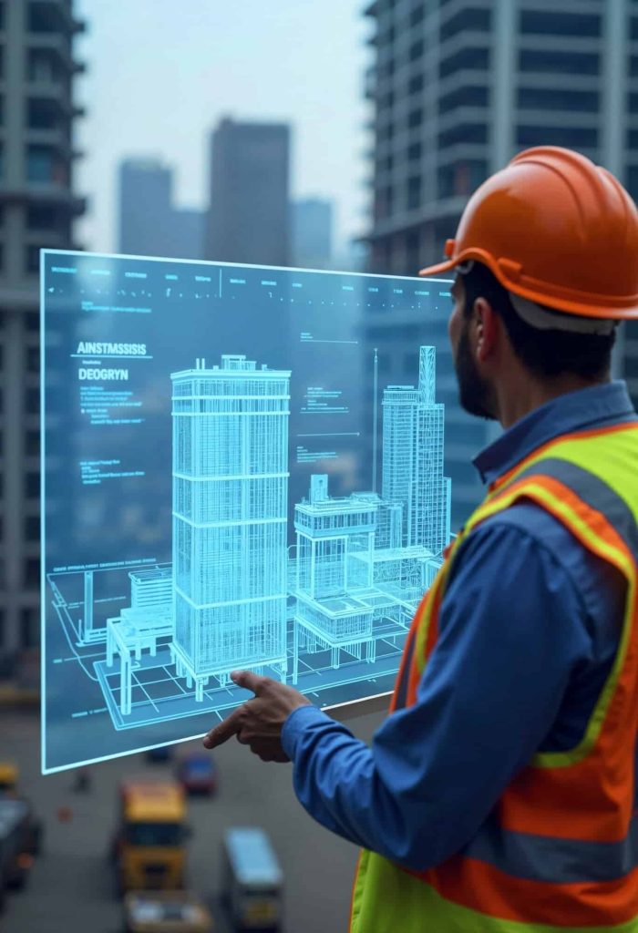
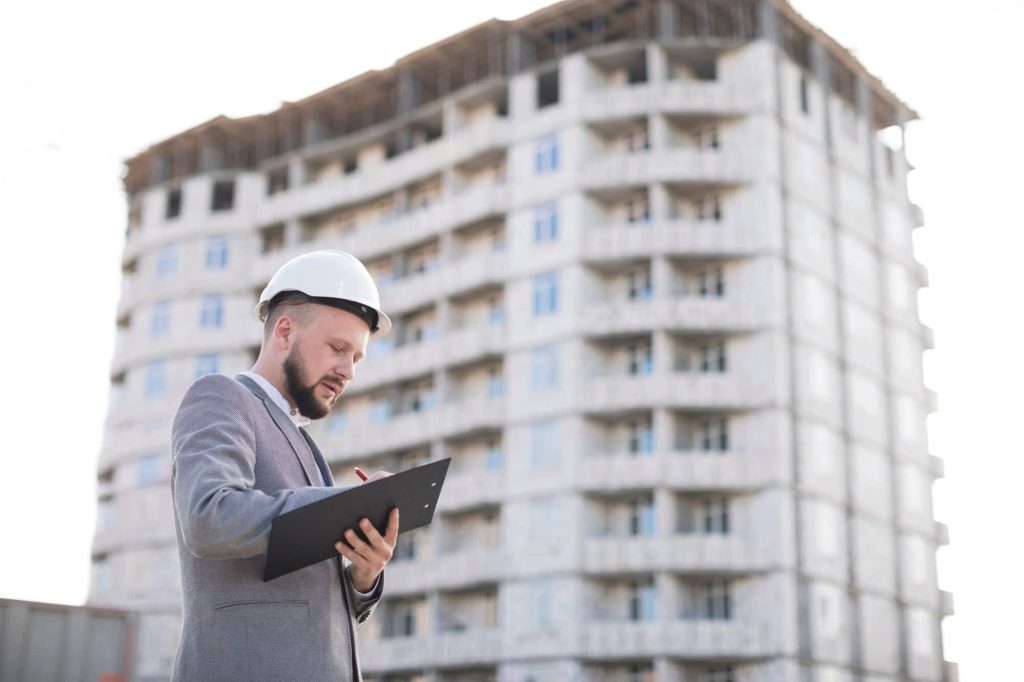
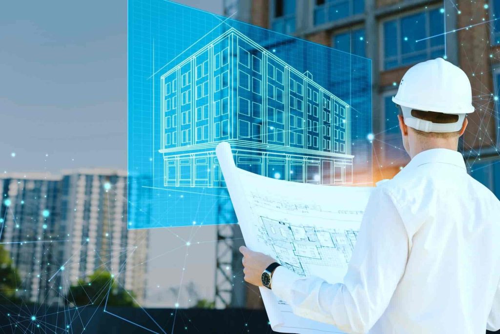
Why 3D Scanning + BIM = Better Projects, Lower Costs, Less Stress
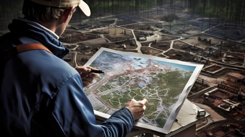
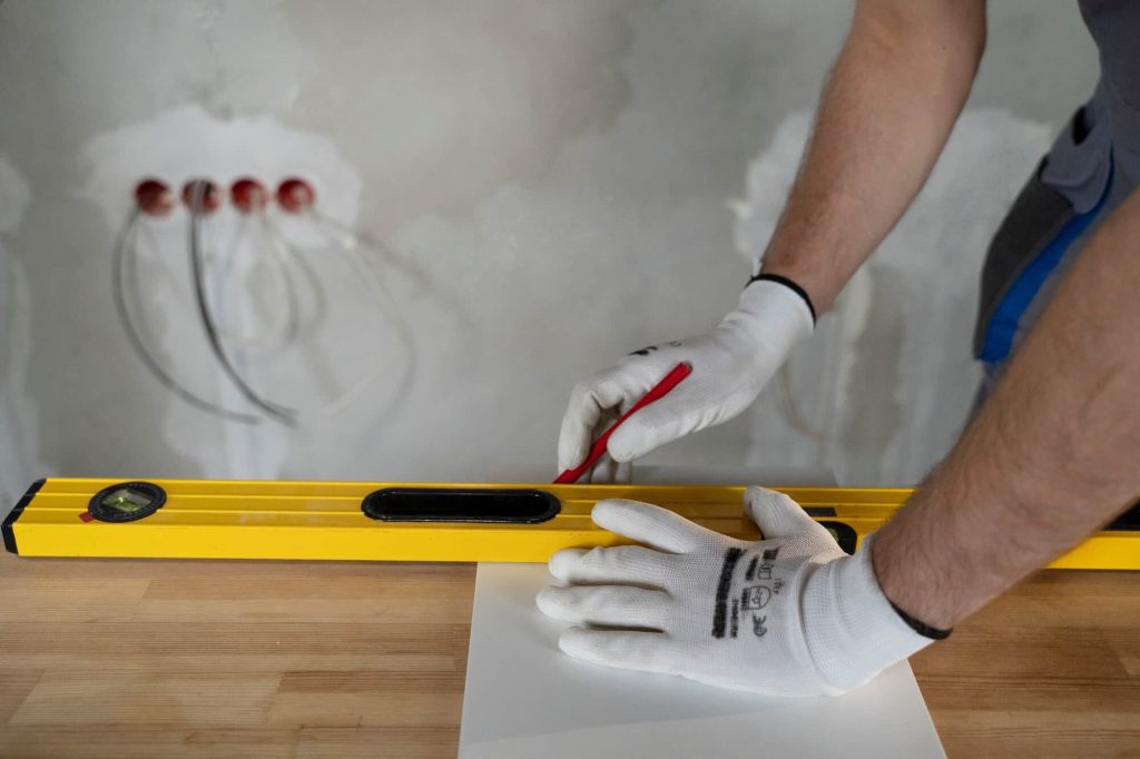
Developers, architects, and contractors all face the same chronic problems: outdated plans, design clashes, change orders, and construction delays. Most of these issues stem from one root cause — inaccurate or missing real-world data. Without precise site conditions, the best-designed projects can run into costly surprises. Traditional measurement methods are slow and prone to human error, and working “based on assumptions” is a recipe for blown budgets and sleepless nights.
How BIM Verification with 3D Scanning Saves Money
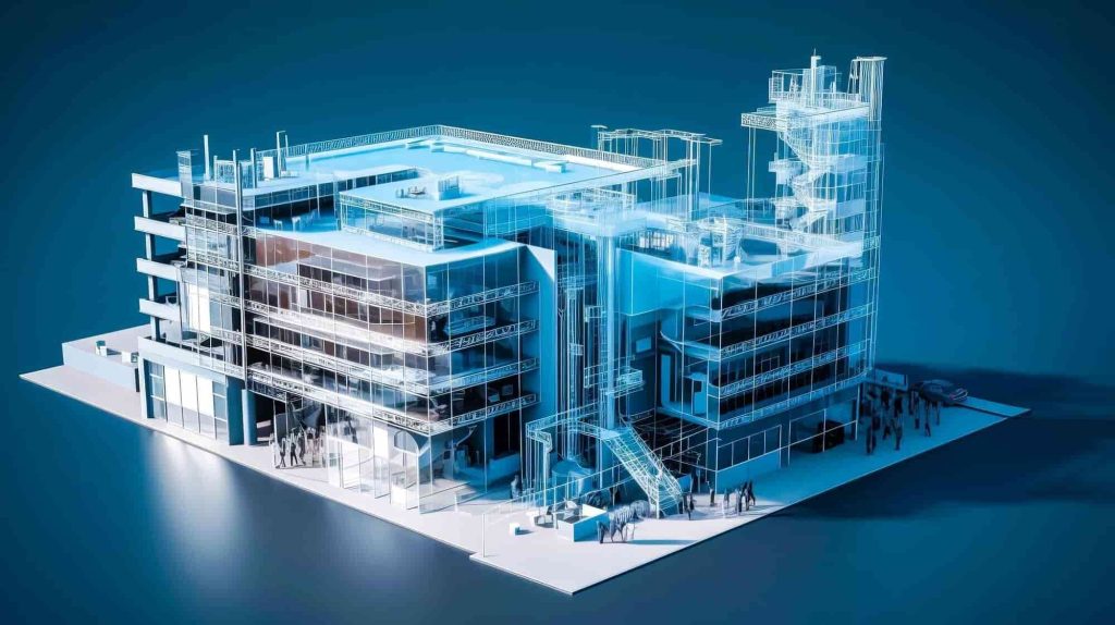
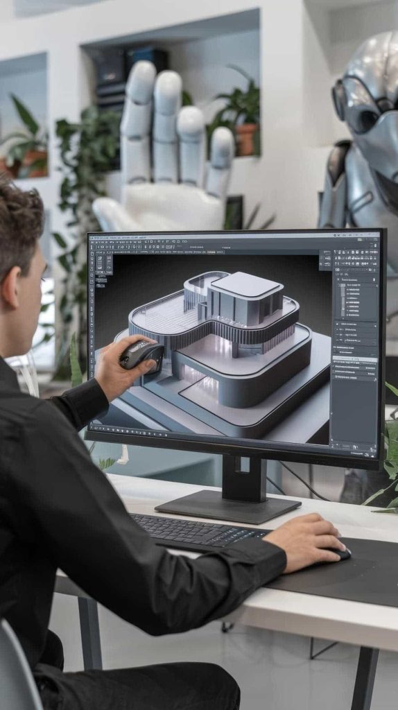
When you combine 3D laser scanning with Building Information Modeling (BIM), you gain a powerful tool for design validation and construction quality control. Laser scanners capture a highly accurate point cloud of the real-world conditions. That data is imported into BIM software, allowing you to compare the as-is vs. as-designed models in real time.
Benefits:
Detect clashes between MEP, structural, and architectural elements before construction,
Reduce change orders and avoid rework,
Spot deviations from plans instantly,
Speed up approvals and inspections,
Gain trust with stakeholders through reliable data.
Studies show that integrating 3D scanning into BIM workflows can reduce construction costs by 5–15% and accelerate project timelines by 10–30%.
3D Scanning as a Tool for Prevention and Documentation
Laser scanning isn’t just for fancy visuals — it’s a documentation tool that acts like a “black box” of your project.
You can use it:
Before construction to document site conditions, existing structures, and create accurate terrain models that serve as the base for design and planning.
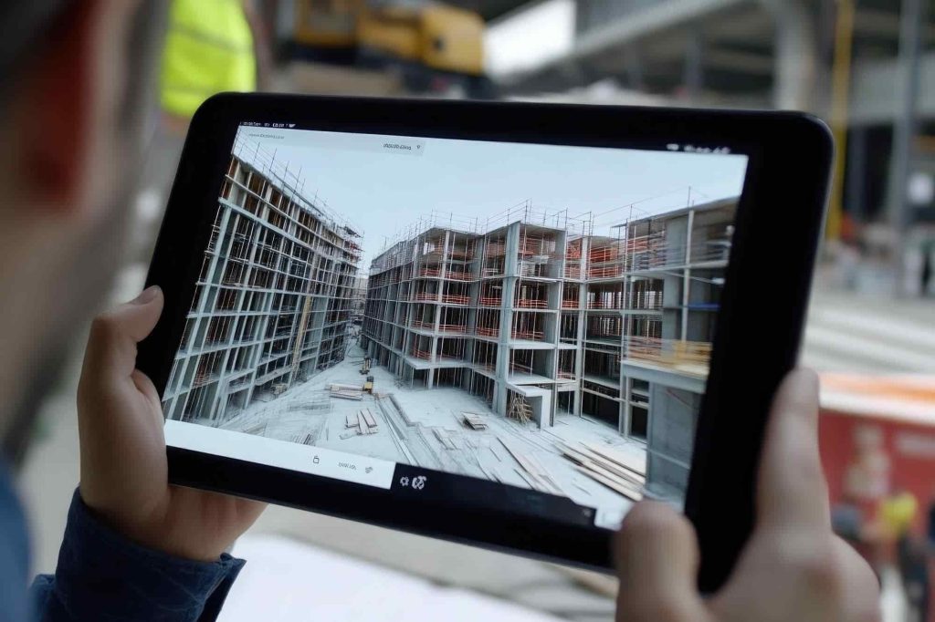
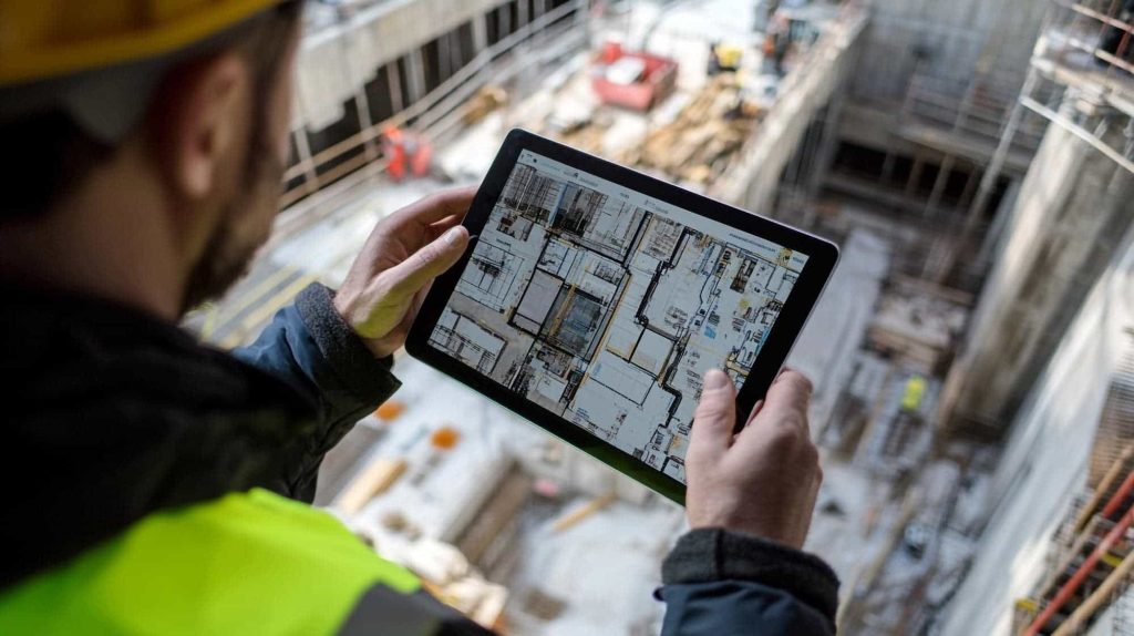
During construction to monitor progress, verify that installations match design specs, and ensure construction milestones are met without costly errors.
After construction for as-built documentation, which is critical for facility management, renovation planning, or future modifications.
Every scan is a digital snapshot of your project, capturing millimeter-level accuracy — protecting your investment from claims, disputes, or miscommunication.
When and How to Use 3D Scanning Throughout the Project Lifecycle
3D scanning can be strategically applied at multiple phases of a project. Here’s how:
Concept & Design Phase: Use laser scanning to capture existing conditions and reduce the risk of design based on outdated or incorrect information.
Pre-construction Phase: Verify terrain models and foundation readiness to avoid delays due to unexpected site conditions.
Structural Completion: Ensure that beams, columns, and critical elements match tolerances before closing up walls or ceilings.
MEP Installation: Identify clashes or misaligned installations early by comparing the scan to the BIM model.
Post-construction: Create a true as-built model for handover to facility managers or to use in digital twin systems.
Proactive scanning at these stages helps you mitigate risk, avoid rework, and build a reliable digital trail of your project’s progress.
When Should You Start Scanning?
Ideally — as early as possible. A pre-construction scan can form the basis for your BIM model and help flag potential issues long before they become costly.
Already mid-project? Schedule scans after key construction phases like:
foundation,
structural frame,
MEP installation,
roof closure.
These milestones are perfect for verifying progress and preventing surprises later.
Why Work with SCANM2?
At SCANM2, we specialize in mobile 3D laser scanning and advanced point cloud processing for projects across the United States. Our team delivers BIM-ready documentation tailored to your needs, compatible with Revit, AutoCAD, Navisworks, ArchiCAD, and other leading platforms.
What Sets Us Apart:
We use professional-grade laserscanners from top global brands to capture millions of data points with millimeter accuracy.
Our in-house specialists convert raw point clouds into clean, structured 3D models and 2D documentation.
We offer deliverables at LOD 100–400, depending on your project stage and scope.
From noise reduction and registration to surface reconstruction and clash analysis, we handle every step of point cloud processing — ensuring you get precise, reliable, and usable data for design, verification, or facility management.
Whether you’re working on an industrial facility, commercial building, or infrastructure project, we help you reduce risk and stay on schedule with high-quality 3D data.
Check our activity on:
Stages of the Reverse Engineering Process – from 3D Scanning to Final Product
Reverse engineering is increasingly becoming a key component of modern production strategies, allowing companies to quickly and accurately recreate unavailable or obsolete components. Advanced 3D scanning and CAD software enable restoration of machinery functionality, extension of their operational lifespan, and improvement in product quality.
Stages of the Reverse Engineering Process
1. 3D Scanning of the Object
The first step is the accurate 3D scanning of a physical object using advanced laser or structured-light scanners. This allows precise mapping of even the most complex geometries with accuracy up to 0.05 mm.
2. Creating a Point Cloud
Scanning data is transformed into a point cloud – a set of XYZ coordinates describing the surface of the object. Software such as Autodesk ReCap or FARO Scene helps to clean the data by eliminating noise and unnecessary points.
3. Converting Data to a Mesh Model
The point cloud is converted into a mesh model, commonly saved in STL format. Programs such as Autodesk Fusion 360, Geomagic Wrap, or MeshLab are used for further mesh optimization.
4. CAD Modeling
The mesh model is transformed into a precise, parametric CAD model. Tools like SolidWorks, CATIA, or Siemens NX enable detailed geometry management, allowing adjustments to new requirements or materials.
5. Analysis and Simulation
At this stage, Finite Element Method (FEM) simulations are conducted using software such as Ansys, SolidWorks Simulation, or Autodesk Inventor Nastran. This evaluates the structural integrity of the design before physical production.
6. Prototyping and Testing
Prototypes are produced using CNC technology or 3D printing (DMLS, SLM). Testing verifies mechanical properties and enables necessary adjustments before mass production.
7. Mass Production
Following successful tests, the project proceeds to mass production, where the quality meets or exceeds that of the original product.
When is Reverse Engineering Beneficial?
Reverse engineering is particularly effective when:
Original technical documentation is missing,
The original manufacturer has discontinued the part,
Existing designs require modernization,
Rapid solutions to unavailable components are needed.
It is especially relevant in sectors such as:
Architecture and construction,
Industrial manufacturing,
Energy,
Aerospace and automotive,
Medicine.
Reverse Engineering Project Management
Effective project management is crucial to the success of reverse engineering processes. Tools such as Jira, Trello, or Asana facilitate team organization, progress tracking, and documentation management. Additionally, Product Lifecycle Management (PLM) platforms like Siemens Teamcenter or PTC Windchill support managing the product lifecycle from conception through to production.
Costs and Benefits of Reverse Engineering
Costs for reverse engineering services are individually determined based on the project’s size and complexity. It is a cost-effective solution that reduces overall expenses, shortens project timelines, and resolves problems related to unavailable components.
Summary
Reverse engineering, combined with 3D scanning and modern CAD software, provides companies with robust tools to overcome challenges posed by missing parts or documentation. This process enables rapid reproduction, modernization, and optimization of complex components.
Utilizing reverse engineering services saves time, reduces production costs significantly, and accelerates project delivery, thereby directly enhancing company competitiveness. Whether you need a digital CAD model, precise 3D prototypes, or mass production, reverse engineering provides tailored and reliable market-ready solutions.
Check our activity on:
Quality Control of Parts Using 3D Scanning
Modern 3D scanning technologies are revolutionizing quality control processes in industry, especially in sectors that require precise production, such as automotive, construction, and machinery manufacturing.
With the application of reverse engineering, 3D scanning allows for the accurate replication of real objects into digital models that can be precisely compared with original CAD designs, and any discrepancies can be quickly detected and corrected.
3D Scanning Process in Quality Control
3D scanning allows for the capture of highly detailed data regarding the geometry of an object in the form of a point cloud, which is particularly useful in verification and quality control processes. Here are the main steps of this process:
Scanning the object: 3D scanning is carried out using laser scanners that collect surface data of the object, creating a three-dimensional map. This 3D model allows for detailed analysis of the object’s geometry.
Comparison with CAD model: The scanned model is compared with the digital CAD model, which helps detect any deviations from the design. These deviations can pertain to dimensions, shape, or positioning of components.
Generating reports: Based on the comparison of scans and the CAD model, detailed reports are generated, highlighting areas where differences exist between the real object and the design. These reports are crucial in the quality audit process and allow for the quick identification of issues.
Deviation analysis: When deviations are detected, their impact on the functionality of the part is analyzed. These deviations may include production defects, assembly errors, or other issues that could affect the final product’s quality.
Production optimization: 3D scanning, in conjunction with reverse engineering, enables faster detection of inconsistencies in the production process, leading to production optimization, error reduction, and time and cost savings.
Advantages of 3D Scanning in Quality Control
Precise measurements: 3D scanning provides unparalleled measurement accuracy, allowing even the smallest deviations to be detected, which could be overlooked using traditional measurement methods.
Real-time verification: 3D scanning enables immediate verification of production quality. By continuously monitoring the process, errors can be quickly identified and corrected, which leads to greater production efficiency.
Process automation: 3D scanning, combined with CAD and BIM technologies, allows for the automatic generation of reports and detection of inconsistencies, reducing verification time and increasing assessment accuracy.
Cost efficiency: By quickly detecting errors and imperfections, 3D scanning helps reduce production costs, as costly corrections don’t need to be made later in the process.
Examples of 3D Scanning Applications in Quality Control in Various Industries
3D scanning finds widespread application in quality control across various industries, enabling precise checks of dimensions, shapes, and positioning of components against their designs. Here are a few examples of how this technology is used in quality verification in key industries:
Construction In construction, 3D scanning plays a crucial role in quality control of structures. Regular scanning of buildings during construction allows for the comparison of the actual state with the project documentation. For instance, scanning foundations, load-bearing walls, and other structural elements allows for verification of their geometry and positioning against the original design. If discrepancies are detected, such as deformations or improper placement of elements, corrections can be made quickly. This type of scanning is also used in the final stages of construction, where comparing the actual state with the design helps verify the correctness of all construction work.
Machinery and Equipment Manufacturing In machinery and equipment manufacturing, where precise fitting of parts is essential, 3D scanning is used to control the dimensions and geometry of components. Scanning allows for the accurate verification of machine parts, such as housings, mechanisms, or engines, ensuring they meet quality and design requirements. If any deviations are detected, for example, in the assembly layout or shape of components, immediate corrective actions can be taken, preventing potential failures and production errors.
Renovation of Buildings and Structures In the renovation of buildings, especially historic ones, 3D scanning enables the precise replication of existing structural elements, which is essential for quality control of renovation work. 3D scanning allows for the comparison of the actual state of the building with its original design or documentation. This technology helps detect any deviations that may indicate inaccuracies in execution, such as surface irregularities or errors in reproducing architectural details. This enables necessary corrections to be made before completing the renovation.
Automotive Industry In the automotive industry, where precise quality of parts is crucial for vehicle safety and performance, 3D scanning is used to control the quality of components such as engines, exhaust systems, suspension, and bodywork. Through 3D scanning, it is possible to accurately compare the dimensions of parts with CAD designs, detecting microscopic deviations that could impact the vehicle’s performance. Scanning also allows for faster verification after assembly, minimizing the risk of production errors and improving the overall quality of products.
Electronics Manufacturing In quality control within the electronics industry, 3D scanning allows for detailed analysis of components, such as printed circuit boards, device housings, and integrated circuits. This technology enables precise checking of dimensions and geometry of electronic parts, ensuring they align with designs. Detecting microscopic defects in production, such as cracks or improper placement of components, allows for their prompt removal, improving the quality of the final products and reducing the risk of failure.
Conclusion
3D scanning in quality control enables precise comparison of the actual state with the design in various industries, which leads to the detection of production errors and optimization of processes. In each of the industries mentioned, from automotive to construction and machinery manufacturing, this technology is a key tool in ensuring high-quality products and improving production efficiency.
Check our activity on:
How to Create a CAD Model from a 3D Scan?
Reverse engineering 3D scan is not just about scanning physical objects – it’s a complete digital workflow that converts real-world geometry into editable, precise CAD (Computer-Aided Design) data.
This process is crucial for product development, part replication, or modification in both industrial and engineering contexts. Below is a step-by-step guide on how to transform a 3D scan into a functional CAD model, with the best tools and technologies available today.
Step 1: 3D Scanning and Point Cloud Acquisition
The reverse engineering process begins with 3D scanning services USA that capture millions of measurement points on the surface of a physical part. This data is compiled into what’s known as a point cloud – a 3D map of XYZ coordinates.
Depending on the object and industry, different scanning technologies may be used:
Laser 3D scanners – ideal for large objects or outdoor scanning with high accuracy.
Structured light scanners – perfect for capturing small parts and intricate surfaces.
Handheld 3D scanners – flexible and suitable for complex geometries in the field.
Photogrammetry – useful for combining multiple photos into a 3D model (common in heritage or architecture).
The result is a dense point cloud that accurately represents the scanned object’s shape.
Contact Us Now for a Free Consultation!
Step 2: Processing the Point Cloud with Autodesk ReCap
Once the scan is complete, the next step is to process the point cloud. In the Autodesk ecosystem, Autodesk ReCap is the go-to tool for:
Importing scan data from various 3D scanners,
Cleaning the point cloud (removing noise and irrelevant data),
Aligning and merging multiple scans,
Scaling and orienting the model for further use.
This step is critical to prepare the data for mesh generation or direct CAD modeling.
Step 3: Converting the Point Cloud to a Mesh
The optimized point cloud is then converted into a mesh model (usually in STL format). This surface model is made of thousands of tiny triangles that represent the object’s shape.
Autodesk tools such as Fusion 360 can handle this conversion internally, but there are also other software options:
MeshLab – open-source mesh editor and viewer,
Artec Studio – professional mesh post-processing software,
Geomagic Wrap – high-end solution for precise mesh conversion,
The mesh model serves as the base for CAD conversion or 3D printing.
Step 4: Creating the CAD Model (Surfacing & Solid Modeling)
To turn the mesh into a usable reverse engineering CAD model, it must be translated into solid or surface geometry.
In Autodesk Fusion 360, users can:
Use the “Mesh to BRep” function to convert mesh into solid geometry,
Use cross-sectional profiles to recreate the surfaces manually (surfacing),
Combine mesh and parametric features in a hybrid workflow.
For advanced engineering, the following CAD platforms may also be used:
Autodesk Inventor – mechanical engineering and product design,
SolidWorks – widely adopted in manufacturing and prototyping,
CATIA – used in aerospace and automotive industries,
Siemens NX – for enterprise-level engineering environments.
Step 5: Finalizing and Applying the CAD Model
The final reverse engineering CAD model can be used for a variety of applications:
CNC machining or 3D printing,
Finite Element Analysis (FEA),
Digital twin modeling for IoT integration,
PLM/ERP system integration,
Legacy part redesign and documentation.
Why Use Professional Reverse Engineering Services?
Working with a professional reverse engineering company USA helps reduce design time, lower costs, and improve product quality. These services are especially valuable when original part drawings or CAD files are unavailable.
If you’re wondering what is reverse engineering, how to convert 3D scans to CAD models, or are simply searching for 3D scanning services near me, partnering with a specialized provider is the fastest way to transform real-world objects into digital assets ready for manufacturing or simulation.
Whether you’re digitizing industrial parts, retrofitting existing systems, or creating accurate digital twins – reverse engineering 3D scanning is the bridge between the physical and the digital world.
Check our activity on:
Import Substitution: How Reverse Engineering Solves the Problem of Missing Parts
For many U.S. manufacturers, missing or obsolete components present a serious obstacle to maintaining production, repairing equipment, or extending the life of legacy systems. When original parts are no longer available — due to discontinued production, limited access to foreign suppliers, or outdated documentation — operations can grind to a halt.
Reverse engineering, combined with advanced 3D scanning technologies, offers a highly effective solution. By digitally capturing the geometry of existing parts and recreating them in CAD software, companies can reproduce critical components with precision — even without original blueprints.
This approach not only restores functionality but also enables design updates, material substitutions, and performance improvements, making it a cornerstone of modern import substitution strategies.
What Is Import Substitution and Why It Matters in 2025
Import substitution is the process of replacing foreign components with locally manufactured alternatives. In sectors such as aerospace, energy, automotive, and medical technology, this approach has become essential for maintaining operational continuity, reducing supply chain risks, and achieving industrial independence.
Reverse engineering plays a crucial role in this strategy by helping manufacturers overcome the “black box” nature of foreign parts — components that arrive without accessible design data or technical documentation. By using high-precision 3D scanning to digitally capture the geometry of existing parts and reconstructing them in CAD software, engineers can reproduce critical components with exacting accuracy.
This not only restores functionality but also opens opportunities for design optimization, material upgrades, and compliance with modern standards. For example, in 2022, the U.S. Navy successfully used reverse engineering to reproduce turbine blades for a legacy vessel after the original supplier ceased operations — cutting procurement time from 11 months to just 6 weeks.
Five Key Benefits of Reverse Engineering
1. Independence from Foreign Suppliers
Reverse engineering empowers companies to produce critical components internally, reducing dependency on overseas manufacturers. This capability is especially valuable when dealing with legacy machinery or parts that are no longer supported by the original supplier. For example, during the 2020–2022 semiconductor shortage, a Michigan-based automotive supplier successfully used reverse engineering to replicate electronic control unit housings and connectors, which were previously imported from East Asia and had become difficult to source.
2. Faster Production and Reduced Downtime
By enabling the reproduction of parts on demand, reverse engineering significantly reduces the lead time required to restore or maintain production systems. What previously took several months to procure from international sources can now be completed in a matter of days, helping manufacturers maintain continuity and meet delivery deadlines.
3. Cost Efficiency and Inventory Reduction
Manufacturers no longer need to maintain large inventories of rare or custom components. With reverse engineering, parts can be recreated as needed, minimizing storage requirements and cutting warehouse and logistics costs by as much as 60%. This just-in-time approach also limits waste and allows for more responsive operations.
4. Extension of Equipment Lifespan
A major advantage of reverse engineering lies in its ability to extend the operational life of legacy machinery. When OEM support is no longer available, companies can still maintain equipment by reverse-engineering worn or failed parts. In many cases, this approach has added 10 to 30 years of extended service life to aging systems, postponing the need for costly capital investments in new machinery.
5. Design Optimization and Modernization
The reverse engineering process not only reproduces existing parts but also provides opportunities for improvement. Scanned components can be digitally reworked to enhance structural performance, reduce weight, increase durability, or meet updated regulatory standards. Additionally, manufacturers can substitute outdated or rare materials with modern, more sustainable alternatives, aligning production with environmental and industry trends.
Step-by-Step: How Reverse Engineering Enables Import Substitution
1. 3D Scanning of the Physical Part
High-resolution scanners (e.g., laser or structured light) capture a point cloud with precision up to 0.05 mm, accurately reflecting complex surfaces, threads, and inner geometries.
2. Data Processing and Geometry Cleaning
Scans are processed to remove noise, align fragments, and generate a watertight 3D mesh. Engineers can identify signs of wear and restore the original geometry.
3. CAD Model Reconstruction
Using reverse engineering software, engineers create a fully editable parametric CAD model compatible with industry-standard formats (STEP, IGES, STL).
4. Prototyping and Manufacturing
Parts can be produced using CNC machining, metal 3D printing (e.g., DMLS, SLM), or injection molding. Additional simulations (FEM) verify mechanical performance before full-scale production.
Applications in Key U.S. Industries
Reverse engineering is now widely used across multiple industries to address the growing issue of unavailable or obsolete components. When original parts are no longer in production, manufacturers turn to 3D scanning and digital reconstruction to restore or improve key elements of machinery and equipment.
Industry
Use Case
Aerospace
Rebuilding discontinued
Medical Devices
Custom implants reverse-engineered for trauma patients with no off-the-shelf options
Energy Sector
Reproduction of heat exchanger elements and pump rotors
Agriculture
Reverse engineering of transmission parts for out-of-production tractors
Integrating Reverse Engineering into Industry 4.0
Reverse engineering is not just about duplication. When combined with digital twins, AI optimization, and predictive maintenance, it becomes a core pillar of smart manufacturing.
According to MarketsandMarkets (2023), the global reverse engineering market will exceed $8.1 billion by 2027, driven largely by import substitution and digital manufacturing initiatives.
Legal Considerations: When Is Reverse Engineering Permitted?
While reverse engineering offers numerous technological and business advantages, it’s essential to be mindful of the legal aspects. Such practices are only allowed under certain conditions, for example when:
you fully own the part and are using it for internal purposes,
the original manufacturer no longer exists or has discontinued support and availability,
the component being reproduced is not protected by a patent, trade secret, or industrial design rights,
the process is conducted for educational or research and development purposes, without bringing the copied product to market.
It’s always recommended to consult with an intellectual property lawyer before starting any reverse engineering project — especially if the results are intended for commercial use.
Conclusion: Why Reverse Engineering Is the Future of Import Substitution
Reverse engineering offers a scalable, flexible, and cost-effective solution to one of the most pressing issues in modern manufacturing — part unavailability. By enabling in-house reproduction, enhancing design optimization, and supporting circular economy goals, it empowers U.S. companies to take control of their supply chains and drive technological sovereignty.
Check our activity on:
How does 3D laser scanning work in reverse engineering?
Reverse engineering is the process of reconstructing the geometry and functionality of existing components without having their technical documentation. One of the most important tools in this process is 3D laser scanning, which is widely used in various industries—from heavy industry to medicine.
What is 3D laser scanning in reverse engineering?
Reverse engineering through scanning is the process of digitally reproducing a real object, allowing for precise analysis of its shape, dimensions, and structure. For this purpose, modern 3D scanners for reverse engineering are used, which capture even the smallest details with very high precision.
How does 3D laser scanning work?
At the heart of the process is a 3D laser scanner, which emits a narrow beam of laser light. This beam reflects off the surface of the object and returns to the scanner’s sensor, which records the time and angle of the reflection. Based on this, the device calculates the exact spatial location of points. The result is a point cloud—a three-dimensional data set that accurately represents the geometry of the scanned object.
Scanning can be carried out:
From a fixed position (static) – the object or the scanner remains stationary,
Manually (mobile) – the operator moves the scanner around the part,
Automatically (robotically) – in the case of production lines.
What does the scan result contain?
The result of scanning is a point cloud with very high density (even millions of points per second), which is then converted into a triangle mesh (STL model). This model can be:
Processed in CAD software (e.g. SolidWorks, Siemens NX, AutoCAD),
Analyzed in terms of wear, deformation, or structural defects,
Used to recreate the technical documentation of the product,
A basis for creating a new version of the component (re-design),
Used in 3D printing or CNC machining.
What objects can be scanned?
Thanks to various technologies (laser, structured light, photogrammetry), reverse engineering with 3D scanning allows scanning of objects with different properties:
Metal, plastic, rubber, ceramic components,
Matte and shiny surfaces,
Parts with complex geometry (e.g. spiral channels, internal holes),
Small precision components and large industrial structures.
Advantages of 3D scanning in reverse engineering
Data safety – no need to interfere with the physical structure of the object.
Speed – scanning takes from a few to several dozen minutes.
High precision – tolerances of around 0.02 mm, ideal for quality control.
Versatility – damaged, worn, or discontinued components can be scanned.
Integration with the digital production chain – ready data for CAM, CAE, CAD.
Step-by-step reverse engineering process
A typical reverse engineering process involves several stages:
3D scanning for reverse engineering – performing precise measurement using a 3D reverse engineering scanner.
Point cloud processing – converting the scan into a digital CAD model.
Analysis and optimization – detecting defects, wear, and possibilities for component upgrades.
Reconstruction and design – creating full technical documentation or files directly for 3D printing or CNC machining.
Applications of 3D laser scanning in reverse engineering services
Reverse engineering with 3D scanning is used in many industries, where precision, reliability, and speed of component restoration are crucial. With 3D reverse engineering scanners, it’s possible not only to accurately replicate worn parts but also optimize them according to modern technical standards.
Energy and heavy industry
In energy and mechanical engineering, 3D scanning-based reverse engineering is used to reconstruct and upgrade:
Pump and hydro turbine rotors,
Industrial fan blades,
Gearbox housings and bearings,
Heating and cooling system components,
Covers, valves, and high-pressure pipe fittings.
These types of reengineering services minimize the risk of failure and enable quick delivery of spare parts, even if the original manufacturer no longer exists.
Automotive and transportation
3D scanners for reverse engineering allow engineers to reproduce components such as:
Classic car bodies,
Exhaust and intake manifolds,
Suspension parts (control arms, steering knuckles),
Rims and wheel hubs,
Cabin interiors (dashboards, door panels).
This is especially useful for restoring vintage vehicles and producing custom parts on demand.
Machinery and equipment manufacturing
In manufacturing plants, reverse engineering enables fast reconstruction of:
Worn injection molds,
Assembly tooling,
Cutting knives,
Stamping dies,
CNC production heads.
Product reverse engineering supports automation and production improvement while reducing downtime costs.
Why choose reverse engineering with 3D scanning?
Reverse engineering services significantly reduce production and maintenance costs. By using 3D laser scanner-based reverse engineering, companies can:
Extend the lifespan of machines without purchasing new ones,
Eliminate the issue of unavailable spare parts,
Implement construction upgrades and optimizations.
Additionally, reengineering services support sustainable development by reducing waste and contributing to a circular economy.
If you’re looking for reverse engineering services near you or professional support in product reverse engineering, take advantage of our offer. We deliver comprehensive projects, combining 3D scanning, modeling, and implementation of ready-to-use solutions.
Check our activity on:
What is Reverse Engineering and How Does It Support Production?
What Does Reverse Engineer Mean?
Many engineers and manufacturers ask: what is reverse engineering and what does reverse engineer mean in practice? In simple terms, reverse engineering is the method of studying an existing object, scanning its geometry, and recreating a precise digital model. It answers the question what does it mean to reverse engineer something — it means transforming a physical component back into technical documentation and CAD data.
This is why many companies rely on reverse engineering services in US: it ensures continuity of production, modernization of equipment, and precision in design.
What is the Reverse Engineering Process?
When people search for reverse engineering what is it or what is the reverse engineering process, they usually want to understand the step-by-step workflow. The process typically includes four stages:
Geometry Digitization Laser scanners capture millions of points per second, generating a detailed point cloud. This makes it possible to reproduce even the most complex shapes.
Data Processing Specialized software cleans up the scans, merges them, and creates a 3D mesh. Key features such as holes, edges, and planes are automatically recognized.
CAD Model Reconstruction Based on the point cloud, engineers build a CAD model. This answers the question what is meant by reverse engineering — it is the transformation of real-world geometry into editable, standardized design data.
Verification and Implementation The model can be validated with FEM simulations and then used for CNC machining or 3D printing. This is the reverse engineering process in its practical form.
What is the Purpose of Reverse Engineering?
The next common question is what is the purpose of reverse engineering. The main goals include:
Reproducing lost or undocumented components.
Modernizing existing designs to extend machine lifespan.
Creating spare parts without stockpiling large inventories.
Supporting innovation by redesigning and improving products.
Ensuring independence from imports by manufacturing compatible parts locally.
In short, what does it mean to reverse engineer in industry? It means turning challenges like missing documentation or obsolete suppliers into opportunities for continuity and improvement.
Modern Applications of 3D Scanning in Reverse Engineering
According to a MarketsandMarkets (2023) report, the reverse engineering market is expected to reach $8.1 billion by 2027. Key trends include:
Digital Twin – Creating digital twins of machines that integrate with IoT systems, enabling real-time monitoring and analysis.
AI-Driven Redesign – Using artificial intelligence algorithms for automatic geometry optimization and improving design parameters.
Metrology 4.0 – Integrating 3D scanners with Manufacturing Execution Systems (MES) to automate quality control and engineering processes.
What is the Meaning of Reverse Engineering in Industry?
When discussing what is the meaning of reverse engineering, it’s important to note that it does not simply copy parts. Instead, it provides a way to analyze, optimize, and redesign components for Industry 4.0. Examples include:
Aerospace — reproduction of turbine blades with 0.05 mm accuracy.
Medical — scanning and adapting implants for better patient integration.
Energy — reconstruction of pump rotors with minimal error tolerance.
Construction — creating as-built documentation for structural elements.
What are some examples of reverse engineering
Aerospace: Reproduction of a Rolls-Royce Trent XWB turbine blade made from ceramic composite, reducing operating temperature by 150°C.
Medical: Scanning of bone implants and modification of surface porosity for better osseointegration.
Energy: Reconstruction of heat pump rotors with an error margin below 0.03 mm.
Legal Considerations: When Is Reverse Engineering Permitted?
While reverse engineering offers numerous technological and business advantages, it’s essential to be mindful of the legal aspects. Such practices are only allowed under certain conditions, for example when:
you fully own the part and are using it for internal purposes,
the original manufacturer no longer exists or has discontinued support and availability,
the component being reproduced is not protected by a patent, trade secret, or industrial design rights,
the process is conducted for educational or research and development purposes, without bringing the copied product to market.
It’s always recommended to consult with an intellectual property lawyer before starting any reverse engineering project — especially if the results are intended for commercial use.
Why Implement Reverse Engineering?
Reverse engineering is an invaluable tool for optimizing processes, reducing costs, and supporting sustainable development in industry and other sectors. The key benefits include:
Extending Machine Lifespan by 20–30 Years Thanks to digital replication and modernization of parts, old equipment gains a “second life.”
Reducing Storage Costs by up to 60% Reverse engineering eliminates the need to stockpile large inventories of spare parts. In case of failure, the component is reproduced on demand, minimizing downtime and logistics costs.
Supporting the Circular Economy Reverse engineering enables “design recycling” – analyzing worn components for enhancement, reuse, or replacement with eco-friendly alternatives.
Independence from Imports and Quality Control It allows for reproducing parts of foreign machines without needing to purchase original components, which is crucial for import substitution. Additionally, 3D scanning and digital analysis help detect manufacturing defects.
In the era of rapid technological advancements, many companies face “technological blind spots” – missing documentation, outdated components, or unavailable suppliers.
Reverse engineering not only solves these problems but also opens the door to innovation: the reproduced element can be improved, adapted to new standards, or integrated with digital Industry 4.0 systems.
FAQ
What is reverse engineering?
It is the process of analyzing an existing part or product and recreating its digital model for design, production, or improvement.
What does reverse engineer mean?
It means to study how something was built and convert it into technical data or a CAD model.
What does it mean to reverse engineer something?
It means taking a finished object, capturing its geometry, and rebuilding a usable design model.
What is meant by reverse engineering?
It is a method to transform real objects into digital data for manufacturing, repair, or redesign.
What is reverse engineering process?
The process includes scanning geometry, processing data, reconstructing CAD models, and verifying results.
What is the meaning of reverse engineering?
The meaning is to bridge the gap between physical objects and digital innovation.
What is the purpose of reverse engineering?
Its purpose is to extend equipment lifespan, reduce costs, and support innovation in production.
Conclusion
So, what is reverse engineering? It is the bridge between existing physical objects and future innovation. Whether the goal is to reduce costs, extend the life of machines, or improve product design, reverse engineering provides the tools to achieve it.
How Realtors Can Use As-Built Documentation to Reduce Buyer Uncertainty
What Is As-Built Documentation?
As-built documentation refers to a precise representation of a property’s current condition, including structural details, dimensions, and modifications made during construction. Unlike traditional blueprints, which depict the intended design, as-built documentation provides an accurate reflection of the final structure, ensuring that buyers, sellers, and real estate professionals have reliable data.
Key Components of As-Built Documentation:
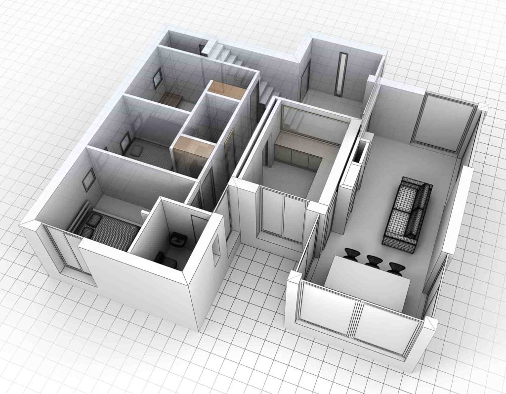
Detailed Floor Plans – Provide an exact layout of the property.
Structural Drawings – Show walls, columns, beams, and support structures.
3D Models – Enhance visualization for potential buyers.
MEP (Mechanical, Electrical, Plumbing) Documentation – Essential for property assessments.
By utilizing as-built documentation, realtors can eliminate discrepancies between property listings and actual conditions, enhancing transparency and trust in real estate transactions.
Why Buyer Uncertainty is a Challenge in Real Estate
Buyer uncertainty is one of the biggest obstacles in real estate transactions. Many potential buyers hesitate due to concerns about hidden defects, structural issues, or inaccurate property descriptions.
Common Buyer Concerns:
Discrepancies between listing details and actual property conditions.
Lack of accurate floor plans for remodeling or expansion.
Uncertainty regarding hidden structural or safety issues.
Complications with financing due to inadequate property documentation.
By providing buyers with verified as-built documentation, realtors can minimize these concerns and streamline the sales process.
How As-Built Documentation Benefits Realtors and Buyers
Improved Property Transparency
Buyers can make informed decisions when they have access to detailed as-built documentation. This level of transparency builds trust and reduces the likelihood of post-sale disputes.
Faster Decision-Making Process
With precise documentation, buyers can quickly assess whether a property meets their needs, leading to faster sales cycles and reduced time on the market.
Enhanced Real Estate Marketing with 3D Models
Modern 3D laser scanning technology allows realtors to showcase properties in a visually engaging manner, making it easier for buyers to explore listings remotely and gain a comprehensive understanding of the space.
3D Laser Scanning and BIM: Revolutionizing Real Estate Documentation
What is 3D Laser Scanning?
3D laser scanning is a cutting-edge technology used to capture high-accuracy property measurements. It creates a digital representation of the space, allowing realtors to provide detailed floor plans and immersive virtual tours.
The Role of Building Information Modeling (BIM)
BIM technology enhances as-built documentation by providing intelligent 3D models with embedded data, including materials, structural components, and maintenance details. These models are invaluable for buyers planning renovations or long-term property management.
Key Applications of As-Built Documentation in Real Estate
Residential Property Transactions
As-built drawings help homebuyers verify property details, assess renovation potential, and avoid unexpected costs.
Commercial Real Estate Deals
Investors and businesses use as-built documentation to ensure compliance with zoning regulations, fire safety codes, and structural integrity requirements.
Historical Building Restorations
Preserving historic structures requires precise documentation to guide restoration efforts while maintaining architectural integrity.
How to Implement As-Built Documentation in Your Real Estate Business
Partnering with 3D Scanning Service Providers. Companies like ScanM2 offer high-precision laser scanning services, delivering accurate as-built documentation tailored for real estate professionals.
Integrating 3D Models in Property Listings. Realtors can enhance their marketing strategies by embedding 3D models and interactive floor plans into online listings.
Using As-Built Documentation for Property Inspections. As-built documentation serves as a valuable tool for home inspections, helping identify discrepancies and structural issues before closing deals.
Case Studies: Successful Use of As-Built Documentation in Real Estate
Case Study 1: Reducing Buyer Hesitation
A real estate agency implemented 3D laser scanning for high-value properties, resulting in a 25% reduction in buyer hesitancy and a 40% increase in listing engagement.
Conclusion: The Future of Real Estate with As-Built Documentation
As-built documentation is transforming the real estate industry by increasing transparency, reducing buyer uncertainty, and enhancing property marketing. Realtors who leverage this technology gain a competitive edge, ensuring smoother transactions and greater client satisfaction.
Check our activity on:
The Benefits of LiDAR Technology in Commercial Property Inspections
Modern commercial property inspections require high-precision, efficient, and data-driven approaches. LiDAR (Light Detection and Ranging) technology is a cutting-edge solution for detailed building assessments, structural integrity evaluations, and geospatial mapping.
This method allows for the creation of accurate 3D models of commercial buildings, offering valuable insights for real estate developers, property managers, engineers, and urban planners. With LiDAR scanning, professionals can analyze properties with unprecedented detail, helping to prevent structural failures, optimize space utilization, and streamline maintenance planning.
Understanding LiDAR Technology and How It Works
LiDAR is a remote sensing technology that utilizes laser pulses to measure distances and create highly detailed 3D representations of physical structures. This technology works by:
Emitting laser pulses that bounce off surfaces to capture precise spatial data.
Measuring the time-of-flight of the laser as it returns to the sensor for precise distance calculations.
Calculating precise distances and generating point cloud data.
Processing the data to create high-resolution 3D models.
These 3D models can then be used for structural analysis, property condition assessments, and integration into Building Information Modeling (BIM) systems.
Key Benefits of LiDAR Technology in Commercial Property Inspections
Unparalleled Accuracy & Precision
One of the biggest advantages of LiDAR in commercial inspections is its ability to provide millimeter-accurate measurements. Unlike traditional inspection methods, which rely on manual data collection, LiDAR eliminates errors by capturing every structural detail in high resolution.
This level of accuracy is particularly useful for:
Pre-construction site analysis
Post-construction quality control
Historical building preservation
Detecting structural deformations
Rapid Data Collection & Reduced Inspection Time
Traditional property inspections can take days or even weeks, especially for large-scale commercial buildings. With LiDAR scanning, entire structures can be mapped within hours, drastically reducing the time required for surveying and data analysis.
This efficiency is beneficial for:
Real estate transactions requiring quick property assessments
Time-sensitive building inspections
Large-scale infrastructure evaluations
Non-Intrusive & Safe Inspection Methods
For older buildings, high-rise structures, or hazardous sites, manual inspections can be dangerous. LiDAR scanning eliminates the need for physical access to hard-to-reach areas, allowing inspectors to safely evaluate building conditions without disrupting operations.
This is particularly useful for:
Industrial plants with restricted access zones
Historical landmarks that require preservation
Structural assessments in disaster-affected areas
Comprehensive Structural Integrity Analysis
LiDAR enables professionals to detect early signs of structural weaknesses, such as:
Foundation shifts
Cracks and material degradation
Load-bearing deficiencies
By integrating LiDAR scans with BIM software, engineers can predict potential failures and plan maintenance strategies accordingly.
LiDAR Applications in Commercial Property Inspections
Real Estate & Property Management
In real estate, LiDAR helps professionals conduct precise property evaluations by providing:
Detailed 3D floor plans for leasing and renovations
Accurate square footage measurements for property valuation
Condition assessments before buying or selling a property
Construction & Facility Maintenance
LiDAR plays a crucial role in construction planning by offering:
As-built documentation for architects and engineers
Quality control checks during construction phases
Monitoring of structural movements over time
Urban Planning & Development
For city planners and developers, LiDAR facilitates:
Topographic surveys for land use planning
Geospatial mapping for smart city projects
Environmental impact assessments
LiDAR vs. Traditional Inspection Methods: A Comparison
Feature
LiDAR Scanning
Traditional Inspection
Accuracy
±2 mm
±5-10 cm
Speed
Hours
Days to weeks
Safety
Non-intrusive
Requires physical access
Data Format
3D Point Cloud
2D sketches/reports
Integration
BIM, GIS, CAD
Limited digital compatibility
LiDAR technology surpasses traditional methods in nearly every aspect, making it a critical tool for modern commercial property inspections.
Future of LiDAR scanning in Commercial Property Inspections
With advancements in drone-based LiDAR scanning, AI-driven analysis, and cloud computing, the future of commercial property inspections is heading toward fully automated, real-time data processing. In the coming years, we can expect:
AI-powered anomaly detection to identify structural risks.
Enhanced Cloud-Based Processing for real-time property reports and faster data analysis.
Seamless Integration with Smart Building Systems for real-time monitoring and data-driven insights.
These innovations will make property inspections more efficient, cost-effective, and data-driven than ever before.
Conclusion
The adoption of LiDAR technology in commercial property inspections represents a significant leap forward in building assessment accuracy, efficiency, and safety. By leveraging high-resolution 3D scanning, property managers, engineers, and real estate developers can make more informed decisions regarding property investments, renovations, and maintenance.
As LiDAR continues to evolve, its role in structural monitoring, smart cities, and real estate analytics will only become more prominent.
Check our activity on:
Why Every Realtor Should Offer 3D Home Scans to Buyers and Sellers
The real estate market is evolving rapidly, and technology plays a key role in speeding up transactions. 3D home scanning is becoming a standard for forward-thinking realtors, helping sellers highlight their properties and enabling buyers to make well-informed decisions. Virtual tours created with laser 3D scanning accelerate deals, reduce unnecessary showings, and build client trust. In this article, we explore why 3D scanning is a must-have tool for modern realtors.
Why 3D Scanning is the Future of Real Estate?
Digitalization has become an essential part of property sales. According to Zillow, 79% of buyers believe that virtual tours help them make purchase decisions, and 62% of sellers prefer working with agents who offer 3D scanning services.
Key Facts and Figures:
31% of transactions close faster with 3D virtual tours (Matterport).
49% more views are generated by listings with 3D scanning.
82% of buyers prefer virtual tours before scheduling a physical visit.
Realtors who incorporate 3D scanning gain a competitive edge and close deals more efficiently.
Benefits of 3D Scanning for Realtors
Faster Property Sales
Photos and videos do not always provide a complete picture of a property. 3D scans allow buyers to virtually “walk through” the home, evaluate its layout and details. This reduces unnecessary showings and increases conversion rates.
Time-Saving
How many times do realtors schedule property tours only for buyers to say, “This layout doesn’t work for us”? With 3D scanning, these situations are minimized—potential buyers visit in person only when they have a clear understanding of the property.
More Clients and Listings
Realtors using 3D technology appear more professional and provide a superior client experience. This helps attract both sellers and buyers.
Increased Transparency and Trust
A transparent sales process builds client confidence. Buyers know that the property matches their expectations, while sellers see their home being presented in the best possible way.
Benefits of 3D Virtual Tours for Buyers
View Properties from Anywhere
In today’s globalized world, more transactions occur remotely. A 3D tour allows buyers to fully explore a property without leaving their home.
Accurate Layout Representation
Photos and videos can distort space perception. A 3D scan provides an accurate view of room sizes and layouts.
Convenience and Time-Saving
Instead of spending weeks traveling to multiple showings, buyers can compare several properties in just a few hours and shortlist their top choices for in-person visits.
Benefits of 3D Scans for Sellers
Higher Sale Prices
A well-presented property commands a higher price. Listings with 3D tours sell for 4-9% more on average.
Increased Buyer Interest
Listings with 3D scanning receive up to 50% more views, attracting more potential buyers.
Fewer In-Person Showings
Sellers no longer need to prepare their home for unnecessary visits—only serious buyers come for a final walkthrough.
How Does Laser 3D Scanning Work?
ScanM2 provides high-precision laser 3D scans that offer:
✅ Photorealistic 3D models of the property. ✅ Interactive virtual tours. ✅ Accurate room measurements with millimeter precision.
📌 ScanM2 Project Example: 3D scan of an apartment in New York.
The process takes only a few hours, and the results can be used indefinitely.
How Realtors Can Implement 3D Scanning in Their Work?
Start with High-Value Properties. Try 3D scanning on luxury or challenging listings—this will help sell them faster and attract more clients.
Add 3D Scans to Listings. Upload virtual tours to real estate platforms (Zillow, Realtor.com, Redfin) and social media.
Use 3D Scans in Marketing Materials. Create interactive presentations for clients showcasing the advantages of this technology.
Market Yourself as a “Tech-Savvy Realtor”. Utilizing modern technology enhances your credibility as a real estate expert.
The Future of 3D Technology in Real Estate
VR Home Showings and the Metaverse. Soon, buyers will tour homes using VR headsets, creating a fully immersive experience.
Automated Transactions. AI and 3D scanning will enable automated property matching based on buyer preferences.
Virtual Home Design and Renovations. After purchasing a home, buyers can virtually modify interiors and layouts using 3D models.
Conclusion
3D scanning is becoming a standard in real estate. The key benefits include:
✅ Faster transactions. ✅ More buyer interest. ✅ Higher property values. ✅ Time efficiency for both realtors and clients.
Ready to integrate 3D scanning into your business?
Contact ScanM2—we create professional 3D models and virtual tours!
Check our activity on:
Why Smart Homeowners Request As-Built Plans Before Selling
When selling a property, savvy homeowners take steps to maximize value, streamline transactions, and avoid potential legal issues. One often-overlooked yet crucial element in this process is obtaining As-Built Plans. These documents accurately reflect the current state of a building, ensuring that buyers, real estate agents, and contractors have a clear picture of the property.
What Are As-Built Plans?
As-Built Plans are detailed architectural drawings or models that document a building’s exact dimensions, structural elements, and modifications made over time. Unlike original blueprints, which represent a building’s intended design, As-Built Plans capture changes that have occurred during construction or renovations.
Why As-Built Plans Matter When Selling a Property
Boost Buyer Confidence and Transparency
Providing potential buyers with accurate As-Built Plans instills confidence by eliminating uncertainty. Buyers appreciate detailed documentation, as it helps them make informed decisions regarding future renovations, structural integrity, and compliance with zoning laws.
Speed Up the Sales Process
Real estate transactions often involve appraisers, inspectors, and mortgage lenders who require detailed property information. As-Built Plans facilitate a smoother process by providing precise data, reducing the time spent on approvals and verifications.
Ensure Compliance with Local Regulations
Many homeowners unknowingly have structural modifications that differ from official records. When selling a property, discrepancies between outdated blueprints and actual conditions can cause legal and permitting issues. Accurate As-Built Plans help avoid delays, fines, and potential deal-breakers.
Our As-Built Documentation Examples
×
How 3D Laser Scanning Revolutionizes As-Built Plan Creation
Precision and Accuracy
Traditional manual measurements are prone to human error. 3D laser scanning captures millions of data points to create highly accurate digital twins of physical structures. This ensures that As-Built Plans reflect real-world conditions with millimeter-level precision.
Efficiency and Time-Saving
Unlike conventional surveying methods, laser scanning is fast and non-intrusive. In just a few hours, a property can be scanned, and a detailed 3D model or 2D CAD drawings can be generated, providing homeowners with quick and reliable documentation.
Cost-Effectiveness
Having up-to-date As-Built Plans can prevent costly errors during renovations or transactions. By investing in 3D laser scanning, homeowners save money by avoiding unexpected setbacks related to structural misrepresentations.
Case Studies: How As-Built Plans Helped Homeowners Sell Faster
Case 1: Selling a Historic Home
A homeowner selling a 100-year-old house faced issues due to outdated blueprints. By obtaining As-Built Plans via 3D scanning, they resolved inconsistencies in the legal records, enabling a smooth transaction and increasing buyer confidence.
A property owner had made undocumented modifications to their home over the years. After the sale, it was discovered that the existing documentation did not match the actual condition of the building. Using laser scanning technology, they created updated As-Built Plans, which helped them correct zoning documentation and avoid potential legal and financial issues.
At ScanM2, we specialize in high-precision 3D laser scanning and 3D modeling to provide reliable, detailed, and fast As-Built documentation. Whether you’re selling a home, planning a renovation, or ensuring compliance with local regulations, our expertise guarantees the most accurate and comprehensive plans available.
Our Advantages:
State-of-the-art laser scanning technology for pinpoint accuracy.
Fast turnaround times to meet real estate deadlines.
Seamless integration with architects, contractors, and real estate agents.
Conclusion
Smart homeowners understand that providing As-Built Plans before selling a property leads to a faster sale, increased buyer trust, and fewer legal complications. By leveraging 3D laser scanning from ScanM2, sellers can ensure their property is accurately documented and market-ready. Contact ScanM2 today to get started with professional As-Built Plans and make your home sale smoother than ever!
FAQs
How do As-Built Plans differ from blueprints?
Blueprints show the intended design, while As-Built Plans reflect the actual, current state of a building, including modifications made over time.
How long does it take to create As-Built Plans with 3D laser scanning?
The scanning process takes only a few hours, and final plans can be delivered within a few days, depending on the project size.
Are As-Built Plans required by law when selling a home?
While not always legally required, they can help avoid compliance issues and speed up the sales process by ensuring documentation matches the property’s true condition.
Can I use As-Built Plans for future renovations?
Yes! As-Built Plans provide a precise reference for architects and contractors, making renovations easier and more efficient.
How much does 3D laser scanning for As-Built Plans cost?
Costs vary based on property size and complexity, but it is a worthwhile investment that can prevent expensive legal and structural issues down the road.
Check our activity on:
Outsourcing in Architecture and Design: How to Reduce Team Workload and Speed Up Projects
The architecture and design industries are evolving rapidly, with increasing demands for efficiency, precision, and innovation. Firms often struggle with project overload, tight deadlines, and the need for specialized expertise. In such scenarios, outsourcing has emerged as a strategic solution, enabling architectural and design firms to optimize workflows, reduce internal workload, and gain access to cutting-edge technology and specialized skills.
This article explores the significance of outsourcing in architecture and design, its key benefits, and how firms can integrate external expertise to enhance productivity and project efficiency.
The Challenges of In-House Workload Management
Despite advancements in technology, architectural and design firms continue to face challenges that can impede growth and project execution. Some common obstacles include:
High Project Demand – Firms often have multiple projects running simultaneously, leading to resource constraints and workforce exhaustion.
Strict time constraints – Construction timelines and client demands require companies to finish projects quickly while maintaining high standards.
Skill Gaps – Complex projects require specialized knowledge, such as BIM modeling, 3D scanning, or advanced rendering, which may not always be available in-house.
Budget Constraints – Hiring full-time specialists for short-term projects can be financially unfeasible, making outsourcing a more cost-effective solution.
Challenges in technology – Staying ahead in the industry demands significant investments in equipment, software, and employee training.
By recognizing these challenges, firms can develop strategies to leverage outsourcing as a powerful tool for sustainable growth.
Key Benefits of Outsourcing in Architecture and Design
1. Access to Specialized Expertise
One of the biggest advantages of outsourcing is gaining access to highly skilled professionals who specialize in niche areas such as:
3D laser scanning and modeling – Accurate digital representation of buildings for precise planning and renovation.
BIM (Building Information Modeling) – Cutting-edge modeling methods that enhance teamwork and streamline project execution.
Architectural visualization – High-quality renderings and animations for realistic project presentations.
Structural analysis and optimization – Ensuring that designs meet engineering and safety standards.
2. Cost-Effectiveness
Instead of hiring full-time employees for specialized tasks, firms can engage external experts only when needed. This significantly reduces overhead costs related to salaries, benefits, and training.
3. Faster Project Turnaround
With external specialists handling time-consuming tasks, in-house teams can focus on critical aspects of the project, leading to quicker delivery and higher efficiency.
Scalability and Flexibility Outsourcing enables companies to adjust their operations according to project needs, providing flexibility without long-term obligations. This flexibility is essential for managing variable workloads effectively.
4. Enhanced Quality and Innovation
Working with experienced outsourcing partners ensures that projects benefit from industry best practices, cutting-edge tools, and high-quality deliverables. As a result, this improves client satisfaction and bolsters the company’s reputation.
What Architectural and Design Services Can Be Outsourced?
Many firms successfully outsource the following services to optimize their workflow:
3D scanning and as-built documentation – Capturing precise measurements and digital representations of existing structures.
3D modeling and CAD drafting – Creating precise technical designs and models to support project planning.
Rendering and visualization – Creating photorealistic visuals for client presentations and marketing.
Virtual and augmented reality integration – Enhancing project presentations with immersive technology.
Structural engineering support – Providing expert analysis and calculations for safe, efficient designs.
Delegating these tasks boosts efficiency while enabling companies to take advantage of cutting-edge technological advancements.
Choosing the Right Outsourcing Partner
Selecting a reliable outsourcing partner is crucial to ensuring successful collaboration. Key factors to consider include:
Demonstrated Experience and Portfolio – Evaluate previous projects to gauge proficiency and dependability.
Technical Expertise and Tools – Verify that the provider utilizes up-to-date software and technology that seamlessly integrates with your workflows.
Timely Delivery and Transparent Communication – A dependable partner should adhere to deadlines and ensure consistent, clear communication.
Data Protection and Confidentiality – Verify that robust security measures are implemented to safeguard sensitive information.
Client Feedback and Testimonials – Favorable reviews from past clients serve as a strong measure of trustworthiness and reliability.
Partnering with a reputable company such as ScanM2, which specializes in 3D laser scanning and modeling, ensures that architectural firms receive high-precision data, minimizing errors and accelerating project timelines.
Case Study: Successful Outsourcing in Architecture
A prominent architectural firm faced challenges in managing multiple renovation projects simultaneously. Because of the intricacy of each site, manual measurements were slow and susceptible to inaccuracies.
The firm partnered with ScanM2 to leverage laser 3D scanning for accurate building documentation. As a result: The team reduced surveying time by 70%.
The risk of measurement errors decreased significantly.
The 3D models were seamlessly integrated into their BIM workflow, improving project coordination.
Project turnaround times were accelerated, enhancing client satisfaction.
This case highlights the tangible benefits of outsourcing and how firms can achieve higher efficiency and accuracy in their work.
Conclusion
Outsourcing in architecture and design is more than just a trend—it’s a powerful strategic advantage. By leveraging external expertise, firms can optimize their workflows, reduce costs, and deliver high-quality projects faster. With services such as 3D scanning, modeling, visualization, and BIM integration, outsourcing provides an efficient way to enhance project execution without overburdening internal teams.
If your firm is looking to streamline operations and improve project accuracy, consider partnering with ScanM2. Our expertise in 3D scanning and modeling helps architecture and design firms meet their goals efficiently and effectively.
Ready to enhance your projects with cutting-edge outsourcing solutions? Contact us today to learn more!
Check our activity on:
TLS, LiDAR, and Photogrammetry: Which 3D Scanning Technology Is Right for Your Project?
For interior designers and architects, understanding 3D scanning methods is essential not only for accurate documentation but also for creating stunning visual presentations. At SCANM2, we pride ourselves on offering next-day on-site service, highly competitive pricing, and unmatched documentation accuracy. In this article, we’ll demystify three major 3D scanning technologies—TLS, LiDAR, and Photogrammetry—by comparing their accuracy, speed, point cloud density, image quality, cost, and average performance metrics. We’ll also show you which method suits various project types, so you can confidently decide on the best solution for your next design venture.
Understanding the 3D Scanning Technologies
1. TLS (Terrestrial Laser Scanning)
What It Is:
TLS is a ground-based laser scanning method renowned for its ultra-high precision. The scanner is placed on a tripod or mounted on a mobile platform, emitting laser beams that measure distances to every point on the object’s surface. This technique is ideal for capturing detailed geometry—making it perfect for precise interior spaces, historical building documentation, or any project where measurement accuracy is paramount.
Key Advantages:
Maximum Precision: TLS is the go-to method for projects demanding sub-millimeter accuracy. For instance, while LiDAR might deliver measurements with about 6 millimeters of precision, TLS routinely offers even finer details—often within ±1–3 millimeters under optimal conditions.
Detail-Rich Data: With extremely dense point clouds, TLS can capture every minute architectural feature.
Real-World Example:
Luxury Estate in Los Angeles Transformed with 3D Laser Scanning and As-Built Services.
We partnered with an elite interior design and home remodeling firm to generate a detailed digital plan for a magnificent Mediterranean estate in Los Angeles. The precision provided by TLS empowered our client to achieve a visionary redesign with unparalleled accuracy, ensuring every curve and contour of the structure was faithfully documented.
LiDAR uses laser pulses to measure distances and is typically deployed from mobile platforms like drones, vehicles, or aircraft. This technology is especially valuable for covering large areas quickly, making it popular in landscape mapping, resort planning, and urban development.
Key Advantages:
Rapid Data Collection: Thanks to its high-speed scanning capability, LiDAR can gather hundreds of thousands of points per second. This makes it highly efficient for large-scale projects where time is of the essence.
High Precision for Wide Areas: With an accuracy level around 6 millimeters, LiDAR provides reliable data for many outdoor applications. Though it may not reach the ultra-high precision of TLS, it offers a solid balance between speed and accuracy.
Scalability: LiDAR is the method of choice for vast areas—like a 100-hectare resort development—where moderate accuracy (typically within 2–3 centimeters) is sufficient for planning and design.
Real-World Example:
LiDAR Scanning for Resort Planning: Precision Mapping with SCANM2.
For a resort planning project, SCANM2 conducted an extensive LiDAR scanning across 100 hectares using drone-mounted LiDAR technology. This method not only reduced time and costs significantly but also delivered the precise mapping needed for an optimized layout plan.
Photogrammetry involves capturing multiple overlapping photographs from different angles to create 3D models. Unlike TLS and LiDAR, which primarily focus on geometric accuracy, photogrammetry excels at producing photo-realistic textures and visual details. However, because it relies on images, there isn’t a direct way to measure physical accuracy as precisely as with laser-based systems.
Key Advantages:
Stunning Visuals: Photogrammetry is unbeatable when it comes to capturing the aesthetic essence of a space. It generates stunning, high-resolution images perfect for presentations and marketing materials.
Cost-Effectiveness: Generally, photogrammetry is less expensive because it only requires a high-quality camera and specialized processing software.
User-Friendly: Its process is accessible and doesn’t always demand high-end technical expertise to yield visually impressive results.
Real-World Example:
3D Laser Scanning and Yacht Restoration Project.
Commissioned by a prestigious design bureau, this project involved the comprehensive scanning and modeling of a private yacht. While the primary goal was to create accurate 3D models for precise restoration and repair, photogrammetry was employed to capture detailed textures and visual details, resulting in a stunning, realistic representation of the yacht’s interior and exterior.
Below is a comparison table that highlights the key parameters for each technology, making it easy for you to see the differences at a glance.
Parameter
TLS (Terrestrial Laser Scanning)
LiDAR
Photogrammetry / Matterport
Accuracy
Ultra-high: ±1–3 mm (ideal for critical measurements)
High: approximately ±6 mm (suitable for large area projects with moderate accuracy requirements, typically within 2–3 cm for some applications)
Not directly measurable; typically offers accuracy in the range of ±1–5 cm, depending on processing and conditions
Data Collection Speed
Moderate: Each scan takes time due to sequential point capture
Very high: Capable of collecting hundreds of thousands of points per second; optimal for quickly covering extensive areas
Variable: Depends on the number of photos and processing time; can be slower for large objects
Point Cloud Density
Extremely high: Millions of points for detailed models
High: Density depends on flight altitude and pulse frequency; ideal for comprehensive mapping
Moderate to high: Depends on camera resolution and shot overlap
Image Quality / Texture
Lacks color data; focuses on geometric accuracy
Often captured in grayscale, but can be enhanced with RGB data when combined with photogrammetry
Exceptional: Produces photorealistic textures and detailed imagery
Cost (Equipment & Labor)
Higher-end: Requires specialized equipment and software
Moderate to high: Cost varies based on platform (drones, aircraft) and project scope
Lower to moderate: Uses standard cameras and accessible software solutions
Average Figures
Scanning speed: ~5–20 points/sec (depending on settings and environment)
Scanning speed: Up to hundreds of thousands of points/sec in flight conditions
Accuracy: ±1–5 cm (subject to environmental conditions and processing quality)
Note: The figures provided below are based on reputable sources and are approximate. Actual values may vary depending on equipment and scanning conditions.
Choosing the Right Technology for Your Project
Each scanning method offers its own set of strengths and limitations. The key is to match the technology to the project’s requirements:
For Large-Scale Projects. When dealing with vast areas such as resort developments or urban planning, LiDAR is the clear choice. Its rapid data acquisition and sufficient accuracy (typically within 2–3 centimeters) make it ideal for broad mapping efforts where speed is essential and ultra-high precision is not mandatory.
For Precision Industrial Measurements. When the project demands maximum accuracy—such as intricate interior detailing or historical building preservation—TLS is unrivaled. Its ability to capture minute details with a precision of ±1–3 mm is critical for ensuring that every aspect of the structure is documented accurately.
For Aesthetic-Driven Projects. If your primary focus is on the visual appeal of a space—say, for marketing or design presentations—Photogrammetry is your best bet. While it may not provide the measurement precision of TLS or LiDAR, its strength lies in delivering high-quality, photorealistic images that truly bring your vision to life.
It’s essential to note that no one technology fits every scenario perfectly. The optimal approach is often a customized blend that balances both the technical requirements and aesthetic goals of the project. At SCANM2, we’re proud to offer expertise across all three technologies. This allows us to guide you in selecting the best method—or a tailored combination—to guarantee your project’s success.
SCANM2: Your One-Stop 3D Scanning Partner
At SCANM2, our commitment is to deliver precision, speed, and cost-effective solutions without compromise. Here’s why partnering with us makes a difference:
Next-Day On-Site Service. We understand that time is money. That’s why our team is ready to mobilize and be on-site the very next day after your order.
Competitive Pricing. High-quality documentation doesn’t have to break the bank. Our solutions are built for cost efficiency, delivering top-quality service at a competitive price.
Unmatched Accuracy. Whether it’s a small interior space or a sprawling outdoor area, we use the right technology for the job. With TLS for precise measurements, LiDAR for speedy large-area mapping, and photogrammetry for beautiful visual documentation, we have the expertise to meet every project need.
We invite you to explore our portfolio and see firsthand how our state-of-the-art scanning technologies can elevate your next project. Whether your focus is on precision measurements, expansive area mapping, or creating stunning visual presentations, SCANM2 has the solution for you.
Final Thoughts
In an industry where precision meets creativity, the right 3D scanning technology can make all the difference. By recognizing the strengths and limitations of TLS, LiDAR, and Photogrammetry, you can make well-informed decisions that align with your design vision and project needs.
Large objects? Consider LiDAR for its rapid data capture and sufficient precision.
Need ultra-high accuracy? TLS is your best choice.
Want to showcase beautiful imagery? Turn to photogrammetry for photorealistic visuals.
At SCANM2, our comprehensive expertise in all three methods means we can tailor our approach to your unique needs. Contact us today to discuss how we can bring your design projects to life with next-day service, competitive pricing, and the highest level of documentation accuracy available.
Feel free to reach out or visit our website to learn more about how our 3D scanning solutions can transform your next project.
Check our activity on:
How to Integrate As-Built Documentation into Your Real Estate Marketing Strategy
In today’s fast-changing real estate market, technology is crucial in transforming the ways properties are marketed, sold, and developed. One of the most transformative innovations is as-built documentation generated through advanced 3D scanning and 3D modeling techniques. This article will guide real estate agents and developers on integrating as-built documentation into their real estate marketing strategy, highlighting the benefits of laser scanning, virtual tours, and high-quality digital assets.
As-built documentation refers to a detailed record of a building or property’s actual dimensions and construction details captured after the completion of construction. As-built documentation offers a precise depiction of the completed structure, differing from the original design blueprints or project plans. This documentation is generated using advanced technologies like laser scanning and 3D modeling, ensuring every detail is captured with precision.
Why It Matters in Real Estate
For real estate professionals and developers, accurate construction documentation is critical. It serves as a dependable reference for:
Confirming property specifications for sales or leasing purposes.
Planning future renovations or expansions.
Enhancing transparency and trust among buyers, investors, and stakeholders.
By utilizing as-built documentation, real estate marketing campaigns become more data-driven and visually compelling, ultimately fostering a sense of credibility and professionalism.
Key Benefits for Real Estate Agents and Developers
Enhanced Accuracy and Trust
Accurate Data: As-built documentation ensures that every detail—from room dimensions to structural elements—is documented accurately. This eliminates guesswork and provides clients with precise, verifiable data.
Improved Transparency: When buyers and investors have access to detailed construction documentation, trust is built. This transparency helps mitigate concerns about discrepancies or hidden issues in properties.
Streamlined Project Planning and Renovation
Efficient Renovations: For developers, having accurate as-built models can significantly reduce the time and cost involved in planning renovations or expansions. This documentation helps identify potential issues early, ensuring smoother project management.
Future-Proofing Investments: Real estate agents can leverage as-built data to provide a clear picture of a property’s current state, which aids in forecasting future maintenance and investment needs.
Enhanced Marketing and Sales
Immersive Virtual Tours: Incorporate 3D models and interactive virtual tours into your listings. These digital tools not only engage prospective buyers but also let them virtually tour properties from the comfort of their homes.
Competitive Edge: Utilizing high-quality as-built documentation in your marketing strategy differentiates your offerings from competitors. It showcases a dedication to excellence and innovation, which can be a key influence for selective buyers.
Integrating As-Built Documentation into Your Marketing Strategy
Step 1: Capture Accurate Data with 3D Scanning
Invest in advanced laser scanning technology or partner with companies specializing in 3D scanning and modeling. This technology ensures that every detail of a property is recorded accurately, forming the foundation for effective as-built documentation.
Key Action Points:
Schedule comprehensive site scans.
Ensure scans cover both interior and exterior details.
Utilize high-resolution laser scanning to capture minute details.
Step 2: Develop Interactive 3D Models and Virtual Tours
Leverage the captured data to create interactive 3D models. These models can be embedded on your website, integrated into virtual tours, or used in printed marketing materials. By offering immersive digital experiences, you enhance engagement and allow potential buyers to experience properties in an innovative way.
Key Action Points:
Create high-quality virtual tours using as-built data.
Embed 3D models in online listings and marketing collateral.
Use interactive tools to highlight unique property features.
Step 3: Integrate As-Built Documentation into Multi-Channel Campaigns
Utilize as-built documentation across various marketing channels to maximize reach and engagement. From email marketing campaigns to social media and online advertising, integrate detailed property documentation to showcase your commitment to accuracy and innovation.
Key Action Points:
Feature as-built documentation in email newsletters. Use high-quality images and 3D renders on social media platforms. Optimize your website for organic search with targeted SEO keywords.
Enhancing Transparency and Competitive Advantage
Building Credibility with Detailed Documentation
Incorporating as-built documentation into your marketing efforts sends a clear message: you value transparency and precision. This commitment builds credibility with buyers and investors, who are increasingly demanding detailed insights into the properties they consider.
Gaining a Competitive Edge
By offering comprehensive digital documentation, real estate agents and developers can stand out in a crowded market. Detailed as-built models and interactive tours not only showcase a property’s true value but also help differentiate your listings from competitors who rely solely on traditional photos and descriptions.
Adopting Cutting-Edge Technologies in Real Estate
The Future of Real Estate Marketing
The integration of 3D scanning, 3D modeling, and as-built documentation is not just a passing trend—it’s the future of real estate marketing. With the ongoing advancement of these technologies, they present new opportunities to elevate property showcases, simplify project planning, and boost sales.
Leveraging Technology for Better Client Experiences
Innovative digital tools are transforming the way clients interact with property data. Whether it’s through immersive virtual tours, detailed floor plans, or interactive 3D models, technology provides a richer, more engaging client experience that can accelerate decision-making and build lasting trust.
Case Studies and Success Stories
Real-World Examples of Success
Consider the following hypothetical scenarios that illustrate the power of integrating as-built documentation into real estate marketing:
Case Study 1: Urban Redevelopment Project
A leading developer in New York City used detailed as-built documentation to plan a major urban redevelopment project. The high-precision 3D models not only facilitated accurate renovation planning but also attracted investors who appreciated the transparency and thoroughness of the documentation. As a result, project timelines shortened, and investor confidence increased.
A prominent real estate agency in California integrated interactive virtual tours into their listings by utilizing as-built documentation. Prospective buyers could explore luxury properties in detail online, leading to faster decision-making and a significant reduction in time-on-market. This innovative approach boosted the agency’s reputation and sales performance.
From these examples, it’s clear that as-built documentation:
Enhances project planning and execution.
Increases buyer trust and engagement.
Provides a clear competitive advantage in a tech-driven market.
How ScanM2 Can Accelerate Your Real Estate Marketing
Why Choose ScanM2?
At ScanM2, we specialize in laser scanning, 3D scanning, and 3D modeling services designed to produce high-quality as-built documentation. Our state-of-the-art technology ensures that every detail of your property is captured accurately, providing you with the tools you need to elevate your marketing efforts.
Our Services Include:
Advanced Laser Scanning: Obtain precise measurements of interior and exterior areas with high detail.
Detailed 3D Modeling: Convert captured data into interactive 3D models and immersive virtual tours.
Personalized Documentation: Customized reports and digital assets designed to fit the specific requirements of real estate agents and developers.
Expert Consultation: Guidance on integrating as-built documentation into your overall marketing strategy.
Get Started Today
Partnering with ScanM2 means taking your real estate marketing to the next level. Contact us today for a consultation or to learn more about how our services can help you streamline project planning, enhance transparency, and boost your competitive advantage.
Conclusion
Incorporating as-built documentation into your real estate marketing strategy goes beyond embracing new technology—it’s about transforming the way properties are showcased, promoted, and sold. By leveraging 3D scanning, laser scanning, and interactive digital assets, real estate agents and developers can enhance accuracy, build trust, and gain a significant competitive edge in the market.
In an industry where precision and transparency are paramount, as-built documentation is the key to unlocking new levels of success. Embrace the future of real estate marketing with innovative technologies and let companies like ScanM2 help you lead the way.
Check our activity on:
How Laser 3D Scanning Supports Efficient Mall Design
At ScanM2, we offer industry-leading Laser 3D Scanning services that revolutionize shopping mall design and renovation. Our state-of-the-art scanning technology creates detailed digital twins of your mall, ensuring unparalleled accuracy in measurements and design planning. With our solution, you achieve space optimization, cost-effective construction, and a superior environment that benefits both tenants and mall owners. If you want to transform your retail space into a more efficient, profitable, and attractive destination, our service is exactly what you need.
The Role of Laser 3D Scanning in Mall Design
Precise Digital Mapping for Maximum Space Utilization
Traditional design methods often fall short when it comes to optimizing every square foot of a mall. Laser 3D scanning generates accurate, comprehensive digital models that reveal every detail of the existing structure.
Space Optimization: Detailed 3D models enable planners to identify underutilized areas and develop layouts that maximize usable space. Whether it’s refining corridor widths, repositioning support structures, or redesigning common areas, our technology ensures every inch counts.
Error Elimination: By capturing precise data, laser scanning minimizes costly mistakes during construction or renovation. This accuracy prevents design mismatches that could lead to wasted space and inefficiencies.
Future-Ready Layouts: With a complete digital twin, malls can adapt to evolving market trends and tenant demands quickly, ensuring the space remains versatile and profitable over time.
Benefits for Mall Owners
Reduced Costs and Enhanced ROI
Mall owners benefit directly from the cost savings and improved operational efficiency enabled by laser 3D scanning.
Reduced Construction and Renovation Expenses: Accurate measurements minimize errors and the need for rework. This results in more efficient, quicker project completion while reducing labor and material costs.
Streamlined Maintenance: An up-to-date digital twin helps in planning regular maintenance with pinpoint accuracy. This proactive approach ensures that building systems function optimally and that any repairs are planned and executed without major disruptions.
Improved Asset Value: By optimizing space usage and ensuring the facility is up-to-date with modern design standards, mall owners can enhance the overall asset value of their properties. A thoughtfully designed mall draws in top-tier tenants and can secure higher rental rates.
Energy Efficiency and Sustainability: Detailed modeling allows for better planning of HVAC, lighting, and other building systems. Efficient designs reduce energy consumption, contributing to sustainability efforts and lowering operational costs.
Data-Driven Decision Making
Using laser 3D scanning data, mall owners can make informed decisions regarding expansions, renovations, or even repurposing underutilized areas. The technology’s accuracy supports strategic planning that aligns with long-term business goals.
Advantages for Tenants
Creating a Superior Retail Environment
For tenants, the benefits of a well-designed shopping mall are evident in increased customer traffic and a better overall shopping experience.
Optimized Store Layouts: Laser scanning supports precise space planning, ensuring that individual retail units are designed to maximize foot traffic and product display areas. This creates an environment where tenants can showcase their products effectively.
Enhanced Customer Experience: A well-organized mall layout contributes to smoother navigation, reducing congestion and creating a more pleasant shopping experience. Happy customers mean higher sales for retailers.
Safety and Accessibility: Accurate digital models help design clear and efficient emergency exits, improve accessibility, and ensure that the mall complies with safety regulations. Tenants benefit from a secure and comfortable environment that builds customer trust.
Flexible Leasing Options: With detailed spatial analysis, mall owners can offer more flexible leasing options tailored to the size and location needs of various retailers. Tailored designs appeal to a wider variety of tenants, accelerating the process of filling vacancies.
Laser 3D scanning is not only about data collection—it’s a powerful tool for collaboration.
Smooth CAD/BIM Integration: The accurate digital models generated can be effortlessly incorporated into Computer-Aided Design (CAD) and Building Information Modeling (BIM) software. This enables architects, engineers, and contractors to work together on designs in real time.
Future Expansion and Adaptation: As market demands change, the digital twin created by our scanning process becomes a living document that can be updated to reflect new design proposals. This adaptability means the mall remains competitive and responsive to future challenges.
Enhanced Communication: Visualizing the design through 3D models makes it easier for all stakeholders—from investors to local authorities—to understand the project, ensuring that everyone is aligned and informed throughout the process.
Maximizing Operational Efficiency
Beyond the initial design and construction phases, the benefits of laser scanning continue to resonate throughout the mall’s operational life.
Improved Facility Management: Detailed 3D models assist in managing complex systems within the mall, from utility networks to security installations. Facility managers can easily identify problem areas, leading to faster repairs and minimized downtime.
Data-Backed Upgrades: Regular scans can track structural changes or wear over time. This proactive approach guarantees that all upgrades are informed by data and executed strategically.
Conclusion: Transform Your Mall into a High-Performance Retail Space
Laser 3D scanning is a transformative technology that supports efficient mall design by optimizing space usage, reducing costs, and elevating the tenant experience. At ScanM2, our comprehensive digital mapping services offer mall owners a strategic advantage—providing precise data that fuels innovation, ensures operational excellence, and maximizes return on investment.
Embrace a future where every square foot is optimized for success. Partner with ScanM2 to transform your shopping mall into a dynamic, adaptable, and profitable space. Contact us today to learn how our Laser 3D Scanning service can redefine your mall design strategy and drive lasting value for both owners and tenants.
Check our activity on:
Outsourcing Measurement Services for Interior Design Projects
In today’s competitive interior design market, precision and efficiency are essential to turning creative visions into reality. Outsourcing measurement services has become an innovative solution for designers who require accurate measurements for interior spaces without compromising on quality. At ScanM2, we leverage state-of-the-art laser 3D scanning and 3D modeling technology to capture every intricate detail of your space—even when dealing with high ceilings or irregular room shapes.
The Critical Role of Accurate Measurements in Interior Design
Every interior design project begins with a fundamental requirement: precise measurements. Whether you’re designing a modern loft with high ceilings or a room with a non-standard geometry, inaccuracies in spatial data can lead to costly errors and delays. Our professional measurement services ensure that you receive precision measurement techniques backed by advanced laser scanning technology, enabling you to focus on the creative process while we handle the technical intricacies.
Our 3D Models Examples
×
Why Outsource Your Measurement Services?
Expertise and Precision
Outsourcing measurement services provides access to experts who specialize in advanced scanning technology. Our team at ScanM2 utilizes laser 3D scanning for high ceilings and complex interior spaces, delivering accurate measurements for interior spaces. This ensures that every design project, regardless of complexity, is built on a reliable foundation.
Time and Cost Efficiency
Time is money in the design world. By outsourcing your measurement services, you reduce the need for in-house measurement processes and minimize the risks of costly mistakes. This efficient workflow allows you to focus on enhancing your design vision while we provide innovative measurement solutions that speed up the project timeline and lower overall costs.
Enhanced Collaboration with Design Tools
Our services integrate seamlessly with modern design and CAD software. The detailed 3D scanning and architectural 3D modeling we provide allow for easy CAD integration, fostering enhanced collaboration between designers, architects, and construction teams. With clear, accurate digital twins of your spaces, everyone involved in the project can work from the same reliable data set, streamlining communication and decision-making.
Advanced Laser 3D Scanning: A Game Changer
At ScanM2, we utilize laser 3D scanning technology to create highly detailed digital replicas of physical spaces. This cutting-edge process captures every nuance—from the curves of an irregular room to the challenging heights of vaulted ceilings. Here’s how our technology revolutionizes the design process:
Digital Twin Technology: We generate digital twins of your interior spaces, allowing you to visualize every aspect of your design with unparalleled accuracy.
Spatial Data Capture: Our scanning process collects detailed spatial data, which is essential for understanding the exact dimensions and architectural features of any space.
Precision Measurement Techniques: With our advanced methods, you can trust that every measurement is exact, minimizing the need for costly revisions during the design and construction phases.
Measuring Complex Interior Spaces
Interior design projects often involve challenges that traditional measurement tools cannot overcome. Consider these scenarios:
Irregular Room Shapes: Rooms with unconventional layouts demand more than a standard tape measure. Our laser 3D scanning technology captures every curve and angle, providing a complete digital model of your space.
High Ceilings and Vaulted Spaces: High ceilings require specialized techniques for precise measurement. Our equipment and methodologies ensure that every inch is accurately captured, which is crucial for lighting, acoustics, and structural planning.
By outsourcing these challenging measurements, interior designers can rely on data that is both reliable and comprehensive, paving the way for innovative design solutions.
The Benefits of Digital Integration
With the integration of digital twin technology and spatial data capture, our measurement services offer more than just numbers on paper. The digital models we create are invaluable tools for:
Design Collaboration Tools: These models serve as a visual and data-rich reference, enabling better communication among project stakeholders.
Architectural 3D Modeling: Transforming raw data into dynamic 3D models allows you to explore design possibilities in a virtual environment.
Streamlined Renovation and Future Projects: Having an accurate digital record of your project ensures that any future renovations or modifications are based on precise, up-to-date measurements.
Conclusion: Transform Your Design Process with Outsourced Measurement Services
Outsourcing your measurement services is a strategic decision that brings precision, efficiency, and cost savings to interior design projects. With ScanM2’s innovative laser scanning and 3D modeling solutions, you gain access to high-quality, reliable data that supports every stage of your design process. Our commitment to precision measurement techniques and CAD integration ensures that even the most complex spaces are measured with unparalleled accuracy.
If you’re an interior designer seeking to elevate your projects through advanced measurement solutions, consider partnering with ScanM2. Let us provide you with the professional measurement services for interior designers that empower your creative vision and drive successful outcomes.
Contact us today to learn more about how our outsourcing services can streamline your design process and set you apart in the competitive interior design industry.
Check our activity on:
How to Buy the Perfect Home: The Role of 3D Laser Scanning in Smart Real Estate Decisions
Buying a home is an exciting but complex journey, filled with both anticipation and uncertainty. From evaluating a property’s structural integrity to ensuring it meets your lifestyle needs, every step requires careful consideration. However, conventional approaches to home inspection and evaluation frequently leave buyers with lingering uncertainties. Are there hidden defects? Is the square footage accurate? Will the property require expensive renovations?
Thanks to advancements in real estate technology, homebuyers now have access to powerful tools that provide deeper insights into a property’s condition. One of the most groundbreaking innovations in this space is 3D laser scanning—a technology that brings unparalleled accuracy to property evaluation and decision-making.
What Is 3D Laser Scanning and How Does It Work?
3D laser scanning is an advanced technology that utilizes laser beams to collect highly accurate measurements of a physical environment. These scanners generate a point cloud, which is then processed into a detailed 3D model or Building Information Model (BIM). This digital twin of the property provides an in-depth look at dimensions, spatial relationships, and potential structural issues—all without the need for invasive inspections.
Unlike traditional measuring tools or photographs, which can be inaccurate or misleading, 3D laser scanning offers a fully immersive and data-rich perspective. It is extensively applied in construction, renovation, and increasingly in real estate transactions, where accuracy is paramount.
Our 3D Models Examples
×
Why 3D Laser Scanning Is a Game Changer for Home Buyers
For decades, homebuyers have relied on standard property inspections, blueprints, and appraisals to gauge a home’s condition. Although these approaches provide valuable information, they frequently overlook essential details. 3D laser scanning for home buyers provides a deeper, more accurate understanding of a property, ensuring that buyers have all the necessary information before making one of the biggest investments of their lives.
1. Accurate and Detailed Property Inspections
Most home inspections involve visual assessments, tape measurements, and subjective evaluations, which can lead to inconsistencies or overlooked issues. 3D laser scanning eliminates human error by capturing every corner, wall, and feature of a home down to the millimeter. Buyers can receive precise documentation of:
Ceiling heights, room dimensions, and wall alignments.
Structural irregularities that may not be visible to the naked eye.
Floor leveling and foundational shifts that could indicate future problems.
With this level of accuracy, buyers can confidently verify whether a home meets their expectations and requirements.
2. Uncovering Hidden Structural Issues
A house may appear flawless at first glance, but underlying issues can lead to expensive repairs down the line. 3D laser scanning helps detect hidden structural problems such as:
Foundation cracks and uneven settling.
Misaligned door and window frames indicating shifting structures.
Roof deformities that may lead to leaks or insulation failures.
With a comprehensive 3D model, buyers can assess these factors in detail and negotiate necessary repairs with sellers before finalizing a purchase.
3. Creating a Digital Twin for Future Planning
A digital twin is a high-resolution virtual replica of a property, enabling buyers to explore and interact with the home remotely. Whether you are purchasing a house from another state or want to visualize furniture placement before moving in, having a 3D model provides a highly realistic way to experience the property from any location.
Additionally, homeowners planning renovations can share the scan data with architects, contractors, or interior designers to ensure precise modifications. This eliminates guesswork and reduces costly mistakes during remodeling projects.
4. Simplifying Mortgage and Insurance Processes
Mortgage lenders and insurance providers often require detailed property documentation to determine loan eligibility and policy coverage. 3D laser scanning in real estate transactions streamlines this process by delivering accurate property records, allowing for:
Faster and more reliable mortgage approvals.
Fair and accurate insurance premiums based on precise property conditions.
Seamless property assessments for investment and resale purposes.
Having high-quality scan data simplifies paperwork, reduces disputes, and expedites approvals, making the buying process smoother.
How 3D Scanning Enhances Decision-Making in Home Buying
3D laser scanning improves home buying decisions by providing a level of transparency that was previously unattainable. With access to a complete, data-driven view of a property, buyers can:
Avoid costly surprises: Identify potential problem areas before purchase.
Enhance remodeling and renovation planning: Ensure a perfect fit for furniture, appliances, and modifications.
Negotiate with confidence: Use scan data to justify price adjustments or request repairs. Minimize buyer’s remorse: Gain complete clarity on every detail of your investment.
The Future of Real Estate: Adopting 3D Laser Scanning
The real estate sector is undergoing rapid transformation, with technology significantly influencing the way properties are assessed, bought, and sold. 3D laser scanning is at the forefront of this transformation, providing a level of detail and insight that was previously unimaginable.
As the demand for data-driven decision-making increases, 3D scanning is becoming an essential tool not only for homebuyers but also for real estate agents, developers, and investors. With the ability to create precise, interactive digital models, this technology is paving the way for a future where property transactions are more transparent, efficient, and secure.
Additionally, virtual real estate tours, smart home integrations, and AI-driven property analysis are expected to complement 3D scanning, making it an integral part of a fully digitized real estate market. Buyers will no longer have to rely on subjective opinions or outdated blueprints—accurate, real-time property data will drive informed choices like never before.
Conclusion: Invest Smart, Buy with Confidence
A home purchase is one of the most significant investments you’ll ever make, and having reliable, data-backed insights is crucial to making the right choice. 3D laser scanning empowers buyers with the tools they need to assess properties with confidence, uncover hidden flaws, and plan for future modifications with precision.
This state-of-the-art technology is no longer just an advantage—it’s quickly becoming essential in today’s real estate market. Whether you’re a first-time homebuyer, an investor, or a real estate professional, leveraging 3D scanning in the home-buying process ensures you make a well-informed decision that aligns with your needs, budget, and long-term plans.
Check our activity on:
How Realtors Use As-Built Models to Help Buyers Visualize Remodeling Projects
Buying a home is one of the most significant financial decisions a person can make. However, many buyers struggle to imagine how a property could look after renovations, which often leads to hesitation or missed opportunities. To solve this problem, realtors are increasingly leveraging as-built models and 3D modeling in real estate to help buyers visualize remodeling projects with clarity. These tools, powered by as-built 3D laser scanning services, provide precise measurements and accurate representations of a property’s current condition, allowing buyers to confidently plan renovations before making a purchase decision.
In today’s competitive real estate market, visual storytelling plays a crucial role in helping potential buyers connect with a property. Traditional listing photos and blueprints do not always capture the full potential of a home, but as-built models bridge that gap by offering an interactive, data-rich representation of the space. Realtors who incorporate these models into their sales strategy provide an unparalleled experience that allows buyers to see beyond what is currently there and envision what could be.
The Importance of Visualization in Real Estate
Many homebuyers find it challenging to visualize modifications such as knocking down walls, adding extensions, or modernizing outdated spaces. This uncertainty can result in reluctance to invest in a property that has strong potential but requires some level of transformation.
By integrating home renovation visualization techniques, realtors can eliminate guesswork and provide an engaging, interactive experience for prospective buyers. Instead of relying on imagination, buyers can see tangible, realistic previews of remodeling options. This process is particularly valuable in cases where homes require significant updates, such as fixer-uppers or historic buildings, where changes can dramatically improve functionality and aesthetics.
Key benefits of 3D floor plans for property listings include:
Clarity in Property Layouts Buyers can better understand the home’s current layout and how it could be modified. They can explore potential extensions, new room arrangements, and open-concept designs before committing.
Confidence in Investment Decisions Buyers gain insight into possible renovations before committing financially. This minimizes the risk of regret and ensures that they are purchasing a home with a clear plan for the future.
Streamlined Renovation Planning Contractors and architects can use as-built data for precise planning, reducing errors and unexpected costs. Accurate dimensions help in determining budgets, material needs, and feasibility before a single renovation step is taken.
Remote Buying and Virtual Tours For out-of-town buyers, having access to detailed 3D models allows them to explore properties virtually and evaluate modification possibilities without being physically present.
How As-Built Models Enhance Buyer Experience
As-built models are digital representations of a property that capture its exact dimensions and existing conditions. Created through as-built 3D laser scanning services, they ensure accuracy down to the smallest details. For realtors and their clients, these models provide significant advantages:
Realistic Property Remodeling Insights Buyers no longer have to rely on vague sketches or verbal descriptions; they can explore detailed visualizations of potential modifications. Whether it’s expanding a kitchen, converting a garage, or reconfiguring a living room, they can see the potential before making a decision.
Architectural Visualization for Decision-Making By viewing 3D modeling in real estate, buyers can assess whether a property’s structure aligns with their future plans. They can compare different renovation options side by side, giving them more control over their investment.
Time and Cost Savings in Home Improvement Planning Accurate measurements mean fewer surprises during renovations, reducing unexpected costs and delays. Errors in measurements often lead to costly rework, which can be avoided with detailed as-built data.
Improved Buyer Engagement High-quality visuals and virtual walkthroughs captivate buyers and make property listings more appealing. Listings with interactive models tend to attract more online views and in-person showings, increasing the likelihood of a faster sale.
Legal and Compliance Benefits When planning major renovations, having a detailed as-built model helps in obtaining necessary permits and ensuring compliance with local building codes.
Our As-Built Services Examples
×
3D Modeling for Home Renovation Visualization
Traditional renovation planning relied heavily on 2D blueprints, which often failed to capture a space’s true potential. 3D modeling in real estate has revolutionized this process, offering more intuitive and immersive visualization methods.
Key benefits of using 3D models for home renovation visualization include:
Enhanced Realism: Unlike static 2D drawings, interactive 3D models allow buyers to explore potential renovations from different angles. They can view a home with different lighting, flooring, and furniture arrangements, providing a highly realistic preview.
Greater Customization Possibilities: Buyers can experiment with design elements, furniture placement, and different finishes to create their ideal home environment. From wall colors to kitchen layouts, they can personalize their future home before making any physical changes.
Prevention of Costly Mistakes: Seeing a renovation before it starts helps avoid design miscalculations and ensures that every change aligns with the buyer’s vision. This helps homeowners make smarter choices regarding materials, room functionality, and even energy efficiency.
Improved Communication with Contractors: A detailed as-built model reduces misunderstandings between homeowners, designers, and contractors, ensuring smoother project execution and better alignment with client expectations.
The Realtor’s Competitive Edge: How As-Built Models Improve Sales
For realtors, staying ahead in a competitive market means offering innovative solutions that enhance the buyer experience. As-built models provide a unique selling proposition, helping realtors differentiate their listings and attract serious buyers.
Some key advantages realtors gain by using as-built 3D laser scanning services include:
Faster Decision-Making: Buyers who can see remodeling possibilities clearly are more likely to move forward with a purchase.
Higher Engagement Rates: Listings featuring home renovation visualization receive more interest than those without.
Better Communication with Buyers and Contractors: Buyers can share as-built models with architects, interior designers, and contractors to refine their remodeling plans before committing.
Greater Marketability for Fixer-Uppers and Older Homes: Properties needing renovation can become more appealing when buyers see their potential through 3D modeling in real estate.
Expanded Client Reach: The ability to showcase a home’s potential remotely through interactive 3D models attracts more buyers, including those from out of state or international investors.
The integration of as-built models into real estate transactions is transforming the way buyers approach home purchasing and remodeling. With detailed home renovation visualization, buyers can confidently invest in properties knowing exactly what changes are possible.
For realtors, leveraging as-built 3D laser scanning services offers a distinct advantage, helping clients see the full potential of a property before they commit. As this technology continues to advance, it will become an essential tool for modern real estate professionals, ensuring that both buyers and sellers benefit from a more informed and efficient home-buying process.
Check our activity on:
How 3D Laser Scanning Improves Land Surveying and Site Analysis
Land surveying is a fundamental step in planning and construction projects, providing critical insights into site conditions, topography, and property boundaries. Traditional methods, while effective, often require significant time and resources, and they can be limited by environmental challenges and human error.
With the advent of 3D laser scanning for land surveying, the industry is experiencing a significant transformation. Advanced scanning technologies allow for highly accurate and detailed site analysis, reducing survey time while increasing precision. This article explores how topographic survey 3D scanning and digital site mapping are redefining land development and terrain analysis.
The Evolution of Land Surveying: From Traditional Methods to 3D Laser Scanning
Land surveying has historically relied on manual measurements, total stations, theodolites, and GPS technology. While these tools provide valuable data, they can be time-consuming and are often dependent on the skill of the surveyor. A site survey with 3D scanning, on the other hand, streamlines data collection by capturing millions of precise data points in seconds, creating a highly detailed digital terrain model.
How 3D Laser Scanning Works:
A laser scanner emits pulses of light that bounce off surfaces and return to the device.
The scanner calculates distances based on the time it takes for the pulses to return, generating a dense point cloud.
These data points are processed into a highly accurate 3D model of the landscape, including natural and man-made features.
The resulting digital site mapping allows for comprehensive terrain analysis without extensive manual labor.
By shifting from manual to terrain mapping with 3D laser scanning, professionals can work with unparalleled accuracy while eliminating the potential for human error.
Our LiDAR Scanning Results
×
Key Benefits of 3D Laser Scanning in Land Surveying and Site Analysis
1. Unmatched Accuracy and Detail
One of the greatest advantages of 3D laser scanning for land surveys is its ability to capture incredibly detailed measurements. Unlike traditional surveying techniques that rely on discrete data points, 3D scanning generates a dense dataset, ensuring that no critical terrain feature is overlooked.
This precision is especially beneficial for topographic mapping technology, where every slope, elevation change, and obstruction is recorded with sub-millimeter accuracy. It allows engineers and architects to work with highly reliable data when making design decisions.
2. Faster Data Collection
Speed is a game-changer in the world of surveying. Where traditional methods might require days or weeks to complete a land development site survey, 3D scanning for construction sites can capture the necessary data in just a few hours.
This efficiency is particularly useful for large-scale infrastructure projects where time-sensitive decision-making is crucial. Contractors and developers can start working with survey data almost immediately, allowing for streamlined project execution.
3. Enhanced Safety
Surveying hazardous environments—such as active construction zones, steep terrains, or remote locations—can be risky. Site surveys with 3D scanning minimize exposure to danger by allowing surveyors to collect data from a safe distance. Drones equipped with LiDAR sensors can further enhance this process by scanning difficult-to-reach areas, ensuring comprehensive terrain mapping without putting personnel at risk.
4. Comprehensive Digital Documentation
With topographic survey 3D scanning, the collected data is stored digitally, creating a permanent and detailed record of the site. This digital documentation is useful for:
Project planning and design
Legal boundary verification
Historical site analysis and conservation
Ongoing site monitoring and progress tracking
The ability to revisit and analyze site data at any time without requiring additional on-site visits improves efficiency and minimizes the risk of disputes or errors.
5. Better Integration with BIM and CAD
Modern 3D scanning for land surveying seamlessly integrates with Building Information Modeling (BIM) and Computer-Aided Design (CAD) software. This compatibility ensures that engineers, surveyors, and architects have access to the same precise dataset, reducing discrepancies and enhancing collaboration across disciplines.
By importing high-resolution 3D scans into design software, professionals can generate accurate terrain models, zoning plans, and infrastructure designs that align with the actual site conditions.
6. Seamless Terrain Analysis for Planning and Design
Topographic and geospatial analysis is crucial for urban planning, infrastructure projects, and environmental studies. With topographic mapping technology, professionals can evaluate terrain conditions, water drainage patterns, soil stability, and elevation changes before initiating construction. This information helps in avoiding costly mistakes and ensures that the site is well-prepared for development.
Practical Applications of 3D Laser Scanning in Land Surveying
Urban Planning and Infrastructure Development
City planners rely on digital site mapping to optimize space utilization and plan future expansions. Whether designing new highways, railways, or commercial developments, accurate terrain mapping with 3D laser scanning ensures that proposed projects are aligned with existing landscapes and infrastructure.
Environmental and Geological Studies
3D laser scanning for land surveys is also widely used in environmental monitoring. Geologists and conservationists use it to study erosion, landslides, flood zones, and natural formations, helping decision-makers develop sustainable land-use strategies.
Construction and Land Development
For land development site surveys, accurate data collection is essential for zoning approvals, excavation planning, and infrastructure placement. Builders and engineers rely on precise 3D models to assess site feasibility and prevent costly errors during development.
Archaeological and Historical Site Preservation
Preserving historical sites requires non-invasive documentation methods. 3D scanning for construction sites can be applied to archaeological studies, capturing intricate details of ancient structures and artifacts without causing physical damage.
Future Trends in 3D Laser Scanning for Land Surveying
The future of topographic mapping technology is advancing rapidly. Emerging trends include:
AI-powered terrain analysis, which can automate feature recognition and streamline data interpretation.
Drone-based LiDAR scanning, which enables large-scale aerial mapping with enhanced efficiency.
Cloud-based 3D data storage, allowing for real-time sharing and collaboration among project teams.
As technology continues to evolve, 3D scanning for land surveys will become even more accessible, accurate, and integrated into everyday surveying practices.
Conclusion
From site surveys with 3D scanning to digital site mapping, laser scanning has revolutionized land surveying by providing unparalleled precision, efficiency, and safety. With advancements in topographic survey 3D scanning, professionals can work with highly detailed and accurate data, ensuring better project outcomes.
Companies like ScanM2.com are at the forefront of this revolution, delivering state-of-the-art 3D scanning solutions that empower architects, engineers, and land developers to build smarter, faster, and more efficiently.
Check our activity on:
How Engineers Can Simplify HVAC and Electrical System Updates with 3D Laser Scanning
Upgrading HVAC and electrical systems in existing buildings is never a straightforward process. Engineers often face hidden challenges—outdated blueprints, undocumented modifications, and unexpected obstacles within walls and ceilings. Without accurate data on the current layout of pipes, wiring, and ductwork, planning upgrades becomes a trial-and-error process that can lead to costly delays and inefficiencies.
Inaccurate measurements and missing details can result in clashes between new and existing systems, forcing costly rework and extending project timelines. For facility managers and construction professionals, the need for precise, real-time data has never been greater. This is where 3D laser scanning and modeling provide a game-changing solution.
How 3D Laser Scanning Improves HVAC and Electrical Upgrades
3D laser scanning technology allows engineers to capture a complete and accurate digital representation of a building’s existing infrastructure. By creating a detailed point cloud model of the space, professionals can visualize every component—including HVAC ductwork, electrical conduits, piping, and structural elements—without relying on outdated or missing as-built drawings.
Key Benefits of Using 3D Laser Scanning:
Accurate Data Capture: 3D laser scanning eliminates guesswork by providing millimeter-precise measurements of an entire facility.
Reduced Project Risks: By identifying potential clashes early in the planning phase, engineers can avoid costly changes during construction.
Faster Design and Planning: Engineers can integrate point cloud data into BIM or CAD software, streamlining the design process.
Improved Coordination Between Teams: Digital models facilitate better collaboration between HVAC, electrical, and structural engineers.
Enhanced Facility Management: Building owners can use updated digital documentation for future maintenance and upgrades.
Practical Applications of 3D Laser Scanning for HVAC and Electrical Upgrades
HVAC System Upgrades
For HVAC professionals, retrofitting or upgrading a heating, ventilation, and air conditioning system can be a logistical challenge. Ductwork must be carefully routed to maximize efficiency while avoiding conflicts with existing structures. 3D laser scanning helps by:
Mapping out current duct layouts with precision.
Identifying spatial constraints for new HVAC components.
Assisting in pre-fabrication to reduce on-site installation time.
Verifying the final installation aligns with design specifications.
Electrical System Upgrades
Electrical engineers benefit significantly from 3D laser scanning when redesigning wiring layouts or integrating new electrical systems. The technology provides:
A clear digital map of current electrical conduits, panels, and junction boxes.
Accurate data to ensure new wiring does not interfere with existing infrastructure.
Seamless integration with BIM for clash detection and optimized routing of conduits.
A safer, more efficient upgrade process by eliminating the risk of unexpected interferences.
Our 3D Models Examples
×
The Role of 3D Modeling in Engineering Solutions
Once 3D scanning data is captured, engineers can use 3D modeling to visualize and plan system upgrades before any physical work begins. These digital models provide a virtual test environment where HVAC and electrical layouts can be adjusted for efficiency, safety, and compliance with industry standards.
With 3D models, engineers can:
Simulate airflow and energy efficiency in HVAC upgrades.
Optimize electrical panel locations for easy access and safety.
Plan upgrades in phases to minimize disruption in active facilities.
Use virtual simulations to assess potential challenges before installation begins.
Improve coordination between trades by sharing highly detailed models across teams.
By leveraging 3D modeling, engineers can move beyond traditional 2D schematics, enhancing precision and collaboration while significantly reducing costly errors during the implementation phase.
Why 3D Scanning is the Future of Construction Technology
As the construction industry moves toward more data-driven solutions, 3D scanning and modeling are becoming essential tools for engineering professionals. The adoption of these technologies is transforming the way buildings are renovated, maintained, and upgraded.
Greater Efficiency: Digital twin models allow for real-time updates and adjustments, reducing project delays.
Sustainability Benefits: By minimizing material waste and optimizing energy-efficient designs, 3D scanning contributes to greener building practices.
Seamless Integration with BIM and CAD: Scanned data can be directly imported into existing software, ensuring compatibility and smooth workflow transitions.
Cost Savings: Preventing rework and reducing site visits ultimately translates into lower overall project costs.
Future-Proofing Buildings: Accurate digital documentation allows for easier upgrades in the future, ensuring that buildings remain adaptable to new technologies and regulations.
As more engineering firms and facility managers recognize the value of precise, data-driven decision-making, 3D scanning will continue to be a cornerstone of modern construction and renovation projects.
Conclusion: A Smarter Way to Upgrade HVAC and Electrical Systems
Traditional methods of upgrading HVAC and electrical systems often lead to inefficiencies, delays, and increased costs. However, with the power of 3D laser scanning, engineers now have access to highly accurate data that improves decision-making and project execution.
By integrating 3D scanning and modeling, professionals can:
Eliminate uncertainty and reduce errors in planning.
Improve collaboration between multidisciplinary teams.
Minimize disruption to ongoing facility operations.
Ensure compliance with safety and industry standards.
Deliver cost-effective and sustainable upgrade solutions.
If your team is planning an HVAC or electrical system upgrade, consider integrating 3D laser scanning into your workflow. At scanm2.com, we provide advanced 3D scanning solutions to help engineers, facility managers, and construction professionals make informed decisions and optimize project efficiency. Contact us today to learn how our technology can support your next project.
Check our activity on:
Streamlining Engineering Projects with Detailed As-Built Drawings
In the fast-paced world of engineering, precision and efficiency are critical. Whether you’re involved in new construction, a renovation, or upgrading infrastructure, precise as-built drawings are essential for a smooth and efficient process. These documents provide a comprehensive record of a structure as it exists, helping engineers, architects, and contractors streamline coordination, reduce costly errors, and ensure that every detail aligns with the actual conditions on-site.
As-built drawings serve as a critical bridge between design intent and reality. Without accurate documentation, teams may face unexpected issues, such as structural inconsistencies, misaligned components, or unanticipated spatial limitations. Having a well-documented representation of an existing structure allows professionals to conduct in-depth analysis, troubleshoot potential problems before they arise, and ensure that any modifications adhere to safety and compliance standards.
Moreover, as-built drawings are particularly valuable in long-term facility management and asset maintenance. Owners and operators rely on these detailed plans to schedule repairs, conduct inspections, and plan future modifications efficiently. In sectors like manufacturing and healthcare, where accuracy is critical, as-built documentation plays a key role in optimizing layouts, maintaining compliance, and reducing downtime.
What Are As-Built Drawings and Why Are They Important?
As-built drawings serve as updated records that capture the final dimensions, layouts, and specifications of a structure once construction is finished. Unlike initial design blueprints, which may change during the building process due to unforeseen conditions or design modifications, as-built drawings document the real-world execution of the project.
For engineering projects, detailed as-built plans offer several key advantages:
Accurate Documentation: Capturing every modification made during construction ensures that future projects can be planned with reliable data.
Enhanced Coordination: When multiple teams, including engineers, contractors, and facility managers, have access to precise as-built drawings, collaboration becomes seamless.
Cost Savings: Preventing rework and minimizing design conflicts significantly reduces expenses and delays.
Compliance Assurance: As-built documentation supports regulatory approvals and helps meet industry standards for safety and quality.
Our As-Built Services Examples
×
How 3D Scanning Improves As-Built Documentation
Conventional methods for producing as-built drawings typically rely on manual measurements, which can be labor-intensive and susceptible to human error. However, with advancements in 3D scanning technology, engineers can now capture detailed spatial data with unparalleled accuracy.
Benefits of 3D Scanning for As-Built Drawings
High Precision: Laser scanning captures millions of data points, ensuring exact measurements.
Faster Data Collection: Compared to manual documentation, 3D scanning speeds up the process, reducing project timelines.
Comprehensive Visualization: Point cloud data creates highly detailed 3D models, allowing engineers to analyze every aspect of a structure before making modifications.
Better Integration with BIM & CAD: As-built data from 3D scans can be directly integrated into Building Information Modeling (BIM) and Computer-Aided Design (CAD) software, improving workflow efficiency.
Beyond speed and accuracy, 3D scanning also enables engineers to capture complex structures and intricate details that traditional methods might miss. Architectural elements with irregular shapes, historic buildings with unique designs, and industrial facilities with intricate piping networks can all be accurately documented using laser scanning technology.
Another key advantage is its ability to work in challenging environments. Whether scanning high-rise structures, confined spaces, or hazardous areas, 3D laser scanning minimizes human exposure to risks while gathering precise data from safe distances. Additionally, the ability to overlay new designs onto existing conditions using scan-to-BIM workflows helps engineers identify potential clashes early in the planning phase, reducing costly modifications later in the project lifecycle.
Why Engineering Projects Rely on Accurate As-Built Blueprints
Every engineering project demands precision, and as-built blueprints serve as the foundation for informed decision-making. Here’s how different sectors benefit from detailed as-built documentation:
1. Structural Engineering
Engineers need reliable as-built drawings to assess load-bearing elements, structural integrity, and potential modifications. With detailed plans, they can ensure safety and stability before initiating renovations or reinforcements.
2. Mechanical, Electrical, and Plumbing (MEP) Engineering
For MEP systems, knowing the exact placement of conduits, pipes, and electrical networks prevents costly clashes during system upgrades. As-built documentation helps teams optimize layouts for efficiency and compliance.
3. Civil and Infrastructure Projects
From bridges to roadways, as-built drawings ensure that infrastructure projects align with real-world site conditions. Engineers use these records to design improvements, expansions, and maintenance strategies with accuracy.
Streamlining Coordination with Digital As-Built Drawings
One of the most significant advantages of using detailed as-built drawings is the improved coordination among project stakeholders. Whether it’s engineers, architects, contractors, or facility managers, having a single source of truth eliminates miscommunication and prevents costly mistakes.
Key Benefits of Digital As-Built Drawings
Remote Access: Cloud-based as-built documentation allows teams to review data from anywhere, improving collaboration.
Version Control: Engineers can monitor changes, guaranteeing that all team members have access to the most up-to-date project information.
Enhanced Decision-Making: Instant access to precise site conditions enables teams to make more informed planning decisions while minimizing risks.
The Future of Engineering Projects: A Data-Driven Approach
As-built drawings are no longer just static blueprints. With digital transformation, they are evolving into dynamic, data-rich models that empower engineers to make smarter decisions.
The integration of 3D scanning and BIM technology ensures that engineering projects are more efficient, accurate, and cost-effective. As technology advances, adopting as-built documentation as a standard practice will be essential for staying competitive in the industry.
Artificial intelligence (AI) and machine learning are revolutionizing the way as-built data is analyzed, processed, and applied. Automated analysis tools can identify discrepancies between initial designs and final construction, highlight potential structural issues, and even predict maintenance needs based on historical data.
This forward-thinking strategy minimizes downtime, enhances safety, and streamlines resource allocation for efficient long-term facility management.
As the industry continues to embrace digital workflows, augmented reality (AR) and virtual reality (VR) are also emerging as valuable tools for project visualization. Engineers can overlay digital as-built models onto physical sites, enabling immersive walkthroughs that enhance planning, troubleshooting, and stakeholder communication.
Conclusion: Elevate Your Engineering Projects with ScanM2
If you’re looking to enhance project coordination and accuracy, ScanM2 provides top-tier 3D scanning services for as-built documentation. Our advanced laser scanning technology ensures that your engineering projects are backed by precise, reliable, and easily accessible data.
With ScanM2, you can streamline every phase of your project, from planning to execution, with confidence in your as-built documentation. Get in touch with us today to discover how our services can enhance your next engineering project.
Check our activity on:
How Realtors Benefit from 3D Building Scans
The Future of Real Estate Marketing is Here The real estate industry is evolving at a rapid pace, and technology is driving much of that change. In today’s competitive U.S. housing market, realtors must leverage innovative tools to attract buyers, showcase properties effectively, and close deals efficiently. 3D building scans for realtors are becoming an essential asset, offering unprecedented advantages in marketing, documentation, and sales strategies.
For real estate professionals looking to enhance their services, 3D scanning for real estate provides an unparalleled way to create immersive experiences, improve property documentation, and boost client confidence. In this piece, we’ll delve into how this innovative technology is transforming the real estate sector and why agents should incorporate it into their marketing strategies.
Enhancing Real Estate
Listings with 3D Scanning More than Just Photos
The Power of 3D Visualization In the past, real estate listings relied heavily on professional photography and well-written descriptions. While these elements remain important, they no longer satisfy the expectations of modern buyers, who prefer more engaging and detailed ways to evaluate properties. 3D building scans create ultra-precise digital replicas of real estate, allowing potential buyers to thoroughly explore every room and corner remotely.
Higher Engagement Rates: Studies show that listings featuring 3D virtual tours for real estate receive significantly more traffic compared to those with standard photos and descriptions.
Screened Buyers: Providing potential buyers with detailed 3D models allows them to make well-informed choices before scheduling an in-person visit. This streamlines the process, saving valuable time for both real estate agents and clients.
Accelerated Sales Process: Immersive real estate listing enhancements help prospective buyers develop a deeper emotional connection with a property, leading to faster decision-making and higher closing rates.
With more buyers relying on digital tools during their property search, integrating 3D scanning for real estate is no longer just an option—it’s a necessity for success in today’s market.
Our 3D Models Examples
×
The Role of 3D Virtual Tours in Real Estate
Creating an Immersive Property Experience
3D virtual tours for real estate are revolutionizing how buyers interact with properties. Instead of relying on still images, potential buyers can now walk through a home virtually, zoom in on details, and even take measurements—just as they would in person.
Key Advantages of 3D Virtual Tours:
Increased Convenience: Buyers no longer need to schedule multiple in-person visits, saving time and effort while exploring homes from the comfort of their own space.
Expanded Audience: Virtual tours enable buyers from different states or even countries to explore properties remotely, broadening the reach and attracting a larger pool of potential purchasers.
Higher Buyer Confidence: A well-executed virtual tour helps buyers gain a true sense of a property’s size, layout, and features, reducing uncertainties and post-purchase surprises.
Competitive Edge for Sellers: Listings that feature immersive property marketing attract more attention and demonstrate a commitment to utilizing advanced technology.
For real estate professionals, incorporating 3D scanning technology offers a chance to stand out from competitors while providing clients with an enhanced and more engaging experience.
Streamlining Documentation with 3D Scanning
Accurate and Efficient Property Records
Beyond enhancing property listings, real estate 3D documentation serves an essential function in property management, renovations, and legal transactions. High-resolution 3D scans provide accurate and comprehensive property records, eliminating the need for manual measurements and reducing errors.
Benefits of 3D Property Documentation:
Renovation & Development Planning: Contractors, engineers, and architects can use BIM for real estate professionals to analyze existing structures and plan modifications with precision.
Appraisal & Inspection Efficiency: Property assessors can work faster and more accurately by utilizing 3D scans to evaluate building conditions and dimensions.
Improved Legal & Financial Transactions: Accurate property documentation can prevent disputes over measurements, boundaries, and structural conditions, making negotiations and closings smoother.
With 3D scanning technology, real estate professionals can ensure that property data is reliable, up-to-date, and easily accessible for future reference.
How 3D Scanning Improves Buyer and Seller Confidence
Building Trust Through Transparency
Real estate transactions often involve high financial stakes, making trust between buyers, sellers, and agents crucial. 3D scanning for real estate enhances transparency, reducing uncertainty and providing a clear, highly detailed representation of a property.
How 3D Scanning Builds Buyer & Seller Confidence:
Informed Decisions: Buyers can thoroughly examine properties through 3D virtual tours for real estate, ensuring they are comfortable and confident before making an offer.
Minimized Miscommunication: Since 3D scans provide exact measurements and spatial details, buyers and sellers can avoid misunderstandings regarding property layouts.
Reduced Need for Multiple Showings: Buyers who have already explored a property virtually will be more serious when requesting an in-person tour, saving time for all parties involved.
By adopting real estate marketing technology, realtors can establish a reputation for being transparent, detail-oriented, and dedicated to providing top-tier client service.
The Future of Real Estate Marketing with 3D Technology
Why Realtors Must Embrace 3D Building Scans
The real estate market is constantly evolving, and new technologies are reshaping how properties are presented and sold. 3D building scans for realtors offer a solution that meets modern buyers’ expectations, enhances seller confidence, and streamlines the real estate transaction process.
Main Benefits of Implementing 3D Technology:
Gain a Competitive Edge: Listings featuring immersive 3D experiences capture more attention and spark increased buyer interest.
Better Buyer Engagement: Interactive 3D tours keep buyers engaged for longer, increasing their likelihood of making an offer.
Faster & More Efficient Transactions: By reducing unnecessary showings and improving documentation accuracy, 3D scanning speeds up the sales cycle.
For realtors aiming to secure long-term success, adopting 3D scanning technology is a transformative strategy that elevates property marketing and streamlines management.
Conclusion
The real estate sector is rapidly evolving with digital advancements, and 3D building scans are leading this technological revolution for realtors. From real estate 3D documentation to immersive property marketing, 3D scanning technology is proving to be an invaluable tool for realtors, buyers, and sellers alike.
If you want to elevate your listings, improve buyer engagement, and streamline the sales process, now is the time to integrate 3D scanning for real estate into your business strategy.
Are you prepared to transform your real estate sales approach? Begin utilizing 3D scanning technology now!
Check our activity on:
The Role of 3D Scanning in Real Estate Transactions: A Guide for Investors
In the fast-paced world of real estate investments, access to precise and reliable property data can mean the difference between a successful deal and a costly mistake. Traditional property assessments often rely on outdated blueprints, manual measurements, and subjective evaluations, leaving investors exposed to unforeseen issues.
The real estate industry is undergoing rapid transformation, with technological innovations redefining how transactions take place. Investors, developers, and realtors are constantly seeking ways to minimize risk, streamline due diligence, and maximize property value. This is where 3D scanning technology comes into play.
3D scanning provides a highly accurate digital representation of buildings and properties, offering insights that go beyond traditional visual inspections. With the ability to capture millions of data points in a short period, this technology significantly enhances real estate transactions, ensuring that all stakeholders have access to verifiable, data-driven insights. Whether you’re assessing a building for investment, negotiating a deal, or planning a redevelopment project, 3D laser scanning offers an unprecedented level of detail and accuracy that traditional methods simply cannot match.
What Is 3D Scanning and How Does It Work?
Understanding 3D Laser Scanning
3D scanning is an advanced technology that utilizes laser sensors to accurately measure and digitally capture the dimensions of physical spaces. This method, referred to as 3D laser scanning, generates a precise and detailed digital model of a structure or property.
This technology operates by projecting laser beams onto surfaces, which then reflect back to the scanner, collecting millions of data points—commonly known as a point cloud. These points are then processed to create an accurate 3D model, which investors, developers, and property managers can analyze for various purposes.
How 3D Scanning Captures Property Data
The 3D scanning process involves several key steps:
Data Capture: A 3D scanner, whether stationary or mobile, scans the property, collecting detailed spatial data within minutes.
Point Cloud Creation: The scanner analyzes the gathered data, generating a dense point cloud that precisely depicts the scanned space.
Modeling and Analysis: The point cloud is converted into 3D models, CAD files, or BIM models, making it easier to analyze and integrate into real estate workflows.
Remote Access and Visualization: Investors and stakeholders can explore the scanned property remotely using 3D property scanning software, reducing the need for in-person visits.
Types of 3D Property Scanning
Terrestrial laser scanning: Used for scanning buildings and infrastructure from a fixed position, ideal for high-accuracy scans of interiors and exteriors.
Drone-based scanning: Captures large properties, topographic data, and aerial views, providing insights into land and real estate developments.
Handheld 3D scanning: Best suited for detailed interior scanning, capturing fine architectural details, and assessing hard-to-reach spaces.
Our 3D Models Examples
×
Advantages of 3D Scanning for Real Estate Investors
1. Accurate and Transparent Property Data
One of the biggest challenges in real estate transactions is ensuring that the property data investors rely on is accurate. 3D property scanning eliminates the guesswork by providing an exact digital twin of the building. Unlike traditional methods, which may miss structural details, 3D scanning records every element with millimeter precision.
This level of accuracy ensures that investors are not misled by outdated floor plans, incorrect square footage estimates, or hidden structural issues. It also makes it easier to validate property listings, ensuring that real estate advertisements reflect reality.
2. Quicker and More Accurate Property Assessments
Traditional property inspections often take considerable time and are susceptible to human error. With property inspection 3D scanning, investors can assess a building remotely with a virtual walkthrough, reducing the need for multiple site visits. This is particularly beneficial for out-of-state or international investors who may not have the opportunity to visit a property in person before making an investment decision.
Furthermore, 3D building scanning accelerates the due diligence process, enabling investors to make well-informed decisions faster and expedite property transactions.
3. Risk Mitigation and Informed Decision-Making
Real estate investments come with inherent risks, particularly when purchasing older properties or buildings with potential structural issues. 3D scanning helps investors identify hidden problems before committing to a purchase.
Through 3D laser scanning, property buyers can detect:
Uneven floors or foundation issues
Structural misalignments
Deterioration or hidden damages
Compliance with safety codes and regulations
Having access to this data enables investors to negotiate better deals, request necessary repairs, or factor in renovation costs before finalizing a transaction.
4. Enhanced Due Diligence and Compliance
For investors purchasing commercial or historical properties, compliance with zoning laws and safety regulations is critical. Building scanning for investors helps ensure that a property meets local building codes and can flag potential regulatory concerns before closing the deal.
Additionally, having a 3D scan of a property ensures that there is documented proof of its condition at the time of purchase, reducing liability in legal disputes or insurance claims.
5. Streamlining Renovations and Development
Many real estate investors purchase properties with the intention of renovation or redevelopment. 3D property scanning simplifies the planning process by providing precise floor plans, elevation models, and structural insights, helping architects and contractors work with confidence.
Architects can integrate 3D laser scans into BIM and CAD software, ensuring that every aspect of a project is based on real-world dimensions rather than estimations.
The adoption of 3D laser scanning in real estate transactions is expected to grow as technology advances. Here are some key trends shaping the industry:
Integration with Building Information Modeling (BIM) BIM technology allows investors to simulate property changes before making renovations. Combining 3D scanning with BIM provides an accurate and interactive model of a building’s entire lifecycle.
AI-Driven Property Analysis Artificial intelligence is enhancing 3D property scanning by automating defect detection and predicting maintenance needs. Investors can rely on data-driven insights for more informed decision-making, eliminating the uncertainties of manual evaluations.
Virtual Twins for Property Management A digital twin is an intricately detailed virtual model that accurately represents a physical building. Real estate firms are using these models for remote monitoring, predictive maintenance, and efficient asset management, giving investors an edge in managing their portfolios.
Conclusion
3D scanning is transforming real estate transactions by providing investors with unmatched accuracy, efficiency, and confidence. From precise property inspection 3D scanning to data-driven decision-making, the technology minimizes risk and maximizes investment potential.
For investors aiming to maintain a competitive edge, incorporating 3D building scanning into the due diligence process can be a transformative advantage. Companies like ScanM2.com offer professional 3D laser scanning services, ensuring that investors have the data they need to make informed and profitable real estate decisions.
Check our activity on:
5 Ways Accurate Floor Plans Can Improve Interior Design
Projects In the world of interior design, precision and detail are non-negotiable. Whether it’s redesigning a home, planning a commercial space, or transforming an office, accurate floor plans serve as the foundation for successful interior design projects. Leveraging modern technologies like 3D laser scanning and 3D modeling allows designers to craft spaces with unparalleled precision, creativity, and functionality.
This article explores five impactful ways precise floor plans can elevate your interior design projects, ensuring a smooth transition from initial concept to final execution.
1. Enhanced Project Visualization with 3D Modeling
Accurate floor plans allow designers and clients to visualize a space with incredible clarity. By integrating 3D modeling and architectural visualization, designers can create lifelike representations of the finished project. This technology offers:
Realistic Previews: With 3D modeling, you can explore every detail of the design—from furniture placement to color schemes—before any physical changes are made.
Client Collaboration: Precise visualizations enable clients to give clear feedback, ensuring their vision is accurately reflected in the final design.
Reduced Errors: A detailed floor plan minimizes the risk of errors during the execution phase, as every element is meticulously planned.
Using tools like 3D laser scanning, designers can capture every corner, angle, and dimension of a space to create a flawless base for their interior designs. Additionally, this approach enables the exploration of multiple design options quickly, offering clients a more personalized experience.
Our 3D Models Examples
×
2. Streamlined Space Planning and Furniture Arrangement
Effective space planning is a cornerstone of interior design. With accurate floor plans, designers can:
Maximize Space Efficiency: Precise layouts help identify ways to optimize space, ensuring every square foot is utilized effectively.
Perfect Furniture Placement: With precise measurements, designers can test different furniture arrangements digitally, finding the perfect fit for aesthetics and functionality.
Adapt to Challenges: Unique features like curved walls or irregular spaces can be accounted for accurately, allowing for creative and tailored solutions.
By incorporating accurate data into 3D floor plans, designers can save time and avoid costly revisions during the furniture placement phase. This level of precision ensures a harmonious balance between practicality and style, resulting in spaces that are both functional and visually appealing.
3. Improved Communication with Contractors and Stakeholders
Clear communication is key to any successful project, and accurate floor plans serve as a universal language between designers, contractors, and stakeholders. Here’s how they help:
Detailed Instructions: Contractors receive clear blueprints, reducing misinterpretations during construction or remodeling.
Project Transparency: Accurate visuals and data ensure that everyone involved—from clients to builders—understands the project’s scope and goals.
Consistency Across Teams: With precise documentation, all team members stay aligned, minimizing delays and misunderstandings.
3D laser scanning takes communication to the next level by delivering detailed point cloud data that can be easily shared and understood by all stakeholders. These detailed scans create a solid foundation for decision-making, fostering smoother collaboration and reducing the likelihood of costly mistakes.
Investing in accurate floor plans at the beginning of an interior design project can lead to significant time and cost savings. Here’s how:
Fewer Revisions: A precise floor plan eliminates guesswork, reducing the need for last-minute changes and rework.
Optimized Budgeting: Designers can calculate materials, furniture, and labor costs more accurately, ensuring the project stays within budget.
Quicker Turnaround: By starting with a detailed plan, the execution phase becomes faster and smoother, as all potential challenges have been addressed in advance.
Technologies like 3D laser scanning provide the accurate measurements needed to avoid costly mistakes, making them a valuable investment for any interior design project. Additionally, identifying potential challenges early allows designers to prioritize innovation and creativity, free from concerns about logistical obstacles.
5. Future-Proofing Designs for Renovations and Upgrades
Accurate floor plans aren’t just valuable for the current project—they also serve as a lasting resource for future renovations or upgrades. Here’s why:
Comprehensive Documentation: A detailed floor plan provides a permanent record of the space’s dimensions, features, and design elements.
Ease of Updates: When it’s time to renovate or redecorate, having accurate plans on hand saves time and effort.
Increased Property Value: Accurate documentation adds value to the property, as future owners or tenants can use the plans for their projects.
By combining 3D laser scanning with digital documentation, designers create a legacy of precision that benefits clients for years to come. Future-proofing ensures that any changes, whether minor updates or major overhauls, can be implemented seamlessly without the need for extensive rework.
Why Accurate Floor Plans Matter
The success of any interior design project hinges on its foundation, and accurate floor plans provide just that. They not only elevate the creative process but also promote efficiency, foster collaboration, and deliver lasting value.
With cutting-edge tools like 3D laser scanning and 3D modeling, companies like scanm2.com are transforming the way interior design projects are executed, offering unmatched precision and innovation.
Whether you’re an interior designer, architect, or property owner, embracing accurate floor plans is the key to unlocking your project’s full potential. At scanm2.com, we specialize in creating detailed, precise, and reliable floor plans to bring your vision to life. Begin your next interior design project with complete confidence.
Visit scanm2.com to learn more about our services in 3D laser scanning, 3D modeling, and architectural visualization.
Check our activity on:
LiDAR in Civil Engineering: Applications and Advantages
In the evolving world of civil engineering, precision and efficiency are paramount. Introducing LiDAR (Light Detection and Ranging), an innovative technology that has revolutionized the way engineers and construction specialists tackle their projects. From topographic mapping to 3D laser scanning, LiDAR offers a suite of tools that enhance accuracy, reduce costs, and streamline workflows. This blog will delve into the applications and advantages of LiDAR in civil engineering, shedding light on why it has become a cornerstone of modern construction and design.
What is LiDAR Technology?
LiDAR operates by emitting laser pulses to accurately calculate the distance between the sensor and various objects on the ground. LiDAR generates highly detailed 3D representations of the environment by emitting thousands of laser pulses each second. These models, often referred to as point clouds, offer unparalleled accuracy and can capture intricate details of terrain, structures, and vegetation.
LiDAR sensors are typically mounted on drones, airplanes, or ground-based systems, making it a versatile tool for a variety of applications. With its ability to gather data in real time, LiDAR has revolutionized how civil engineers approach their projects, enabling data-driven decision-making at every stage of development.
Key Applications of LiDAR in Civil Engineering
Topographic Mapping
LiDAR plays a crucial role in topographic mapping, a core application in civil engineering. Unlike traditional surveying techniques, which can be time-intensive and may fall short in accuracy for large-scale endeavors, LiDAR offers a faster and more precise alternative. LiDAR, however, generates highly accurate topographic maps in a fraction of the time.
Site Analysis: Engineers use LiDAR-generated maps to analyze terrain before construction begins, identifying potential challenges like uneven ground or flood-prone areas.
Urban Planning: LiDAR supports the design of infrastructure projects like roads, bridges, and buildings by delivering precise and detailed elevation data.
LiDAR in Construction
LiDAR plays a critical role in modern construction workflows, from initial site surveys to project completion.
Volume Calculations: LiDAR helps measure the volume of excavated or filled materials, ensuring precise resource management.
Structural Monitoring: During construction, LiDAR can monitor the progress and alignment of structures, minimizing the risk of errors and rework.
3D Modeling: LiDAR data is often integrated into Building Information Modeling (BIM) systems, providing accurate 3D representations of the construction site.
Flood Risk Assessment
LiDAR’s ability to capture high-resolution elevation data makes it invaluable for flood risk assessments.
Watershed Analysis: Using topographic data from LiDAR, engineers can assess water flow patterns and pinpoint regions vulnerable to flooding.
Drainage Design: LiDAR data enables the creation of effective drainage systems, minimizing the potential for water-related damage to infrastructure.
Highway and Road Design
LiDAR has transformed highway and road design by providing engineers with detailed data about existing roadways and their surroundings.
Alignment and Grading: Engineers use LiDAR to design road alignments and grading plans that meet safety and regulatory standards.
Environmental sustainability is a critical aspect of civil engineering. LiDAR supports this by offering detailed data that helps minimize environmental disruption.
Vegetation Mapping: LiDAR can distinguish between different types of vegetation, aiding in conservation efforts.
Wildlife Habitats: Engineers use LiDAR to map and protect wildlife habitats during construction.
3D Scanning in Abu Dhabi: Process & Results
×
Advantages of LiDAR in Civil Engineering
Accuracy and Precision: LiDAR provides centimeter-level accuracy, which is essential for civil engineering projects. LiDAR’s capability to capture intricate details ensures that designs are grounded in accurate data, significantly minimizing the margin of error.
Time Efficiency: Traditional surveying methods can take weeks, if not months, to complete. LiDAR drastically reduces this timeframe, enabling faster project initiation and completion.
Cost-Effectiveness: While the initial investment in LiDAR technology may seem high, its ability to minimize errors, reduce rework, and optimize resource usage leads to significant cost savings over time.
Versatility: From aerial surveys to ground-based scans, LiDAR adapts to various project needs. Its applications span urban planning, environmental assessments, and infrastructure design.
Data Integration: LiDAR data integrates seamlessly with modern design tools like BIM and CAD, enabling engineers to create comprehensive 3D models and simulations.
The Future of LiDAR in Civil Engineering
As LiDAR technology advances, its potential applications within civil engineering are anticipated to grow even further. Improvements in sensor technology, data processing capabilities, and machine learning integration will make LiDAR more powerful and accessible than ever before.
A growing trend is the integration of LiDAR with artificial intelligence (AI), enabling advanced predictive modeling capabilities. By analyzing LiDAR data, AI can identify patterns and provide insights that help engineers make proactive decisions. Moreover, the increasing use of drones equipped with LiDAR sensors is revolutionizing large-scale projects by providing cost-effective and highly efficient solutions.
Conclusion
LiDAR technology has established itself as an essential tool in civil engineering, delivering unmatched accuracy, efficiency, and adaptability. From topographic mapping to environmental assessments, its applications are reshaping the industry and setting new standards for precision and sustainability. As the technology continues to advance, LiDAR’s role in civil engineering will only grow, driving innovation and excellence in construction and design.
For professionals looking to elevate their projects, integrating LiDAR into their workflows is no longer a luxury but a necessity. ScanM2.com offers cutting-edge LiDAR solutions tailored to the needs of civil engineers, ensuring that every project is built on a foundation of accuracy and reliability.
Check our activity on:
Drone-Based As-Built Surveys for Large Commercial Properties
Imagine standing in the middle of a sprawling commercial complex—a place so vast that traditional surveyors would need days or even weeks to gather all the necessary data. Now, picture a drone soaring overhead, capturing every detail in mere hours. This is the power of drone-based as-built surveys. They are not just a technological innovation; they are a revolution in how we approach property documentation, construction, and management.
But why are drones creating such a buzz in the world of surveying? And what does this mean for large commercial properties? In this article, we will explore how drone-based surveys are reshaping the industry, delivering accuracy, efficiency, and stunning visuals that were unimaginable just a decade ago.
The Growing Role of Drones in As-Built Surveys
Once considered futuristic gadgets, drones have rapidly evolved into essential tools across various industries, from agriculture to filmmaking. Yet, their impact has been most transformative in the field of as-built surveys. These flying marvels combine state-of-the-art sensors, cameras, and software to provide a bird’s-eye view of properties, creating detailed 3D models and maps.
For large commercial properties like shopping centers, office parks, and industrial facilities, the ability to gather comprehensive data quickly and accurately is a game-changer. But it’s not just about speed—it’s about creating a level of detail and accuracy that surpasses traditional methods.
Did You Know? The use of drones in construction and surveying has grown by over 200% in the last five years, with companies reporting significant cost and time savings.
Our LiDAR Scanning Results
×
What Makes Drone-Based As-Built Surveys Special?
Let’s break down why drone technology is becoming the go-to solution for large-scale surveys:
Seeing the Big Picture and the Fine Details
Traditional surveys often require piecing together fragmented data collected from different parts of a property. Drones eliminate this issue by capturing the entire site in a single, seamless operation. High-resolution imagery and 3D point clouds provide both macro and micro perspectives, ensuring nothing is overlooked.
Imagine trying to measure a sprawling commercial warehouse manually. The task would involve countless hours, numerous measurements, and potential errors. With a drone, you get a detailed scan of the entire structure in minutes, with millimeter-level accuracy.
Efficiency Without Compromising Precision
In industries like construction and real estate, time is a critical factor. Drone surveys allow for the coverage of vast areas in significantly less time compared to traditional methods. For example, a large office complex that might take weeks to survey manually can be scanned in just a few hours.
Reaching the Unreachable
Some parts of commercial properties, such as rooftops, towers, or hazardous areas, are difficult and dangerous to access. Drones excel in these scenarios, effortlessly flying to heights and tight spaces where human surveyors cannot go.
A Deeper Dive: How Drone Surveys Work
The process of conducting a drone-based as-built survey is a fascinating blend of technology and strategy:
Initial Planning Every survey starts with a detailed plan. Flight paths are designed to maximize coverage and minimize overlaps, ensuring that no part of the property is missed. Advanced software predicts the optimal routes for data collection.
The Flight Equipped with cameras, LiDAR sensors, or thermal imaging tools, drones take to the skies. They capture a wealth of data, from high-definition images to 3D scans, often in a matter of minutes.
Data Processing Once the flight is complete, the real magic begins. Cutting-edge software processes raw data into practical insights, producing precise 3D models, comprehensive maps, and accurate measurements. This step is crucial for generating the as-built documentation that architects, engineers, and property managers rely on.
Deliverables The processed data is delivered in formats tailored to the project’s needs. This could include digital floor plans, 3D renderings, or even virtual walkthroughs of the property.
Real-World Applications of Drone-Based Surveys
Construction Progress Tracking
Imagine being able to monitor the progress of a large commercial construction project from your office. Drones make this possible by providing regular, real-time updates through aerial imagery and 3D scans. These insights help project managers spot potential issues early and keep timelines on track.
Renovation and Retrofitting
Renovating a commercial property often requires understanding its current state down to the smallest detail. Drone surveys provide architects and engineers with a complete, accurate picture of existing structures, enabling precise planning for renovations or retrofits.
Maintenance and Inspection
Regular maintenance of large properties can be daunting. Drones streamline this process by conducting thorough inspections of roofs, facades, and other inaccessible areas. With thermal imaging, they can even uncover hidden problems such as water leaks or insulation deficiencies.
Marketing and Real Estate
Aerial images and 3D models created by drones are powerful tools for marketing large commercial properties. Potential buyers and tenants can virtually tour the property, obtaining a detailed understanding of its layout and features without needing to visit in person.
The Benefits: More Than Just Convenience
Unmatched Accuracy: With drones, you’re not just getting speed; you’re getting precision. Advanced sensors and photogrammetry ensure every measurement is accurate to the millimeter.
Cost Efficiency: Drone-based surveys minimize the need for extensive labor and equipment, making them a more cost-effective option compared to traditional methods. They also help avoid costly mistakes by providing reliable data from the start.
Enhanced Collaboration: The detailed outputs of drone surveys—such as 3D models and point clouds—are invaluable for fostering collaboration among stakeholders. These deliverables serve as a shared foundation for decision-making, whether you are an architect, engineer, or property owner.
Eco-Friendly Operations: Traditional surveying often involves significant machinery and manpower, both of which have environmental impacts. Drones offer a greener alternative by reducing the need for on-site vehicles and equipment.
The Future of Drone Surveys in Commercial Properties
The future of drone-based surveys is brimming with potential, as upcoming advancements promise to elevate their capabilities to new heights.
AI Integration for Smarter Surveys Artificial intelligence is set to revolutionize drone operations by enabling autonomous flight planning, real-time obstacle detection, and intelligent data analysis. This means drones will not only collect data but also process and interpret it, delivering actionable insights faster than ever before.
Enhanced LiDAR and Imaging Technologies As LiDAR sensors and imaging tools become more advanced, drones will be able to capture even more precise data. This includes ultra-detailed 3D scans, thermal imaging with higher resolutions, and better performance in challenging weather conditions.
Real-Time Data Sharing Imagine a construction site where drone data is streamed in real-time to project managers, engineers, and architects. This level of connectivity will enable immediate decision-making, minimizing delays and improving collaboration across teams.
Integration with Digital Twins Digital twins—virtual replicas of physical properties—are becoming a vital part of property management. Drone surveys will play a key role in maintaining and updating these digital twins, ensuring they remain accurate and useful for predictive maintenance, energy optimization, and long-term planning.
Increased Accessibility As drone technology becomes more affordable, smaller businesses and projects will gain access to its benefits. This democratization of drone surveys will further expand their adoption across industries.
The potential for drones in commercial property management and construction is limitless. As these technologies continue to advance, they will revolutionize efficiency, precision, and sustainability within the built environment.
Conclusion
Drone-based as-built surveys are no longer just a technological innovation; they have become an essential tool for modern commercial property management.By delivering unparalleled accuracy, speed, and cost savings, they are reshaping the industry and setting new standards for what’s possible.
At ScanM2, we take pride in leading the way with cutting-edge solutions. Our drone-based surveying services combine cutting-edge technology with expert insights, ensuring that you receive the most accurate and comprehensive documentation possible. Whether you’re embarking on a new construction project, overseeing an existing property, or planning renovations, our team is ready to assist you.
Don’t get left behind. Embrace the power of drones and discover how they can revolutionize your next project. With companies like ScanM2 leading the charge, the future of commercial property surveys has never looked brighter.
Check our activity on:
As-Built Services for Retail Spaces: A Game-Changer in Modern Construction
Picture this: You’re planning a brand-new retail store or revamping an existing one. Everything depends on precision — from the layout of shelves to the exact placement of electrical outlets. But what happens if your documentation isn’t up to date? Small errors can spiral into costly mistakes, wasting time and resources. That’s where As-Built services step in to save the day.
As-Built documentation is the unsung hero of retail projects. It’s not just a technical tool; it’s the foundation of every successful construction, renovation, or expansion effort. But what exactly makes it so valuable? Let’s dive into the transformative power of As-Built services and why they’re essential for retail spaces.
The Heart of As-Built Services: What Do They Offer?
When we talk about As-Built services, we’re talking about creating a clear and accurate picture of a space as it exists today. Forget outdated blueprints or vague sketches. As-Built documentation captures the exact details of a retail space, including every nook, corner, and modification made over time.
Imagine walking into a store and knowing every wall’s dimensions, the precise placement of utilities, and the detailed layout of fixtures. That’s the power of As-Built services. These documents ensure that what’s on paper matches what’s on the ground, enabling seamless planning and execution.
Our As-Built Services Examples
×
Why Retail Spaces Need As-Built Documentation
Retail is a fast-moving industry, and spaces often need to adapt quickly to new trends and demands. Accurate As-Built documentation ensures you’re not operating in the dark. Here’s why it’s a game-changer:
Bringing Ideas to Life
You have a vision for your store — perhaps it’s a sleek modern design with open spaces and innovative lighting. But turning that vision into reality requires precise planning. With As-Built drawings, you get an exact roadmap, ensuring that every design element fits perfectly.
Saving Time and Money
Mistakes in construction are costly, both in terms of time and resources. Imagine realizing midway through a project that a wall’s placement doesn’t align with your shelving plan. As-Built documentation eliminates these surprises, helping you stay on schedule and within budget.
Meeting Regulations Without Hassle
From fire safety codes to accessibility standards, retail spaces must comply with various regulations. Accurate As-Built documentation makes it easier to navigate these requirements, ensuring a smoother approval process for permits and inspections.
A Day in the Life of an As-Built Plan
Let’s take a real-world scenario. Picture a retail chain planning to renovate multiple locations. Each store has unique layouts, and the design team needs to understand the exact dimensions and features of each space. How do they ensure consistency and accuracy across the board?
Enter As-Built documentation. With detailed drawings and data, the design team can:
Plan renovations tailored to each store’s specific layout.
Optimize space for product displays and customer flow.
Collaborate seamlessly with contractors and engineers.
This isn’t just about avoiding mistakes; it’s about creating a better shopping experience for customers and maximizing the store’s potential.
Laser Scanning: The Cutting-Edge Tool Behind As-Built Services
Creating accurate As-Built documentation requires advanced tools, and laser scanning is leading the charge. This technology captures every detail of a retail space with pinpoint accuracy, creating 3D models and point clouds that bring the space to life digitally.
Why Laser Scanning Matters
Think of laser scanning as the ultimate measuring tape, but one that captures millions of data points in seconds. Here’s how it transforms the As-Built process:
Unrivaled Precision: Every detail, from the height of a ceiling to the angle of a staircase, is recorded with millimeter accuracy.
Speed: A process that once took days can now be completed in hours, saving valuable time.
3D Visualization: With 3D models, you can virtually walk through the space, making it easier to plan and visualize changes.
Integration with Modern Tools: The data integrates seamlessly with CAD and BIM software, streamlining the design process.
A Vision of the Future
Imagine walking into a store planning meeting, not with a stack of paper drawings, but with a detailed 3D model you can explore on your tablet or VR headset. Laser scanning makes this a reality, bridging the gap between the physical and digital worlds.
Transforming Retail Spaces: From Vision to Reality
Every retail project starts with a vision. Maybe it’s a trendy boutique with an industrial vibe or a spacious supermarket optimized for convenience. Whatever the goal, As-Built documentation turns that vision into reality by providing the solid foundation you need to build upon.
For example, consider the importance of customer flow in retail. The way shoppers move through a space can impact sales and satisfaction. With accurate As-Built plans, you can design layouts that guide customers naturally, highlighting key products and creating an enjoyable shopping experience.
Elevating Customer Experiences
Beyond construction and renovation, As-Built services contribute to the overall success of a retail space by enhancing the customer experience. Here’s how:
Optimized Layouts: Ensure aisles, displays, and checkout areas are strategically placed for maximum convenience.
Enhanced Ambiance: Use precise measurements to incorporate lighting and decor that elevate the store’s atmosphere.
Adaptability: Stay ahead of trends by using accurate documentation to implement quick updates and seasonal changes.
The Long-Term Value of As-Built Documentation
Investing in high-quality As-Built services isn’t just about the immediate project. It’s a long-term asset that continues to deliver value:
Future Renovations: When it’s time to update your store again, you’ll have a reliable starting point.
Maintenance and Repairs: Technicians can use the documentation to locate utilities and troubleshoot issues quickly.
Expansions: If your business grows, As-Built plans ensure that new additions integrate seamlessly with existing structures.
Closing Thoughts: The Foundation of Retail Success
As-Built services for retail spaces aren’t just a technical necessity; they’re the cornerstone of successful projects. By providing unparalleled accuracy, efficiency, and adaptability, these services empower retailers to create spaces that inspire, engage, and deliver results.
In the ever-changing world of retail, where every detail matters, As-Built documentation is your secret weapon. It’s not just about building stores — it’s about building experiences that keep customers coming back. So the next time you embark on a retail project, start with As-Built services and set yourself up for success from the ground up.
Check our activity on:
How to Complete Architectural and Design Projects Faster with Accurate Building Documentation
In the fast-paced world of architectural design, delays can derail projects and increase costs. A major factor contributing to these delays is the presence of incomplete or inaccurate building documentation. Manual measurements, prone to errors and time-consuming processes, often fail to meet the demands of modern architecture. Innovative solutions such as 3D laser scanning are transforming how architects and designers tackle their projects.
This blog will explore how accurate building documentation, enabled by advanced 3D scanning, can accelerate architectural and design projects. Whether you’re an architect, designer, or contractor, understanding the advantages of these cutting-edge tools can transform the way you plan and execute your projects.
The Challenge: Manual Measurements Slow Down Projects
Traditional methods of gathering building data, such as manual tape measurements and hand-drawn sketches, are no longer sufficient for today’s architectural needs. These outdated practices introduce several challenges:
Time-Consuming Processes: Manually measuring buildings can take days or even weeks, especially for large or complex structures.
High Error Rates: Human error in measurements or data transcription can lead to inaccurate documentation, causing costly design revisions.
Limited Details: Traditional methods often fail to capture the intricate details of buildings, leaving gaps in documentation.
For architects and designers, these challenges lead to extended timelines, frustrated clients, and increased project costs. So, how can the industry overcome these obstacles? The answer lies in automation and precision.
The Solution: Automating Building Documentation with 3D Laser Scanning
3D laser scanning offers a groundbreaking solution to the inefficiencies of manual measurements. By automating the data collection process, architects and designers can access highly accurate, detailed building documentation in a fraction of the time.
What Is 3D Laser Scanning?
3D laser scanning is a cutting-edge, non-intrusive technology that employs lasers to accurately measure and document the dimensions of a building or structure. The captured data generates a “point cloud,” which is a detailed digital model representing the geometry of the building. The point cloud serves as a foundation for creating precise 3D models, detailed As-Built drawings, and comprehensive architectural documentation.
Our 3D Models Examples
×
Key Benefits of 3D Laser Scanning for Architects and Designers
Speed
Scanning large buildings can take just a few hours.
Real-time data processing reduces the time required to produce As-Built drawings and other documentation.
Accuracy
Laser scanning provides measurements with millimeter-level precision, eliminating errors.
Detailed point clouds capture even the most complex architectural elements.
Comprehensive Data
From structural details to intricate design features, 3D scanning ensures nothing is overlooked.
Provides a complete record of the building, which can be revisited anytime.
Cost Efficiency
Minimizes the necessity for multiple site visits.
Minimizes design changes caused by inaccurate measurements.
Why Choose 3D Scanning for Your Next Project?
The advantages of 3D laser scanning go beyond speed and accuracy. This technology enables architects and designers to tackle challenges with confidence, offering long-term value and adaptability.
Improved Collaboration Digital models created from 3D scans can be shared easily among team members, contractors, and stakeholders. This seamless exchange of accurate data fosters better communication and reduces misunderstandings during the design and construction phases.
Future-Proof Documentation With detailed and precise building documentation, your project remains adaptable for decades. Whether for future renovations, expansions, or compliance updates, having a reliable data source eliminates guesswork and simplifies decision-making.
Enhanced Creativity and Innovation By removing the burden of manual measurements and inaccuracies, architects can focus more on creativity. Accurate data empowers professionals to push boundaries and experiment with innovative designs that integrate seamlessly into existing structures.
Sustainability Benefits Precise documentation promotes sustainability by minimizing material waste and enhancing energy efficiency. Laser scanning ensures precise measurements for retrofitting and energy-efficient upgrades, contributing to greener construction projects.
Applications of Accurate Building Documentation in Architectural Projects
Accurate building documentation powered by 3D laser scanning can benefit various stages of architectural and design projects. Here’s how:
Design and Planning
Architects can rely on precise 3D models and As-Built drawings generated from laser scans to develop highly detailed designs. These models ensure that every element fits perfectly into the overall structure, reducing design conflicts and speeding up the planning phase.
Additionally, having an accurate digital representation allows teams to simulate various design scenarios, making it easier to choose the best options for functionality and aesthetics.
Renovation and Restoration
Renovation and restoration projects often deal with aging or damaged structures where traditional measurement methods fall short. Laser scanning captures every aspect of the building’s current condition, including structural inconsistencies, warped surfaces, or material degradation. This level of detail ensures that new designs integrate seamlessly with existing features while addressing any underlying issues.
BIM Integration
Building Information Modeling (BIM) has become an essential tool in modern architecture, and 3D laser scanning provides the foundational data needed for successful BIM integration.
High-resolution point clouds can be converted into detailed BIM models, enabling accurate clash detection, resource planning, and improved coordination among project stakeholders. This results in reduced delays and smoother project execution.
Compliance and Documentation
Accurate building documentation ensures that all project components meet regulatory requirements and building codes. Laser scanning provides a comprehensive record of the building’s dimensions, materials, and structural elements, making it easier to secure permits and pass inspections. This comprehensive data becomes an essential resource for meeting future compliance requirements.
Construction Monitoring
During construction, laser scanning can track progress and verify that the work adheres to the design specifications. By comparing real-world conditions to digital plans, architects and contractors can quickly identify deviations and resolve issues before they escalate, saving both time and resources.
Facility Management
Once a project is completed, accurate building documentation continues to provide value for facility management. Detailed 3D models and As-Built drawings help managers oversee maintenance, plan upgrades, and optimize space utilization. This forward-thinking approach lowers operational expenses and increases the building’s longevity.
Conclusion
In the world of architectural and design projects, time and precision are of the essence. Traditional manual measurements are no longer sufficient to meet the demands of contemporary construction and renovation projects. With 3D laser scanning, architects and designers can overcome these challenges, completing projects faster and with greater accuracy.
By integrating this technology into your workflow, you’re not just solving current problems but setting up your projects for long-term success. Detailed documentation ensures seamless future modifications, while faster project completion boosts client satisfaction and competitive advantage. Additionally, the ability to integrate 3D scans with BIM and other digital tools positions your firm at the forefront of architectural innovation.
At scanm2.com, we offer specialized 3D laser scanning services designed to meet the unique requirements of your project. From As-Built drawings to comprehensive building documentation, we deliver the precision and efficiency your projects demand.
Ready to elevate your architectural designs? Reach out to us today to discover more and embrace the future of precise architectural documentation.
Check our activity on:
LiDAR Scanning in BIM Modeling: Transforming Modern Architecture and Construction
As technology continues to revolutionize architecture and construction, LiDAR scanning is emerging as a game-changer in Building Information Modeling (BIM). By merging the accuracy of laser scanning with the capabilities of digital modeling, this cutting-edge method is transforming the processes of designing, constructing, and maintaining buildings. Thanks to advancements in LiDAR technology, professionals can now reach unprecedented levels of precision and efficiency in their work. In this blog, we’ll explore the fascinating intersection of LiDAR scanning and BIM modeling, its benefits, and its real-world applications, showcasing why this combination is vital for the future of construction and design.
What Is LiDAR Scanning and BIM Modeling?
LiDAR scanning (Light Detection and Ranging) uses laser technology to measure distances with pinpoint accuracy. LiDAR generates detailed 3D models of objects and environments by sending out laser beams and analyzing the signals that bounce back. This method is ideal for accurately capturing complex details of buildings, landscapes, and urban settings. Building Information Modeling (BIM) is a digital approach that produces detailed 3D representations of a building’s physical structure and functional attributes. BIM serves as a centralized hub for data, enabling architects, engineers, and construction professionals to collaborate efficiently throughout a project’s lifecycle.
When LiDAR scanning is integrated into BIM workflows, it creates unparalleled opportunities for precision, efficiency, and innovation in construction and design. This combination allows professionals to connect physical structures with digital models, fostering smarter and more sustainable construction methods.
Why LiDAR Scanning Is Essential for BIM Integration
LiDAR scanning provides the foundation for accurate BIM models by capturing real-world data with unmatched precision. This ensures that every measurement, angle, and feature of a structure is accurately reflected in the digital model. Let’s dive deeper into the key reasons why LiDAR is essential for BIM:
Accuracy Beyond Traditional Methods: LiDAR scans capture details with millimeter-level precision, offering a level of accuracy that traditional surveying methods cannot match. Such accuracy is especially crucial for intricate designs and complex structures, where even small mistakes can cause major problems during the construction process.
Time Efficiency: Large-scale scans can be completed in hours, significantly reducing the time required for data collection. This efficiency allows project teams to move forward quickly, minimizing delays and ensuring that tight project deadlines are met without compromising on quality.
Comprehensive Data Collection: LiDAR captures a vast amount of information in a single scan, including complex geometries, surface textures, and hard-to-reach areas. This comprehensive dataset forms the backbone of detailed and reliable BIM models, eliminating the need for multiple site visits.
Improved Collaboration: With accurate data integrated into BIM, project teams can collaborate more effectively. The shared access to precise and up-to-date information helps reduce miscommunications, streamlines workflows, and ensures that all stakeholders are on the same page.
Enhanced Design Optimization: LiDAR-based BIM models allow for advanced design analysis and optimization. Detecting potential conflicts and inefficiencies early in the design stage allows professionals to make well-informed decisions, resulting in cost reductions and better project outcomes.
Our BIM Models Examples
×
Applications of LiDAR Scanning in BIM
LiDAR technology is being used across a wide range of projects to enhance BIM workflows. Below are some of the key applications:
Renovation Projects LiDAR and BIM are ideal for restoring aging or historic buildings. By capturing detailed scans of existing structures, teams can create accurate models that respect the building’s original design while enabling modern upgrades. These models help preserve architectural heritage while facilitating compliance with modern building codes and sustainability goals.
Urban Planning LiDAR-based BIM models are increasingly used for urban planning, allowing city planners to create smart city initiatives, improve infrastructure, and optimize land use. These models provide critical insights for managing urban growth, improving transportation systems, and ensuring environmental sustainability.
Construction Planning Incorporating LiDAR scans into BIM ensures precise construction planning, minimizing risks and maximizing efficiency during the building process. This is especially important for large-scale projects where precision and effective coordination are vital for success.
Smart Building Design LiDAR scanning plays a crucial role in the development of smart buildings by providing accurate 3D data for system integration, such as IoT sensors, energy optimization tools, and automated building management systems. These advancements improve occupant comfort while lowering operational expenses.
Historic Preservation For architects working on historic preservation, LiDAR and BIM provide a way to document and protect cultural heritage while allowing for future restoration. The detailed 3D models ensure that restoration efforts are carried out with precision and respect for the building’s original features.
LiDAR and BIM: Shaping the Future of Architecture
As industries continue to embrace digital transformation, the integration of LiDAR scanning with BIM is becoming increasingly vital. Here’s how this integration is driving the future forward:
Digital Twins: LiDAR and BIM enable the creation of digital twins, which are virtual replicas of physical assets. These twins are invaluable for monitoring and maintaining building performance, as they provide real-time data for predictive maintenance and operational efficiency.
Reality Capture: LiDAR enhances reality capture, ensuring that BIM models are based on real-world conditions rather than theoretical designs. This capability is particularly valuable for renovation and retrofit projects where accurate as-built data is critical.
Smart Cities: By combining LiDAR and BIM, cities can develop smarter, more efficient urban environments that improve quality of life for residents. These technologies enable better resource management, sustainable urban growth, and more effective disaster planning and recovery.
Environmental Sustainability: LiDAR-powered BIM workflows advance sustainability by optimizing resource utilization and cutting down on waste. Precise data empowers teams to make well-informed choices that adhere to environmental standards and objectives.
While specific project details may vary, the following examples illustrate how LiDAR and BIM are being used in real-world scenarios:
Modernizing Commercial Spaces LiDAR scans of retail and office buildings provide accurate data for remodeling and modernization. These scans help designers create layouts that maximize functionality and align with modern aesthetic trends.
Infrastructure Upgrades Bridges, highways, and railways benefit from LiDAR-based BIM workflows for maintenance and expansion projects. The detailed models allow engineers to assess structural integrity, plan upgrades, and ensure long-term safety.
Residential Developments LiDAR helps optimize residential building designs by accurately capturing site conditions. This ensures that homes are built to exact specifications, minimizing construction delays and costs.
Historic Building Preservation Architects and conservationists use LiDAR and BIM to document historic landmarks with unparalleled detail. These models serve as a blueprint for restoration efforts, ensuring that every element of the building is preserved for future generations.
Disaster Recovery LiDAR-based BIM workflows are invaluable for assessing damage and planning reconstruction after natural disasters. These technologies provide the data needed to rebuild efficiently and resiliently.
Conclusion
LiDAR scanning and BIM modeling are at the forefront of innovation in architecture, construction, and urban planning. By combining the precision of laser scanning with the versatility of BIM, professionals can achieve unprecedented levels of accuracy, efficiency, and collaboration. Whether you’re planning a new construction project, renovating a historic building, or designing a smart city, LiDAR and BIM are the tools you need to succeed. ScanM2.com offers advanced LiDAR scanning services tailored for BIM integration. Contact us today to learn how we can support your next project with cutting-edge technology and expertise.
In recent years, 3D laser scanning has become an indispensable tool in the architectural industry. From optimizing renovation processes to improving design accuracy, this advanced technology has transformed how architects tackle their projects. For architects looking to deliver projects with higher accuracy, efficiency, and cost-effectiveness, 3D laser scanning offers numerous advantages that can elevate the design and construction process.
This article will explore how 3D laser scanning in architecture benefits professionals by eliminating guesswork, improving design accuracy, and transforming workflows.
Eliminating Guesswork in Renovation Projects
Renovating existing structures is often fraught with challenges. Architects must grapple with outdated blueprints, missing information, or inconsistencies between documentation and the actual building. This is where 3D laser scanning services step in to revolutionize the process.
Accurate Building Documentation
A key advantage of 3D laser scanning lies in its capability to obtain highly accurate and detailed measurements of a building or structure. High-definition lasers map out every corner, curve, and surface of a building, creating a digital point cloud that architects can use as a foundation for their designs.
This removes the reliance on manual measurements and drastically minimizes the potential for errors.
For example, imagine working on a historic building where blueprints are either missing or unreliable. 3D laser scanning can provide a digital replica of the structure, ensuring that every intricate detail is accounted for before renovations begin.
Time Savings
Traditional methods of measuring and assessing a building can take weeks or even months. 3D laser scanning accelerates this process significantly, enabling architects to concentrate on design work instead of resolving issues. This level of efficiency is especially crucial for projects with strict deadlines.
Enhanced Collaboration
The digital models generated from laser scans can be shared with stakeholders, including contractors and clients. This guarantees that all project stakeholders are aligned, minimizing misunderstandings and preventing miscommunications throughout the renovation process.
By removing uncertainty, architects can tackle renovations with assurance, equipped with the most precise and current data about the structure they are working on.
Leveraging Scans to Improve Design Accuracy
Accuracy is the foundation of any successful architectural design. Whether designing a new structure or adapting an existing one, architects must rely on accurate data to ensure their vision aligns with reality. 3D scanning technology provides an unparalleled level of detail that enhances the design process.
Seamless Integration with Design Software One of the standout features of 3D laser scanning is its compatibility with popular architectural design tools, such as AutoCAD, Revit, and BIM platforms. The point cloud data generated by scans can be easily imported into these programs, allowing architects to create detailed 3D models or technical drawings with unmatched accuracy.
Identifying Design Challenges Early During the planning phase, 3D scans can reveal potential design conflicts or structural issues that might otherwise go unnoticed. For instance, when integrating modern systems like HVAC or electrical wiring into an existing building, scans can identify tight spaces or obstacles that could complicate installation.
Optimizing Space Utilization For architects working on projects where space efficiency is critical, such as urban developments or commercial interiors, 3D laser scanning provides insights that help maximize the potential of every square foot. Architects can visualize how different design elements fit together and make adjustments before construction begins, avoiding costly rework.
Supporting Sustainability Goals Sustainability has become an increasingly important focus in architecture, and 3D laser scanning is instrumental in supporting these objectives. By delivering precise data, architects can reduce material waste and create energy-efficient designs that comply with environmental regulations.
Our 3D Models Examples
×
Broader Benefits of 3D Scanning Technology
Beyond renovation projects and design precision, 3D scanning technology offers a host of other benefits that make it a must-have tool for architects.
Enhanced Client Collaboration Clients often struggle to visualize designs from traditional blueprints. With 3D scanning, architects can create immersive visualizations or walkthroughs that help clients understand the project in detail. This fosters better-informed decisions and increases client satisfaction.
Optimized Construction Workflows Accurate laser scans reduce the likelihood of errors during construction, ensuring that every element of the design is executed as planned. Contractors can rely on precise data to guide their work, resulting in fewer delays and lower costs.
Preserving Architectural Heritage For projects involving historic buildings, 3D laser scanning is invaluable. It allows architects to document and preserve the original structure digitally while planning sensitive renovations that respect the building’s heritage.
Future-Proofing Designs The digital models created through laser scanning can be stored for future use, providing a reliable reference for maintenance, renovations, or expansions. This guarantees that architects and building owners retain access to precise data, even years into the future.
Real-World Applications of 3D Laser Scanning
To illustrate the transformative power of 3D laser scanning, consider the following examples:
Urban Redevelopment: Architects working on large-scale urban projects use laser scanning to map out existing buildings, streetscapes, and infrastructure. This data forms the foundation for designing modern spaces that seamlessly integrate with the existing environment.
Healthcare Facilities: Renovating hospitals or clinics requires precise planning to accommodate specialized equipment and adhere to strict regulations. 3D scans ensure that these requirements are met without compromising efficiency or safety.
Commercial Interiors: Retail spaces and office buildings often require customized layouts to meet tenant needs. Laser scanning provides the accurate measurements necessary for creating tailored designs that maximize functionality and aesthetics.
Conclusion
The benefits of 3D laser scanning in architecture are undeniable. By eliminating guesswork, enhancing design precision, and streamlining workflows, this technology empowers architects to take their projects to the next level. Whether tackling complex renovations or creating innovative new designs, architects can rely on 3D scanning technology to deliver outstanding results. For professionals in the U.S. looking to stay ahead in the competitive architectural field, partnering with a company like scanm2.com can make all the difference. With expert laser scanning services, architects can achieve greater efficiency, accuracy, and client satisfaction in every project. Embrace the future of architecture with 3D laser scanning and unlock new possibilities for design and construction success.
Check our activity on:
Integrating LiDAR with CAD and BIM Software: Transforming Modern Design and Construction
In today’s ever-evolving world of architecture, engineering, and construction (AEC), the integration of advanced technologies like LiDAR with CAD and BIM software is revolutionizing how projects are planned, executed, and maintained. LiDAR (Light Detection and Ranging) offers precise, high-resolution data, and when combined with CAD (Computer-Aided Design) and BIM (Building Information Modeling), it becomes a powerhouse for innovation in design and construction.
What is LiDAR Technology?
LiDAR is a type of remote sensing that works by emitting laser pulses and measuring the time it takes for them to hit an object and return, providing precise distance measurements. This method generates highly accurate 3D representations of physical environments. LiDAR systems typically include a laser, a GPS receiver, and an inertial measurement unit (IMU) to ensure precise data collection. This process generates a detailed “point cloud,” made up of millions of individual data points that collectively depict the scanned object or area with high precision.
This technology finds applications across a wide range of industries, including environmental monitoring, autonomous vehicles, construction, and urban planning. In the AEC sector, LiDAR stands out for its ability to quickly and accurately capture as-built conditions of buildings and infrastructure.
By integrating this data into CAD and BIM workflows, professionals can achieve unprecedented levels of precision and efficiency.
How CAD Software Works with LiDAR Data
CAD software has long been a cornerstone of architectural and engineering design. With the integration of LiDAR data, CAD tools can now incorporate highly detailed 3D models of real-world environments.
Point Cloud to CAD Workflow:
Data Collection: A 3D laser scanner captures the physical environment, generating point cloud data.
Data Processing: Point clouds undergo refinement to eliminate noise and enhance the quality of the dataset.
CAD Integration: The refined data is imported into CAD software for further manipulation and design.
This workflow enables architects and engineers to overlay new designs onto existing structures with pinpoint accuracy. For example, laser scanning for construction projects allows teams to visualize how a new addition will fit into an existing building.
Our BIM Models Examples
×
The Role of BIM in LiDAR Integration
Building Information Modeling (BIM) serves as a digital framework that represents both the physical and functional aspects of a building. The integration of LiDAR with BIM software elevates project planning and execution to an entirely new level.
Benefits of LiDAR for BIM Applications:
Accuracy: LiDAR mapping for building design ensures that BIM models are based on precise measurements.
Efficiency: Transforming LiDAR data into BIM models minimizes the need for manual data input and optimizes workflows.
Collaboration: Integrating BIM enhances coordination among stakeholders by offering a unified and reliable source for project data.
For example, by utilizing architectural design tools enhanced with LiDAR, project managers can detect potential problems early in the design process, thereby saving both time and resources.
Practical Applications of LiDAR with CAD and BIM
The synergy of LiDAR, CAD, and BIM has practical applications across a variety of projects:
Renovation and Restoration LiDAR-driven construction analysis helps create as-built models of existing structures, making it easier to plan renovations. This is especially important for historical structures, where accuracy and minimizing disruptions are essential.
Urban Planning LiDAR mapping allows for accurate 3D representations of urban environments, aiding in city planning and infrastructure development. Planners can evaluate how new projects will affect existing environments through improved visualization techniques.
Facility Management BIM models enriched with LiDAR data provide valuable insights for maintaining and managing buildings over their lifecycle. For example, detailed point cloud data can help identify structural issues or areas requiring maintenance.
Industrial Projects In factories and plants, LiDAR data is used to create detailed 3D models of machinery and layouts, ensuring optimal space utilization and improved safety protocols.
New Construction From conceptual design to final execution, 3D laser scanning to CAD tools ensures that new projects align perfectly with their surroundings. This helps minimize errors and enhances the overall efficiency of the project.
By leveraging these practical applications, AEC professionals can significantly enhance project outcomes.
Large-scale construction projects often involve multiple teams, stakeholders, and intricate details. The coordination of LiDAR and BIM simplifies communication and ensures that all stakeholders rely on a consistent data set. This is particularly useful for:
Infrastructure Projects Bridges, tunnels, and roadways benefit from LiDAR’s ability to capture vast areas with high accuracy. By integrating this data into BIM models, engineers can simulate stress tests, analyze load distribution, and plan maintenance schedules effectively.
Energy Sector Accurate modeling is essential for power plants, oil refineries, and renewable energy projects to maintain optimal operational efficiency. LiDAR-enhanced BIM models provide critical insights into structural and spatial dynamics.
Construction Logistics For projects involving phased construction, LiDAR and BIM coordination ensure that each phase aligns with the overall plan. This reduces delays and minimizes costly errors.
Disaster Recovery After natural disasters or accidents, LiDAR data can be used to assess damage and develop accurate restoration plans. Integrating this data into BIM enables teams to efficiently prioritize repairs and allocate resources effectively.
Such applications demonstrate the transformative potential of combining LiDAR with BIM for managing complex projects.
Conclusion
The integration of LiDAR with CAD and BIM software goes beyond being a technological innovation; it is a transformative shift for the architecture, engineering, and construction industries. By combining the precision of LiDAR technology with the robust capabilities of CAD and BIM, professionals can achieve unparalleled accuracy, efficiency, and collaboration.
Embracing these technologies accelerates decision-making, minimizes errors, and enhances overall project results. Whether it’s for renovating historical landmarks, planning urban developments, or executing large-scale infrastructure projects, LiDAR integration is paving the way for smarter, more sustainable practices.
As the AEC industry continues to evolve, embracing innovations like LiDAR will be essential for staying ahead. The future holds even more advanced integration possibilities, such as AI-driven automation and tools for real-time collaboration. By harnessing these innovations, professionals can address today\u2019s challenges while laying the groundwork for future projects.
When it comes to accurate measurements in construction, architecture, or industrial projects, precision is paramount. For decades, traditional measuring tools such as tape measures and laser rangefinders have been the go-to options for professionals. The advent of laser 3D scanning technology has transformed the industry, delivering a degree of precision and efficiency that traditional tools are unable to achieve.
How Laser Scanning Outperforms Tape Measures and Laser Rangefinders
Traditional tools like tape measures and laser rangefinders have been reliable staples in the construction and engineering industries for years. Although these tools fulfill their intended function, they have built-in limitations that can impede both accuracy and efficiency in contemporary projects.
Comprehensive Coverage
Tape measures and laser rangefinders can only measure single dimensions or distances at a time. This requires multiple measurements and significant manual calculations to create a complete picture. In comparison, laser 3D scanning collects millions of data points within seconds, creating an exceptionally detailed and precise 3D model of the measured object or area.
Imagine attempting to map the intricate details of a historical building using traditional tools. The process would be painstakingly slow and prone to errors. Laser scanning technology, however, creates a full digital replica of the structure in minutes, ensuring no detail is overlooked.
Speed and Efficiency
A major benefit of laser 3D scanning lies in its remarkable speed. Traditional tools demand manual labor and often require multiple professionals to achieve precise measurements. In contrast, laser scanning significantly shortens the time required for data collection. For example, a large construction site that might take days to measure using conventional methods can be scanned in just a few hours with laser technology.
This level of efficiency directly leads to cost savings for businesses, helping projects remain on schedule and within their budget constraints.
Enhanced Safety
Measuring large or hard-to-reach areas can be hazardous when using traditional tools. Professionals might need to climb ladders, traverse uneven terrain, or work at significant heights to capture measurements. Laser 3D scanners eliminate these risks by allowing operators to gather data from a safe distance, even in challenging environments.
Our 3D Models Examples
×
The Accuracy Gap Between Traditional and Advanced Methods
In any project, accuracy is the cornerstone of success. Whether you are constructing a new building or renovating an existing one, even minor measurement errors can result in expensive mistakes and project delays.
Unmatched Precision Traditional tools are susceptible to human error. A slight misalignment of a tape measure or an incorrect angle with a laser rangefinder can lead to inaccurate data. Laser 3D scanning, however, delivers precision down to the millimeter. Such a high degree of accuracy guarantees consistent and dependable measurements, minimizing the chances of rework. For instance, when creating blueprints for a factory upgrade, using laser scanning ensures that every machine’s position is mapped precisely, avoiding clashes during installation and optimizing the use of available space.
Data Integration Another advantage of laser scanning is its ability to integrate seamlessly with advanced design and modeling software such as BIM (Building Information Modeling) and CAD (Computer-Aided Design). Traditional measurements often need to be manually entered into these systems, which increases the chances of errors. Laser scanners provide point cloud data that can be directly imported, streamlining the workflow and improving overall project accuracy.
Repeatability In projects that require multiple phases or ongoing monitoring, consistency is critical.
Laser scanners ensure that repeated measurements are identical, eliminating discrepancies that often arise with traditional tools.
Versatility Across Applications Laser scanning isn’t just for large-scale projects. It can be applied to everything from interior design and residential construction to large-scale infrastructure projects. This versatility makes it an essential tool for professionals in a wide range of industries, such as healthcare, education, and manufacturing.
Why Choose Laser 3D Scanning for Construction Projects?
The advantages of laser 3D scanning extend beyond speed and accuracy. This technology is shaping the future of construction by enabling professionals to:
Visualize projects in 3D for better planning and decision-making: With a highly detailed 3D model, architects and engineers can foresee challenges before they arise, improving overall project outcomes.
Detect potential issues early: Structural inconsistencies, misalignments, or spatial conflicts can be identified in the planning stages, reducing costly errors during construction.
Reduce waste and material costs: Accurate measurements allow for precise material estimates, minimizing surplus and ensuring resources are used efficiently.
Enhance collaboration: Sharing 3D models with stakeholders, including contractors and clients, fosters better communication and understanding of the project’s scope.
Monitor progress in real time: Laser scanning can be used throughout the construction process to compare current conditions with design plans, ensuring that the project stays on track.
Additionally, laser 3D scanning is invaluable for renovations and restorations. Whether it’s preserving historical landmarks or modernizing an industrial facility, the technology provides an accurate and detailed baseline for planning and execution.
While traditional measuring tools have served their purpose for decades, the advent of laser 3D scanning technology marks a turning point for industries that rely on precise measurements. By offering unparalleled accuracy, speed, and safety, laser scanning is setting new standards for efficiency and reliability.
In addition to its immediate advantages, laser scanning is driving the development of more innovative practices. With the integration of technologies like AI and machine learning into laser scanning systems, the range of potential applications is growing rapidly. From creating digital twins of buildings to enhancing sustainability through precise resource management, the possibilities are endless.
Professionals looking to stay competitive should consider investing in laser 3D scanning technology to future-proof their projects. The blend of affordability, precision, and efficiency establishes it as a crucial tool for contemporary construction and design.
For more information about how laser 3D scanning can transform your next project, visit scanm2.com. Our team excels in providing state-of-the-art scanning solutions customized to fit your unique requirements.
Check our activity on:
How to Avoid Costly Errors in Structural Renovations with 3D Laser Scanning
Updating or refurbishing a structure—be it residential, commercial, or industrial—brings along a unique array of challenges. From outdated architectural plans to hidden structural issues, unforeseen problems can cause delays, cost overruns, and even safety risks. Fortunately, advancements in technology, such as 3D laser scanning, are revolutionizing the way structural renovations are planned and executed. 3D laser scanning delivers precise and comprehensive data, reducing the risk of expensive renovation mistakes and paving the way for successful project execution.
The Hidden Costs of Renovation Errors
Structural renovations often seem straightforward at the start, but hidden pitfalls can quickly escalate costs and derail timelines. A major obstacle often lies in relying on outdated or incomplete information about the building. Plans drawn decades ago may not accurately reflect the current state of a structure, leading to issues like:
Safety Risks from Miscalculated Loads: Renovations frequently involve changes to load-bearing structures. Using incorrect or outdated data can result in errors that compromise the building’s safety, such as overloading beams or failing to account for material degradation over time.
Unexpected Structural Weaknesses: Hidden damages, like cracks in foundations or corrosion in steel reinforcements, are often uncovered during renovations. Without a clear understanding of these issues early on, they can delay progress and inflate budgets.
Material and Labor Wastage: Small measurement inaccuracies can cascade into larger problems. For instance, custom materials ordered based on incorrect dimensions might need to be redone, and teams may have to spend additional hours fixing unforeseen issues.
These problems not only increase costs but also create frustration for everyone involved. A lack of accurate data is often the root cause of these setbacks, highlighting the need for precise, reliable tools in renovation planning.
How 3D Laser Scanning Prevents Errors
3D laser scanning offers a powerful solution for addressing these renovation challenges. By capturing millions of data points in a matter of minutes, this technology creates highly accurate 3D models of structures. These models provide insights into the building’s condition, enabling precise planning and reducing the risk of errors.
Accurate Renovation Planning 3D laser scanning generates detailed and precise point clouds, which are then used to create BIM (Building Information Modeling) models. These models allow architects and engineers to analyze every aspect of the structure—from load-bearing elements to minor details—ensuring that renovation plans are based on accurate data.
Identifying Hidden Issues Laser scanning captures every detail of a building, revealing cracks, deformations, or other structural weaknesses that may not be visible to the naked eye. Identifying these problems early enables proactive solutions, preventing expensive construction delays.
Enhanced Collaboration BIM models created from 3D laser scanning data enable seamless collaboration among stakeholders. Designers, contractors, and project managers can work from the same accurate model, reducing miscommunication and ensuring that every aspect of the renovation aligns with the original plan.
Practical Uses of 3D Laser Scanning in Renovations
The advantages of 3D laser scanning go far beyond merely detecting and avoiding mistakes. Here are some practical applications where this technology truly shines:
Structural Integrity Analysis: Engineers can use detailed 3D models to simulate how the building’s structural elements will perform under different conditions. This ensures that every renovation complies with safety regulations and is built to stand the test of time.
Renovations of Historical Buildings: Preserving the architectural integrity of historical sites while modernizing their infrastructure requires precision. Laser scanning creates highly detailed records of intricate details, ensuring that no aspect of the original design is lost.
Industrial Renovation Projects: In factories or warehouses, adding or upgrading equipment often requires precise measurements to maximize efficiency and avoid disruption. 3D laser scanning ensures the layout is optimized before any changes are made.
Commercial and Residential Upgrades: Whether it’s expanding a retail space or adding a new wing to a home, laser scanning helps prevent issues like incorrect dimensions or misaligned structures, saving time and money.
Our 3D Models Examples
×
Why Accurate Data Matters in Renovation Projects
Accuracy is the foundation of any successful renovation. Here’s why:
Prioritizing Safety: Renovations frequently deal with essential structural components such as beams, columns, and foundations. Mistakes in these critical areas can lead to devastating outcomes. Accurate data ensures every modification is safe and sound.
Cost Efficiency: Reworking mistakes caused by inaccurate measurements can quickly inflate budgets. With 3D laser scanning, precise measurements eliminate the need for costly do-overs, reducing waste in both materials and labor.
Long-Term Value: Renovations are an investment in the future of a building. By using detailed, accurate models, owners and architects can ensure their projects remain relevant and compliant with evolving regulations and standards.
Steps to Incorporate 3D Laser Scanning into Your Renovation Project
Engage Professional Scanning Services Select a reliable provider with proven expertise in laser scanning for renovation projects. Such professionals possess the skills and advanced tools required to provide top-tier results.
Perform a Thorough Scan A full 3D laser scan captures the entire structure, leaving no detail overlooked. This process provides a complete and accurate foundation for renovation planning.
Create and Share BIM Models Point cloud data is transformed into BIM models, which can be easily shared among all stakeholders. This ensures everyone involved—from engineers to contractors—is working from the same detailed plan.
Use the Data for Proactive Planning With accurate models in hand, project managers can identify potential challenges and test solutions before construction begins, reducing the likelihood of delays or unexpected costs.
The Future of Renovation Planning
The construction and renovation industries are evolving rapidly, with technology playing a central role. 3D laser scanning is not just a trend; it’s a transformative tool that sets the standard for accuracy and efficiency in renovation projects. As buildings age and regulations become more stringent, the need for precise, reliable data will only grow.
Imagine a future where every renovation project starts with a complete digital twin of the building. Architects and engineers can evaluate designs in a virtual setting, replicate real-world scenarios, and detect potential problems before they occur. Such advanced planning guarantees that renovations are finished on schedule, stay within budget, and meet the highest quality standards.
By adopting 3D laser scanning now, you’re not only solving today’s problems but also preparing for a smarter, more efficient future in construction and design.
Check our activity on:
How Laser Scanning Is Revolutionizing Roof Inspections: A Comprehensive Guide
Roof inspections are a critical part of maintaining the structural integrity and safety of any building. They ensure that potential issues are identified early, preventing costly damage and extending the roof’s lifespan. With the introduction of laser scanning technology, inspections have become more accurate and efficient, offering a revolutionary approach that fits seamlessly into modern building maintenance practices. Traditionally, these inspections have been time-consuming, labor-intensive, and sometimes hazardous. However, with the advent of 3D laser scanning, the process has been transformed, offering faster, safer, and more accurate results. This comprehensive guide explores how laser scanning is revolutionizing roof inspections, highlighting its benefits and applications in the U.S. roofing industry.
The Challenges of Traditional Roof Inspections
Historically, roof inspections required physical access to the roof, often involving ladders, scaffolding, or even cranes. These methods posed significant safety risks to inspectors and were subject to weather-related delays. Additionally, traditional inspections could miss critical details, leading to costly repairs or premature roof replacements.
Challenges of traditional methods include:
Safety risks: Inspectors working at heights face the risk of falls and injuries.
Limited accuracy: Visual inspections can overlook hidden damage or structural weaknesses.
Time-consuming processes: Inspections often require extended periods for setup and manual evaluation.
Increased costs: The need for specialized equipment and labor can inflate expenses.
Our 3D Models Examples
×
What Is 3D Laser Scanning?
3D laser scanning is an advanced technology designed to capture highly accurate measurements and create precise 3D models of physical spaces. Utilizing LiDAR (Light Detection and Ranging) systems, laser scanners emit beams of light that measure distances to surrounding surfaces. These measurements are compiled into a “point cloud,” a dense collection of data points representing the scanned environment in remarkable detail.
Common tools used in 3D laser scanning include:
Terrestrial Laser Scanners: Ground-based scanners ideal for large roofs or complex structures.
Drone-Mounted LiDAR Systems: Drones equipped with laser scanners are perfect for inspecting hard-to-reach areas and large commercial buildings.
Handheld Scanners: Lightweight devices used for small-scale, detailed inspections.
The output from these tools is then processed using specialized software, such as Autodesk ReCap or Bentley Pointools, to generate 3D models, making it easier to analyze and document roof conditions effectively.
How Laser Scanning Enhances Roof Inspections
3D laser scanning addresses the limitations of traditional roof inspections by offering a non-invasive, efficient, and highly accurate alternative. Here’s how:
Comprehensive Roof Surveys Laser scanning enables detailed roof surveys, capturing every feature and flaw. This level of detail allows for better decision-making and more accurate maintenance planning.
Improved Damage Detection Roof damage assessment is more precise with 3D laser scanning. Issues such as cracks, leaks, and structural weaknesses can be identified quickly, even in hard-to-reach areas.
Safer Inspections By reducing the need for inspectors to climb onto roofs, laser scanning minimizes the risk of accidents and injuries.
Faster Turnaround Times Data collection and processing are faster than traditional methods, enabling quicker reporting and decision-making.
Integration with Drone Technology Drone-based laser scanning combines aerial capabilities with LiDAR technology, making it ideal for inspecting large or complex roofs. This approach further enhances safety and efficiency.
Applications of Laser Scanning in Roof Inspections
Laser scanning is versatile and can be applied to various aspects of roof inspections:
Roof Maintenance: A commercial building in Arizona underwent regular roof inspections using laser scanning, which identified small leaks that could have caused extensive damage if left untreated. This proactive approach saved the owner thousands of dollars in potential repairs.
Storm Damage Assessment: After a severe hurricane in Louisiana, a multi-story apartment complex utilized drone-based laser scanning to evaluate storm damage. The technology quickly identified compromised areas, streamlining insurance claims and repair planning.
New Construction Quality Assurance: A roofing contractor in Texas used laser scanning during a new warehouse project to ensure the roof’s alignment matched the architectural design. The precision of the scans helped avoid costly rework.
Historical Building Preservation: In Boston, a 19th-century church with intricate roofing details was scanned to assess structural integrity without causing any damage to its fragile components. The scans provided invaluable data for restoration.
Industrial and Commercial Roofing: A logistics center in California relied on laser scanning to inspect its expansive roof. The data revealed areas of sagging that were not visible during traditional inspections, enabling targeted reinforcements without interrupting daily operations.
The Future of Roofing Inspections with 3D Technology
The future of roofing inspections lies in the continued evolution of 3D laser scanning and its integration with complementary technologies. Emerging trends include the use of Artificial Intelligence (AI) to analyze scan data, identifying patterns and potential issues with minimal human intervention. Predictive maintenance tools powered by AI could forecast roof degradation, allowing property owners to plan repairs well in advance.
Additionally, cloud-based data sharing is poised to make collaboration between contractors, insurance companies, and property managers seamless. By enabling instant access to detailed roof models and inspection reports, stakeholders can make faster, more informed decisions.
Another key innovation is the growing role of drone technology. Advances in drone-mounted LiDAR systems are making it possible to inspect even the most challenging roof structures with ease, reducing time and labor costs further. Coupled with virtual reality (VR) and augmented reality (AR), these technologies will allow inspectors and clients to visualize roof conditions in real time, enhancing communication and transparency.
As regulations and safety standards evolve, laser scanning will also play a pivotal role in compliance. The ability to create precise digital records of roof inspections ensures adherence to building codes and industry guidelines, reducing liability and improving accountability.
These advancements are not just enhancing efficiency but also transforming how the roofing industry operates, setting a new standard for precision, safety, and innovation.
Conclusion
Laser scanning is revolutionizing the way roof inspections are conducted, offering unmatched precision, safety, and efficiency. This technology is not just a tool for today but a cornerstone for the future of building maintenance and inspection. From preventing minor issues from escalating into costly repairs to enabling precise documentation for insurance and compliance, laser scanning is setting a new benchmark for the roofing industry.
Its applications extend across residential, commercial, and industrial sectors, making it a versatile solution for property owners, contractors, and insurance providers. By adopting 3D laser scanning, stakeholders can ensure that their roofs are not only maintained efficiently but also prepared to meet the challenges of tomorrow.
As technology continues to advance, the integration of laser scanning with AI, drones, and cloud computing will only enhance its value, ensuring faster, safer, and more accurate inspections. At scanm2.com, we are committed to staying at the forefront of this transformation, providing cutting-edge solutions that redefine industry standards. If you’re ready to embrace the future of roof inspections, contact us today and discover the difference that innovative technology can make for your property.
Check our activity on:
Space Optimization with BIM Models: A Smart Approach to Efficient Design
Space is one of the most valuable resources in architectural and urban design. With the growing demand for efficient and functional spaces, architects and designers need innovative tools to make the most of every square foot. Building Information Modeling (BIM) has become a revolutionary tool in this field, providing a comprehensive method for optimizing space utilization. Utilizing BIM models, experts can develop more intelligent and efficient designs tailored to the demands of contemporary buildings.
What Are BIM Models?
Building Information Modeling (BIM) refers to a digital framework that represents both the physical and functional aspects of a building. These models offer a comprehensive, multi-dimensional perspective on all aspects of a building, ranging from its structural elements to its interior configurations. Unlike traditional methods, BIM integrates geometric, spatial, and performance data into a single cohesive platform.
Key features of BIM models include:
Cross-Disciplinary Collaboration: BIM enables architects, engineers, and contractors to collaborate in real-time, ensuring all parties have access to the most current data throughout the project.
Lifecycle Management: BIM encompasses the entire lifespan of a building, from initial design and construction through to ongoing operation and maintenance.
Data Integration: Beyond 3D modeling, BIM includes data on materials, energy consumption, and cost analysis, enabling comprehensive project planning.
Our BIM Models Examples
×
The Role of BIM in Space Optimization
BIM models play a pivotal role in optimizing space usage. Whether designing a commercial office, a residential building, or an industrial facility, BIM technology enables designers to enhance functionality while reducing waste. Here’s how:
Accurate Visualization: BIM provides a 3D view of the building, allowing designers to visualize spaces more effectively. This visualization includes not only the physical layout but also the flow of movement, lighting, and ventilation. Designers can identify potential inefficiencies, such as underutilized areas, and make informed decisions to enhance spatial organization.
Enhanced Collaboration: BIM provides a unified platform that ensures architects, engineers, and contractors remain aligned throughout the project. This efficient communication reduces errors and promotes a cohesive approach to optimizing space. Stakeholders can simultaneously review and adjust designs to align with spatial goals.
Comprehensive Analysis: BIM models integrate data on various environmental aspects, including lighting, acoustics, and energy performance. Designers can analyze how these factors interact with space, creating environments that balance functionality with comfort. For example, optimizing natural light can reduce energy costs while enhancing occupant well-being.
Adaptable Space Planning: BIM enables swift adjustments, allowing designs to be easily modified to meet evolving needs. This is particularly useful in maximizing office layouts or repurposing existing buildings. Architects can test various scenarios to find the most efficient configurations for both current and future needs.
Benefits of Using BIM for Space Optimization
Maximized Space Utilization With BIM, designers can experiment with various layouts to find the most efficient use of space. For instance, office spaces can be designed to accommodate more workstations without compromising comfort or aesthetics. BIM’s capability to replicate real-world scenarios guarantees that every square foot is utilized effectively.
Cost Savings Efficient space utilization reduces construction and operational costs. By pinpointing and removing redundant components, BIM enables clients to reduce costs while fulfilling their design objectives. Moreover, BIM’s precise cost analysis tools help avoid budget overruns by offering a detailed overview of material and labor costs.
Enhanced Sustainability BIM supports eco-friendly design by integrating data on energy usage and environmental impact. This enables architects to design spaces that are not only efficient but also environmentally sustainable. For instance, by evaluating insulation and ventilation systems, designers can lower energy usage while enhancing thermal comfort.
Future-Proofing Designs Structures created using BIM are better prepared to accommodate future requirements. Whether it’s expanding a facility or reconfiguring spaces, BIM models provide the flexibility needed to accommodate change. This adaptability makes BIM an essential tool for long-term planning and investment.
Real-World Applications of BIM in Space Optimization
Maximizing Office Layouts: In office design, every square foot matters. BIM technology enables architects to create layouts that maximize employee productivity while minimizing wasted space. By analyzing factors like traffic flow, workstation placement, and natural lighting, designers can craft environments that enhance collaboration and well-being. For example, open-plan designs can be balanced with private areas to suit diverse working styles.
Optimizing Residential Spaces: From small apartments to sprawling homes, BIM models help homeowners and developers make the most of their spaces. By incorporating storage innovations, versatile furniture, and adaptable layouts, designers can craft homes that feel open and comfortable, even when space is limited. BIM also supports customizations to meet individual lifestyle needs.
Streamlining Industrial Facilities: In industrial settings, efficient space planning is crucial for operational success. BIM technology helps optimize layouts for machinery, storage, and workflows, ensuring that facilities run smoothly and efficiently. By using BIM models to simulate operations, designers can pinpoint inefficiencies and make targeted improvements.
How BIM Models Support Smart Building Design
Smart buildings are the future of architecture, and BIM models are at the forefront of this innovation. By integrating data on IoT devices, energy systems, and building automation, BIM helps create intelligent spaces that adapt to user needs.
Key features include:
Energy Efficiency: BIM models analyze energy usage to design spaces that minimize consumption. For instance, systems can be optimized for peak performance during specific hours, reducing costs and environmental impact.
Automated Systems: From lighting to HVAC, BIM integrates automated systems for enhanced functionality. These systems can react to real-time data, like modifying temperatures based on the number of occupants.
User-Focused Design: Smart buildings emphasize occupant comfort by leveraging data-driven insights to craft ideal environments. This includes ergonomic layouts, intuitive navigation, and enhanced safety features.
Why BIM Technology is Essential for Architects
Architects face increasing pressure to deliver designs that are both innovative and practical. BIM technology addresses this challenge by offering tools that simplify complex processes. With BIM, architects can:
Strengthen Collaboration Share comprehensive models with stakeholders to maintain alignment throughout the project. This minimizes delays and ensures that all stakeholders have a thorough understanding of the project.
Reduce Errors Identify and resolve design issues before they become costly mistakes. BIM’s clash detection capabilities ensure seamless integration of structural, mechanical, and electrical components.
Deliver Better Results Create spaces that are efficient, functional, and visually appealing. By utilizing data and advanced visualization, architects can surpass client expectations and create projects built to endure over time.
Conclusion: Unlocking the Potential of BIM for Space Optimization
BIM models have revolutionized the way architects and designers approach space optimization. By offering in-depth insights and fostering collaboration, BIM guarantees that each project reaches its maximum potential. From maximizing office layouts to supporting smart building design, the benefits of BIM are undeniable.
As the demand for efficient and sustainable spaces continues to grow, embracing BIM technology is no longer optional—it’s essential. If you’re looking to optimize your building design, consider partnering with experts like ScanM2. With our expertise in laser 3D scanning and BIM modeling, we can help you turn your vision into reality.
What if you could bring your creative visions to life with a level of detail so precise, so realistic, that your audience feels as if they’re stepping into the scene? Laser scanning technology is making this possible, revolutionizing photorealistic 3D rendering for professionals across industries. Whether you’re an animator crafting immersive virtual worlds, or an architect showcasing your latest masterpiece, laser scanning offers the precision and efficiency to turn ideas into captivating realities.
But what makes laser scanning so transformative? And how can it elevate your projects to new heights? Let’s dive into the incredible ways this technology is reshaping 3D rendering and why you should embrace it for your next project.
What Is Laser Scanning and Why Is It a Game-Changer?
Laser scanning, often referred to as LiDAR (Light Detection and Ranging), serves as the cornerstone for creating some of the most lifelike 3D models in use today. It uses light pulses to measure distances and shapes with unparalleled accuracy. By scanning a physical space or object, it creates a dense “point cloud” of data that represents every surface, curve, and texture in stunning detail.
Imagine capturing the essence of a grand cathedral or the rugged surface of an ancient statue—all with precision down to millimeters. This is what laser scanning delivers: a digital mirror of the real world, ready to be transformed into breathtaking visualizations.
How Laser Scanning Works:
Data Capture: A laser scanner emits thousands of light pulses every second, bouncing off surfaces and returning precise measurements.
Point Cloud Generation: These measurements form a dense collection of data points that digitally represent the scanned environment.
Modeling and Rendering: The point cloud is processed to create accurate 3D models, ready for visualization or animation.
Our 3D Models Examples
×
The Incredible Benefits of Laser Scanning for 3D Rendering
Unmatched Accuracy Accuracy is the cornerstone of photorealistic rendering. Laser scanning doesn’t just capture dimensions—it records the intricate details of surfaces, such as the roughness of a brick wall or the gleam of polished marble. This precision ensures that your 3D models are not only realistic but also immersive, leaving your audience in awe.
Lightning-Fast Data Collection Gone are the days of spending weeks manually measuring spaces or recreating objects by hand. Laser scanning collects comprehensive data in hours, even for large or complex projects. This allows you to transition from initial concept to final creation more quickly than ever.
Authentic Textures for Enhanced Realism Why settle for generic textures when you can replicate the exact look and feel of real-world surfaces? Laser scanning captures every nuance, allowing you to incorporate natural textures into your renderings. From the sheen of metal to the grain of wood, your visuals will exude authenticity.
Seamless Integration into Your Workflow Whether you’re using Autodesk, Unreal Engine, or Blender, laser-scanned data integrates seamlessly with leading rendering tools. This compatibility eliminates tedious adjustments, letting you focus on your creative vision.
Applications of Laser Scans in Photorealistic 3D Rendering
1. Real Estate and Architectural Presentations
Imagine inviting potential buyers to step into their dream home—virtually. With laser scanning, architects and real estate developers can create hyper-realistic visualizations that showcase every detail of a property, from the sunlight streaming through the windows to the texture of the flooring.
Virtual tours become a storytelling tool, helping clients visualize not just a space, but the life they’ll live within it. For example, a luxury apartment complex can be previewed in various styles and finishes, helping clients personalize their future home.
2. Museum and Heritage Virtual Tours
What if you could visit the Parthenon or the Louvre from your living room? Laser scanning is making cultural treasures more accessible than ever. By digitally preserving artifacts and historical sites, museums can offer virtual tours that are as engaging as being there in person.
For instance, a laser-scanned replica of an ancient temple can transport viewers back in time, letting them explore every carved detail without leaving their homes. This is history recreated in a way that has never been seen before.
3. Creating Animations for Film and Gaming
Creating fantastical worlds or lifelike environments for movies and video games requires impeccable detail. Laser scanning provides animators with a rich foundation to build upon, ensuring every mountain peak, cityscape, or creature feels tangible.
For example, a blockbuster movie set in a futuristic city can use laser-scanned environments to create a backdrop so vivid, viewers feel like they’re part of the story. The same goes for video games—players are fully immersed in worlds that feel alive.
4. Industrial and Manufacturing Visualizations
Complex machinery and industrial sites are no match for laser scanning. By capturing every component in detail, engineers and manufacturers can create precise 3D models for training, simulations, and marketing.
Consider a factory assembly line scanned and rendered in 3D—teams can use this model to test changes, troubleshoot issues, or even train new staff without disrupting operations.
Why Choose Laser Scanning for Photorealistic 3D Rendering?
Cost-Effective Precision: While laser scanning might seem like a high-tech luxury, it’s actually a cost-saving solution. The initial cost of scanning quickly proves its value by minimizing the need for manual measurements, corrections, and revisions. For designers and animators, this means more time spent creating and less time fixing mistakes.
Future-Ready Digital Assets: Laser-scanned models are more than just snapshots of the present—they’re tools for the future. The collected data can be revisited and utilized for modifications, extensions, or completely new projects. For architects, this means a scanned building can be modified years later without the need for new site visits.
Immersive Storytelling: Audiences crave experiences that feel real, whether it’s a virtual walkthrough of a new home or an animated journey through a fantasy world. Laser scanning delivers the precision and detail essential for creating captivating and immersive stories.
Conclusion: Unlock the Potential of Laser Scanning for Your 3D Rendering Projects
By offering unparalleled accuracy and capturing even the finest details, it enables animators, architects, and designers to create visualizations that are both realistic and compelling. Whether it’s a lifelike animation, a virtual museum tour, or an architectural presentation, the possibilities with this technology are limitless.
At SCANM2, we’re passionate about helping creative professionals harness the power of laser scanning. Our expertise guarantees that each scan provides the accuracy and quality required to transform your vision into reality. We collaborate closely with you to provide detailed data that seamlessly integrates into your workflow, making your projects smoother, faster, and more accurate.
Check our activity on:
3D Scanning and BIM Integration: Revolutionizing Smart Building Design
The construction and architecture industries are constantly evolving, driven by the need for greater efficiency, sustainability, and technological integration. Among the most significant advancements reshaping these fields are 3D scanning and Building Information Modeling (BIM) integration. Together, these technologies have proven to be game-changers, offering architects, engineers, and developers new ways to design, manage, and optimize smart buildings.
This article explores how 3D scanning and BIM integration are transforming smart building design, providing a detailed look at the benefits, applications, and future potential of these cutting-edge tools.
Our BIM Models Examples
×
Understanding 3D Scanning and BIM
3D scanning leverages laser technology to accurately measure and document the dimensions and intricate details of physical environments. By generating a digital point cloud, 3D scanning creates highly accurate representations of buildings, structures, or environments. This data is invaluable for projects that require precision, such as renovations, restorations, or the development of smart buildings.
In contrast, BIM serves as a digital methodology designed to oversee and manage every stage of a building’s lifecycle. Unlike traditional 2D plans, BIM provides a 3D model enriched with data about every component of a structure. From materials and dimensions to energy performance and maintenance schedules, BIM offers a comprehensive view of a building’s functionality.
When combined, 3D scanning and BIM integration form a powerful duo. The data captured by 3D scanners can be seamlessly integrated into BIM software, creating a foundation for accurate, efficient, and innovative building designs.
Why 3D Scanning and BIM Integration Are Essential for Smart Buildings
Smart buildings are designed to be more energy-efficient, adaptable, and connected than traditional structures. To achieve these goals, accurate and detailed data is crucial. This is where 3D scanning and BIM integration shine. By capturing real-world conditions and turning them into actionable digital models, these technologies enable the creation of intelligent systems that optimize building performance.
For instance, smart buildings frequently integrate sophisticated HVAC systems, automated lighting solutions, and advanced energy management technologies. To design and implement these systems effectively, designers need precise measurements of the building’s layout and structure. 3D scanning provides this data, while BIM ensures it can be used to simulate and plan the integration of these technologies.
Real-World Applications of 3D Scanning and BIM in Smart Building Design
The applications of 3D scanning and BIM integration are vast, but their impact is particularly evident in smart building projects. Consider the following scenarios:
Renovating Existing Structures: In older buildings, understanding the existing conditions is critical for modernization. 3D scanning captures every detail of the current structure, providing a reliable basis for BIM models that guide renovation efforts.
Optimizing Energy Efficiency: Smart buildings are designed to minimize energy consumption. BIM models, created using 3D scanning data, allow designers to simulate energy use and identify areas for improvement, such as better insulation or more efficient HVAC systems.
Enhancing Collaboration: Modern construction projects involve multiple stakeholders, from architects to contractors. BIM delivers a centralized digital model, ensuring all stakeholders operate with consistent information, minimizing errors and enhancing collaboration.
These examples illustrate how 3D scanning and BIM integration can simplify complex projects while delivering superior results.
The Role of Technology in Smart Building Success
Technology serves as the backbone of smart buildings, enabling the integration of systems that communicate and adapt to user needs. In the context of smart building design, 3D scanning and BIM play pivotal roles by offering the precision and data needed to bring complex designs to life.
One of the most significant technological contributions is real-time data analysis. Smart buildings rely on data to function efficiently, from monitoring energy usage to controlling lighting systems. By using BIM, architects and engineers can simulate these functions during the design phase, ensuring that the building operates optimally once constructed.
Additionally, digital twins are becoming increasingly significant.
These virtual replicas of buildings are developed using BIM models. Paired with 3D scanning, digital twins allow real-time monitoring of a building’s systems, offering insights into maintenance needs and performance optimization. This technology not only improves building efficiency but also extends its lifespan by enabling predictive maintenance.
Additionally, automation technologies such as AI-driven tools and IoT devices depend heavily on accurate modeling and precise placement. For example, integrating smart HVAC systems or automated security protocols requires a detailed understanding of the building’s layout, something only achievable with data collected through 3D scanning and processed through BIM.
In essence, the role of technology in smart building success is to provide a seamless blend of functionality, sustainability, and user convenience, with 3D scanning and BIM serving as the foundational pillars.
Overcoming Challenges with 3D Scanning and BIM
While the integration of 3D scanning and BIM is transformative, it is not without its challenges. One major challenge is the substantial upfront cost associated with acquiring both the necessary hardware and software. High-quality 3D scanners and advanced BIM tools can be expensive, and their cost might deter smaller firms from adopting them.
Another obstacle is the intricate process of integrating data seamlessly. Combining 3D scanning data with existing BIM models requires meticulous attention to detail to ensure accuracy. Inconsistencies between scanned data and modeled components can result in errors that may be expensive to correct. To address this, professionals need proper training and experience in using these tools.
Collaboration between stakeholders can also be a challenge. Since BIM models serve as a centralized platform, all parties involved in the project must adopt compatible technologies and workflows. Misalignment in software or data formats can create roadblocks in an otherwise seamless process.
Finally, data security is a growing concern. With smart buildings increasingly dependent on digital systems, safeguarding sensitive data against cyber threats is of paramount importance. BIM models often contain comprehensive details about a building’s design, making them attractive targets for cyberattacks. Implementing strong cybersecurity measures is vital to effectively addressing this challenge.
Despite these challenges, the long-term advantages of combining 3D scanning and BIM significantly surpass the initial hurdles. With ongoing advancements in software, affordability, and training programs, these challenges are becoming increasingly manageable, paving the way for wider adoption in the construction industry.
The Future of Smart Buildings
With the rising demand for smart buildings, the importance of 3D scanning and BIM integration is set to increase even further. Advancements in these technologies are expected to emphasize automation and the real-time processing of data. Imagine a future where drones equipped with 3D scanners can capture a building’s dimensions autonomously, or where BIM software can analyze data and suggest design improvements automatically.
By adopting these innovations, architects and engineers can design buildings that are both highly efficient and better equipped to meet the needs of their occupants. The future of smart buildings is bright, and 3D scanning and BIM integration are lighting the way.
Conclusion
The integration of 3D scanning and BIM represents a fundamental shift in how buildings are designed, constructed, and managed. These technologies allow architects and engineers to achieve unparalleled accuracy, foster collaboration, and create structures that are both innovative and sustainable. In the context of smart buildings, the value of this integration is even more pronounced, as it enables the seamless incorporation of cutting-edge systems and technologies.
Additionally, the flexibility of 3D scanning and BIM guarantees that smart buildings are prepared to adapt to future advancements. As new technologies emerge, these tools provide a flexible foundation that allows for upgrades without significant disruptions. Such adaptability is essential in a rapidly evolving world where technological progress continues at an accelerating pace.
For developers, embracing 3D scanning and BIM integration is more than an investment in technology—it’s a commitment to delivering smarter, more efficient, and more sustainable solutions. As industries increasingly prioritize innovation and environmental stewardship, these tools stand out as essential components of modern construction.
In the end, the success of smart buildings hinges on the effective utilization of advanced technology. By integrating 3D scanning and BIM, the construction industry is paving the way for a future where buildings are not just structures but intelligent ecosystems designed to enhance the quality of life for their occupants. This transformative potential makes these tools indispensable for anyone looking to shape the built environment of tomorrow.
How Structural Engineers Use 3D Scanning for Load Calculation
In today’s rapidly evolving construction and engineering sectors, innovative technologies like 3D scanning and Building Information Modeling (BIM) are redefining the way professionals approach building inspections and structural analysis. These tools are not just enhancing accuracy but are also streamlining workflows, ensuring that projects meet both safety standards and client expectations.
The Role of 3D Scanning in Building Inspections
3D scanning has become a cornerstone technology in structural engineering and building inspections. Using laser scanning devices, professionals can capture precise, high-resolution data of a structure’s physical characteristics. This information is utilized to generate precise point clouds that form the basis for in-depth analysis.
Key Benefits of 3D Scanning for Inspections
Accurate Measurements: Laser scanning provides precise dimensions of a building, enabling engineers to assess structural integrity and stability.
Time Efficiency: Traditional inspection methods can be time-consuming and error-prone. 3D scanning simplifies the process, allowing for quicker data acquisition.
Comprehensive Documentation: The resulting point cloud data offers a complete digital record of the structure, aiding in both current and future inspections.
Non-Intrusive Method: In contrast to traditional techniques, 3D scanning significantly reduces interruptions to building activities and occupants.
With these advantages, 3D scanning is particularly valuable for aging buildings and structures requiring frequent assessments to ensure ongoing stability.
BIM Integration: The Next Step in Structural Analysis
Building Information Modeling (BIM) takes the data generated by 3D scanning and elevates it into actionable insights. BIM software creates 3D models that incorporate critical information, such as material properties, load distribution, and structural connections, offering engineers and architects a holistic view of a building.
How BIM Enhances Building Inspections
Streamlined Collaboration: BIM platforms enable seamless sharing of 3D models among stakeholders, ensuring everyone has access to the latest data.
Enhanced Load Calculation: Engineers can simulate various load scenarios to assess the building’s response, aiding in structural load distribution analysis.
Enhanced Decision-Making: Detailed 3D models enable teams to spot potential problems early, minimizing the likelihood of expensive repairs or project delays.
Historical Data Integration: BIM allows for the integration of past inspection data, offering a comprehensive lifecycle view of the building.
By merging 3D scanning with BIM, engineers gain a powerful toolkit to not only inspect but also future-proof buildings against potential structural challenges.
Applications in Structural Engineering
Load Calculations and Structural Stability Accurate load calculations are essential for maintaining building stability. Using point cloud data from 3D scans, engineers can perform precise load assessments. These calculations help identify stress points, ensuring the structure can safely handle its intended load distribution.
Retrofits and Renovations For older buildings, 3D scanning and BIM provide invaluable insights into structural conditions. This data supports retrofits and renovations by highlighting areas needing reinforcement and ensuring the compatibility of new materials with existing structures.
Disaster Recovery and Risk Assessment After events like earthquakes or hurricanes, 3D scanning enables rapid assessment of structural damage. Combined with BIM, this information aids in devising effective recovery strategies and strengthening buildings against future risks.
The Workflow: From 3D Scans to BIM Models
The process of integrating 3D scanning with BIM involves several critical steps that ensure accurate and actionable results:
Step 1: Initial Site Assessment and Scanning
Before scanning begins, the site is evaluated to determine the most effective scanning strategy. Factors like the building’s size, complexity, and condition are considered. Advanced laser scanners are used to collect millions of data points, producing a highly accurate and detailed point cloud representation of the structure. This process is both rapid and non-invasive, allowing data collection without interrupting normal building operations.
Step 2: Processing Point Cloud Data
The raw point cloud data is transferred to specialized software for processing. During this phase, the data is cleaned to remove noise and irrelevant details, ensuring only the most accurate and essential information is retained. The refined point cloud is then organized into a coherent format, ready for integration into BIM platforms.
Step 3: Creating the BIM Model
The processed point cloud data is imported into BIM software, where it is used to generate a 3D model of the building. The model incorporates geometric details along with supplementary data, including material properties, structural load limits, and mechanical systems. Developing a BIM model converts raw data into a complete and detailed digital representation of the building.
Step 4: Structural Analysis and Simulation
Once the BIM model is complete, engineers perform in-depth analyses to assess the building’s structural integrity. Load simulations and stress tests are conducted to evaluate the building’s performance under various conditions. These analyses help identify potential weak points and inform decisions on necessary reinforcements or modifications.
Step 5: Reporting and Collaboration
The final BIM model and analysis results are shared with project stakeholders. This cooperative method guarantees that architects, engineers, and building owners receive consistent and dependable information. The BIM model acts as a key resource for continuous maintenance and future project planning.
Our 3D Models Examples
×
Future of Building Inspections: Why Invest in 3D Scanning and BIM?
The integration of 3D scanning and BIM offers unparalleled opportunities to modernize building inspections and structural analysis. These technologies bring precision and efficiency to every stage of the inspection process, making them indispensable for the future of the industry.
One of the most significant advantages is the ability to capture and store highly accurate digital representations of structures. These digital records reduce reliance on paper documentation and enable engineers to revisit detailed data long after the initial inspection. This long-term value is particularly useful for managing aging infrastructure, where consistent monitoring is critical.
Moreover, 3D scanning and BIM integration contribute to substantial cost savings. Detecting potential structural issues early allows building owners to resolve them before they develop into significant repair needs. This forward-thinking strategy reduces downtime, keeping buildings operational and safe with minimal interference in daily activities.
The sustainability benefits of digital inspections are also noteworthy. By reducing the need for physical resources and streamlining workflows, these technologies align with eco-friendly practices in the construction and engineering industries. Moreover, the predictive features of BIM simplify maintenance planning, helping to prolong building lifespans and minimize waste.
Most importantly, the integration of 3D scanning and BIM equips stakeholders with reliable data to make well-informed decisions. This degree of clarity and assurance guarantees that projects adhere to the highest safety and efficiency standards, establishing a new industry benchmark.
Conclusion: A New Era of Structural Analysis
Building inspections and structural engineering are entering a transformative era, driven by the integration of 3D scanning and BIM technologies. These tools enable engineers and architects to approach challenges with unprecedented accuracy and confidence, ensuring that buildings meet the demands of modern safety and efficiency standards.
Beyond their direct uses, 3D scanning and BIM open the door to more intelligent and sustainable approaches to building management. By offering detailed insights and predictive capabilities, these technologies support proactive decision-making, reducing costs and enhancing long-term structural stability.
For architects, engineers, and building owners, embracing these technologies represents a forward-looking investment in the future of the built environment.
If you’re prepared to enhance your building inspections and structural analysis, scanm2.com offers professional solutions customized to meet your requirements. Allow us to guide you in confidently embracing the future of construction and engineering.
Check our activity on:
Building Inspections and BIM Integration for Enhanced Analysis
Thorough building inspections are essential for maintaining the safety, operational efficiency, and durability of structures. Over time, advancements in technology have transformed the methods used to carry out inspections. Today, the integration of Building Information Modeling (BIM) with cutting-edge tools like 3D scanning and LiDAR has revolutionized the process, offering unparalleled precision and efficiency. This article explores the transformative potential of BIM in building inspections, highlighting how it enhances structural analysis and data-driven decision-making for construction professionals.
Expanding the Scope of Building Inspections
Traditional building inspections relied heavily on manual evaluations and visual assessments. Although suitable for their era, these approaches frequently allowed for errors and inefficiencies to persist. With the advent of BIM, inspections have become more data-driven and holistic. BIM facilitates the development of detailed digital models that act as a centralized hub for all building-related information.
Incorporating BIM into building inspections transforms how professionals approach every aspect of the process:
Enhanced Visualization: BIM models provide a 3D representation of structures, allowing inspectors to identify issues that might otherwise remain hidden.
Data Integration: All relevant information—from material specifications to structural dimensions—is stored in one accessible platform.
Proactive Problem-Solving: Advanced analytics integrated with BIM facilitate early detection of potential issues, minimizing risks and costs.
For construction firms, these capabilities are indispensable, especially as projects grow increasingly complex and regulations become more stringent.
The Power of LiDAR and 3D Scanning in Inspections
LiDAR (Light Detection and Ranging) and 3D scanning technologies are at the heart of modern building inspections. These tools generate highly accurate data, producing detailed point clouds that can be seamlessly integrated into BIM models. The integration of LiDAR, 3D scanning, and BIM introduces an unprecedented standard of accuracy and efficiency.
How LiDAR and 3D Scanning Enhance Inspections:
Comprehensive Data Capture: From small details to large-scale structural elements, every aspect of a building is documented accurately.
Speed and Scalability: Large areas can be scanned in a fraction of the time required for manual inspections.
Accessibility: Even challenging or hazardous locations can be assessed safely using remote scanning tools.
Visualization: The resulting point cloud data allows inspectors to examine buildings from multiple perspectives, ensuring no detail is overlooked.
These advantages are particularly impactful in the context of aging infrastructure or disaster-prone areas, where accurate data is crucial for effective decision-making.
Structural analysis is a cornerstone of building inspections. This process evaluates a structure’s integrity, stability, and overall performance across different conditions. With BIM integration, this process becomes significantly more precise and efficient. By combining structural analysis software with BIM, professionals can simulate real-world scenarios and predict how a building will behave over time.
Key Capabilities of BIM-Driven Structural Analysis:
Stress Testing: Simulations identify stress points under different loads, enabling engineers to reinforce vulnerable areas.
Material Assessment: BIM models incorporate material data, helping professionals evaluate the durability and performance of construction materials.
Environmental Impact Analysis: Tools simulate environmental conditions such as wind, earthquakes, and temperature changes, ensuring buildings can withstand external forces.
These capabilities are invaluable for both new constructions and renovations, especially in regions with stringent building codes or challenging environmental conditions.
Why Accurate Data is Crucial for Building Inspections
Accurate data forms the foundation of effective building inspections. Inaccuracies can lead to costly mistakes, safety hazards, and compliance issues. The integration of BIM with advanced scanning technologies addresses these challenges by delivering a new standard of precision.
The Long-Term Value of Accurate Data:
Error Reduction: By automating measurements and documentation, BIM eliminates human error.
Data Retention: BIM models serve as living documents that evolve with the building, providing a continuous source of reliable information.
Informed Decision-Making: Reliable data empowers project stakeholders to make confident and well-grounded decisions.
Regulatory Compliance: BIM ensures that inspections adhere to local and national building standards, reducing the risk of legal complications.
Moreover, the data captured during inspections can be repurposed for future needs, such as renovations, retrofits, or disaster recovery efforts. For example, a detailed BIM model created during an inspection can guide emergency repairs or long-term restoration projects.
Creating a Culture of Precision
The construction industry is increasingly recognizing the importance of accurate data in inspections. As more firms adopt BIM, they are setting a precedent for quality and reliability that will shape the future of the industry. In this context, BIM is not just a tool but a catalyst for innovation, driving better outcomes for all stakeholders involved.
Practical Applications of BIM Integration
Preserving Historic Landmarks BIM and 3D scanning have revolutionized the preservation of historic buildings across the U.S. By creating digital twins of these structures, preservationists can ensure that restorations respect the original design while incorporating modern safety standards. Enhancing Commercial Real Estate
For commercial property owners and managers, BIM simplifies routine inspections and maintenance. Detailed models streamline planning for repairs, renovations, and tenant improvements, ensuring minimal disruption to operations.
Supporting Disaster Recovery In disaster-prone regions, such as coastal areas vulnerable to hurricanes, BIM-integrated inspections enable faster, more effective assessments of damaged buildings. This accelerates recovery efforts and ensures that rebuilding efforts meet current safety standards.
Optimizing Pre-Construction Planning Before new construction begins, BIM integration allows teams to identify potential issues early. BIM delivers valuable insights into site conditions and structural issues, helping to minimize risks and maximize resource efficiency.
Conclusion: A New Era for Building Inspections
The integration of BIM with 3D scanning and LiDAR technologies marks a significant evolution in building inspections. By providing accurate, detailed, and actionable insights, these tools empower professionals to improve safety, reduce costs, and enhance collaboration.
With the construction and engineering sectors increasingly adopting digital innovations, BIM-driven inspections are poised to become the industry norm. This transformation not only tackles present-day challenges but also paves the way for a more durable and sustainable future. By adopting these technologies now, professionals can secure their position as leaders in innovation for years to come.
3D Models for Structural Damage Analysis in Building Inspections
The way we inspect buildings has undergone a revolution in recent years. Traditional methods, while effective in their time, often fall short of delivering the accuracy and detail needed to fully understand structural damage. This gap has been filled by advanced technologies like 3D modeling and laser scanning, which are now at the forefront of structural damage analysis. These tools not only provide unparalleled insights but also make the inspection process more efficient and reliable. In this article, we dive into how these technologies work and why they’re becoming indispensable for building professionals.
The Critical Importance of Structural Damage Analysis
Every building has a story to tell, and structural damage is often a key chapter. Whether caused by natural disasters, aging, or design flaws, damage can compromise a building’s safety and functionality.
Timely identification and precise evaluation are essential for avoiding major failures and reducing the expenses associated with repairs. But conventional inspection techniques often struggle to uncover hidden issues or provide a comprehensive picture.
This is where 3D models shine. They capture the intricate details of a structure, making it easier to identify weaknesses, track changes over time, and develop effective repair strategies. By combining cutting-edge laser scanning with expert analysis, these models offer a window into a building’s true condition.
How 3D Models Enhance Building Inspections
Imagine walking through a virtual replica of a building, where every beam, joint, and crack is rendered in stunning detail. That’s the power of 3D modeling. By transforming raw data into visually rich digital models, inspectors can dive deep into structural analysis without ever setting foot on-site. These models do more than just look impressive; they offer actionable insights that can make or break a project.
For instance, consider the challenge of assessing damage to a complex structure like a high-rise building or an industrial facility. Traditional inspection methods might miss small but critical issues, such as hairline cracks or slight misalignments. A 3D model, however, provides a comprehensive view that includes even the smallest anomalies. This enables inspectors to not only locate the problem but also understand its potential impact on the overall structural integrity.
Moreover, 3D models allow for simulations and stress tests to be performed digitally. Engineers can use the data to evaluate how different repair strategies might affect the building’s performance over time. Such predictive analysis plays a crucial role in guaranteeing safety and reliability over the long term.
Our 3D Models Examples
×
Why Accurate Reports Matter
A detailed report isn’t just a formality—it’s the foundation for effective decision-making. Reports generated from 3D models offer unparalleled clarity and precision, setting a new standard in detail and accuracy. They’re not just about documenting damage; they’re about telling the story of the building in a way that’s actionable and meaningful.
For instance, when assessing structural damage after a natural disaster, the details matter. An accurate report can specify the extent of damage, the materials affected, and the urgency of required repairs. This enables property owners, engineers, and contractors to prioritize tasks and efficiently distribute resources.
In addition to clarity, these reports also offer quantifiable data. Measurements taken from 3D scans are precise, allowing for exact cost estimations and repair schedules. This is particularly useful in insurance claims or legal disputes, where evidence needs to be indisputable. A high-resolution 3D rendering included in the report can visually demonstrate the condition of the structure, making it easier to convey complex information to stakeholders.
Another advantage is the speed at which these reports can be generated. With automated data analysis tools, the time between inspection and actionable insights is significantly reduced. This means less downtime for property owners and faster responses to urgent structural issues.
After Natural Disasters Following disasters such as hurricanes or earthquakes, rapid response becomes critical. Rapid assessments are crucial for prioritizing repairs and ensuring public safety. 3D models created from laser scans can quickly reveal the extent of the damage, enabling informed decisions.
Aging Structures Just as people experience wear and tear over time, buildings also exhibit signs of aging. 3D scanning provides a clear picture of how a structure is holding up over time. By comparing scans taken at different intervals, engineers can identify patterns of deterioration and predict future issues.
Renovation and Retrofitting Before you can fix or upgrade a building, you need to know exactly what you’re working with. 3D models offer a precise map of the existing structure, ensuring renovations are planned and executed with confidence. This helps minimize the likelihood of unexpected and expensive issues in the future.
Legal and Insurance Documentation When disputes arise over structural damage, having a 3D model can be a game-changer. It provides irrefutable evidence of a building’s condition, which can be critical for settling insurance claims or legal cases.
The Future of Building Inspections
The integration of 3D modeling and laser scanning into building inspections is just the beginning. New advancements, such as artificial intelligence (AI) and machine learning, are poised to revolutionize the field of structural damage analysis.
These advancements could enable predictive analytics, automated damage detection, and real-time monitoring, making inspections even more precise and proactive.
For example, imagine a system that not only identifies a crack in a beam but also predicts when it might fail based on historical data and environmental conditions. This level of foresight could revolutionize maintenance planning and significantly reduce risks.
Conclusion
The field of building inspections is undergoing significant change, with 3D models leading the way in this transformative process. By providing detailed, accurate, and actionable insights, they empower professionals to tackle structural challenges with confidence. 3D modeling and laser scanning significantly improve inspection accuracy while simplifying the process, resulting in time and resource savings.
With ongoing technological advancements, the potential for structural damage analysis continues to grow. Incorporating AI and predictive analytics is expected to enhance the reliability and efficiency of inspections even further. Whether you’re a property owner, engineer, or contractor, leveraging these tools will be critical for navigating the complexities of modern construction and maintenance.
3D models aren’t just tools; they’re partners in ensuring safety, sustainability, and success. Embracing these technologies not only ensures your projects are future-ready but also helps create a safer and more intelligent built environment.
Check our activity on:
Precision in Building Inspections with As-Built Drawings
In the modern construction industry, precision is not just a preference—it’s a necessity. Whether you’re managing construction, designing buildings, or overseeing property, precise data plays a crucial role in ensuring the success of any project. As-built drawings stand out as one of the most dependable resources for ensuring accuracy during building inspections. These documents provide a comprehensive view of a building as it exists, helping teams avoid costly mistakes, improve safety, and streamline project workflows.
What Are As-Built Drawings?
As-built drawings provide a detailed depiction of a building’s true condition post-construction, documenting all structural components, mechanical systems, and any changes made during the process. Unlike initial design plans, which reflect the intended design, as-built drawings document the real-world execution, including any deviations from the original plans.
These drawings provide more than just technical data—they tell the story of a building’s evolution. For example, an as-built drawing might show how a structural change improved functionality or accommodated unforeseen challenges during construction. Such insights are invaluable for future projects, renovations, or inspections.
Why Precision Matters in Building Inspections?
In building inspections, even minor inaccuracies can lead to significant consequences. Imagine a case where an overlooked structural discrepancy delays a project—this can escalate costs and compromise safety. Precision in inspections ensures such scenarios are avoided.
Detailed building evaluations with as-built drawings reveal hidden risks, such as compromised load-bearing walls or faulty electrical systems. They also help maintain regulatory compliance by verifying that buildings adhere to all applicable local codes and standards. For construction teams, the cost savings from catching potential issues early cannot be overstated, and the enhanced safety outcomes benefit everyone involved.
Laser scanning has transformed the creation and application of as-built drawings, setting new standards for accuracy and efficiency. This technology uses precise measurements to generate 3D models and point clouds, capturing every detail of a structure. Consider walking into a site where every corner, angle, and feature is recorded with millimeter accuracy—this is the power of laser scanning.
Using laser scanning, teams can:
Capture comprehensive data that includes hard-to-reach areas.
Develop immersive 3D visualizations to enhance analytical depth.
Drastically cut down the time required for traditional manual measurements.
For instance, a large commercial building that once took weeks to document manually can now be scanned and modeled in days. The resulting data forms a strong foundation for precise as-built documentation, ensuring no detail is missed.
Practical Applications of As-Built Drawings in Inspections
As-built drawings are not just static documents—they are dynamic tools that find applications in numerous scenarios. Let’s explore a few:
Structural Assessments: When inspecting a building’s integrity, as-built drawings highlight the exact locations of load-bearing walls, beams, and other critical elements. This data ensures repairs are planned with precision.
Renovation Planning: Renovations often encounter unexpected challenges due to outdated or incomplete data. Accurate as-built documentation ensures that all existing conditions are accounted for, saving time and resources.
HVAC and Electrical Inspections: Knowing the precise layout of mechanical and electrical systems makes maintenance and upgrades more efficient. Inspectors can quickly identify problem areas without unnecessary guesswork.
Disaster Recovery: After events like fires or natural disasters, as-built drawings provide clear evidence of a building’s pre-damage state. This is crucial for insurance claims and rebuilding efforts.
Creating high-quality as-built drawings requires advanced tools and methods.
Laser Scanners: These devices capture data with unparalleled accuracy, recording millions of points per second. Whether it’s a high-rise building or a historical monument, laser scanners adapt to diverse scenarios.
BIM Software: Building Information Modeling (BIM) transforms raw scan data into detailed 3D models and interactive visualizations. BIM not only enhances the accuracy of as-built drawings but also facilitates collaboration among project teams.
Point Cloud Processing: After scanning, point cloud data can be converted into CAD files for deeper analysis and documentation.
Drone Technology: In cases where traditional scanning is challenging, drones equipped with cameras and sensors provide aerial data, adding another layer of precision to documentation.
The Benefits of As-Built Drawings for Construction Accuracy
Integrating as-built drawings into your workflow leads to:
Stronger Collaboration: Shared access to precise data minimizes miscommunication.
Significant Time Savings: Automated tools speed up inspections and planning.
Sustainability Goals: By reducing material waste through accurate planning, as-built drawings support environmentally friendly construction practices.
Real-World Examples of As-Built Precision in Inspections
Imagine a historic renovation project where every intricate architectural feature must be preserved. Using laser scanning, the team created as-built drawings that detailed each element with precision. This guaranteed that the project preserved its original design intent while seamlessly incorporating contemporary safety standards.
Another example involves a large commercial development. Initial design plans differed from actual construction, causing potential conflicts. Early detection of these discrepancies through as-built documentation prevented delays and saved significant costs.
Future Trends in As-Built Documentation
The future of as-built precision is closely tied to technology. Here are key developments to watch:
AI Integration: Artificial intelligence will analyze vast datasets from as-built scans, identifying anomalies and optimizing inspections.
Cloud-Based Collaboration: Teams across locations can seamlessly share and update as-built drawings, streamlining workflows.
Augmented Reality (AR): Imagine viewing a site through AR glasses, with as-built data overlaid on the physical space—this is becoming a reality.
Choosing the Right Partner for As-Built Services
Achieving precision in building inspections requires the right expertise. At scanm2.com, we specialize in providing precise as-built documentation using state-of-the-art laser scanning and 3D modeling technologies. With our experienced team and cutting-edge tools, you can trust us to provide data you can rely on for every phase of your project. From inspections to renovations, we ensure precision, efficiency, and safety.
Precision goes beyond being a technical necessity; it serves as the cornerstone for success in both construction and maintenance projects. By integrating as-built drawings and the latest technological advancements, you can tackle challenges with confidence and clarity. Partner with scanm2.com to experience the transformative power of accurate documentation. Reach out to us today and take your next project to the next level of excellence.
Check our activity on:
3D Models in Structural Assessments: A Modern Approach to Building Inspections
Imagine a world where building inspections are not just about ticking boxes but about diving deep into the very essence of a structure. With modern technology, this vision is no longer a distant dream. Today, 3D models and laser scanning are reshaping how we approach structural assessments, offering insights that were once thought impossible. In this article, we’ll explore how these tools are changing the game, ensuring buildings stand strong for years to come.
The Evolution of Building Inspections
Think back to traditional building inspections—inspectors with clipboards, measuring tapes, and hours spent manually noting down observations. Although these methods served as a foundation for maintaining safety, they had their drawbacks. Errors caused by human oversight, limited time, and insufficient visual detail frequently led to gaps in accuracy.
Now, imagine replacing all that with a digital twin of a building—an exact 3D replica that reveals every crack, misalignment, or potential issue. This demonstrates the transformative impact of 3D modeling in structural evaluations. It’s more than a technological advancement; it’s a complete transformation in how we perceive and care for our built environments.
Why 3D Models Matter
The introduction of 3D models has brought a new level of precision and clarity to structural assessments. These models are more than just advanced blueprints; they provide a dynamic and immersive view of a structure’s health and integrity.
Let’s dive deeper into their significance:
Unmatched Detail: 3D models capture every inch of a structure with incredible precision. From the smallest cracks in the foundation to intricate architectural details, nothing is left unseen. Such precision is crucial for making well-informed decisions regarding maintenance and repairs.
Improved Visualization: In contrast to traditional 2D drawings, 3D models provide an immersive and interactive view of a building. This makes it easier for stakeholders—from engineers to clients—to understand a project’s scope and challenges.
Proactive Maintenance: Through the analysis of 3D models, specialists can detect potential problems early, preventing them from escalating. This forward-thinking approach conserves time and resources while prioritizing safety.
Integration with Advanced Tools: 3D models seamlessly integrate with Building Information Modeling (BIM) systems, enabling a more comprehensive approach to construction and renovation projects.
For industries like construction, real estate, and architecture, 3D models have become indispensable, bridging the gap between visual appeal and technical accuracy.
How Laser Scanning Brings Structures to Life
At the heart of 3D modeling lies laser scanning, a cutting-edge technology that captures a building’s essence with pinpoint accuracy. This process, though highly technical, is a marvel of modern engineering.
The Magic Behind Laser Scanning
Laser scanners emit thousands of beams per second, measuring distances to surfaces with extraordinary precision. These measurements form a “point cloud,” a dense collection of data points that map out every surface, edge, and contour of a structure. The result? A digital replica that’s as lifelike as the real thing.
Advantages That Reshape Inspections
Speed and Efficiency: Laser scanning can document entire buildings in a fraction of the time required by traditional methods, allowing inspections to proceed without significant interruptions.
Non-Invasive Process: The scanning process doesn’t damage or alter the structure, making it ideal for historic buildings and sensitive environments.
Adaptability Across Projects: Whether assessing a skyscraper, a factory, or a residential home, laser scanning provides consistent, reliable results across various applications.
Beyond Data Collection
But laser scanning is about more than just gathering data. It’s about interpretation. Scans can highlight structural weaknesses, environmental impacts, and material degradation, providing a narrative that helps engineers and architects make informed decisions. It’s a tool that doesn’t just show—it tells.
Real-World Impact: Applications of 3D Models
Bringing History Back to Life Picture a historic landmark—centuries old, weathered by time, yet standing tall as a testament to human achievement. Revitalizing such a structure demands a careful harmony between preservation and modernization. 3D models make this possible by providing a detailed blueprint of its current state, allowing restorers to plan every move with precision.
Strengthening Infrastructure From bridges to skyscrapers, infrastructure underpins our daily lives. Using 3D models, engineers can conduct detailed analyses of stress points, material fatigue, and potential vulnerabilities. This ensures that repairs and upgrades are not just reactive but proactive.
Revolutionizing Renovations Renovating a building is no small feat. With 3D models, contractors and designers gain a crystal-clear understanding of a structure’s layout and condition. This not only speeds up the renovation process but also ensures the final result aligns perfectly with the original vision.
The Human Element: Why It’s More Than Just Technology
While technology drives this transformation, the human element remains irreplaceable. Behind every laser scan and 3D model is a team of skilled professionals who interpret the data, apply their expertise, and make critical decisions that shape the future of a building.
The Role of Expertise
Experienced engineers and architects bring context to raw data, turning millions of data points into actionable insights. Their ability to identify patterns, foresee potential issues, and recommend solutions ensures that technology is used to its fullest potential.
Collaboration and Communication
3D models also serve as a bridge for collaboration. They provide a common language for diverse teams, ensuring everyone—from project managers to field workers—is on the same page. This synergy fosters innovation, reduces errors, and accelerates project timelines.
A Vision for the Future
As 3D modeling technology continues to evolve, so too will the skills and expertise of the professionals who use it. The future isn’t just about smarter tools; it’s about smarter teams harnessing these tools to build a safer, more sustainable world.
Closing Thoughts
3D models are not just tools; they are storytellers, revealing the past, present, and future of our built environment. They bring clarity to complexity, turning inspections into immersive experiences that leave no stone unturned.
For businesses and individuals ready to embrace this modern approach, the benefits are clear: safer buildings, smarter decisions, and a future where inspections are not just a requirement but an opportunity for innovation.
Interested in discovering how 3D models can revolutionize your projects? Reach out to ScanM2 and take the first step towards a new era of building inspections.
Check our activity on:
How Laser 3D Scanning Enhances Building Inspections
Building inspections have always been a cornerstone of the construction and maintenance industries. Ensuring the safety, compliance, and integrity of a structure requires accurate data and detailed analysis. The introduction of laser 3D scanning has elevated inspections to an unprecedented level of accuracy and effectiveness. This advanced technology allows inspectors and construction professionals to obtain highly accurate measurements and detailed visualizations of buildings, revolutionizing traditional methods.
In this article, we’ll explore how laser 3D scanning technology is transforming building inspections, its practical applications, and the benefits it offers to the construction and real estate sectors.
Understanding Laser 3D Scanning
Laser 3D scanning is a sophisticated technology that uses laser beams to precisely capture measurements of objects and their environments. The captured measurements are transformed into a point cloud, a digital format that creates an accurate 3D representation of the scanned space. This allows for highly detailed visualizations and comprehensive data that surpass traditional inspection methods.
Unlike manual measurements or visual inspections, laser scanning captures every surface detail with unmatched accuracy. This technology has become indispensable for analyzing construction sites and performing various inspection tasks.
Key Benefits of Laser 3D Scanning for Building Inspections
1. Precision and Accuracy
A key benefit of laser 3D scanning lies in its capability to deliver highly accurate measurements.This level of accuracy is especially crucial in building inspections, as even small errors can result in expensive repairs or significant safety hazards. The technology ensures that every corner, beam, and surface is accounted for, leaving no room for guesswork.
2. Improved Safety
Inspecting buildings often involves accessing hard-to-reach areas, which can pose safety risks. With laser scanning for inspections, professionals can capture data from a distance, minimizing the need for scaffolding, ladders, or hazardous maneuvers. This enhances safety while also significantly shortening the time required for inspections.
3. Comprehensive Documentation
The data generated by 3D scanning is stored digitally, providing a permanent record of the building’s condition at the time of inspection. This can be invaluable for future reference, renovation planning, or legal documentation.
4. Time and Cost Efficiency
Conventional inspection methods typically demand considerable time and labor resources. Laser 3D scanning simplifies the process by collecting detailed data in significantly less time. This increased efficiency leads to lower labor expenses and accelerated project schedules.
Applications of Laser 3D Scanning in Building Inspections
Structural Integrity Assessments: Inspectors use laser scanning to evaluate the structural soundness of buildings. Accurate models can reveal cracks, deformations, or structural weaknesses that might otherwise go unnoticed by the naked eye.
Preserving Historical Buildings: For aging structures and historical landmarks, laser scanning offers a non-invasive method to thoroughly document and evaluate their current condition. These comprehensive insights aid in preservation efforts and ensure the structural integrity of historical buildings is upheld.
Construction Progress Monitoring: Laser scanning is not limited to post-construction inspections. It’s also used to track progress on active construction sites, ensuring that work aligns with design specifications.
HVAC and Utility Inspections: Laser 3D scanning is particularly useful for inspecting mechanical systems, plumbing, and electrical installations in buildings. Accurate models facilitate detailed assessments and enable early detection of potential issues, preventing them from developing into significant problems.
How Laser 3D Scanning Revolutionizes Traditional Inspections
Enhanced Visualization with 3D Models Laser scanning’s ability to generate lifelike 3D models allows inspectors and stakeholders to explore every aspect of a building remotely. These models capture intricate details, such as walls, piping, and structural elements, enabling easier problem detection and collaborative solutions. Architects and technicians can also use these models for virtual walkthroughs and maintenance planning, saving time and resources.
Integration with Advanced Tools Laser 3D scanning integrates seamlessly with Building Information Modeling (BIM) and CAD software, allowing professionals to compare current conditions with design plans and identify deviations accurately. Such integrations enable predictive analysis, aiding in the prevention of future structural or environmental problems.
Identifying Hidden Problems Traditional inspection methods often overlook hidden issues. Laser scanning captures millions of data points to reveal anomalies like uneven surfaces, corrosion, or moisture infiltration. This precision makes it invaluable for inspecting facilities where minor issues can lead to major disruptions.
Why Businesses Should Embrace Laser 3D Scanning
Improved Operational Efficiency: Laser 3D scanning drastically reduces inspection times, allowing businesses to optimize resource utilization more effectively. Inspections that previously required days can now be finished in hours, greatly enhancing overall project efficiency.
Meeting Regulatory Standards: Accurate data collected through laser scanning ensures compliance with U.S. building codes and safety regulations. The detailed reports generated from scans provide reliable documentation for inspections, renovations, or maintenance.
Competitive Advantage: Adopting laser scanning technology helps businesses stand out by offering precise services and faster project turnarounds. Real estate developers can showcase properties with 3D walkthroughs, while contractors can provide transparent updates, building trust with clients.
Future-Proofing Investments: Laser 3D scanning prepares businesses for the future of the construction and real estate industries. Adopting this technology allows companies to stay ahead of market trends, securing long-term relevance and fostering innovation.
Laser 3D scanning goes beyond being a technological innovation—it marks a pivotal change in the approach to building inspections and construction projects. Its ability to deliver precise data, streamline operations, and enhance safety has made it a cornerstone of modern inspection practices.
For businesses, implementing this technology is a strategic step to stay competitive in a rapidly changing market. It facilitates improved collaboration between architects, engineers, and inspectors, ensuring projects are carried out with precision and efficiency. Investing in laser scanning improves current operations while positioning companies as forward-thinking leaders equipped to address future challenges.
Moreover, the versatility of laser 3D scanning extends beyond inspections. It plays a critical role in renovations, historical preservation, and even disaster recovery efforts, offering solutions that traditional methods cannot achieve. This adaptability ensures that the technology will remain valuable across various applications, making it a worthwhile investment for businesses of all sizes.
In an era where precision, speed, and innovation are paramount, laser 3D scanning stands out as a game-changing tool. By embracing this technology, U.S. businesses can unlock new possibilities, reduce risks, and achieve long-term success in the construction and real estate industries. Now is the time to leverage the power of laser 3D scanning and secure a competitive edge in today’s fast-paced world.
Check our activity on:
How LiDAR Assists in Designing Shopping Malls
The design of shopping malls has come a long way from being merely functional spaces to becoming hubs of innovation and experiential retail. Today, technology plays a central role in ensuring these sprawling structures meet modern needs for efficiency, safety, and adaptability. LiDAR (Light Detection and Ranging) stands out as one of the most revolutionary technologies in this domain. This advanced scanning method provides architects, planners, and engineers with the precise data they need to design, renovate, and optimize shopping malls in ways previously unimaginable.
Understanding LiDAR: How It Works
LiDAR is an advanced remote sensing method that employs laser beams to determine distances. It emits thousands of laser pulses per second and analyzes their reflections to create precise, three-dimensional models of physical environments. This technology has been widely adopted in various industries, including architecture, for its ability to provide accurate, high-resolution data in a short amount of time. LiDAR is utilized in shopping mall design to generate accurate 3D models of current spaces. Plan layouts that optimize flow and functionality. Assist in renovations by accurately capturing current conditions. Generate As-Built documentation to reflect precise details of completed structures.
Why LiDAR Is a Game-Changer for Shopping Mall Design
Unparalleled Accuracy: When designing or renovating a shopping mall, even minor inaccuracies can lead to costly errors or inefficiencies. LiDAR captures millions of data points to create a highly detailed digital representation of the space, ensuring measurements are precise down to the millimeter. This is especially critical for large-scale projects like malls, where layouts must seamlessly integrate retail, dining, entertainment, and parking facilities.
Faster Data Collection: Traditional surveying methods often involve lengthy processes, disrupting ongoing operations in existing malls or delaying new projects. LiDAR significantly reduces this time by quickly scanning entire areas and delivering data that’s ready for analysis. Such efficiency proves especially valuable for projects with strict deadlines.
Enhanced Flexibility in Design: LiDAR’s integration with Building Information Modeling (BIM) systems allows for dynamic design workflows. Architects and planners can explore different layouts and configurations, simulate pedestrian movement, and refine spatial arrangements prior to finalizing the design.
Improved Renovation Capabilities: Renovating an existing mall requires a thorough understanding of the current structure. Outdated blueprints or incomplete data can pose significant challenges. LiDAR solves this issue by providing up-to-date, comprehensive scans of the building, including hard-to-reach areas. This ensures renovations are planned and executed with minimal guesswork.
Applications of LiDAR in Shopping Mall Projects
Retail Space Optimization
One of the primary goals in mall design is maximizing the usability of retail spaces. LiDAR data helps developers analyze existing conditions and plan layouts that prioritize foot traffic, customer engagement, and tenant requirements. For instance, anchor stores can be strategically placed to drive traffic to smaller retailers, while food courts and entertainment zones can be positioned to enhance overall visitor experience.
Parking Lot and Traffic Management
A well-designed shopping mall isn’t just about what’s inside—it’s also about how visitors arrive and navigate the premises. LiDAR helps map parking lots, driveways, and pedestrian paths to ensure smooth traffic flow and optimal parking layouts. This is especially crucial for malls expecting high volumes of visitors.
Safety and Compliance
LiDAR scans can identify structural vulnerabilities and safety hazards that might not be visible to the naked eye. By addressing these issues early in the design or renovation phase, developers can ensure compliance with safety standards and create spaces that are both secure and inviting.
Sustainability in Design
Modern malls are increasingly being designed with sustainability in mind. LiDAR data supports this by enabling energy-efficient layouts, optimizing natural lighting, and ensuring effective ventilation systems. By reducing material waste and improving energy use, LiDAR contributes to greener construction practices.
Real-World Scenarios: LiDAR in Action
Renovating Historic Shopping Malls: Many malls today are housed in buildings that carry historical or architectural significance. Revamping these structures demands careful balancing of their historical character with modern functionality. LiDAR scans provide the detailed measurements needed to achieve this balance without compromising on accuracy.
Designing Malls for Mixed-Use Developments: Mixed-use developments that combine retail, residential, and office spaces are becoming increasingly popular. LiDAR’s ability to capture data across diverse spaces ensures these projects are designed holistically, with seamless transitions between different zones.
Emergency Response Planning: In the rare event of an emergency, such as a fire or structural failure, having detailed 3D models of the mall can aid first responders in navigating the space efficiently. LiDAR data guarantees that these models remain precise and up to date.
The Future of LiDAR in Shopping Mall Design
With ongoing advancements, LiDAR technology is poised to broaden and diversify its applications in shopping mall design. One emerging trend is the integration of LiDAR with artificial intelligence (AI) to analyze collected data and predict future trends. For instance, AI algorithms can process LiDAR scans to model how foot traffic will evolve based on demographic shifts or changes in consumer behavior.
An additional emerging application is the integration of LiDAR with augmented reality (AR) and virtual reality (VR) technologies. Architects and developers could use VR to visualize and walk through proposed mall designs before construction begins. This immersive approach would allow stakeholders to identify potential design flaws and make adjustments in real-time.
LiDAR technology is also anticipated to have a pivotal role in the development of smart mall concepts. These malls will leverage IoT (Internet of Things) devices alongside LiDAR data to monitor and manage everything from energy consumption to crowd control. For example, real-time LiDAR scans can detect areas of high congestion, enabling mall operators to implement dynamic adjustments to improve customer flow and safety.
The adoption of LiDAR in modular construction is also anticipated. By using LiDAR to ensure precise measurements, modular components can be prefabricated with a high degree of accuracy, speeding up construction timelines while reducing waste and costs. This is especially important for large-scale projects such as shopping malls, where efficiency is paramount.
LiDAR technology has redefined what’s possible in the design and renovation of shopping malls. Its ability to provide precise, actionable data empowers architects and developers to create spaces that meet the demands of modern retail while anticipating future trends. As LiDAR technology becomes more accessible, its influence on the retail industry will continue to expand, leading to smarter and more efficient mall designs.
The transformative potential of LiDAR extends far beyond the architectural realm. It offers a sustainable approach to construction and renovation by reducing waste, optimizing energy usage, and supporting environmentally friendly practices. Moreover, as consumer preferences continue to shift towards more personalized and engaging shopping experiences, LiDAR provides the tools to create adaptive and versatile retail environments.
In the rapidly evolving world of retail architecture, embracing LiDAR technology is no longer just an advantage; it’s a necessity. By leveraging its capabilities, the industry can ensure that shopping malls remain relevant, functional, and innovative in the years to come.
LiDAR technology has redefined what’s possible in the design and renovation of shopping malls. Its ability to provide precise, actionable data empowers architects and developers to create spaces that meet the demands of modern retail while anticipating future trends. With increasing accessibility, this technology will further transform the retail landscape, driving the creation of smarter and more efficient mall designs.
Check our activity on:
How LiDAR Technology Transforms Commercial Real Estate Inspections
When it comes to managing and evaluating commercial properties, accurate data is the foundation of good decision-making. From structural assessments to property documentation, every detail matters. A technology that is gaining significant traction in this area is LiDAR, which stands for Light Detection and Ranging. This powerful tool is reshaping the way inspections are conducted and bringing unprecedented precision to commercial real estate evaluations.
This article delves into the concept of LiDAR, its functionality, and the reasons behind its growing importance in property inspections.
Understanding LiDAR: What It Is and How It Operates
LiDAR, short for Light Detection and Ranging, is an advanced remote sensing method that utilizes laser pulses to measure distances with exceptional precision. A LiDAR system emits thousands, sometimes millions, of laser beams per second. The laser pulses reflect off surfaces and travel back to the sensor, where the time taken for each pulse to return is calculated. The time-of-flight information is processed to determine distances, enabling the creation of a highly detailed 3D map of the scanned environment.
LiDAR systems typically consist of three main components:
Laser Scanner: Emits laser pulses and captures the returning signals.
GPS Receiver: Tracks the exact location of the LiDAR system during the scan.
Inertial Measurement Unit (IMU): Monitors the system’s orientation, ensuring that data remains accurate even if the equipment moves.
These components function in unison to produce a dense “point cloud”, comprising millions of data points that accurately depict the scanned environment. Each point in the cloud corresponds to a precise coordinate in space, capturing every nook and cranny of the property with incredible detail.
LiDAR can be deployed in various ways depending on the scale and purpose of the inspection:
Ground-Based LiDAR: Mounted on tripods or mobile vehicles for detailed scans of specific structures or interiors.
Aerial LiDAR: Mounted on drones or aircraft to cover larger areas, such as industrial facilities or sprawling commercial campuses.
Handheld LiDAR: Portable devices that allow for quick and targeted data collection in tight or hard-to-reach spaces.
Unlike traditional measuring tools, LiDAR doesn’t require physical contact with the object being scanned, making it ideal for inspecting hazardous or inaccessible areas. It’s also unaffected by lighting conditions, meaning it can capture data in low-light environments or even complete darkness.
The versatility of LiDAR has made it a go-to solution for tasks like topographical mapping, urban planning, and now, commercial real estate inspections. By offering unparalleled accuracy and efficiency, LiDAR ensures that property evaluations are based on the most reliable data available.
The Benefits of Using LiDAR for Commercial Property Inspections
1. Precision Like Never Before
LiDAR delivers accuracy on a millimeter scale, allowing inspectors to measure structural elements with incredible detail. This ensures that property evaluations are based on reliable data, minimizing errors and oversights.
2. Fast and Efficient Inspections
Inspections that would traditionally take days can be completed in a matter of hours using LiDAR. This time efficiency is especially valuable for large commercial properties, where manual inspections could be prohibitively time-consuming.
3. Comprehensive Coverage
Unlike conventional methods that rely on spot-checks or sample measurements, LiDAR scans the entire property. This comprehensive method guarantees that every area is accounted for, from rooftop HVAC units to basement utility systems.
4. Digital Documentation
LiDAR creates digital “point clouds” that represent the property in 3D. These digital models can be saved, shared, and reviewed over time, providing a lasting record of the building’s condition during the inspection.
5. Safer Inspection Processes
For buildings with inaccessible areas or hazardous conditions, LiDAR provides a safer alternative. Inspectors can gather data remotely without needing to climb scaffolding or navigate unstable structures.
Applications of LiDAR in Commercial Real Estate
Structural Assessments: LiDAR excels at identifying structural issues such as cracks, misalignments, or wear and tear. By comparing scans over time, property managers can monitor the progression of potential problems and address them before they escalate.
Pre-Purchase Inspections: For buyers investing in commercial properties, knowing exactly what they’re purchasing is critical. LiDAR offers a thorough and detailed assessment of a building’s condition, enabling buyers to make well-informed decisions.
Renovation Planning: When planning renovations, having an accurate 3D model of the property can be invaluable. Architects and contractors can use LiDAR data to visualize their designs, identify challenges, and avoid costly mistakes.
Compliance with Regulations: Many jurisdictions require detailed documentation for commercial properties, particularly during changes of ownership or major renovations. LiDAR streamlines the report creation process and guarantees compliance with regulatory standards.
Space Optimization: In retail or office spaces, LiDAR data can be used to evaluate layouts and optimize space usage. For example, understanding how floor plans interact with natural light or HVAC systems can inform design decisions.
LiDAR in Action: Real-World Examples
Office Complex Inspections: A detailed inspection utilizing LiDAR was conducted on a multi-story office building located in an urban area. The scan identified uneven settling in the foundation and provided precise measurements to engineers for corrective action.
Warehouse Space Utilization: A distribution center used LiDAR to optimize its storage layout. The scans revealed areas with underutilized vertical space, allowing for the installation of additional shelving systems.
Historic Building Preservation: LiDAR was used to document a historic theater before a major restoration project. The scans ensured that the restoration adhered to the original architectural details while meeting modern building codes.
How LiDAR Fits Into the Future of Real Estate Inspections
As technology continues to advance, the real estate industry is embracing tools that make inspections smarter and more efficient. LiDAR stands at the leading edge of this transformation. Its ability to deliver fast, accurate, and comprehensive data makes it an essential part of the toolkit for property inspectors, architects, and engineers.
By integrating LiDAR into real estate inspections, professionals can address challenges proactively, improve safety, and ultimately make better decisions. Whether for a routine inspection, a major renovation, or a pre-purchase evaluation, LiDAR is proving to be a game-changer.
Conclusion
LiDAR technology is more than just a tool for modern real estate inspections—it’s a paradigm shift. Its accuracy, speed, and adaptability make it an essential tool for professionals in the commercial property industry. From structural assessments to digital documentation, the applications of LiDAR are vast and continually expanding.
By staying informed about advancements like LiDAR, property managers, developers, and investors can position themselves at the cutting edge of the industry. The future of real estate inspections has arrived, driven by the power of light.
Check our activity on:
3D Scanning Technology in Architecture
In today’s architectural landscape, accuracy, speed, and flexibility have become essential. Traditional measurement methods, while effective in the past, often lack the precision needed for modern designs, leading to costly errors and delays. 3D scanning technology in architecture has emerged as a game-changing solution, empowering professionals to design and renovate with confidence.
ScanM2 provides cutting-edge laser scanning services across the U.S., helping architects, engineers, and construction teams leverage the power of accurate digital data for smarter decision-making and enhanced project outcomes.
The Role of 3D Scanning in Modern Architecture
Modern architecture demands more than just creativity—it requires precision, efficiency, and adaptability to various project challenges. 3D scanning in architecture plays a vital role in addressing these demands by offering highly detailed spatial data that supports every phase of a project, from initial concept to final construction.
Transforming Design Accuracy
Imagine starting a project with every structural detail accurately captured, from wall angles to ceiling heights. Laser scanning for building design ensures a perfect match between your conceptual design and the physical structure by capturing millions of measurement points in a matter of minutes. This detailed data eliminates guesswork and allows architects to make informed design choices with confidence.
Enhancing Renovation Accuracy
Renovations often involve working with older buildings that lack updated documentation. This can lead to unforeseen issues during construction.
3D technology for building renovation addresses these challenges by creating a complete digital record of the existing structure, even in complex or hard-to-access areas. Scans can reveal hidden issues such as structural deformations, helping architects adjust plans before work begins.
Key benefits for renovation projects include:
Reduced risk of errors: Fewer surprises during construction.
Faster project timelines: Minimized rework due to improved planning.
Better client collaboration: Visual models make it easier to explain design concepts.
By offering precise data early in the process, scanm2.com empowers renovation teams to maintain historical integrity while upgrading functionality.
Supporting Construction with Precise Measurements
During the construction phase, 3D scanning ensures each element fits as planned. Contractors can verify alignment, confirm material quantities, and reduce waste, ultimately saving both time and budget. This level of accuracy helps keep projects on track and within budget.
Integrating Laser Scanning with BIM and CAD
Building Information Modeling (BIM) and Computer-Aided Design (CAD) have transformed modern architecture by allowing teams to create and share digital models of structures. However, these models are only as accurate as the data they’re based on. Laser scanning for BIM and CAD ensures these models are grounded in reality.
How Laser Scanning Enhances BIM Workflows
BIM relies on comprehensive datasets that represent real-world conditions. Laser scanning data can be directly imported into BIM platforms, allowing architects and engineers to work with an exact digital twin of the structure. This ensures design elements align perfectly with the existing building.
Key Advantages for BIM Integration:
Clash Detection: Identify conflicts between structural and mechanical systems before construction.
Progress Monitoring: Compare scans from different stages of construction to ensure progress aligns with plans.
Facility Management: Once the building is complete, the data can assist in long-term maintenance and future renovations.
Laser Scanning for CAD Precision
CAD software uses the data from laser scans to create accurate 2D and 3D drawings, essential for construction documentation. This integration ensures that technical drawings reflect the true dimensions of the structure, minimizing measurement discrepancies.
At scanm2.com, we specialize in converting point cloud data into BIM and CAD-compatible formats, ensuring a smooth workflow for your entire design and construction process.
A point cloud is a collection of millions of points captured during a 3D laser scan. Each point represents a precise location on the surface of a structure, collectively forming a detailed, three-dimensional map of the space.
Why Point Clouds Matter:
Extreme Precision: Captures fine details down to millimeter accuracy.
Comprehensive Data: Covers entire structures, including hard-to-measure areas.
Visualization Power: Creates highly detailed 3D representations for planning and presentations.
How Architects Use Point Clouds
Point clouds serve as the foundation for multiple stages of architectural projects, including:
Design Validation: Ensure proposed designs fit within existing conditions.
Structural Assessment: Identify deformations or structural issues in older buildings.
Interior Layout Planning: Plan furniture, fixtures, and custom elements with confidence.
Scanm2.com helps architects harness the full potential of point clouds, turning raw scan data into actionable models that drive project success.
Real-World Applications of 3D Scanning in Architecture
The benefits of 3D scanning aren’t just theoretical—they’ve been transforming architectural projects across the U.S.
Large-Scale Construction Projects For massive developments, such as commercial complexes and multi-story buildings, laser scanning ensures every component fits together seamlessly. Architects and project managers can validate each construction phase against the original design, reducing costly delays.
Historic Preservation Restoring historic buildings often requires balancing preservation with modern compliance standards. 3D scanning captures every detail, from ornamental carvings to structural imperfections, allowing for sensitive restoration planning.
Custom Architectural Designs Bespoke designs, such as luxury homes and unique commercial spaces, demand exceptional accuracy. 3D scans provide the data needed for fully customized floor plans, wall placements, and architectural features.
Shaping the Future of Architecture with 3D Scanning
As the architectural industry continues evolving, the need for advanced tools to enhance design accuracy and efficiency grows. 3D scanning technology has become an essential asset, offering unparalleled precision from the design phase through construction and renovation.
By partnering with scanm2.com, architectural professionals gain access to industry-leading laser scanning services tailored for complex projects across the U.S. Our expertise ensures that your designs are supported by accurate data, helping you build smarter, faster, and with greater confidence.
Explore the possibilities of 3D scanning in architecture. Visit scanm2.com today to learn how our technology can bring your next project to life.
Check our activity on:
Benefits of Laser 3D Scanning for Restoring Fire-Damaged Buildings
Restoring a building after fire damage can be overwhelming, requiring careful assessment and planning to ensure a safe and effective reconstruction process. Traditional methods often fall short in capturing the full extent of damage, leading to delays and additional costs. Fortunately, laser 3D scanning has transformed how fire-damaged buildings are assessed and documented, offering a more precise and efficient solution.
Laser 3D scanning enables the creation of highly accurate digital representations of fire-affected structures. This non-invasive technology captures every detail of a building’s geometry, damage extent, and structural integrity, helping restoration professionals make informed decisions. From residential properties to large commercial buildings, this modern approach streamlines the entire recovery process.
What is Laser 3D Scanning for Fire Restoration?
Laser 3D scanning is an advanced surveying technology used to capture the exact dimensions and conditions of a space in a highly detailed digital format. It works by emitting laser beams that measure distances to surfaces, creating a data set known as a point cloud.
This point cloud forms a precise digital replica of the scanned environment, making it an invaluable tool in restoration projects.
In fire-damaged buildings, laser scanning allows experts to capture every surface, structure, and material affected by fire, including hard-to-reach or hazardous areas. This data is not limited to visible damage; it also reveals structural deformations and warping that might be difficult to identify with the naked eye.
By using this method, restoration teams gain a comprehensive view of the building’s condition without the need for invasive inspections, reducing safety risks and preserving fragile areas. The technology can also scan through soot and smoke damage, ensuring no area is overlooked during assessment.
The Benefits of 3D Scanning in Reconstruction Projects
Restoring fire-damaged structures requires precision and accuracy at every stage, from damage assessment to final repairs. Laser 3D scanning offers several benefits that make it a superior choice for reconstruction projects:
Accurate Fire Damage Assessment: Precise measurements of the entire building are captured within millimeters of accuracy. This level of detail helps restoration teams identify compromised structures and areas needing reinforcement, ensuring nothing is overlooked during the planning process.
Enhanced Planning and Design: A detailed 3D model generated from the scan allows architects, engineers, and contractors to create accurate reconstruction plans. With reliable data, they can design blueprints tailored to the building’s exact dimensions, reducing the risk of design errors and rework.
Cost Management and Resource Optimization: By identifying the extent of damage with precision, restoration professionals can prioritize repairs and avoid unnecessary material use. This targeted approach reduces waste, keeps costs under control, and helps maintain project timelines.
Improved Safety: Laser scanning minimizes the need for manual inspections in unstable or hazardous environments. Restoration teams can assess fire-damaged buildings remotely using the data collected, reducing the risk of injury.
Comprehensive Documentation for Insurance and Compliance: A full digital record of the fire damage provides essential documentation for insurance claims, renovation permits, and legal compliance. The ability to reference a detailed model ensures transparency and simplifies the claims process.
Why Choose Laser 3D Scanning for Your Fire Restoration Needs?
When dealing with fire damage, having reliable data is essential for making informed decisions during the restoration process. Laser 3D scanning offers a level of accuracy and efficiency that surpasses traditional inspection methods, making it particularly valuable for complex reconstruction projects.
Faster and More Comprehensive Data Collection: Unlike manual measurements that can take days or even weeks, laser scanning captures an entire building in a matter of hours. The data is immediately available for review, speeding up the entire assessment phase.
Superior Accuracy for Informed Decisions: With data collected at millimeter precision, restoration teams can identify structural weaknesses and hidden damage that might otherwise go unnoticed. This level of detail reduces the risk of structural oversights and unexpected project delays.
Reduced Disruption During Assessment: Because laser scanning is a non-contact method, it minimizes the need for physical access to unsafe or fragile areas. The technology works from a distance, capturing structural data without further disturbing the damaged site.
Long-Term Reference for Maintenance: The data captured during fire restoration can serve as a long-term reference for future maintenance and renovations. Building owners and restoration professionals can revisit the digital model for insights on the original structure and post-restoration modifications.
Real-World Application of Laser 3D Scanning for Fire Restoration
Consider a multi-story office building heavily damaged by fire. The restoration team needed to assess structural stability while preserving the historical features of the property. Using laser 3D scanning, the entire building was captured, highlighting damaged areas, weakened supports, and intact architectural elements.
This comprehensive data allowed architects to design reconstruction plans that prioritized both structural safety and historical accuracy. As a result, restoration work progressed more efficiently, with fewer delays and minimal disruption to the preserved sections of the building.
How to Use Laser 3D Scanning Effectively in Fire Restoration Projects
For restoration professionals seeking to incorporate laser scanning technology, the following steps can ensure maximum effectiveness:
Initial Damage Assessment: Start with a complete 3D scan of the fire-damaged building to establish a baseline for the extent of damage. This will help in determining structural weaknesses and planning stabilization efforts.
Collaborate with Design and Engineering Teams: Share the point cloud data and 3D models with architects and engineers early in the restoration process. This collaboration ensures design decisions are based on the most accurate data available.
Use the Data for Ongoing Monitoring: If repairs take place in phases, periodic scanning can track progress and ensure restoration work aligns with the original plans.
Maintain a Digital Record for Future Reference: Retain the scanned data even after restoration is complete. It can serve as a critical resource for future renovations, insurance claims, or maintenance planning.
By leveraging laser 3D scanning throughout the fire restoration process, professionals can ensure projects are completed with greater accuracy, safety, and cost-efficiency.
Check our activity on:
How As-Built Services Simplify Interactions with Insurance Companies
Navigating the complexities of insurance claims can feel overwhelming, especially when you’re required to provide precise documentation under tight deadlines. Whether you’re dealing with damages caused by a natural disaster, undergoing renovations, or ensuring accurate records for policy adjustments, having reliable documentation is critical. As-Built services offer an innovative solution to streamline the process, saving time, reducing stress, and providing clarity for all parties involved.
This article explores how As-Built services simplify insurance-related processes and why they’re becoming an essential tool for property owners, insurance professionals, and adjusters alike.
Why Accurate Documentation is Essential in Insurance
For insurance companies, accurate property documentation is a cornerstone of their decision-making process. Whether it’s assessing risk, determining policy terms, or evaluating a claim, they rely on detailed records to make informed decisions. Without precise documentation, miscommunications can arise, leading to delays, disputes, or even rejected claims.
Imagine a scenario where a property suffers water damage after heavy rainfall. Photographs and verbal descriptions might highlight the immediate issues but fail to capture underlying structural concerns. With As-Built services, insurers receive comprehensive and accurate data, including floor plans, measurements, and 3D models, offering a clear, unbiased picture of the damage.
How As-Built Services Streamline the Insurance Claims Process
The claims process often involves multiple steps, from reporting damages to negotiating settlements. As-Built services simplify this process by providing the essential documentation needed to move forward efficiently. Here’s how:
Precise Measurements and Data As-Built services use advanced laser scanning to capture a property’s dimensions and condition with unparalleled accuracy, ensuring no detail is overlooked.
Enhanced Transparency By offering objective, detailed records, As-Built documentation reduces the chances of disputes and builds trust between property owners and insurers.
Accelerated Claims Resolution With all necessary data readily available, insurance companies can assess damages quickly, leading to faster claim approvals and reduced downtime for property owners.
Comprehensive Records As-Built drawings and models serve as a permanent record of a property’s state, useful not only for current claims but also for future disputes or policy adjustments.
Beyond Claims: The Broader Value of As-Built Documentation
While the immediate benefits of As-Built services are evident during insurance claims, their value extends far beyond these situations. Property owners and businesses can leverage As-Built documentation in several ways:
Policy Underwriting and Renewals Insurance companies often require detailed property records when issuing or renewing policies. As-Built documents provide an accurate depiction of the property’s structure, ensuring appropriate coverage without unnecessary costs.
Risk Assessment and Prevention Detailed As-Built data allows property owners to identify potential risks, such as structural vulnerabilities, and address them proactively. This reduces the likelihood of damage and the need for future claims.
Facilitating Renovations During renovations or upgrades, As-Built documentation serves as a reliable reference point, helping both property owners and insurers understand the scope of changes and assess risks accurately.
Digital Archives for Property Management As-Built services create a digital record that property owners can maintain for years. This is invaluable for long-term management, especially when disputes or maintenance needs arise.
By extending their use beyond insurance claims, As-Built services prove to be a versatile and long-term investment for property owners.
The Future of Insurance Documentation with As-Built Services
As technology evolves, so does the insurance industry’s approach to documentation. Traditional methods, such as paper records and static photographs, are giving way to more advanced solutions like 3D models, digital point clouds, and laser scans. This shift is not just about modernization—it’s about meeting the increasing demand for accuracy, speed, and efficiency.
In the future, As-Built services may become the industry standard for property documentation. Their ability to capture every detail with millimeter precision makes them indispensable for claims, risk assessments, and policy creation. Additionally, the integration of As-Built data with other emerging technologies, such as AI and predictive analytics, could further enhance the insurance process.
For property owners, adopting As-Built services today means staying ahead of the curve. As insurers begin to expect more detailed and reliable documentation, having access to this technology ensures that you’re prepared for any eventuality.
Rethinking the Role of Documentation in Insurance Interactions
The role of accurate documentation in the insurance process cannot be overstated. As-Built services provide the tools to streamline claims, reduce disputes, and facilitate smoother communication between property owners and insurers. They also empower property owners with reliable data that serves as a long-term asset.
When you think about insurance interactions, it’s clear that preparation is key. As-Built services allow property owners to stay organized, informed, and confident when dealing with insurers. This isn’t just about resolving claims faster—it’s about transforming the way we approach property management and risk assessment.
By embracing precise documentation methods today, property owners set the stage for smoother, more efficient insurance processes tomorrow. Whether you’re dealing with an immediate claim or planning for the long term, As-Built services offer a foundation of accuracy and reliability that benefits everyone involved.
Check our activity on:
Restoring Buildings After a Fire: Why As-Built Services Are a Must-Have
Rebuilding a structure following a fire is a complicated and demanding process. Whether the fire has caused significant structural damage or left behind less visible but equally damaging issues, rebuilding requires careful planning and precise execution. One of the most essential services during fire restoration is the As-Built service. This service provides accurate, up-to-date documentation of the building’s condition, serving as a critical tool for ensuring the success of the restoration process.
At ScanM2, we focus on laser 3D scanning and As-Built solutions, delivering precise and comprehensive documentation for buildings affected by fire damage. Our services enable architects, engineers, and contractors to work with precise data, ensuring the building’s restoration is done with minimal risks and maximum efficiency.
Why As-Built Documentation Is Crucial in Fire Restoration
When it comes to fire restoration, having accurate As-Built documentation is vital. As-Built documentation refers to detailed drawings, 3D models, and point clouds that reflect the true state of a building, including its structure and layout, after a fire. These documents are not only useful for design and construction purposes but also help identify potential hazards and weaknesses in the building’s structure.
Here’s why As-Built services are indispensable during fire restoration:
Accurate Representation of the Existing Structure After a fire, much of the building’s original structure may be compromised. With As-Built services, you get a precise representation of the building as it stands, highlighting areas of damage and structural integrity. This ensures that all work done to restore the building is based on current, accurate information.
Comprehensive and Detailed Data Laser scanning provides highly detailed data, capturing every aspect of a building, including hard-to-reach areas. This allows architects and contractors to assess the building’s condition thoroughly and make informed decisions about what needs to be repaired or rebuilt.
Design Accuracy Restoration work requires accurate measurements and precise layouts. As-Built documentation offers accurate floor plans and elevation views, helping design professionals visualize how the restoration should proceed. This minimizes errors and allows for more efficient planning and execution.
Adherence to Building Regulations and Safety Requirements Restoration after a fire must comply with strict building regulations and safety protocols. With As-Built documentation, you have a solid reference for ensuring compliance with these regulations. The data gathered through laser scanning can be used to verify whether the structure needs reinforcing or if certain elements need to be replaced to meet current safety standards.
Faster Restoration Process The use of As-Built services speeds up the restoration process. With accurate and up-to-date data at hand, contractors and architects can make quick decisions, avoiding the delays that often come with having to revisit or redo work due to inaccurate measurements or assumptions.
The Role of Laser Scanning in Fire Restoration
Laser scanning technology is essential for ensuring the precision of As-Built documentation. This technology creates a digital 3D representation of the building by scanning its surfaces with a laser. The resulting point cloud captures every detail, from the shape and dimensions of walls and ceilings to the positioning of windows and doors.
The precision of laser scanning ensures that every element of the building is documented to the highest standard. This data is invaluable during fire restoration, as it allows restoration teams to view the building in a virtual environment before any physical work is done. This way, teams can plan their approach with full knowledge of the building’s existing conditions, leading to more efficient and effective restoration.
How As-Built Services Help in Rebuilding After Fire Damage
1. Identifying Structural Issues Early On
A primary step in the post-fire rebuilding process is evaluating the structural stability of the building. Fire can cause severe damage to load-bearing elements like beams, columns, floors, and the roof, and often, the damage is not immediately visible. This is where As-Built services, including laser scanning, come into play.
Laser scanning provides a detailed 3D map of the building’s current condition, capturing not just the visible aspects but also any internal damage that may not be easily noticeable. This allows engineers and contractors to identify areas that require reinforcement or replacement before starting the rebuilding process. This early detection of structural issues ensures that repairs are done efficiently and minimizes the risk of unforeseen problems arising during the restoration.
By identifying critical issues early, As-Built services help reduce the need for costly rework and additional repairs later on, leading to significant time and cost savings.
2. Rebuilding with Precision and Accuracy
Once structural issues have been identified, the next step in the restoration process is rebuilding the damaged areas. Rebuilding a fire-damaged structure requires precision in aligning new components with the existing structure. As-Built services provide the exact measurements needed to do this accurately.
For example, if fire damage has caused a part of the building to shift or deform, the 3D scans will highlight these changes, allowing contractors to design and install new structural components that fit perfectly. This precision ensures that the restored building remains stable, functional, and safe for its intended use.
Using As-Built documentation for rebuilding also allows contractors to align new materials and systems, such as HVAC, plumbing, and electrical systems, with existing ones. This reduces the chances of clashes between old and new systems and helps create a smoother, more efficient restoration process.
3. Planning for Future Safety and Upgrades
Fire restoration doesn’t just restore the building to its original state; it’s also an opportunity to plan for future improvements and safety enhancements. As-Built documentation provides an essential reference for any upcoming renovations or improvements to the structure.
Whether it’s improving fire safety systems, updating infrastructure, or making the building more energy-efficient, the detailed data provided by As-Built services ensures that these changes are made in a way that respects the building’s existing structure and complies with current building codes.
Additionally, building owners can use the As-Built models to plan for the long-term maintenance and monitoring of the building. Accurate records of the building’s structure, systems, and components make it easier to manage maintenance schedules and ensure that the building remains in good condition for years to come.
4. Facilitating Communication Among All Stakeholders
Effective communication is key to the success of any restoration project, and As-Built services help ensure that all stakeholders are on the same page. With 3D models and accurate floor plans, architects, engineers, contractors, and building owners can collaborate more effectively.
For example, a contractor can use the 3D model to explain the scope of the work to the building owner, ensuring that everyone understands the restoration plans. Architects can make changes to the design based on the As-Built data, while engineers can review the data to assess whether additional structural supports are necessary. The ability to visualize the building from every angle creates a shared understanding that minimizes miscommunication and mistakes.
The Benefits of Choosing ScanM2 for Fire Restoration
At ScanM2, we understand the importance of precision and accuracy when it comes to fire restoration. Our laser 3D scanning services provide high-quality As-Built documentation that helps speed up the restoration process and ensures the building is rebuilt safely and according to the highest standards.
We specialize in creating detailed 3D models, point clouds, and floor plans that provide all the necessary data for a successful fire restoration project. Whether you are a contractor, architect, or property owner, our services equip you with the necessary tools and knowledge for a successful and streamlined restoration process.
Rebuilding a structure after a fire is certainly a difficult task, but with the proper tools and resources, it becomes significantly more achievable. As-Built services are a crucial part of the restoration process, providing detailed and accurate documentation that guides every step of the rebuilding effort. From identifying structural issues early on to facilitating future upgrades, As-Built documentation ensures that the restoration is done correctly and efficiently.
At ScanM2, we specialize in offering high-quality laser 3D scanning services that produce accurate As-Built documentation for fire restoration efforts. Our detailed 3D models and point clouds offer the accurate data needed for rebuilding after fire damage, ensuring that the work is done safely, on time, and within budget.
By using our services, you not only ensure that your building is restored with the highest level of precision, but you also lay the foundation for its long-term safety and sustainability. Whether you’re a contractor, architect, or building owner, ScanM2’s As-Built services are a must-have resource for any fire restoration project.
Contact us today to learn more about how we can help you rebuild after fire damage with our accurate and reliable As-Built documentation.
Check our activity on:
Why Are As-Built Services Essential After a Fire?
A fire has the power to transform everything in a moment. The heat, smoke, and water damage can leave not only emotional scars but physical devastation that makes rebuilding feel overwhelming. Once the flames are out, the true challenge begins: repairing the property and restoring life to its usual rhythm. Yet, before a single beam is replaced or a wall is reconstructed, there’s a critical step that determines the entire success of the recovery process — As-Built services.
As-Built services after a fire deliver accurate, comprehensive records of a structure’s existing state after sustaining damage. This information is the foundation for effective restoration, ensuring every decision made during reconstruction is informed, safe, and accurate. At scanm2.com, we specialize in delivering advanced laser scanning and As-Built services tailored for post-fire restoration, helping property owners and professionals rebuild with clarity and confidence.
What Are As-Built Services and Why Do They Matter After a Fire?
Picture attempting to assemble a complicated puzzle where some pieces are missing. That’s what restoration efforts can feel like without the right data. As-Built services create a complete, data-rich picture of your property’s current condition, documenting all structural elements, damages, and modifications that occurred over time.
After a fire, blueprints from the original construction may no longer reflect reality.
Walls may be compromised, support beams weakened, and utilities damaged. As-Built services after fire damage involve capturing detailed 3D scans, floor plans, and structural layouts that reveal the full extent of the damage and the areas that remain intact.
This information serves as the foundation for well-informed decisions made by architects, engineers, and contractors as they map out the restoration process.
The Role of As-Built Services in Post-Fire Restoration
Fires don’t just cause visible damage; they compromise the very integrity of a building. What seems structurally sound might be weakened within. Without precise data, the risks of faulty restoration multiply.
As-Built services act as a bridge between the aftermath and the future. By using advanced laser scanning technology, every detail of a damaged structure can be recorded with millimeter accuracy. This information serves several vital purposes:
Damage Identification: Pinpointing compromised areas ensures no hidden damage goes unaddressed.
Accurate Planning: Restoration teams can create informed strategies based on real conditions, not assumptions.
Compliance Assurance: As-Built documentation supports compliance with building codes, ensuring repairs meet safety standards.
Without this clarity, the restoration process could be delayed, compromised, or even unsafe.
Real Benefits of As-Built Services After Fire Damage
Beyond the technical accuracy, As-Built services bring tangible benefits that can make a world of difference during challenging times. Let’s explore how they directly impact post-fire recovery.
1. Clear Documentation for Insurance Claims
After a fire, insurance claims can feel like navigating a maze. Insurers demand precise evidence of damage, yet the chaos left behind often complicates the process. As-Built documentation provides undeniable proof of both the damage and the pre-existing conditions of the structure, ensuring a smoother claims process with fewer disputes.
2. Minimizing Errors in Restoration Work
Restoration without accurate plans is like building blindfolded. As-Built services eliminate guesswork by offering comprehensive floor plans, structural layouts, and damage mapping. This clarity minimizes the chance of expensive mistakes and allows contractors to operate efficiently from the outset.
3. Restoring with Confidence
Fires can be traumatic, and property owners deserve peace of mind when rebuilding. With As-Built services, decisions are backed by factual data, minimizing the risk of incomplete restorations or missed structural issues. It’s not merely about reconstructing — it’s about doing it correctly.
Time is a critical factor in fire recovery. The longer a building sits without proper assessment, the greater the risk of secondary damage like moisture buildup, mold growth, and further structural deterioration. Timely As-Built services ensure restoration efforts can begin without unnecessary delays, preventing further financial strain and safety hazards.
At scanm2.com, our rapid-response laser scanning services capture the complete picture of fire damage swiftly, so restoration can move forward without delay.
The scanm2.com Difference: Expertise in Post-Fire As-Built Services
At scanm2.com, we understand the complexities of post-fire recovery. Our specialized laser scanning technology allows us to create highly accurate As-Built documentation for damaged properties. We go beyond basic floor plans by delivering:
Detailed 3D Models: Capturing every dimension with precision for advanced restoration planning.
Comprehensive Structural Assessments: Mapping both visible and hidden damage.
Utility and Systems Mapping: Detailing the condition of electrical, plumbing, and HVAC systems.
Our team works closely with property owners, restoration contractors, and insurance adjusters, ensuring a seamless recovery process based on clarity and trust.
Conclusion: Building a Safer Future After a Fire
Recovering from a fire is never easy, but the right tools and expertise can make the journey smoother. As-Built services after a fire provide the foundation for safe, efficient, and successful restoration. By documenting every detail of a building’s condition, they ensure accuracy in planning, clarity in insurance claims, and peace of mind for property owners.
If you’re facing the challenges of post-fire restoration, let scanm2.com be your trusted partner. Our advanced laser scanning and As-Built documentation services offer the precision and reliability needed to rebuild with confidence.
Check our activity on:
How Interior Designers Can Use Laser Scanning to Transform Spaces
Interior design is the art of transforming spaces into functional, beautiful environments that reflect style, personality, and purpose. But even the most creative concepts can fall apart without precise measurements and a clear understanding of a space’s structure. Whether you’re designing a cozy loft, a sleek office, or renovating a historic home, the foundation of great design is data you can trust.
This is where laser scanning comes into play. It provides interior designers with a revolutionary way to capture a space in incredible detail, eliminating guesswork and enabling smarter design choices. From creating accurate room measurements to generating 3D floor plans, this technology is transforming how design professionals work.
At scanm2.com, we specialize in laser scanning services tailored for interior designers, helping them achieve perfection in their projects with reliable, data-driven insights.
What is Laser Scanning in Interior Design?
Laser scanning involves using advanced 3D laser technology to map the exact dimensions and features of a physical space. The process captures millions of data points to create a highly detailed “point cloud,” a digital replica of the environment.
The resulting data can be converted into 3D models, architectural drawings, or even interactive floor plans, all with unparalleled accuracy.
For interior designers, this level of detail is transformative, especially when working on projects where precision matters—like custom furniture layouts or the restoration of historical elements.
Rethinking Design: Why Accuracy Matters
In interior design, accuracy isn’t just a technical necessity—it’s the backbone of creative freedom. Without precise measurements, even the most stunning design concepts can fall apart during implementation. Imagine planning a luxurious living room only to discover that the custom-built shelves don’t fit the wall as expected, or that a chandelier is slightly off-center from the dining table.
These mistakes often stem from the use of manual measuring tools, where small errors compound into big problems. A few centimeters of miscalculation can lead to costly adjustments, wasted materials, and frustrated clients. Laser scanning eliminates these risks by capturing measurements with millimeter precision.
Why does accuracy matter so much in design?
Perfect Furniture Fit: Custom furniture designs rely on exact measurements. Laser scanning ensures designers have the precise room dimensions they need to create built-ins, shelving, or modular pieces that fit seamlessly.
Symmetry and Balance: Whether placing wall art, mirrors, or lighting fixtures, balance is key. Laser scanning provides data that allows designers to visualize placements and make data-backed decisions on positioning.
Efficiency in Renovations: In renovation projects, especially in older properties, walls might not be perfectly square, and floors might slope slightly. Scans reveal these quirks so designs can be adapted without costly surprises.
Imagine designing a high-end kitchen remodel. Every cabinet, appliance, and lighting fixture needs to align perfectly with the room’s architecture. Laser scanning ensures you have a complete understanding of the space, helping you avoid the “measure twice, cut once” dilemma altogether.
When you have complete confidence in your data, you can focus on creativity—crafting designs that work in harmony with the space, rather than designing around limitations.
Breathing Life into Your Vision
Interior design is about more than just measurements—it’s about creating spaces that evoke emotion, tell a story, and serve a purpose. Laser scanning becomes a powerful creative tool by allowing designers to move beyond technical constraints and focus on artistic expression.
Imagine working on a minimalist living room design where every piece of furniture plays a critical role in the visual balance. With a detailed digital scan, you can experiment with various layouts in a virtual model before making physical changes. Want to see how a mid-century coffee table interacts with a modular sofa? Or how shifting a bookshelf affects traffic flow? The answers are at your fingertips—before anything gets moved.
But the true magic happens when it comes to visualization and presentation.
Client Collaboration: Imagine presenting a virtual walkthrough of the proposed design to your client. They can explore the space digitally, providing feedback before a single piece of furniture is purchased.
Material Selection: Curious how a certain wood finish will look under natural light in the space? Laser scanning allows designers to test materials and textures in a 3D environment.
Customization Possibilities: With highly accurate data, you can plan custom-built pieces like shelving units, cabinetry, or architectural features with absolute confidence that they will fit flawlessly.
This level of visualization doesn’t just impress clients—it streamlines decision-making, reduces revision cycles, and helps designers bring their ideas to life more efficiently than ever.
The Power of 3D Floor Plans
3D floor plans are a designer’s best friend when working with laser scanning data. They transform raw point clouds into visually engaging, interactive models of the space.
But why are they so powerful?
Enhanced Communication: A 3D floor plan bridges the gap between technical data and visual representation, making it easier to explain design concepts to clients and contractors.
Design Flexibility: By working in a 3D space, designers can explore different furniture arrangements, lighting setups, and color schemes with ease.
Space Optimization: Especially in compact spaces, 3D models help designers maximize functionality while keeping the space visually appealing.
These dynamic plans help clients truly “see” the vision before construction or remodeling begins, ensuring fewer misunderstandings and better results.
A Tool for Every Project
One of the most significant advantages of laser scanning is its versatility. Whether you’re designing a modern urban apartment, a boutique hotel, or a historic renovation, this technology adapts to the unique demands of each project.
Residential Design: For compact apartments or luxury homes, laser scanning helps optimize space usage by providing exact measurements for furniture placement, storage solutions, and decor choices.
Commercial Interiors: In offices, retail spaces, and hospitality venues, ensuring efficient space planning is critical. Laser scanning enables designers to create layouts that balance aesthetics with practicality, improving both the visual appeal and functionality of the space.
Historic Restorations: Working with older buildings presents unique challenges, from uneven walls to preservation restrictions. Laser scanning captures every detail, helping designers maintain historical integrity while modernizing the space.
Large-Scale Renovations: When working on multi-floor buildings or complex renovations, laser scanning simplifies the process by delivering a comprehensive digital blueprint of the entire space.
Regardless of the project type, laser scanning gives designers the data they need to make confident, creative choices while reducing time-consuming revisions.
The Future of Interior Design is Data-Driven
Interior design is evolving. As technology advances, tools like laser scanning are no longer luxuries—they’re essentials for modern design practices. They empower designers to be more efficient, creative, and precise while enhancing the overall client experience.
At scanm2.com, we specialize in laser scanning services that help interior designers work smarter. Whether you’re planning a cozy residential makeover or transforming a large commercial space, we provide the data you need to design with confidence.
Ready to elevate your next project? Explore the possibilities with scanm2.com and bring your design visions to life with accuracy and creativity.
Check our activity on:
How Designers Can Create Perfect Custom Furniture Layouts with Accurate Data
Creating custom furniture layouts involves a harmonious mix of artistic vision, technical expertise, and spatial awareness. Whether it’s a modern, minimalistic living room or a complex office environment with built-in features, every design decision revolves around how well furniture fits the space. Precision is not just a luxury in custom furniture design—it’s essential.
Without accurate measurements and reliable data, the most elegant designs can fall apart during installation. But with the help of 3D modeling and laser scanning, designers can now ensure their layouts are as functional as they are beautiful. So, how does accurate data transform the way designers create? Let’s dive deeper.
Why Accurate Data is Key for Custom Furniture Layouts
Accurate data plays a foundational role in custom furniture design, acting as the blueprint for a project’s success. Imagine planning a set of built-in bookshelves for a historical home where walls may not be perfectly straight. Even a small mistake in measurements can lead to noticeable gaps, misalignment issues, and expensive project delays. Precision transforms the entire process, making sure each element fits seamlessly.
When working with exact data, designers gain several critical advantages:
Optimal Use of Space: Every inch of available space can be fully utilized when measurements are precise. This is especially valuable for smaller rooms or uniquely shaped spaces where maximizing functionality is crucial. Custom furniture thrives in tight corners, under staircases, or in loft spaces where standard furniture would fall short.
Error Prevention: Inaccurate measurements often lead to costly mistakes, like pieces being too large or small for the intended space. Reliable data ensures that production and installation happen without modifications, reducing material waste and rework.
Seamless Integration with Existing Elements: Custom furniture often needs to complement existing features like windows, doors, or architectural details. Accurate data helps designers create layouts where furniture interacts harmoniously with the space rather than conflicting with it.
Enhanced Aesthetics and Functionality: With reliable data, designers can focus on creating pieces that not only look great but also serve the space’s functional needs. Built-ins, curved surfaces, and unique design elements can be executed confidently without guesswork.
When designers start with precision, the entire process—from concept to installation—flows more smoothly.
3D Data and Furniture Design: A Game-Changer
3D scanning and modeling have revolutionized custom furniture design. These technologies don’t just simplify the measurement process—they expand creative possibilities. With laser scanning, designers can capture a space in its entirety, from room dimensions to architectural quirks, ensuring every design choice is based on reality.
By creating a digital twin of the space, designers can explore creative layouts without physically altering the environment. This opens up opportunities for experimenting with complex forms, asymmetrical furniture, or multi-functional elements with confidence.
Another advantage of 3D data? It enhances collaboration. Clients can view a digital model of their future space, simplifying the communication of design ideas and facilitating early feedback collection. For manufacturers, detailed 3D models ensure production accuracy, reducing the margin of error when bringing the design to life.
Our 3D Models Examples
×
Tools That Make Accurate Furniture Layouts Possible
The tools behind modern furniture design have evolved significantly. Today’s technology empowers designers with precision and creative flexibility. Let’s explore the key tools that make this precision possible:
3D Laser Scanners: Laser scanners capture precise room dimensions, mapping out every corner, curve, and structural detail. This is especially useful in spaces with irregular shapes or historic properties where walls and floors may be uneven. The captured data forms the basis for a precise and dependable design workflow.
3D Modeling Software (BIM and CAD): Tools such as Revit, AutoCAD, and SketchUp enable designers to convert scanned measurements into detailed digital models. These tools enable detailed modeling of both the space and the furniture itself, helping designers visualize how pieces will interact within the environment. They also support material selection and structural analysis.
Measurement Tools Integrated with 3D Tech: Some laser scanning tools now come with integrated measurement features, allowing designers to take ultra-precise measurements directly from the scanned data. This removes the necessity for multiple site visits and manual measurements, accelerating the overall design workflow.
3D Visualization Tools: Beyond technical modeling, visualization software like Twinmotion or Lumion allows designers to create photorealistic renderings. These renderings help clients envision the finished space with specific materials, textures, and lighting effects. Combining these tools transforms furniture design from a process of estimation to one driven by data and certainty.
3D Floor Plans: The Foundation for Custom Furniture Layouts
3D floor plans go beyond simple visuals—they serve as a functional tool for planning and refining furniture arrangements. Unlike traditional 2D sketches, a 3D floor plan allows designers to explore how furniture will fit and flow within a space before production begins. By using 3D floor plans, designers can:
Understand Spatial Relationships: Visualize how furniture interacts with doorways, windows, and other elements, ensuring balanced placement.
Experiment with Layout Variations: Designers can test multiple arrangements within the same digital space, making it easier to compare and refine options.
Enhance Client Collaboration: Presenting a space in 3D helps clients better understand proportions and design choices, leading to quicker approvals.
For complex projects, such as multi-room layouts or open-concept spaces, 3D floor plans help ensure continuity in design and functionality across the entire project.
The Power of 3D Visualization in Furniture Design
3D visualization goes beyond technical design—it’s about storytelling. It allows both designers and clients to see a space brought to life with realistic textures, lighting, and context before a single piece of furniture is made.
Key Benefits of 3D Visualization Include:
Enhanced Design Communication: Clients often struggle to visualize how a finished space will look. Lifelike renderings transform abstract ideas into clear visuals, bridging the gap between concept and reality.
Material and Finish Selection: Designers can showcase different materials, colors, and styles within the same layout, helping clients make informed choices before finalizing the design.
Eliminating Guesswork: Whether it’s a built-in bookcase or a multi-piece sectional, 3D visualization reveals how furniture fits in relation to other design elements, from flooring to wall colors.
3D visualization doesn’t just help designers—it enhances the entire client experience by turning concepts into compelling visuals.
The Future of Custom Furniture Design Is Data-Driven
Accurate data has become the backbone of modern custom furniture design, ensuring both beauty and precision in every project. By embracing tools like 3D laser scanning, modeling software, and advanced visualization platforms, designers can create furniture layouts that are not only visually stunning but also perfectly tailored to their spaces.
As technology continues to advance, the possibilities for custom furniture will only expand—pushing the boundaries of creativity while maintaining the highest standards of accuracy. Whether you’re designing a built-in wardrobe, a full-room layout, or a unique piece of statement furniture, data-driven design is the key to getting it right the first time.
Check our activity on:
Future-Proofing Your Architecture Projects with Laser Scanning
In modern architecture, the ability to design, build, and adapt structures that last for decades isn’t just about aesthetics—it’s about making informed decisions supported by accurate data. With rapid advancements in technology and evolving project requirements, future-proofing your architecture projects is more important than ever.
Laser scanning has become a game-changing solution for architects, construction managers, and facility owners looking to secure their projects’ long-term success. By capturing highly accurate data, this technology supports renovations, modernizations, and maintenance for years—even decades—after a building’s completion.
Let’s explore why laser scanning is essential for future-proofing architecture, how it works, and how it can transform your next project.
What Is Laser Scanning, and How Does It Work?
Laser scanning uses advanced LiDAR (Light Detection and Ranging) technology to capture precise measurements of physical spaces. It works by emitting laser pulses that bounce back from surfaces, measuring the distance between the scanner and each point. These millions of data points create a comprehensive “point cloud,” which represents a structure’s exact dimensions and features.
This data can be converted into detailed 3D models or BIM (Building Information Modeling) files, serving as a digital replica of the scanned environment. Unlike manual measurements, laser scanning captures even the smallest details, providing a complete, accurate picture of a space—essential for long-term planning and decision-making.
Why Are Accurate Data Crucial for the Next 10–20 Years?
Imagine renovating a 50-year-old building without precise documentation of its original structure. Outdated blueprints may be incomplete, or worse, missing entirely. Guesswork in architecture leads to delays, budget overruns, and potential structural risks.
Accurate data captured through laser scanning eliminates these issues by preserving a building’s current state in a permanent digital record. This data remains relevant even decades later, ensuring smoother project adaptations over time.
Consider a hospital undergoing expansion 15 years after its initial construction. Laser scan data collected during the original build allows architects and engineers to work with confidence, knowing the exact dimensions of walls, mechanical systems, and structural components. This accuracy helps:
Reduce Uncertainty: With laser-precise measurements, architects don’t need to rely on outdated drawings or assumptions.
Facilitate Sustainable Modernization: Whether adding energy-efficient features or adapting for new use, accurate data helps teams make informed design choices.
By capturing highly detailed as-built conditions today, your project remains adaptable for the next wave of innovation, whether in energy efficiency, smart building technology, or adaptive reuse.
The Role of As-Built Laser Scanning in Architecture
As-built laser scanning plays a pivotal role in documenting the true state of a building at any point in its lifecycle. Unlike design plans that represent how a structure should be built, as-built documentation captures how it was actually constructed, including any modifications, irregularities, or structural changes made during construction.
This precise record becomes invaluable when planning renovations or expansions. Architects can reference the existing structure’s exact measurements, ensuring that new additions integrate seamlessly without compromising the building’s integrity.
Moreover, as-built laser scanning is particularly beneficial in older structures where original documentation may be lost or incomplete. Consider historical buildings—many lack detailed records, making restoration projects challenging. Laser scanning creates a non-invasive digital twin, allowing preservation teams to document every architectural element without disturbing the physical structure.
For modern architecture, as-built scanning also supports long-term maintenance strategies. Facility managers can use the data to monitor structural health over time, track modifications, and even plan for future smart building upgrades with confidence.
How Laser Scanning Supports Architectural Modernization
Modernizing a building—whether to update its aesthetics, improve energy efficiency, or adapt it for new use—requires a clear understanding of its current state. Laser scanning simplifies this process by providing a complete, digital representation of the space.
Take, for instance, the renovation of a multi-level office building. By scanning the entire structure, architects receive a comprehensive 3D model, eliminating the need for manual measurements and reducing the risk of oversight. This data allows for:
Seamless Integration of New Design Elements: Adding modern features, such as glass facades or modular extensions, becomes more precise.
Energy Efficiency Upgrades: Planning for solar panels or HVAC improvements is easier when existing roof structures and mechanical systems are accurately mapped.
Structural Adaptations: When transforming old warehouses into creative workspaces, laser scanning provides insights into load-bearing walls and safe design alterations.
With a reliable digital twin available, modernization projects can be completed faster, more accurately, and with fewer costly surprises.
Practical Applications of Laser Scanning in Real-World Projects
Laser scanning has transformed how architectural projects are approached, especially in complex environments where accuracy is non-negotiable.
Commercial Renovations: A commercial skyscraper undergoing phased renovations relies on laser scanning to map each floor precisely. This allows contractors to minimize tenant disruption while ensuring construction aligns with existing structural components.
Healthcare Facility Expansions: Hospitals often require continuous updates to accommodate new medical technologies. Laser scanning ensures that new wings or specialized units integrate seamlessly with existing infrastructure, such as plumbing and electrical systems—critical for patient care continuity.
Industrial Facility Upgrades: In manufacturing plants, equipment layout often evolves over time. Laser scanning captures real-time data on machinery positioning, enabling optimized floor plans for efficiency and safety during expansions.
Preservation of Historic Landmarks: When restoring a century-old museum, laser scanning was used to create a detailed 3D model capturing every column, arch, and molding. This allowed conservation teams to plan structural reinforcements while preserving the building’s original architectural charm.
These examples showcase the versatility of laser scanning, proving its effectiveness in projects ranging from everyday renovations to specialized restorations.
The benefits of laser scanning extend far beyond capturing measurements. This technology transforms how architectural projects are managed, planned, and executed:
Unmatched Precision: Capture millions of data points with sub-millimeter accuracy.
Time Savings: Rapid scanning reduces the need for lengthy site visits.
Reduced Project Risks: Avoid costly construction errors with accurate as-built data.
Long-Term Usability: Scan data can be referenced years later for modifications or maintenance.
Future-Proof Your Architecture Projects with Confidence
Future-proofing architecture isn’t just about using advanced materials or bold designs—it’s about ensuring the long-term adaptability of your project through precise, lasting data.
Laser scanning offers a powerful way to capture the full scope of a building with exceptional accuracy, giving architects, engineers, and facility managers the tools they need to create sustainable, adaptable spaces. Whether you’re starting a new construction project or planning renovations for a decades-old structure, investing in laser scanning ensures your work remains valuable and reliable for years to come.
Check our activity on:
Facade Restoration with 3D Models: Transforming the Way We Preserve Buildings
Facades are more than just the outer layer of a building—they reflect its character, history, and structural identity. However, exposure to weather, pollution, and the natural aging process can lead to deterioration over time. Facade restoration becomes essential not only for aesthetic purposes but also to ensure safety, preserve historical integrity, and extend the building’s lifespan.
Traditionally, restoring facades was a complex task filled with uncertainties due to outdated documentation, manual measurements, and incomplete assessments. Today, however, 3D modeling and laser scanning technologies have revolutionized this process. These tools provide unparalleled accuracy, improving the planning and execution of restoration projects across all types of structures.
What Is 3D Modeling for Facade Restoration?
3D modeling for facade restoration involves creating a highly accurate digital replica of a building’s exterior using laser scanning technology. The process begins with laser scanning, where millions of laser pulses measure the surface geometry of the facade with incredible precision.
This data forms a point cloud, a collection of data points representing the exact shape, texture, and structural condition of the facade.
The point cloud is then converted into a 3D model, a digital twin that accurately mirrors the building’s exterior in every detail. This model serves as a powerful tool for restoration professionals, allowing them to assess the current condition of the structure, plan repairs, and create precise restoration documentation—all without needing constant physical access to the building itself.
Why Is 3D Modeling Changing the Restoration Process?
3D modeling has transformed facade restoration by addressing many of the challenges faced in traditional methods. Key benefits include:
Precision Beyond Compare: Laser scanning captures every detail with millimeter accuracy, ensuring restoration decisions are based on precise data rather than estimations.
Time and Cost Efficiency: By eliminating the need for repeated site visits and manual measurements, restoration teams can plan their work more efficiently, reducing project delays and unexpected costs.
Preservation of Architectural Integrity: 3D models allow restorers to work with complete and accurate data, ensuring the original design, including fine architectural details, is preserved.
Better Collaboration Among Teams: Restoration often involves multiple stakeholders, including architects, engineers, contractors, and preservation specialists. A digital 3D model allows all parties to access the same data, reducing misunderstandings and improving project coordination.
Minimized Physical Contact with the Building: For historical facades or fragile structures, minimizing direct physical interaction reduces the risk of damage during inspections and planning.
How the 3D Modeling Process Works for Facade Restoration
The 3D modeling process involves several stages, each contributing to a comprehensive understanding of the building’s condition:
Laser Scanning the Facade: Specialized laser scanners are positioned around the building to capture millions of data points, creating a complete digital map of the exterior.
Data Processing and Point Cloud Generation: The scanned data is compiled into a dense point cloud, representing the exact geometry of the building.
Creation of the 3D Model: Using specialized software, the point cloud is converted into a detailed 3D model. This model can be further enhanced for BIM (Building Information Modeling) purposes, incorporating additional data layers such as material specifications and structural conditions.
Restoration Planning: The completed 3D model provides a comprehensive view of the facade, allowing restoration teams to identify areas requiring repair, plan material selection, and simulate potential restoration techniques virtually.
Who Benefits Most from 3D Modeling in Facade Restoration?
3D modeling is not limited to a single profession or industry. It provides value across multiple sectors and roles involved in facade restoration:
1. Architects and Restoration Designers
For architects and restoration designers, 3D models offer a highly detailed reference point for design decisions and historical preservation efforts. By working with precise digital replicas, they can replicate even the most intricate architectural details and ensure that the building’s original design is respected during the restoration process.
Additionally, BIM modeling enhances their ability to integrate restoration data into broader design projects, helping architects visualize how the restored facade fits into the overall building layout and structural modifications.
2. Structural Engineers
Structural engineers benefit from the accuracy provided by 3D models when assessing the stability and integrity of a building’s facade. With precise measurements and a complete structural overview, engineers can:
Identify areas of structural weakness or deformation.
Evaluate load-bearing components of the facade.
Plan reinforcements or stabilization strategies with minimal physical intervention.
3. Building Owners and Facility Managers
For property owners, the clarity provided by 3D models translates into better decision-making and resource allocation. A complete digital model of the facade offers:
Clear documentation for insurance purposes.
Accurate estimations for restoration costs.
Improved long-term maintenance planning.
Owners can also use the models as permanent records, assisting with future renovations, repairs, or property assessments.
4. Contractors and Construction Managers
Contractors rely on accurate documentation for project planning and execution. 3D models help them:
Reduce measurement errors and material waste.
Plan work schedules more effectively based on accurate site data.
Enhance safety by minimizing unnecessary physical inspections on fragile structures.
The clarity of a digital model ensures that restoration teams can work with well-defined guidelines, reducing the chances of costly rework.
5. Preservation and Cultural Heritage Specialists
When dealing with historically significant structures, every detail matters. 3D models ensure:
Precise documentation of architectural elements before restoration begins.
The ability to restore missing or damaged features based on exact measurements.
Compliance with preservation standards by documenting the structure in its original form before interventions take place.
6. Municipal Authorities and Urban Planners
For cities and towns, historical preservation is a vital part of cultural identity. Municipal authorities can leverage 3D models for:
Evaluating building conditions for safety compliance.
Maintaining accurate records of heritage sites.
Planning city-wide facade restoration initiatives with minimal disruption to public spaces.
Real-World Applications of 3D Models in Facade Restoration
3D modeling is widely used across various project types:
Restoration of Historical Landmarks: Preserving architectural details without physical contact.
Commercial and Residential Properties: Reducing disruption during facade repairs in urban areas.
Industrial Facilities: Documenting large, complex structures for efficient restoration.
Healthcare and Educational Buildings: Maintaining critical services during exterior work.
Our 3D Models Examples
×
Why 3D Modeling Is the Future of Facade Restoration
The shift toward 3D modeling and laser scanning represents more than a technological advancement—it’s a transformation in how we preserve and restore our architectural heritage. These tools offer unmatched accuracy, better collaboration, and more efficient project management, ensuring that every restoration project is executed with care and precision.
Whether you’re working on a historical landmark, a modern commercial building, or planning routine maintenance, 3D modeling for facade restoration is the future of building preservation.
Check our activity on:
Laser Scanning for Small Apartment Redesigns
Laser scanning, also known as 3D laser scanning, is a contactless technology used to accurately capture the geometric details of physical spaces. It involves the use of specialized equipment called a laser scanner that emits a series of laser beams across a space. These beams reflect off surfaces and return to the scanner, allowing the device to measure the time of flight for each pulse. This method produces a detailed dataset known as a point cloud, consisting of millions of data points that map the scanned environment with precision. This data is then processed to create a digital representation of the space, which can take the form of 3D models, floor plans, or As-Built drawings. The level of detail and accuracy makes laser scanning especially useful for projects where precise measurements are critical, such as redesigning small apartments.
Why Laser Scanning is Essential for Small Apartment Redesigns
Redesigning a small apartment often involves working with limited square footage where every measurement matters. Measurement inaccuracies can result in expensive errors, inefficient use of space, and complications during the construction process. Laser scanning addresses these issues by providing highly accurate data that can be used at various stages of the redesign process.
1. Precision in Apartment Measurements
One of the primary benefits of laser scanning is its exceptional accuracy. Conventional measurement techniques, like tape measures or handheld laser distance meters, are susceptible to human error and may miss finer architectural details.
Exact measurements of walls, ceilings, and floors.
Complex architectural features such as niches, columns, or sloped ceilings.
Placement of windows, doors, and structural elements.
This accuracy allows designers to plan furniture layouts, cabinetry installations, and space adjustments with confidence, ensuring a perfect fit in confined areas.
2. Creation of As-Built Drawings for Small Apartments
As-Built drawings are technical documents that reflect the current state of a building or apartment, including structural elements and spatial dimensions. These drawings are crucial in redesign projects where existing plans are outdated or unavailable.
Laser scanning simplifies the creation of As-Built drawings by capturing precise data of the apartment’s current conditions. These drawings typically include:
Floor plans with detailed measurements.
Elevations and sectional views.
Structural features, load-bearing walls, and ceiling heights.
As-Built drawings help architects and designers work with an accurate foundation, reducing the risk of design conflicts during the renovation process.
3. Generation of 3D Models for Design Visualization
Laser scanning enables the generation of 3D models, providing a virtual visualization of the scanned apartment. These models are compatible with widely used design and drafting software, including AutoCAD, Revit, SketchUp, and Rhino.
Key applications of 3D models in small apartment redesign:
Visualizing different layout options before construction.
Testing furniture placement and spatial flow.
Simulating lighting conditions and material finishes.
This level of visualization enables designers to experiment with creative solutions and optimize space usage more effectively.
4. Space Optimization and Layout Planning
Small apartments require creative design approaches to make the most of the available space. Laser scanning provides a detailed understanding of the apartment’s layout, making it easier to identify opportunities for improvement.
Benefits include:
Designing built-in storage solutions tailored to the apartment’s dimensions.
Reconfiguring wall partitions for better space utilization.
Maximizing natural light distribution through optimized layout planning.
Laser scanning ensures that every design decision is backed by accurate data, which is particularly important in limited square footage where every inch matters.
5. Time and Cost Efficiency
Redesigning a small apartment often involves tight budgets and timelines. Laser scanning contributes to both time and cost savings by:
Minimizing Rework: Accurate measurements reduce the likelihood of errors and the need for corrections during construction.
Faster Project Start: The scanning process is fast and provides ready-to-use data for planning.
Enhanced Collaboration: Digital As-Built drawings and models can be easily shared among project stakeholders, reducing miscommunication.
How Laser Scanning Compares to Traditional Measurement Methods
Laser scanning offers significant advantages over traditional measurement techniques, especially when working on small apartment redesigns where precision and efficiency are critical.
Accuracy:
Laser scanning provides millimeter-level precision, capturing exact measurements of walls, ceilings, floors, and architectural details. In contrast, traditional methods such as tape measures or handheld laser distance meters often lead to slight inaccuracies due to human error, which can result in measurement discrepancies.
Speed and Efficiency:
The laser scanning process is significantly faster than manual measuring techniques. A full apartment scan can often be completed within a few hours, while manual measurements may take days, especially if the space has complex architectural features. This time-saving aspect helps speed up the design phase and minimizes disruptions.
Data Detail and Completeness:
Laser scanning captures a complete set of spatial data, recording every corner and structural element in a digital point cloud. Traditional methods, however, rely on selective measurements taken by hand, which can miss intricate features or lead to incomplete datasets. This makes laser scanning particularly useful for spaces with irregular shapes or complex layouts.
Visualization and Design Compatibility:
With laser scanning, the captured data can be converted into 3D models, point clouds, and detailed technical drawings compatible with popular design software like AutoCAD, Revit, and SketchUp. Traditional measurements, on the other hand, often result in basic 2D sketches that lack the depth and versatility offered by modern digital formats.
Application Scope:
Laser scanning is ideal for both simple and highly detailed spaces, capturing data suitable for technical analysis and creative design exploration. Traditional methods are generally more suited for basic measurements and may fall short in projects requiring high precision or complex documentation. In summary, laser scanning clearly outperforms traditional measurement techniques in terms of accuracy, efficiency, data richness, and versatility, making it a preferred choice for modern small apartment redesign projects.
Understanding Point Clouds: The Core of Laser Scanning Data
A point cloud is the raw output generated during a laser scan. It consists of millions of individual data points, each representing a precise location in 3D space. This data can be processed into more user-friendly formats like:
3D Mesh Models: For digital visualization and design exploration.
2D Floor Plans: Simplified versions for layout planning.
CAD Drawings: Usable in architectural design tools for detailed planning.
Point clouds provide the flexibility to work with both visual and technical data, making them ideal for small apartment redesign projects where both aesthetics and precision matter.
Our 3D Models Examples
×
How to Interpret Laser Scanning Results in Apartment Redesign
For designers and architects working on small apartment redesigns, laser scanning results can be interpreted through various formats depending on the project’s needs:
Point Cloud Data: Used for raw spatial analysis and measurements.
3D BIM Models: For detailed building information modeling and design simulations.
As-Built Drawings: For simplified construction plans and documentation.
The selection of the format varies based on the project’s complexity and the phase of the redesign process.
Technical Requirements and Compatibility
Laser scanning data is commonly provided in industry-standard formats such as:
.E57: A universal format for point clouds.
.RVT: Autodesk Revit models for BIM workflows.
.DWG: AutoCAD file format commonly used for technical drafting.
.IFC: Industry Foundation Classes format designed for BIM data sharing and collaboration.
These formats ensure compatibility with most architectural and design tools, making collaboration easier between project teams.
Conclusion
Laser scanning offers a transformative approach to small apartment redesigns by delivering precise measurements, As-Built drawings, and 3D models. Its unmatched accuracy and efficiency help optimize layouts, reduce errors, and streamline the entire renovation process. With its ability to capture detailed spatial data and support multiple design tools, laser scanning has become an essential tool for modern apartment redesigns, particularly where space optimization and accuracy are crucial.
Check our activity on:
As-Built Services for Healthcare Facilities
Healthcare facilities, from bustling hospitals to small outpatient clinics, are dynamic environments where accuracy, precision, and compliance with regulations are critical. As these spaces grow, evolve, or undergo renovations, the need for comprehensive and reliable As-Built documentation becomes indispensable. But what exactly are As-Built services, and why are they particularly vital for healthcare? Let’s dive into the details.
What Are As-Built Services?
At its core, As-Built documentation provides an accurate representation of a building or facility as it exists, rather than how it was originally designed or planned. Think of it as a “real-world” snapshot of a structure, capturing every detail of walls, utilities, systems, and fixtures. These documents often include drawings, 3D models, or detailed plans, all reflecting any changes or deviations from the original construction designs.
In healthcare, this level of accuracy isn’t just helpful—it’s essential. Medical facilities operate under strict regulations, with intricate layouts that must cater to both patient care and staff efficiency. Without precise As-Built documentation, managing changes or upgrades to these facilities can quickly become chaotic.
As-Built services for healthcare go beyond standard construction documentation. They are specifically tailored to address the unique challenges and demands of medical facilities, ensuring that every detail is accounted for. This attention to detail helps healthcare administrators and construction teams make informed decisions that ultimately improve patient outcomes and operational efficiency.
The Unique Demands of Healthcare Facilities
Hospitals, clinics, and medical labs differ significantly from other building types. They house advanced equipment, life-saving technologies, and specific spaces like operating rooms and ICUs, all of which have unique requirements. Because of these complexities, healthcare construction and renovation projects demand a higher level of detail and customization in their As-Built services.
1. Specialized Spaces Require Special Attention
Healthcare facilities include a wide variety of spaces, each with its own set of requirements. For example, operating rooms require precise HVAC systems to maintain air quality, while imaging centers need reinforced walls and floors to support heavy equipment like MRI machines. As-Built services must account for these nuances to ensure that each space functions as intended.
2. Minimizing Disruptions to Patient Care
Another unique challenge in healthcare construction is the need to maintain uninterrupted patient care during renovations or expansions. Contractors rely on As-Built documentation to plan projects that minimize disruptions, such as scheduling work around critical operations or creating temporary spaces to house equipment and staff.
3. Long-Term Planning for Facility Growth
Healthcare facilities often expand over time to accommodate new technologies, growing patient populations, or updated care models. As-Built documentation serves as a foundation for these future projects, providing a clear picture of the existing infrastructure.
Why Are As-Built Services So Important for Healthcare?
Imagine planning a hospital renovation without knowing the exact location of existing plumbing or HVAC systems. It would be like navigating without a map—time-consuming, costly, and prone to errors. This is where As-Built documentation proves invaluable.
Accurate Renovations and Expansions
Healthcare facilities are rarely static. Expansions to accommodate new departments, technology upgrades, or even layout reconfigurations for better workflow are common. Reliable As-Built documentation ensures that construction teams work with a precise understanding of the existing structure, avoiding costly surprises.
For example, when adding a new wing to a hospital, builders need to know exactly where to connect utilities like water, electricity, and ventilation. Without accurate As-Built drawings, these connections can become complicated and lead to delays or additional costs.
Compliance and Safety
Hospitals and clinics must meet stringent safety and accessibility standards. As-Built services help facility managers verify that every space, system, and piece of equipment aligns with these regulations. This is especially critical during audits or when seeking certifications.
In the healthcare industry, compliance isn’t just about passing inspections—it’s about creating safe environments for patients and staff. As-Built documentation ensures that fire exits, ventilation systems, and even door widths meet the necessary codes.
Enhanced Facility Management
Day-to-day operations in healthcare require seamless management of space and infrastructure. With accurate As-Built documentation, facility managers can easily locate systems for maintenance, plan for future upgrades, or troubleshoot issues.
For example, if a hospital’s electrical system requires repairs, As-Built plans can guide maintenance teams to the exact location of breakers, wiring, and other components. This saves time and ensures that repairs are completed without disrupting critical services.
Types of Healthcare Facilities That Benefit from As-Built Services
The need for As-Built services spans a wide range of healthcare environments. Here’s a closer look at where these services are most impactful:
Hospitals: With sprawling campuses and intricate systems, hospitals rely on As-Built documentation for everything from routine maintenance to large-scale renovations.
Clinics: Smaller in size but equally complex, clinics benefit from detailed plans that account for patient areas, staff workflows, and medical equipment.
Outpatient Care Centers: These facilities often undergo rapid changes to meet patient demand, making accurate documentation critical for planning.
Medical Laboratories: Labs require precise layouts for equipment placement, ventilation, and safety measures.
Specialty Centers: Spaces like imaging centers or dialysis units often need customized As-Built services to account for their unique equipment and operational needs.
Each of these facilities has unique demands, and As-Built documentation plays a key role in meeting them.
Real-World Applications of As-Built Services in Healthcare
The practical applications of As-Built services are vast and varied. Here are a few scenarios where they make a significant impact:
Hospital Renovation Projects
When hospitals undergo renovations—whether to update patient rooms or build a new wing—accurate As-Built plans provide contractors with a clear understanding of the existing layout. This reduces delays and ensures that new construction integrates seamlessly with old structures.
New Clinic Construction
Even during new construction, As-Built services play a role by documenting any changes that occur during the building process. This ensures the final plans reflect the reality of the completed structure.
Compliance and Certification
As-Built documentation is often required during compliance audits to prove that facilities meet regulatory standards. This is especially important in healthcare, where safety and accessibility are non-negotiable.
Equipment Upgrades
Installing advanced medical equipment, such as MRI machines or surgical robots, often requires precise structural and utility modifications. As-Built drawings help planners determine where and how to make these adjustments.
Benefits of Professional As-Built Services for Healthcare
Now that we’ve covered the what and why, let’s explore the advantages of working with experienced professionals for your As-Built needs.
Precision and Accuracy. Advanced technologies like 3D laser scanning ensure that every detail is captured with unparalleled precision. This level of accuracy is especially important in healthcare, where even minor errors can have significant consequences.
Expertise in Healthcare Regulations. Professional As-Built service providers understand the specific requirements of medical facilities. They ensure that documentation aligns with all relevant codes and standards.
Time and Cost Savings. Accurate documentation minimizes the risk of construction delays or unexpected expenses, making projects more efficient from start to finish.
Custom Solutions. Every healthcare facility is unique, and professional As-Built services can be tailored to meet the specific needs of your space.
Improved Communication. With detailed and clear As-Built documentation, communication among architects, contractors, and facility managers becomes more effective, reducing misunderstandings and ensuring smooth project execution.
The Future of Healthcare As-Built Services
As technology continues to evolve, so do As-Built services. Emerging tools like Building Information Modeling (BIM) and virtual reality are enhancing the way healthcare facilities plan and execute renovations. These advancements promise even greater accuracy and efficiency, ensuring that medical spaces remain functional, safe, and adaptable for years to come.
For example, BIM allows stakeholders to visualize how changes to a hospital’s layout will impact workflow, helping decision-makers make more informed choices. Virtual reality takes this a step further by allowing teams to “walk through” a proposed design before any construction begins.
Conclusion: A Foundation for Healthcare Success
In the fast-paced world of healthcare, where patient care is the priority, reliable As-Built documentation provides a solid foundation for success. Whether you’re managing a hospital renovation, opening a new clinic, or planning for future growth, investing in professional As-Built services ensures your facility is prepared to meet its challenges with confidence.
By understanding the unique needs of healthcare environments and leveraging advanced technologies, As-Built documentation empowers facilities to operate more efficiently, safely, and effectively. It’s not just about drawings—it’s about creating spaces that support better health outcomes for all.
Check our activity on:
How to Create Accurate As-Built Measurements for Perfect Tile Layouts
Planning a tile installation project can be an exciting yet daunting task. Whether you’re renovating a bathroom, upgrading a kitchen, or designing a striking feature wall, the secret to a flawless tile layout lies in accurate measurements. But how do you ensure your plans align perfectly with the reality of your space? That’s where As-Built measurements come into play.
In this blog, we’ll explore how leveraging advanced tools like laser scanning and 3D modeling can transform the way you approach tile layout and design. By the end, you’ll have a solid understanding of why precise As-Built documentation is essential for achieving impeccable results.
Why Accurate Measurements Are Crucial for Tile Layouts
Even the most beautiful tiles lose their charm if the layout is uneven, mismatched, or poorly aligned. Mistakes in measurements can lead to:
Wasted materials: Incorrect cuts and extra tiles add to project costs.
Time delays: Reworking poorly aligned tiles can push deadlines.
Compromised aesthetics: Gaps, uneven grout lines, and misaligned patterns detract from the final look.
Accurate measurements act as the foundation for your project, ensuring every tile is positioned with precision. This is especially critic
What Are As-Built Measurements?
As-Built measurements refer to the precise dimensions and features of a space as it exists, not as it was originally designed. These measurements account for any deviations or changes that may have occurred during construction or over time.
For example, walls may not be perfectly straight, and floors could slope slightly due to settling. Traditional measuring methods like tape measures often fail to capture these nuances, leading to errors in planning.
Using As-Built documentation ensures your tile layout is tailored to the actual dimensions and contours of your space, not just the theoretical plans.
Laser Scanning: A Game-Changer for Tile Layout Planning
Laser scanning technology has revolutionized how professionals capture As-Built measurements. Instead of manually measuring every nook and cranny, laser scanners generate a 3D point cloud—a highly detailed digital representation of your space. Here’s how this technology benefits tile layout planning:
Unmatched Accuracy Laser scanning captures dimensions down to millimeter precision, accounting for even the smallest irregularities in walls, floors, and corners.
Comprehensive Data In a single scan, you obtain a full view of the space, including details like window sills, door frames, and existing fixtures. This data is invaluable for planning complex tile patterns.
3D Visualization The point cloud can be converted into a 3D model, allowing designers and contractors to visualize the space and experiment with tile layouts before installation begins.
Time Efficiency Laser scanning significantly reduces the time spent measuring and re-measuring, keeping your project on schedule.
Steps to Create Accurate As-Built Measurements for Tile Projects
1. Assess the Space
Before diving into measurements, evaluate the area to identify potential challenges. Are there uneven surfaces? Architectural quirks? These factors will influence your tile layout.
2. Choose the Right Tools
For ultimate precision, consider professional tools like laser scanners or hire a service that provides 3D scanning for tile installation. For smaller projects, a digital laser measure can also improve accuracy compared to a traditional tape measure.
3. Capture As-Built Data
Using laser scanning, collect detailed measurements of the space. Pay close attention to critical areas, such as:
Floor and wall junctions
Window and door openings
Any sloped or curved surfaces
4. Generate a Point Cloud or 3D Model
The point cloud produced by laser scanning can be processed into a digital 3D model. This model serves as a virtual blueprint for your tile layout, ensuring no detail is overlooked.
5. Plan the Tile Layout
With your As-Built data in hand, map out the tile design. Use specialized software to:
Experiment with patterns and alignments.
Plan cuts for edges and corners.
Identify areas that require special adjustments, such as uneven surfaces.
6. Verify and Adjust
Before finalizing your plan, review it carefully. Cross-check the dimensions with the actual space and adjust for any discrepancies.
Applications of As-Built Data in Tile Projects
Accurate As-Built measurements are beneficial for a variety of tile projects, including:
Floor Tiling: Large floor areas often have subtle slopes or uneven patches. Using As-Built data ensures tiles are laid flat, avoiding future issues with cracking or grout failure.
Wall Tiling: From kitchen backsplashes to feature walls, wall tiles demand precise alignment, especially when working with geometric or mosaic patterns. As-Built measurements prevent misalignments caused by uneven walls.
Bathroom Renovations: Bathrooms are notorious for irregular surfaces and tight spaces. Laser scanning helps map out the entire room, making it easier to design seamless tile layouts around sinks, bathtubs, and other fixtures.
Commercial Spaces: For larger-scale projects, such as tiling in restaurants or office spaces, As-Built documentation streamlines planning and ensures consistent quality across the entire space.
Benefits of As-Built Documentation for Tiling
Enhanced Precision: Laser scanning eliminates guesswork, providing the exact data needed to plan tile layouts with confidence.
Reduced Waste: Accurate measurements minimize material waste, cutting costs and reducing environmental impact.
Faster Installation: With a clear plan based on As-Built data, contractors can work more efficiently, avoiding delays caused by unexpected issues.
Better Aesthetics: A perfectly executed tile layout enhances the visual appeal of the space, adding value to the property.
Partnering with Professionals for Accurate Measurements
While DIY tools can help with basic projects, complex or large-scale tile installations often require professional expertise. Companies specializing in laser scanning for tile placement provide high-precision data and expert guidance, ensuring your project is executed flawlessly.
Final Thoughts
Achieving a perfect tile layout starts long before the first tile is set. By prioritizing accurate As-Built measurements, you lay the groundwork for a successful project, free from costly errors and rework. With cutting-edge tools like laser scanning and 3D modeling, it’s easier than ever to bring your vision to life.
So, whether you’re renovating a small bathroom or planning a large commercial installation, remember: precise measurements are the cornerstone of exceptional tiling.
Check our activity on:
How to Create As-Built Documentation for Custom Furniture Manufacturing
In the world of custom furniture manufacturing, precision is paramount. From crafting bespoke pieces that fit perfectly within unique spaces to ensuring seamless integration with existing interiors, the process demands meticulous planning and execution. One critical component of this process is As-Built documentation—an invaluable resource that serves as the foundation for accurate design and manufacturing.
In this article, we’ll explore what As-Built documentation entails, why it’s essential for custom furniture projects, and how it can be efficiently created using modern tools like point cloud technology and CAD systems.
What Is As-Built Documentation?
At its core, As-Built documentation captures the precise measurements and physical characteristics of a space as it exists in the real world. This type of documentation differs from initial design plans, which often reflect theoretical dimensions or planned layouts.
Instead, As-Built plans provide an accurate snapshot of the actual conditions on-site, incorporating any changes or discrepancies that occurred during construction.
For custom furniture manufacturing, As-Built documentation acts as the bridge between the creative vision and physical execution. It ensures that every design decision is based on reliable data, minimizing costly errors and maximizing efficiency.
Why Is As-Built Documentation Important for Custom Furniture Manufacturing?
The furniture industry often faces unique challenges, especially when dealing with projects that require a perfect fit into existing spaces. Here’s why As-Built documentation is crucial for these endeavors:
Accuracy in Design and Fit: Custom furniture must integrate seamlessly into the architectural context of a space. As-Built plans provide the exact dimensions and spatial relationships, allowing designers to tailor their creations with unparalleled precision. This is particularly important for tight spaces, irregular layouts, or areas with non-standard measurements.
Streamlined Collaboration: As-Built documentation facilitates better communication between architects, designers, and manufacturers. By working from a unified set of accurate drawings or point cloud data, all stakeholders can collaborate more effectively, reducing misunderstandings and ensuring alignment throughout the project.
Cost and Time Savings: Errors in custom furniture projects can be expensive. Miscalculations in dimensions may lead to delays, wasted materials, or even a need to start over. By using As-Built documentation as a reference point, manufacturers can avoid these pitfalls, saving both time and money.
Compliance and Record-Keeping: For projects involving historical buildings or regulated spaces, As-Built documentation may be required to comply with local codes and guidelines. It also serves as a permanent record of the completed work, which can be invaluable for future renovations or modifications.
Steps to Create As-Built Documentation for Custom Furniture Manufacturing
Creating As-Built documentation is a multi-step process that combines on-site data collection, advanced technology, and careful interpretation. Here’s a closer look at the workflow:
1. On-Site Measurement and Data Collection
The first step in creating As-Built documentation involves gathering precise measurements of the space. Traditionally, this was done manually with measuring tapes and sketches—a time-consuming and error-prone approach. Today, laser scanning technology has revolutionized this process.
Laser Scanning and Point Clouds: Using 3D laser scanners, professionals can quickly capture millions of data points to create a detailed representation of the space. These point clouds form the basis for highly accurate As-Built documentation, capturing every curve, angle, and irregularity in the environment.
2. Processing Point Cloud Data
Once the laser scanning is complete, the raw point cloud data must be processed. Specialized software is used to convert this data into a structured format that can be interpreted and utilized for furniture design.
Point Cloud to CAD Conversion: The processed point cloud is translated into CAD (Computer-Aided Design) models, which form the foundation of As-Built drawings. These models can include floor plans, elevations, and cross-sections, providing a comprehensive understanding of the space.
3. Creating As-Built CAD Drawings
Using the CAD models derived from point cloud data, professionals create detailed As-Built drawings tailored to the needs of the custom furniture project. These drawings may include:
Floor Plans for Interiors: Highlighting spatial relationships, measurements, and furniture placement.
Detailed Elevations: Providing a vertical perspective of walls, windows, and other architectural elements.
3D Models: Enabling visualization of how custom furniture will fit within the space.
4. Incorporating Design Elements
With accurate As-Built documentation in place, designers can confidently develop furniture concepts that align with the space’s constraints and aesthetic requirements. This stage involves integrating material choices, structural considerations, and ergonomic factors into the design.
5. Verification and Updates
Before moving into production, it’s essential to verify the accuracy of the As-Built documentation against the physical site. Any discrepancies should be addressed at this stage to avoid complications during manufacturing or installation.
Key Tools and Technologies for As-Built Documentation
Modern As-Built services rely heavily on advanced tools and software. Here are some of the technologies that play a pivotal role in the process:
3D Laser Scanners: Devices like FARO and Leica scanners capture detailed spatial data with incredible precision.
Point Cloud Software: Platforms like Autodesk ReCap and CloudCompare process raw scanning data for use in CAD systems.
CAD and BIM Software: Tools like AutoCAD, Revit, and SketchUp enable the creation of comprehensive As-Built drawings and 3D models.
Applications of As-Built Documentation in the Furniture Industry
As-Built documentation has diverse applications in custom furniture manufacturing, including:
Built-In Furniture Designing custom cabinetry, shelving, and seating that fits perfectly into unique spaces.
Office and Commercial Interiors Crafting furniture solutions tailored to dynamic workspaces or retail environments.
Historical Restoration Creating bespoke furniture for heritage sites while respecting architectural integrity.
Space Optimization Maximizing functionality in small or irregularly shaped areas.
Challenges and Best Practices for Creating As-Built Documentation
While the benefits of As-Built documentation are clear, the process does come with challenges. Here’s how to address them:
Ensuring Data Accuracy Always use high-quality scanning equipment and validate measurements with manual checks.
Managing Large Data Sets Point clouds can be enormous, so invest in powerful processing software and hardware.
Collaboration Across Teams Foster clear communication between all parties involved, from designers to manufacturers.
Final Thoughts: Why As-Built Documentation Matters
In the competitive world of custom furniture manufacturing, As-Built documentation is not just a technical necessity—it’s a strategic advantage. By providing an accurate and reliable foundation for design and production, it ensures that every project meets the highest standards of quality and precision.
Whether you’re crafting a bespoke dining set for a private residence or designing innovative furniture solutions for a commercial space, As-Built documentation is the key to turning vision into reality. With tools like point cloud technology and CAD systems, the process has never been more efficient or effective.
If you’re ready to embrace the future of custom furniture manufacturing, start by investing in comprehensive As-Built documentation. It’s a decision that will save time, reduce costs, and deliver exceptional results for your clients.
Check our activity on:
How Contractors Use 3D Scanning to Minimize Budget Overruns
In the world of construction, staying within budget can be a monumental challenge. Unforeseen conditions, miscommunications, and design errors often lead to costly overruns that stress stakeholders and derail projects. Thankfully, advancements in technology, particularly 3D scanning, are revolutionizing the way contractors approach planning, execution, and problem-solving.
Laser scanning technology has revolutionized the way construction professionals manage project costs. From pre-construction planning to as-built documentation, this laser scanning technology allows contractors to work smarter, reduce risks, and ensure projects stay on track financially. Let’s dive into how 3D scanning is transforming the industry and helping contractors minimize budget overruns.
What Is 3D Scanning?
At its core, 3D scanning uses laser technology to capture the precise geometry of a physical space or object, creating a digital representation known as a point cloud. These point clouds can be transformed into 3D models, as-built documentation, or incorporated into Building Information Modeling (BIM) systems.
The accuracy of 3D scanning allows construction professionals to visualize and analyze spaces down to the millimeter, eliminating many of the uncertainties that have traditionally plagued construction projects.
Before exploring how 3D scanning addresses budget overruns, it’s important to understand why they occur. Here are a few common culprits:
Inaccurate Site Data: Traditional surveying methods often leave room for interpretation or miss key details, leading to errors in design and planning.
Design Changes: As projects evolve, unexpected changes to the original plan can create additional costs.
Rework: Misplaced components or errors in measurements can lead to expensive corrections during the construction process.
Poor Communication: Breakdowns in coordination among architects, engineers, and contractors can cause confusion and project delays.
Unforeseen Conditions: Especially in renovation or retrofit projects, hidden conditions like structural issues or mismarked utilities can lead to major setbacks.
By addressing these issues head-on, 3D scanning helps contractors mitigate risks and avoid financial pitfalls.
Applications of 3D Scanning in Construction
1. Pre-Construction Planning
One of the most impactful ways 3D scanning reduces budget overruns is during the pre-construction phase. By providing detailed and accurate site data, 3D scanning enables contractors to:
Perform precise site analysis.
Pinpoint potential issues, like uneven ground or structural misalignments, prior to starting construction.
Collaborate effectively with architects and engineers using a shared, detailed model.
Accurate data reduces the likelihood of design errors and ensures that all stakeholders are on the same page before the first shovel hits the ground.
2. As-Built Documentation
As-built documentation is essential for capturing the exact state of a project at various stages. 3D scanning creates precise records of existing conditions, ensuring:
Accurate measurement of existing structures for retrofit or renovation projects.
Seamless integration of new designs into old spaces.
A dependable resource for contractors, minimizing the likelihood of expensive errors during implementation.
For instance, in tenant improvement projects, as-built documentation allows contractors to navigate complex, pre-existing conditions with confidence, ensuring renovations stay on schedule and budget.
3. BIM Integration
Building Information Modeling (BIM) is a fundamental aspect of contemporary construction, and 3D scanning fits effortlessly into this workflow. By combining point cloud data with BIM software, contractors can:
Create highly accurate, data-rich models of construction projects.
Model various construction scenarios to detect potential challenges in advance.
Streamline processes, from acquiring materials to managing project timelines.
BIM integration not only enhances project efficiency but also provides a clear roadmap, reducing the likelihood of surprises and subsequent budget overruns.
The Importance of 3D Scanning in Renovation Work
Renovation projects frequently present a distinct array of challenges. From dealing with outdated infrastructure to adapting to hidden conditions, contractors must navigate the unknown. Here, 3D scanning offers unparalleled advantages.
Tenant Improvement Projects
In commercial and residential renovation projects, as-built documentation is critical for understanding existing layouts. 3D scanning helps contractors:
Capture detailed measurements of walls, ceilings, floors, and utilities.
Avoid clashes between new installations and existing structures.
Plan renovations that align with the client’s budget and timeline.
By providing an accurate starting point, 3D scanning minimizes the risk of costly surprises mid-project.
Real-World Impact: How Contractors Are Benefiting
The adoption of 3D scanning technology is transforming construction workflows by enhancing accuracy, streamlining processes, and reducing unnecessary expenses. Contractors can now rely on precise digital models and comprehensive data to guide every stage of their projects.
Key benefits include the ability to uncover potential structural issues early, improve coordination between teams, and reduce the likelihood of costly errors. By integrating 3D scanning into pre-construction planning, on-site assessments, and documentation, contractors can achieve more predictable project outcomes while staying within budget and on schedule.
This technology enables professionals to make well-informed choices and utilize their resources effectively, leading to more streamlined and successful construction projects.
Advantages of 3D Scanning for Cost Management
Enhanced Accuracy: Laser scanning captures every detail, reducing the likelihood of measurement errors and rework.
Risk Reduction: By uncovering potential issues early, contractors can address them proactively, avoiding unexpected costs.
Time Savings: With faster data collection and more efficient planning, projects can move forward more quickly.
Improved Collaboration: Shared, highly detailed models foster better communication among stakeholders.
Looking Forward: The Evolving Future of 3D Scanning in Construction
With laser scanning technology becoming increasingly accessible, its impact on construction is set to grow significantly. Emerging trends include:
Drone-Based Scanning: For large or hard-to-reach sites, drones equipped with 3D scanners are streamlining the data collection process.
Real-Time Scanning: Advances in real-time scanning and augmented reality are enabling contractors to visualize changes on-site instantly.
AI Integration: Artificial intelligence is now utilized to process 3D scan data, detecting potential problems and offering automated solutions.
These innovations pave the way for enhanced precision, improved efficiency, and greater cost savings for contractors in the future.
Our 3D Models Examples
×
Conclusion
3D scanning has emerged as a vital tool for contractors looking to minimize budget overruns and improve project outcomes. Offering exceptional precision and practical insights, this technology is reshaping how construction projects are designed, carried out, and recorded. Whether it’s pre-construction planning, as-built documentation, or BIM integration, 3D scanning offers a clear path to smarter, more efficient construction. For contractors in the U.S., embracing this advanced technology has shifted from being optional to essential in today’s competitive and budget-focused industry.
Check our activity on:
When Should You Upgrade from Manual Measurements to 3D Scanning?
In construction, design, and renovation, even the smallest details play a crucial role. Accurate measurements are typically the foundational and most essential step for a project’s success. Traditionally, these measurements were taken manually, using tape measures, levels, and rulers. But as technology advances and projects grow in complexity, the limitations of manual methods become more apparent.
If you’ve ever faced challenges like inconsistent measurements, overlooked details, or the need to revisit a site multiple times, you might wonder if there’s a better way. Enter 3D laser scanning—a game-changing technology that’s transforming the way we capture and work with spatial data. So, when is the ideal moment to transition from manual measurements to 3D scanning? Let’s dive in.
Understanding the Increasing Complexity of Modern Projects
Modern construction and renovation projects often require a level of precision that manual measurements struggle to deliver. Picture this: a building with intricate architectural details, a factory with a maze of pipes and equipment, or a historic landmark with irregular shapes and angles. Manually recording these details is not only labor-intensive but also susceptible to mistakes.
This is where 3D scanning technology becomes indispensable. Using advanced lasers, scanners can quickly capture millions of data points, creating a highly accurate digital model of the space. This data can then be used for everything from designing renovations to solving complex engineering challenges.
But why not stick with the old ways? After all, they’ve worked for decades, right? Let’s delve deeper.
Why Manual Measurements Fall Short
Manual measurement techniques rely heavily on human effort and judgment. While experienced professionals can achieve reasonable accuracy, even the best teams can’t avoid occasional mistakes. A small misstep in measuring a doorway, ceiling height, or wall angle can lead to big problems later—delays, rework, and added costs.
Moreover, traditional methods often require multiple site visits. Imagine realizing halfway through a project that a key measurement was missed. You’d need to pause everything, send someone back to the site, and hope the new data integrates smoothly with your existing plans.
3D laser scanning, on the other hand, captures a complete snapshot of the space in one go. This means you have all the data you need from the start, including details you might not think to measure manually. Once you’ve worked with this level of precision, it’s hard to go back.
How 3D Scanning Works
For those unfamiliar, 3D laser scanning involves using a device that emits laser beams to map the dimensions and features of a space. As the laser hits surfaces, it collects millions of data points, creating what’s known as a “point cloud.” The point cloud can be transformed into a digital 3D model or seamlessly integrated into design tools such as AutoCAD or Revit.
The process is fast, precise, and incredibly detailed. In just a few hours, you can scan an entire building, capturing everything from structural elements to minute imperfections. This digital record can then be referenced throughout the project, ensuring everyone involved has access to the same accurate information.
The decision to adopt 3D scanning technology depends on your specific needs, but here are some signs that it might be time:
Your Projects Are Getting More Complex: If you’re working on buildings with unique shapes, tight tolerances, or dense equipment layouts, manual measurements might not be up to the task.
You’re Experiencing Frequent Errors: Do mistakes in measurements lead to costly delays or rework? Upgrading to 3D scanning can help eliminate these frustrations.
Your Clients Expect More: As client demands for accuracy and transparency increase, being able to offer detailed 3D documentation can set you apart.
You’re Adopting Digital Tools: Many industries are moving toward digital workflows like BIM (Building Information Modeling). 3D scans provide the precise input needed for these systems.
While these points offer guidance, the most compelling reason to switch often comes down to one thing: efficiency. In a competitive industry, saving time without compromising quality can make all the difference.
The Human Side of 3D Scanning
One of the most underrated benefits of 3D laser scanning is the sense of confidence it provides. Knowing that you have a complete, accurate digital record of your project removes much of the guesswork from design and planning. It allows you to focus on creative solutions instead of worrying about whether your measurements will hold up.
Clients, too, appreciate this level of precision. When you can share a detailed 3D model with them, it builds trust and opens up new opportunities for collaboration. Whether it’s a property owner seeing their renovation plans in stunning detail or a developer visualizing how new elements will fit into an existing structure, the impact is tangible.
Our 3D Models Examples
×
Overcoming Common Concerns
For some, the idea of adopting a new technology like 3D scanning can be intimidating. What if the equipment is too expensive? What if the learning curve slows down your team? While these concerns are valid, they can be effectively addressed.
For those hesitant to invest in their own scanner, partnering with a professional 3D scanning service can be a great way to get started. This allows you to test the technology without a significant upfront cost. Moreover, numerous providers offer training and support to help teams adapt to the new workflows with ease.
Once you experience the benefits firsthand, the decision to fully embrace 3D scanning often feels like a no-brainer.
Looking Ahead
The future of construction and renovation is undeniably digital. With the ongoing evolution of tools like 3D laser scanning, they are set to become an integral part of how we design, construct, and manage our spaces. Those who have embraced this technology early are already enjoying its benefits, including accelerated project timelines, reduced errors, and enhanced client satisfaction.
So, is now the right moment for you to make the upgrade? If you’re ready to leave the frustrations of manual measurements behind and embrace a more efficient, accurate way of working, 3D scanning technology is waiting for you. It’s more than just a tool—it’s a smarter and more efficient approach to work.