Scanning and Project Documentation of a Residential Villa – 500 m²
We completed a comprehensive 3D laser scanning and as-built documentation project for a residential villa located in Hatta, UAE. The project included detailed interior and exterior scanning, topographical survey work, preparation of 2D documentation, and development of a BIM model based on high-accuracy point cloud data.
The villa has an area of approximately 500 m² and was fully occupied during the survey process. The client required a complete digital representation of the property to support future renovation, design development, engineering coordination, and facility management activities.
Project Overview
Project Type: 3D Laser Scanning and As-Built Documentation
Location: Hatta, UAE
Object Type: Residential Villa
Area: Approximately 500 m²
Purpose:
To create a complete and accurate digital twin of the property, including architectural, engineering, and topographical documentation derived from laser scanning data.
Project Challenges
Occupied Residential Property
The villa remained fully furnished and occupied during the survey. Scan positions had to be carefully planned to capture all spaces while minimizing disruption to residents.
Complex Architectural Layout
The property included multiple rooms, decorative architectural features, recessed spaces, covered outdoor areas, and interconnected zones that required additional scan stations to ensure complete coverage.
Topographical Survey Requirements
In addition to building documentation, the client required detailed topographical plans of the surrounding site. Landscaping, pathways, property boundaries, and external site elements had to be accurately documented and integrated into the final deliverables.
Engineering Documentation
The project required documentation of visible MEP systems, including lighting fixtures, electrical devices, HVAC components, plumbing fixtures, and drainage points. This significantly increased the level of detail required during processing and modeling.
Accelerated Delivery Schedule
Part of the documentation package, including topographical plans, was required before the completion of the entire project. This required parallel workflows, additional coordination, and enhanced quality control procedures.
Technical Data and Accuracy
Survey Method: Terrestrial 3D Laser Scanning
Point Cloud Density: High-density scan data
Measurement Accuracy: ±3–5 mm
Quality Control: Registration and verification of all scan stations
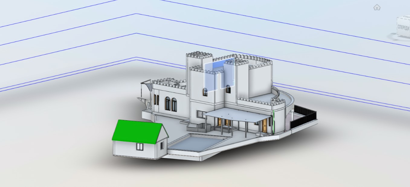
Model Development: Autodesk Revit BIM model (LOD 250)
Methodology
1. On-Site Laser Scanning
Complete terrestrial laser scanning of interior spaces, exterior facades, surrounding site areas, and visible engineering systems.
2. Data Processing
Registration, alignment, and verification of all scan data to create a unified and accurate point cloud.
3. Topographical Survey Development
Creation of detailed site plans based on scan data, including terrain information, pathways, landscaping, and property boundaries.
4. Architectural and Engineering Documentation
Preparation of floor plans, engineering layouts, building sections, elevations, and technical drawings derived directly from the point cloud.
5. BIM Modeling
Development of an Autodesk Revit model to LOD 250, including architectural geometry and visible MEP elements required by the client.
6. Quality Assurance and Delivery
Internal review, quality verification, and preparation of final deliverables in the required formats.
Deliverables
Point Cloud
- RCP
- E57
- Registered point cloud dataset
2D Documentation
- Dimensioned floor plans
- Building sections
- Engineering layouts
- Topographical plans
- Site plans
- DWG files
- PDF documentation package
BIM Model
- Autodesk Revit Model (LOD 250)
- Architectural model
- Visible MEP elements
- RVT format
- DWG exports
Results and Client Value
Villa scanning results in Hatta, UAE


Accurate Digital Twin
A complete digital representation of the existing villa was created, providing a reliable foundation for future renovation and design activities.
Reduced Design Risk
Laser scanning eliminated uncertainties associated with traditional measurements and significantly reduced the risk of design conflicts during future project phases.
Improved Coordination
The BIM model serves as a centralized source of information for architects, engineers, contractors, and facility managers involved in the project.
Comprehensive Documentation
The client received a complete package of architectural, engineering, and topographical documentation suitable for permitting, renovation planning, and facility management.
Fast Project Delivery
Despite the complexity of the project and phased delivery requirements, all documentation was completed within the agreed schedule while maintaining high accuracy standards.