

Point Cloud Processing for Stadiums
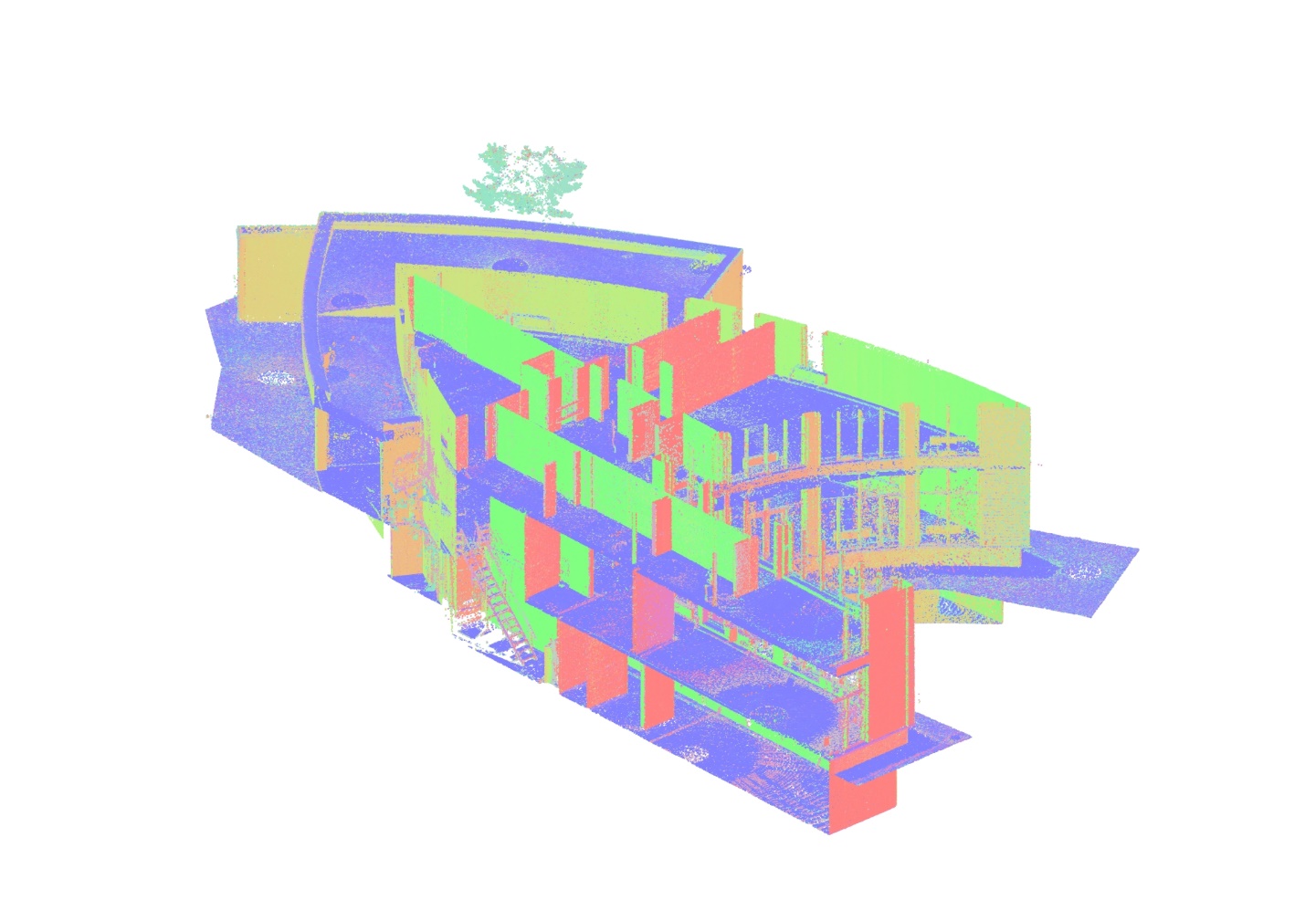
Stadium laser scanning projects generate large and complex point cloud datasets that must be accurately registered, cleaned, organized, and verified before they can be used for BIM modeling, as-built documentation, renovation planning, or engineering coordination. Seating bowls, grandstands, roofs, façades, concourses, and technical areas create dense geometry that requires careful data preparation.
At ScanM2, we provide Point Cloud Processing Services for Stadiums, transforming raw terrestrial laser scan data into clean, structured, and project-ready datasets. Our processing workflow helps architects, engineers, contractors, and facility operators work with reliable existing conditions information while reducing unnecessary file size, scan noise, and registration inconsistencies.
Whether the point cloud was captured by ScanM2 or supplied by another surveying team, we prepare the dataset for efficient use in CAD, BIM, engineering, and facility management workflows.
Contact Us Now for a Free Consultation!
Why Stadium Point Clouds Require Professional Processing
Raw scan data collected across a stadium can contain hundreds of individual scan positions and millions of measured points. Before this information can support design or documentation, all scans must be accurately aligned within a common coordinate system.
Large sports facilities also contain repetitive seating geometry, multiple levels, curved structures, open spaces, technical rooms, and exterior areas. These conditions increase the importance of reliable registration and quality control, particularly when data is collected over several scanning sessions.
Where new survey data is required, our 3D Laser Scanning Services for Stadiums provide the source data needed for subsequent point cloud processing and documentation.
What Our Stadium Point Cloud Processing Includes
Point Cloud Registration
Individual scan positions are aligned into a unified coordinate system to create a complete digital representation of the surveyed stadium areas.
Registration Verification
Scan alignment is checked for consistency so that geometry from different positions and levels matches correctly throughout the dataset.
Noise Cleaning
Unwanted points created by temporary objects, moving people, vehicles, reflections, or scanning artifacts can be removed where appropriate while preserving permanent stadium geometry.
Point Cloud Organization
Large datasets can be structured by building level, stadium zone, scan area, or project phase to simplify use by architects and engineers.
Data Optimization
Point cloud files can be optimized for more efficient use in CAD and BIM software without unnecessarily compromising the geometric information required for the project.
Colorized Point Clouds
Where photographic information is available, RGB data can be preserved to improve visualization and make complex stadium areas easier to interpret.
Preparing Stadium Point Clouds for BIM and CAD Workflows
A properly processed point cloud becomes the geometric foundation for subsequent project documentation. Architects can measure existing spaces directly from the dataset, engineers can review structural relationships, and BIM specialists can model stadium geometry against verified survey information.
For projects that require conversion of the processed dataset into an intelligent digital building model, our Scan to BIM Services for Stadiums provide a continuous workflow from registered scan data to project-ready BIM.
Where the client already has an established BIM environment, processed point clouds can also serve as the source data for our BIM Modeling Services for Stadiums.
Challenges of Processing Large Stadium Datasets
Stadium point clouds can become significantly larger than datasets from conventional commercial buildings. Thousands of seats, repetitive grandstand geometry, roof structures, multiple circulation levels, exterior façades, and extensive technical spaces may all be included within a single project.
Processing therefore requires a balance between preserving sufficient geometric detail and keeping files practical for daily project use. Poorly organized datasets can become difficult to navigate, slow to load, and inefficient for architects or engineers working in BIM and CAD environments.
Our workflow focuses on maintaining reliable geometry while preparing the dataset according to the intended downstream use, whether the project requires modeling, drafting, engineering coordination, or long-term documentation.
Where Processed Stadium Point Clouds Are Used
Renovation and Reconstruction
Provide architects and engineers with accurate existing conditions data before modifying seating areas, grandstands, public spaces, façades, roofs, or technical zones.
As-Built Documentation
Processed scan data can be used to produce accurate plans, elevations, sections, and existing conditions documentation through our As-Built Drawings Services for Stadiums.
Structural Coordination
Engineers can review visible structural geometry and spatial relationships before developing modification or reinforcement solutions.
MEP Modernization
Clean point clouds provide reliable spatial context when planning new mechanical, electrical, plumbing, fire protection, security, or communication systems.
Facility Documentation
Registered scan data can remain part of the stadium’s digital record and support future inspections, maintenance, refurbishment, and facility planning.
Project Example: Indoor Basketball Court Point Cloud Processing
ScanM2 completed scanning and point cloud processing for a full-size indoor basketball court at a VASA Fitness facility in Chandler, Arizona. The approximately 4,500 sq ft space included the complete court, painted markings, walls, glazing, entrance zones, and adjacent functional areas.
Terrestrial laser scanning produced a high-density colored dataset that was then registered, stitched, cleaned, and segmented before further drafting and 3D modeling. Accurate registration was especially important because the client required reliable measurements of the basketball court geometry and exact positioning of painted lines.
Point Cloud Processing Project Results


The processed point cloud became the foundation for the final 2D court plan and 3D model. The complete workflow—from field scanning through registration, cleaning, modeling, QA, and delivery—was completed within one week.
View the Full Indoor Basketball Court Project →
Stadium Point Cloud Processing Deliverables
Final deliverables are prepared according to the client’s software environment and intended use of the dataset.
- Registered point clouds
- Cleaned point cloud datasets
- Colorized point clouds
- Organized scan datasets
- RCP and RCS files
- E57 files
- LAS files
- PTS files
- XYZ files
- CAD-ready point clouds
- BIM-ready point clouds
Processing Existing Stadium Scan Data
Clients do not need to repeat the field survey if suitable laser scan data has already been collected. ScanM2 can review datasets captured by another surveying contractor and determine whether the available coverage and accuracy are sufficient for the required processing scope.
Depending on the condition of the source data, our team can perform registration, alignment verification, cleaning, organization, optimization, format conversion, and preparation for downstream BIM or CAD workflows.
This approach allows architectural and engineering teams to reuse existing survey information while avoiding unnecessary site mobilization and repeated data acquisition.
Why Choose ScanM2 for Stadium Point Cloud Processing
Processing stadium scan data requires experience with large datasets, repetitive geometry, multiple levels, exterior and interior scanning, and complex project coordinate systems. The final point cloud must remain accurate while also being practical for downstream users.
ScanM2 combines terrestrial laser scanning, point cloud processing, CAD drafting, and BIM expertise within one workflow. This allows our specialists to prepare datasets according to how architects and engineers will actually use them during renovation, modeling, coordination, and facility management.
Every dataset is checked before delivery to ensure that the point cloud provides a dependable foundation for the next stage of the project.

