

3D Laser Scanning for Thermal power station
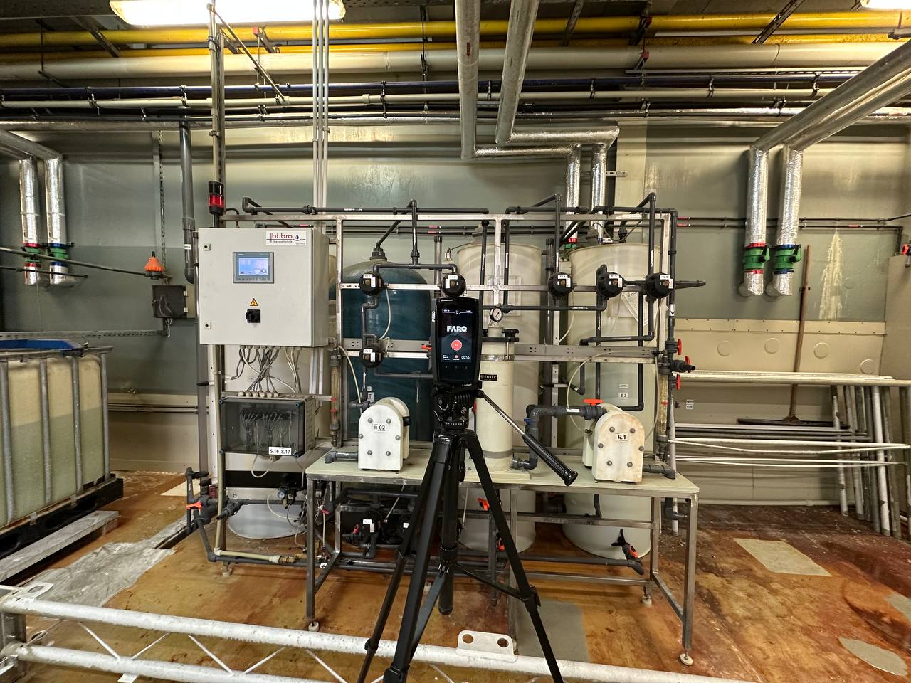
Modernizing a thermal power station means working within an existing network of boilers, turbines, steam pipelines, steel structures, and auxiliary systems. Even a relatively small equipment replacement can affect multiple interconnected installations. Accurate measurements of the current plant configuration are essential before engineers can develop reliable reconstruction plans.
ScanM2 provides 3D Laser Scanning Services for Thermal Power Stations, capturing the existing geometry of power generation buildings, mechanical equipment, pipework, and supporting structures. The resulting point clouds provide a measured foundation for plant modernization, equipment coordination, as-built documentation, and digital modeling.
Contact Us Now for a Free Consultation!
Modernizing a Thermal Power Plant Starts with Existing Conditions
Thermal power stations frequently undergo phased modernization. Boilers may be upgraded, turbines refurbished, auxiliary equipment replaced, and steam or water systems modified while other parts of the facility remain operational.
These projects depend on understanding the physical relationship between existing machinery, piping, structural supports, and available installation space. Original construction drawings may not include later modifications or the exact installed positions of equipment.
Terrestrial laser scanning captures accessible surfaces across complex industrial environments, producing three-dimensional measurement data that engineers can use to assess existing conditions before design work begins.
Which Areas of a Thermal Power Station Can Be Scanned?
The survey scope is determined by the equipment being modified, the engineering disciplines involved, and the areas that can be safely accessed. Scanning may cover an individual installation or multiple interconnected plant buildings.
Boiler Houses and Steam Generation Equipment
Boiler houses contain large equipment assemblies, pipe networks, steel framing, access platforms, and maintenance structures. Their geometry can be difficult to document using isolated manual measurements.
Laser scanning captures visible equipment envelopes, supporting structures, surrounding piping, and spatial relationships required for boiler upgrades and installation planning.
Turbine Halls and Generator Areas
Turbine halls contain major generating equipment, overhead lifting systems, structural elements, and technical installations. Survey data can help engineers evaluate equipment clearances, foundation interfaces, and the available space for proposed modifications.
Steam Pipelines and Pipe Racks
High-density piping arrangements present significant coordination challenges. Scanning can capture accessible pipe surfaces, bends, valves, supports, and nearby structures to provide geometric references for route changes and new connections.
Auxiliary Equipment and Technical Buildings
Depending on the plant configuration, survey areas may include pump rooms, heat exchangers, water treatment installations, fuel-handling infrastructure, and other supporting systems. These spaces often contain equipment installed or modified during different stages of the facility’s operation.
Engineering Challenges Addressed by 3D Laser Scanning
The main value of a thermal power station survey is the ability to examine complex existing geometry before committing to a new design.
- Limited installation space: measure clearances around existing equipment, platforms, and structures.
- Outdated technical drawings: establish a current geometric reference for accessible installations.
- Complex pipe connections: document existing routes and interfaces before developing modifications.
- Equipment replacement: compare proposed machinery dimensions with the available plant space.
- Multidisciplinary coordination: provide consistent measurement data for structural, mechanical, and plant engineering teams.
Scanning Steam Piping in Congested Industrial Spaces
Steam and auxiliary piping systems often occupy multiple elevations and pass through steel framing, technical galleries, and equipment areas. Their routing may have changed during earlier modernization work.
Laser scanning can provide a spatial record of visible piping arrangements, including the relative positions of pipes, supports, valves, and adjacent equipment.
Engineers can use this information when assessing proposed piping modifications, identifying potential spatial conflicts, and preparing layouts for new connections.
Surface scanning does not establish internal pipe condition, wall thickness, material specification, or pressure integrity. These require appropriate inspection and engineering methods.
Supporting Boiler Replacement and Retrofit Projects
Boiler modernization may involve replacing components, changing auxiliary installations, upgrading piping, or modifying the surrounding steel structures.
A measured point cloud helps project teams understand the current arrangement of equipment and nearby construction. It can be used to review installation envelopes, access constraints, and the geometric compatibility of proposed systems.
When new equipment must be installed within an existing boiler house, the survey can support coordination between equipment suppliers, plant engineers, and contractors.
Documenting Steel Structures and Equipment Supports
Thermal power stations contain extensive steel structures supporting platforms, pipes, mechanical installations, and access systems. Modifications to these structures require an accurate understanding of the existing arrangement.
Laser scanning can document visible structural members, connection areas, platform elevations, and the geometry surrounding proposed modification locations.
The captured geometry supports spatial coordination but does not independently establish structural capacity, material properties, or concealed connection details.
Working Inside an Operating Thermal Power Station
Industrial surveys must account for plant operations, restricted zones, high-temperature installations, moving machinery, and site-specific safety procedures.
Survey planning should establish which areas can be accessed, whether equipment shutdowns are necessary, and what safety requirements apply to each work zone.
Laser scanning is a non-contact measurement method, but it does not eliminate operational risks or access restrictions. Equipment selection, scanning positions, and work procedures must be appropriate for the site conditions.
What Happens to the Survey Data?
A thermal power station survey typically involves numerous scanner positions. Individual scans are registered into a common coordinate system to produce a combined point cloud representing the measured areas.
The data can then be organized by building, elevation, technical zone, or project work package. This makes it easier for engineers to examine the relevant installations without navigating an unnecessarily large dataset.
Where required, processing includes registration verification, removal of identified unwanted points, and preparation of files for the intended engineering software.
From Laser Scanning to CAD and BIM Documentation
A point cloud is a measured geometric reference, not automatically a finished engineering model. The next stage depends on what the project team needs to produce.
For conventional documentation, survey data can support as-built drawings, including plans, sections, elevations, and equipment layouts.
For projects requiring coordinated three-dimensional representations of existing structures and installations, the survey can provide source data for BIM modeling services.
The required output should be defined before the survey, because modeling objectives can influence scanning coverage, measurement density, and the areas requiring additional detail.
A Targeted Survey or a Complete Power Station Scan?
Scanning an entire thermal power station is not always necessary. A focused project may only require measurements of a turbine hall, boiler installation, pipe rack, or auxiliary equipment room.
For larger modernization programs, multiple plant areas may need to be connected within one coordinated survey dataset. The scope should include the surrounding geometry that could affect planned modifications, not only the equipment being replaced.
Defining the survey boundaries helps control project costs while ensuring that critical interfaces are captured.
Our Thermal Power Station Scanning Process
Each survey is planned according to the facility configuration, operational restrictions, and intended engineering deliverables.
- Technical consultation. Define the modernization task, required survey areas, and expected outputs.
- Site planning. Review available drawings, access conditions, safety requirements, and measurement objectives.
- 3D data capture. Scan accessible equipment, structures, and installations from planned measurement positions.
- Scan registration. Align the collected measurements into the agreed coordinate framework.
- Data verification. Review registration quality, coverage, and relevant geometric consistency.
- Engineering deliverables. Prepare the point cloud and any separately agreed CAD or BIM outputs.
Typical Survey Deliverables
Depending on the agreed scope, a thermal power station scanning project may include:
- Registered 3D point clouds of the surveyed plant areas
- Organized measurement datasets for individual buildings or systems
- Point cloud files in agreed formats such as E57 or RCP/RCS
- Geometric references for equipment coordination and retrofit design
- Measured CAD drawings when included in the project scope
- Existing-condition BIM models when separately specified
Survey Accuracy and Measurement Limitations
The achievable accuracy of a thermal power station survey depends on instrument specifications, registration methods, site geometry, measurement distances, and environmental conditions.
Reflective surfaces, restricted access, dense installations, and heat-related effects can influence data quality. Critical dimensional requirements should be discussed before scanning so that appropriate methods and verification procedures can be selected.
Laser scanning captures accessible visible surfaces. Concealed components, internal machinery geometry, and areas blocked from scanner view require additional measurements or reliable technical documentation.
Measured Existing Conditions for Thermal Power Plant Upgrades
Thermal power station modernization requires engineering decisions based on the actual configuration of existing installations. Accurate 3D survey data helps reduce uncertainty when coordinating new equipment, modifying pipework, or planning structural changes.
ScanM2 provides project-specific laser scanning services for complex industrial facilities, preparing measured geometric information for reconstruction planning, equipment coordination, and technical documentation.

