

Scanning of a Residential Wood Frame House
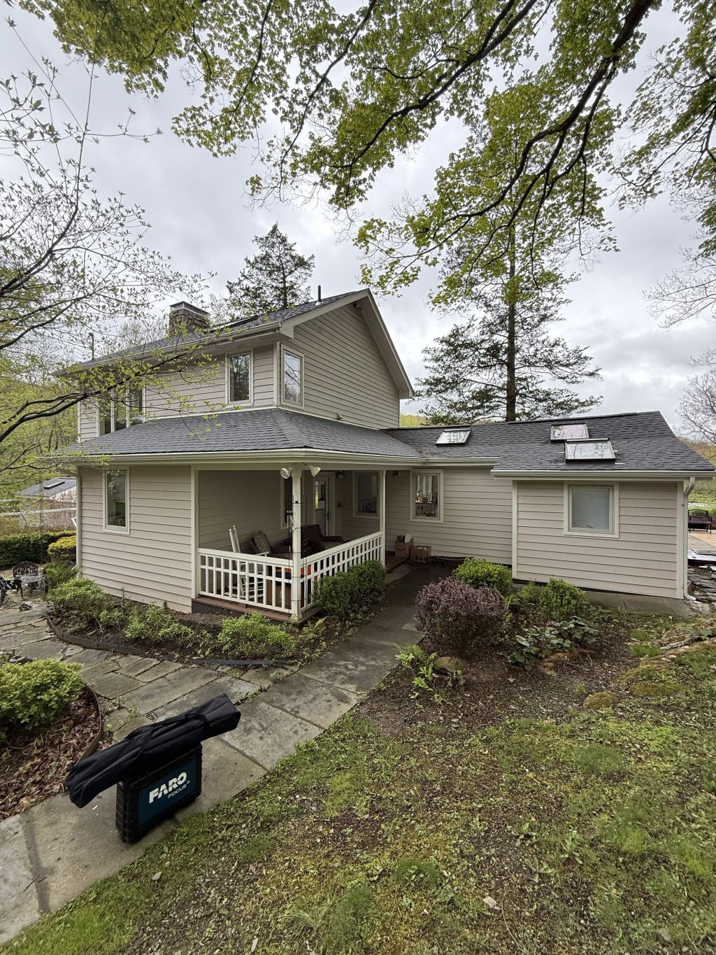
We completed express 3D laser scanning of a residential wood frame house in Warwick, New York. The project included scanning of the interior spaces, exterior facades, porch structure, and the area beneath the porch to capture the building geometry and visible structural framing elements.
The house has an area of approximately 3,500 sq. ft. Field scanning was completed in 5 hours, and the final point cloud and 3D model were delivered within one week. The client needed accurate data quickly for structural assessment and future renovation planning, so the project required both speed and a high level of detail.
Project Overview
Project Type: 3D laser scanning for informational and structural assessment purposes
Location: Warwick, New York, USA
Object Type: Residential wood frame house
Area: approximately 3,500 sq. ft.
Goal:
Deliver a complete data package including point cloud data and a detailed 3D model of the house.
Key Requirement:
Accurate representation of the building geometry and structural framing elements with LOD 350 detail.
Project Challenges
Tight Timeline
The client required the project to be completed urgently. Laser scanning made it possible to reduce field measurement time and avoid repeated site visits.
Interior and Exterior Coverage
The scope included both interior and exterior scanning. This was necessary to create a complete digital representation of the building and its current condition.
Wood Frame Structure
Special attention was given to visible framing elements, structural irregularities, and deformation areas. This was important for future renovation planning and structural evaluation.
Porch and Understructure
In addition to the main building, the porch structure and the space beneath it were scanned in detail to assess support conditions and framing geometry.
Technical Data and Accuracy
Method: precise 3D laser scanning
Equipment: FARO laser scanner
Model detail: LOD 350
The scan data was processed into a registered point cloud and then used as the basis for the 3D Revit model.
Methodology
1. Scanning
Fieldwork was completed in one day and covered all interior and exterior areas of the house, including the porch and understructure.
2. Point Cloud Processing
The scan data was registered, aligned, cleaned, and prepared for modeling during the first two days after scanning.
3. 3D Modeling
A detailed 3D Revit model was developed at LOD 350. The model included architectural geometry, structural framing elements, porch geometry, and key building components.
4. Quality Control and Delivery
The final model was checked against the point cloud, verified for LOD 350 requirements, and delivered to the client within one week.
Deliverables
Point Cloud
- RCP
- RCS
3D Model
- RVT
- DWG
- LOD 350
Results and Client Value
The client received a reliable digital representation of the existing house without the need for repeated manual measurements. The final model provided accurate information about the wood frame structure, porch support system, and building geometry.
Project Documentation and 3D Model


The project helped reduce survey time, lower on-site measurement costs, and provide a strong technical basis for future renovation and structural planning.

