

Point Cloud Processing for Oil and Gas Facilities
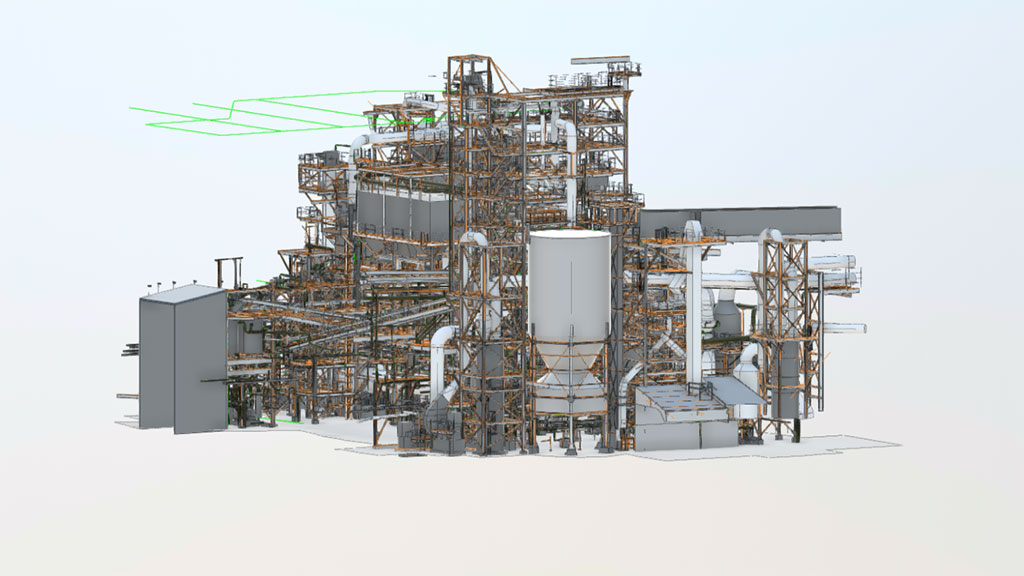
Oil and gas facilities operate within highly complex industrial environments that include refineries, pipeline systems, compressor stations, offshore platforms, and extensive process equipment. Accurate spatial documentation of these facilities is essential for engineering planning, infrastructure upgrades, and modernization projects.
Point cloud processing for oil and gas facilities allows engineers to transform raw laser scanning data into structured digital information representing the real geometry of industrial infrastructure. These datasets provide highly detailed spatial models that support engineering analysis, plant reconstruction, and digital facility documentation.
Contact Us Now for a Free Consultation!
Point cloud data can be used to create accurate engineering models of refinery units, pipeline infrastructure, and equipment installations, allowing engineering teams to work with reliable information when planning maintenance, modernization, or expansion of industrial facilities.
Why Point Cloud Data Is Critical for Oil and Gas Infrastructure
Oil and gas production environments contain dense networks of pipelines, process equipment, structural platforms, and utility systems. Over time, facility upgrades, equipment replacements, and infrastructure modifications may create discrepancies between original engineering drawings and actual plant conditions.
Point cloud modeling for oil and gas plants provides engineers with an accurate digital representation of the facility as it exists in reality. These spatial datasets allow engineering teams to verify pipeline routing, equipment placement, and structural layouts before initiating modernization or construction projects.
Accurate point cloud data is especially important for facilities such as:
- oil refineries
- pipeline infrastructure
- compressor stations
- offshore production platforms
- storage terminals and processing plants
Reliable documentation of these environments reduces engineering risks and improves coordination during infrastructure upgrades and reconstruction projects.
Engineering Challenges in Oil and Gas Facility Documentation
Industrial oil and gas facilities present significant challenges for accurate engineering documentation due to the complexity of equipment layouts and the density of infrastructure systems.
Dense Pipeline Systems
Refineries and processing plants contain extensive pipeline networks connecting distillation units, storage tanks, compressors, and processing equipment. These systems include complex pipe routing, valves, fittings, and structural supports that must be accurately documented.
Large Process Equipment
Industrial process plants contain numerous pieces of heavy equipment, including:
- compressors
- distillation columns
- separators
- heat exchangers
Documenting the spatial configuration of this equipment is essential for engineering coordination and equipment replacement planning.
Structural Platforms and Pipe Racks
Oil and gas facilities also contain complex structural infrastructure supporting pipeline systems and industrial equipment. These structures often include steel platforms, pipe racks, elevated walkways, and equipment support frames.
Hazardous Operating Environments
Many oil and gas facilities operate under strict safety regulations. Restricted access zones and hazardous operating conditions can make traditional field measurements difficult, increasing the need for accurate digital facility documentation.
Point Cloud Processing Workflow for Oil and Gas Facilities
Creating accurate digital models of industrial facilities requires a structured workflow that transforms raw scanning data into engineering-ready datasets.
1. Laser Scanning Data Collection
High-resolution laser scanning technologies capture millions of spatial measurements representing refinery units, pipelines, structural platforms, and equipment installations. These measurements form the initial point cloud dataset representing the real geometry of the facility.
2. Point Cloud Data Registration and Processing
Captured scans are aligned and combined into a unified spatial dataset. This stage includes scan registration, noise filtering, and data cleaning to ensure accurate representation of industrial infrastructure.
3. Point Cloud Modeling and Data Structuring
Point cloud datasets are analyzed and structured to identify key infrastructure components such as pipelines, equipment, and structural elements. Engineers classify and interpret the spatial data to prepare it for engineering modeling.
4. Conversion to Engineering Models
Processed point cloud data can be converted into detailed engineering models, including CAD drawings and BIM models representing refinery infrastructure, equipment layouts, and pipeline systems.
These digital models support engineering coordination and modernization planning for industrial facilities.
Contact Us Now for a Free Consultation!
Applications of Point Cloud Modeling in Oil and Gas Facilities
Point cloud modeling is widely used across oil and gas production environments to support engineering and infrastructure management activities.
Common applications include:
- refinery modernization projects
- pipeline system upgrades
- equipment installation planning
- plant reconstruction and expansion
- digital facility documentation
- engineering coordination for infrastructure upgrades
Accurate digital models of refinery units and pipeline infrastructure help engineering teams plan complex projects with greater precision and reduced operational risks.
Examples of Point Cloud Models for Oil and Gas Facilities
Below are examples of point cloud models and digital engineering documentation prepared for oil refineries, pipeline infrastructure, offshore platforms, and industrial process plants.
Point Cloud Models of Oil and Gas Facilities Project Gallery


These models represent spatial datasets used to document refinery infrastructure, pipeline systems, structural platforms, and industrial process equipment.
From Point Cloud Data to CAD and BIM Documentation
Processed point cloud data serves as the foundation for multiple types of engineering documentation used in industrial facility management.
Engineering teams can convert point cloud datasets into:
- CAD drawings representing facility layouts
- BIM models used for coordination and planning
- engineering documentation of industrial infrastructure
These models allow engineers to visualize the existing configuration of oil and gas facilities and plan modernization projects with greater accuracy.
Engineering Benefits of Point Cloud Processing
Using point cloud data for industrial facility documentation provides several important advantages for engineering teams and plant operators.
Key benefits include:
- accurate representation of existing plant conditions
- improved engineering coordination
- reduced risks during infrastructure upgrades
- faster planning of modernization projects
- reliable digital documentation of industrial assets
Accurate point cloud models allow engineers to analyze complex refinery and pipeline infrastructure while minimizing field measurement errors.
Point Cloud Processing for Oil and Gas Modernization Projects
Modern oil and gas facilities undergo continuous upgrades and reconstruction projects as infrastructure evolves and production requirements change. Reliable digital documentation of existing plant conditions is essential for successful project execution.
Point cloud processing provides engineers with accurate spatial models of industrial facilities that support retrofit projects, equipment upgrades, and facility expansion planning.
By working with precise digital models of refinery infrastructure and pipeline systems, engineering teams can improve planning accuracy and reduce the risks associated with complex industrial projects.

