

How Existing Building Documentation Is Created Using 3D Laser Scanning

From Reality Capture to Accurate CAD Drawings and BIM Models
Accurate Existing Building Documentation is the foundation of every successful renovation, modernization and adaptive reuse project. Before architects and engineers can design with confidence, they need reliable information about the building’s actual condition—not outdated drawings that may no longer reflect reality.
Modern 3D laser scanning has transformed the documentation process by capturing millions of precise measurements in a matter of hours. These measurements are converted into a detailed point cloud and then used to create floor plans, elevations, sections, CAD drawings and BIM models that accurately represent the existing building.
In this article, we explain each step of the workflow — from the initial site survey to the final documentation package — and show why laser scanning has become the preferred method for documenting existing buildings.
What Is Existing Building Documentation?
Existing Building Documentation is the process of recording the current condition of a building before renovation, expansion, modernization or change of use.
The goal is to create an accurate digital representation of the building that reflects its actual geometry, structural elements and architectural features. This documentation serves as the basis for architectural design, engineering, BIM workflows and construction planning.
Unlike original construction drawings, Existing Building Documentation reflects the building as it exists today, including any modifications made over its lifetime.
Typical deliverables include:
- Existing floor plans
- Building elevations
- Cross sections
- Roof plans
- Reflected ceiling plans
- CAD drawings
- Point clouds
- BIM models
- IFC models
When Is Existing Building Documentation Required?
Accurate documentation is essential whenever reliable information about an existing building is needed.
Common applications include:
- Building renovations
- Facility modernization
- Office fit-outs
- Industrial plant upgrades
- Historic building restoration
- Data center expansion
- Hospital reconstruction
- Airport modernization
- Facility management
- Digital Twin implementation
Without accurate documentation, project teams often encounter hidden conditions, dimensional inaccuracies and coordination problems that lead to costly delays.
Step 1. Project Planning
Every project begins by defining the required deliverables and the level of detail needed for the documentation.
During this stage, the project team determines:
- Areas to be documented
- Required accuracy
- Access restrictions
- Building occupancy
- Safety requirements
- Final deliverables
- CAD or BIM requirements
Proper planning ensures that all necessary information is captured during the site visit, reducing the need for additional scanning sessions.
Step 2. 3D Laser Scanning

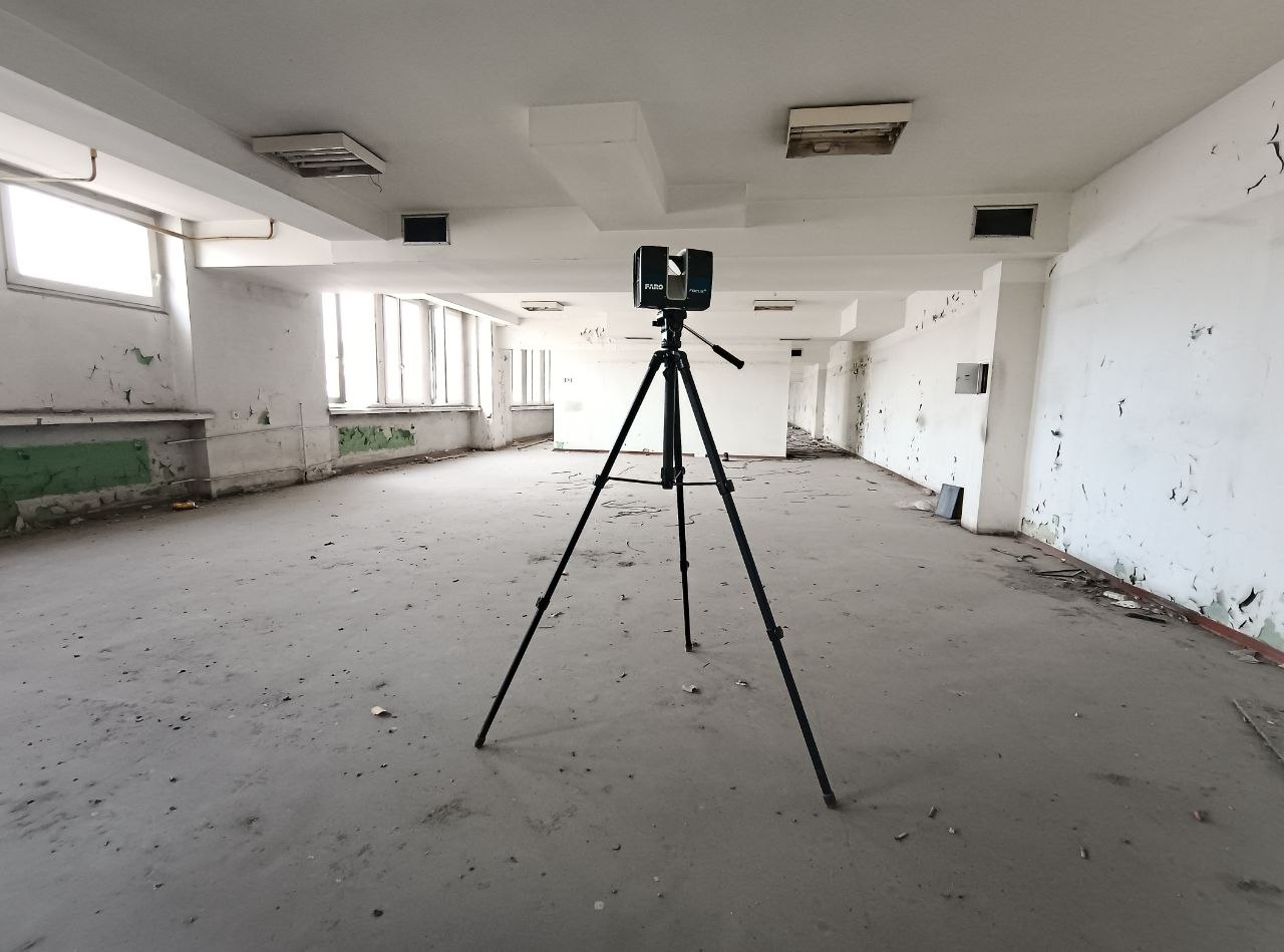
Once planning is complete, the building is documented using professional terrestrial laser scanners.
The scanner is positioned at multiple locations throughout the building to capture millions of measurement points from different perspectives.
Unlike traditional surveying methods, laser scanning records the entire environment rather than selected dimensions. This creates a comprehensive digital snapshot of the building that can be revisited at any time during the project.
Because every surface is measured, architects and engineers can extract additional dimensions later without returning to the site.
Learn more about our 3D Laser Scanning Services and how they support accurate building documentation.
Step 3. Point Cloud Registration
Each individual scan captures only part of the building.
During registration, all scans are accurately aligned into a single unified point cloud representing the entire facility.
Specialized software automatically identifies common reference points between scans, while experienced specialists verify the alignment to ensure maximum accuracy.
This step is critical because every subsequent drawing and BIM model depends on the quality of the registered point cloud.

Step 4. Point Cloud Processing
After registration, the point cloud is processed and optimized.
This stage typically includes:
- Removing noise
- Eliminating duplicate data
- Cleaning unwanted objects
- Optimizing file size
- Organizing scan data
- Preparing the point cloud for CAD and BIM production
The result is a clean, structured dataset that provides a reliable basis for documentation.
Discover how our Point Cloud Processing Services transform raw scan data into accurate engineering deliverables.
Step 5. Creating CAD Documentation

Using the processed point cloud, specialists create accurate 2D documentation directly from measured data.
Typical deliverables include:
- Existing floor plans
- Building elevations
- Cross sections
- Roof plans
- Reflected ceiling plans
- Site plans
- Detail drawings
Because every drawing is based on actual measurements, dimensional accuracy is significantly higher than documentation produced from manual surveys or outdated drawings.
These deliverables are produced as part of our Existing Building Documentation Services, providing reliable information for renovation and modernization projects.
Step 6. BIM Modeling

Many projects require more than traditional CAD documentation.
For renovation, facility management and Digital Twin projects, the point cloud is transformed into an intelligent BIM model.
Instead of simply drawing walls and structural elements, BIM objects contain information that supports coordination, quantity takeoffs, maintenance and future modifications.
Depending on project requirements, models may be created at different Levels of Detail (LOD) to match the intended use.
Our Scan to BIM Services convert laser scan data into intelligent BIM models ready for design, coordination and facility management.
Quality Control and Verification
Before the documentation is delivered, every drawing and BIM model undergoes a comprehensive quality assurance process.
Specialists compare the final deliverables with the original point cloud to verify dimensions, geometry and completeness.
This verification process helps ensure that the documentation accurately reflects the existing building and meets the project’s technical requirements.
Final Deliverables
Depending on project requirements, clients may receive a complete documentation package that includes:
- Point cloud data
- CAD drawings
- Existing floor plans
- Building elevations
- Cross sections
- Roof plans
- Reflected ceiling plans
- BIM models
- IFC models
- Revit models
- PDF documentation
All deliverables are produced from the same verified dataset, ensuring consistency across every format.
Why 3D Laser Scanning Is the Preferred Method
Compared with traditional surveying methods, 3D laser scanning offers significant advantages in terms of speed, accuracy and completeness.
Instead of measuring selected points manually, laser scanners capture millions of measurements that create a permanent digital record of the building.
This approach reduces field time, minimizes the risk of missing critical information and allows project teams to access accurate building data throughout the entire project lifecycle.
As a result, architects, engineers, contractors and facility managers can make better decisions while reducing design conflicts and costly construction changes.
Conclusion
Creating accurate Existing Building Documentation is no longer limited to manual measurements and outdated drawings.
By combining 3D laser scanning, point cloud processing, CAD documentation and BIM modeling, project teams gain a reliable digital representation of the existing building that supports every stage of renovation, modernization and facility management.
Whether documenting a commercial property, industrial facility, hospital, airport or data center, modern laser scanning delivers the accuracy and completeness needed for successful projects while reducing risk, saving time and improving collaboration across all disciplines.
FAQ
What is Existing Building Documentation?
How long does the documentation process take?
Why is laser scanning more accurate than manual surveys?
Can BIM models be created from laser scan data?
What file formats can be delivered?
Can occupied buildings be scanned?

How 3D Laser Scanning Supports Construction Claims and Dispute Resolution
24.08.2026
Construction claims and disputes often arise when project participants disagree about what was actually built, when specific work was completed, whether installed elements match the ...

Point Cloud Cleaning Explained: How Scan Data Is Prepared for CAD and BIM
19.08.2026
3D laser scanning can capture millions or even billions of measurement points across an existing building, industrial facility, or construction site. However, the raw dataset ...

What Is an IFC Model and How Is It Used in BIM?
14.08.2026
Building Information Modeling projects often involve architects, structural engineers, MEP specialists, contractors, and building owners working with different software platforms. Exchanging information between these systems ...

BIM Coordination for Data Centers: Preventing Costly Conflicts Before Construction
15.07.2026
Coordinated BIM Models for Mission-Critical Facilities, MEP Systems, and Data Center Expansion Modern data centers are among the most technically demanding building types in the ...

