

Point Cloud Processing for Thermal power station
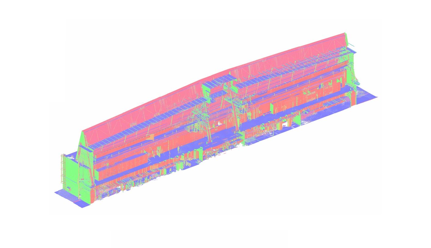
Laser scanning a thermal power station produces detailed measurements of buildings, equipment, pipelines, platforms, and supporting structures. However, thousands of overlapping observations from different scanner positions do not automatically form a usable engineering dataset. The measurements must be aligned, verified, organized, and prepared for the applications that will use them.
ScanM2 provides Point Cloud Processing Services for Thermal Power Stations, converting raw 3D scanning data into coordinated digital datasets for engineering analysis, plant reconstruction, equipment replacement, and technical documentation. We work with complex industrial geometry and prepare point clouds for use in compatible CAD, BIM, and visualization environments.
Contact Us Now for a Free Consultation!
Processing Thermal Power Station Data by Engineering Zone
Thermal power stations contain several distinct technical environments. A boiler house, turbine hall, pipe gallery, and auxiliary equipment building may all be part of one survey, but each area presents different processing challenges.
Instead of treating the entire facility as one undifferentiated point cloud, processing can be organized around the engineering zones that matter to the project.
| Survey area | Processing challenge | Primary objective |
|---|---|---|
| Boiler house | Dense equipment, multiple elevations, complex steelwork | Maintain alignment across technical levels |
| Turbine hall | Large open volumes and extensive equipment surfaces | Produce consistent geometry for machinery and structures |
| Pipe galleries | Long routes, repeated pipe geometry, limited visibility | Preserve coordinate consistency across connected areas |
| Auxiliary buildings | Multiple rooms, restricted access, fragmented scan positions | Combine measurements into usable building datasets |
| Outdoor installations | Long distances, variable conditions, disconnected structures | Align surveyed equipment and infrastructure |
Zone-based organization also allows project teams to receive only the datasets relevant to their work, reducing the need to load the complete facility model for a localized engineering task.
Boiler Houses: Preserving Geometry Across Multiple Levels
Boiler installations often extend through several elevations and include large equipment housings, steel platforms, ducts, piping networks, and access structures. Scanners may need to capture the same technical area from different floors or service platforms.
The main processing challenge is maintaining a consistent spatial relationship between these measurements. Incorrect alignment between upper and lower scan groups can affect the apparent position of equipment, platforms, and pipe connections.
Registration checks should therefore consider both local overlap and the overall relationship between technical levels. Where suitable survey control is available, it can provide additional constraints for the registration network.
Handling Repetitive Structural Geometry
Boiler buildings may contain similar steel frames, repeated platforms, and parallel piping arrangements. Such geometry can create ambiguity during automated scan alignment, especially when scan overlap is limited.
Processing must therefore consider reliable geometric correspondences, registration constraints, and available control information rather than relying solely on visually similar structural features.
Turbine Halls: Combining Large Open Spaces with Equipment Detail
Turbine halls present a different challenge. Large open volumes may provide long measurement ranges, while machinery, foundations, overhead cranes, and technical installations require detailed local coverage.
A processed dataset must preserve the spatial relationship between the building and its equipment without unnecessarily increasing file size through repeated observations of large surfaces.
For turbine replacement projects, the most important information may be concentrated around equipment foundations, installation clearances, service platforms, and adjacent technical systems.
Processing can prioritize these areas while organizing less critical building geometry at a suitable density for the intended engineering workflow.
Why Registration Errors Matter Along Long Pipe Routes
Steam, feedwater, condensate, and auxiliary piping may extend through long corridors and connect multiple production buildings. Surveys of these routes often involve a sequence of scanner positions with limited visibility between distant areas.
When scans are aligned sequentially without adequate network constraints, small errors can accumulate along the route. This may produce inconsistencies when the dataset is connected to another building or an independently surveyed area.
Appropriate registration methods, overlapping observations, and available survey control help reduce these risks. The final coordinate consistency should be evaluated against the project’s requirements rather than assumed from successful software registration alone.
Cleaning Point Clouds in an Active Industrial Environment
Operational thermal power stations contain temporary objects, moving personnel, maintenance equipment, reflective surfaces, and areas with restricted visibility. These conditions can introduce unwanted measurements into the dataset.
Point cloud cleaning may involve identifying and removing isolated points, transient objects, and other measurements that do not represent the required permanent geometry.
However, processing must distinguish unwanted data from genuine industrial details. Small pipe supports, brackets, cable trays, and connection elements can appear visually insignificant but may be important for engineering coordination.
Filtering settings should therefore be selected according to the required deliverables rather than applying aggressive cleaning across the entire dataset.
Three Questions Before Reducing Point Cloud Density
Large power station surveys can generate substantial data volumes. Reducing point density may improve software performance, but unnecessary simplification can remove information needed for engineering work.
Which Features Must Remain Measurable?
A general building survey and a detailed equipment-interface assessment have different geometric requirements. Critical mounting surfaces, narrow supports, and connection areas may need denser measurement data than large walls or floors.
Who Will Use the Dataset?
Architectural drafting, mechanical coordination, BIM reconstruction, and equipment clearance studies may require different levels of detail. The intended application should influence how the point cloud is segmented and optimized.
Can the Original Measurements Be Preserved?
Where practical, original or higher-density source data should remain available for tasks requiring additional detail. An optimized working dataset should not become the only retained source when future verification may be necessary.
Registration Quality and Measurement Reliability
Point cloud quality cannot be evaluated solely by how smoothly the combined dataset appears on screen. Engineering use requires attention to registration consistency, measurement coverage, coordinate references, and source limitations.
Depending on the survey and available information, quality control may include:
- Reviewing scan registration residuals and alignment reports
- Checking overlapping surfaces between neighboring scans
- Comparing registered geometry with available survey control
- Identifying gaps caused by occlusion or restricted access
- Verifying coordinate consistency between separately processed zones
- Documenting relevant processing limitations
Registration statistics describe aspects of the alignment process, but they do not independently guarantee dimensional accuracy at every point in a large industrial dataset. Critical interfaces may require additional measurement verification.
Separating Existing Equipment from Temporary Site Conditions
Power station modernization often involves scaffolding, temporary supports, dismantled equipment, and construction materials. These objects may be present during scanning but absent from the intended permanent facility configuration.
Processing can help organize the data so that known temporary elements are distinguished from the existing plant geometry, provided their status can be reliably established.
Removing an object from a working dataset does not reveal the geometry hidden behind it. If a temporary installation blocks a required surface, additional measurements may be necessary after access becomes available.
Preparing Separate Datasets for Engineering Teams
Different engineering disciplines rarely need the entire thermal power station point cloud at the same time.
A mechanical engineering team may require detailed measurements around a boiler unit or turbine installation. Structural engineers may focus on columns, beams, foundations, and floor levels. Designers preparing technical drawings may need selected plans and sections from multiple areas.
By organizing the processed data into coordinated packages, the same measurement campaign can support several downstream workflows without forcing every specialist to work with an unnecessarily large dataset.
| Engineering team | Relevant point cloud data | Potential use |
|---|---|---|
| Mechanical engineering | Equipment zones, pipe connections, surrounding installations | Equipment replacement and spatial coordination |
| Structural engineering | Building frames, foundations, platforms, floor geometry | Existing-condition assessment and reconstruction planning |
| BIM specialists | Registered building and technical system geometry | Development of structured digital models |
| CAD drafting teams | Selected areas and measured cross-sections | Preparation of plans, elevations, and sections |
| Installation planning | Equipment surroundings and accessible spatial constraints | Review of installation routes and clearances |
Point Cloud Processing for Phased Modernization
Thermal power station reconstruction may involve separate surveys before, during, and after equipment replacement. Measurements collected at different stages can provide useful records of changing plant conditions.
However, combining datasets from different dates requires careful interpretation. Equipment removed during an outage should not be represented as part of the current configuration simply because it appears in an earlier scan.
Survey dates, project stages, coordinate references, and relevant changes should be considered when organizing multi-stage point cloud data.
Where reliable common references are available, datasets from different survey campaigns can be aligned for comparison. Such alignment does not eliminate the need to distinguish physical changes from measurement or registration differences.
Point Cloud Deliverables and File Compatibility
Processed point clouds can be prepared in formats compatible with the project’s engineering software. The appropriate format depends on the original scanner data, required attributes, target application, and agreed delivery specifications.
Common options include E57 for scan data exchange, LAS or LAZ for supported point cloud workflows, RCP or RCS for compatible Autodesk applications, and other supported formats such as PTS or PTX.
File conversion should preserve the coordinate system and required measurement attributes wherever supported. The output should also be checked for compatibility with the intended downstream software.
Where Processed Point Clouds Go Next
Point cloud processing prepares measurement data for engineering use, but it does not automatically create drawings, BIM elements, or mechanical CAD models.
For structured digital representation of existing buildings and systems, the processed data can support Scan to BIM Services for Thermal Power Stations.
For conventional technical documentation, registered scans can provide the geometric reference for As-Built Drawings Services for Thermal Power Stations.
When the objective is to develop coordinated models for reconstruction and engineering design, the data may also be used within BIM Modeling Services for Thermal Power Stations.
Our Processing Workflow
The processing sequence is adapted to the available source files, facility size, coordinate requirements, and intended deliverables.
- Source assessment. Review raw scans, existing registrations, survey control, and target file requirements.
- Registration planning. Establish how individual scan groups and plant zones will be connected.
- Alignment and verification. Register compatible scans and evaluate the consistency of the resulting dataset.
- Cleaning and organization. Filter identified unwanted points and structure the data by relevant technical areas.
- Optimization. Prepare manageable datasets while preserving the detail required for engineering use.
- Export and quality review. Produce agreed file formats and verify relevant delivery requirements.
Can Existing Thermal Power Station Scans Be Reprocessed?
Existing scan data can often be reprocessed for a new engineering objective, provided the source files contain sufficient usable information.
For example, a dataset originally prepared for general facility documentation may later need to be divided into equipment-specific packages or converted for use in another software environment.
Re-registration, cleaning, segmentation, and format conversion may be possible without returning to the site. However, processing cannot recreate surfaces that were never measured or reliably determine hidden equipment geometry.
If additional measurements are required, 3D Laser Scanning Services for Thermal Power Stations can provide new source data for the relevant areas.
Reliable Scan Data for Thermal Power Station Engineering
The value of a laser scanning survey depends not only on the measurements collected but also on how those measurements are prepared for engineering work. Registration consistency, controlled filtering, suitable data organization, and clear quality limitations all influence the usability of the final point cloud.
ScanM2 processes complex industrial scanning datasets for power generation and infrastructure projects. Contact our team to discuss the available scan files, surveyed plant areas, coordinate requirements, and expected engineering deliverables.

