

3D Scanning in New York for Buildings, Construction & BIM
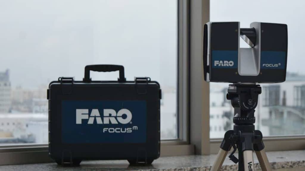
ScanM2 provides professional 3D scanning services in New York for architects, engineers, contractors, property owners, and design teams that need accurate information about existing conditions. Using high-precision 3D laser scanning, we capture buildings and spaces as they exist and convert field data into point clouds, CAD drawings, as-built documentation, and BIM models.
Our 3D scanning services in NYC and across New York can be used for renovation, architectural design, construction planning, existing building documentation, Scan to BIM, and projects involving complex or irregular geometry.
Contact Us Now for a Free Consultation!
Instead of relying on isolated manual measurements, project teams receive a coordinated digital dataset that can be referenced throughout design and construction.
3D Laser Scanning Services in New York
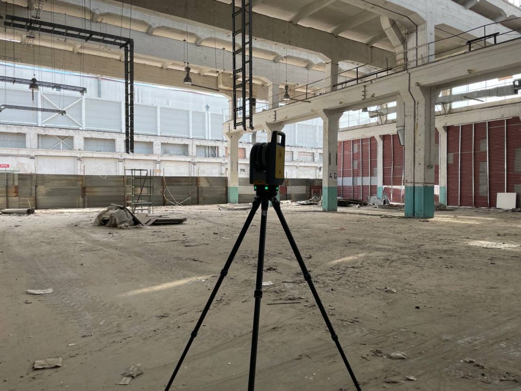
Every project starts with the same fundamental requirement: reliable information about the actual geometry of the site.
Our 3D laser scanning services in New York capture millions of spatial measurements from multiple scanner positions. These scans are registered into a coordinated point cloud that represents walls, floors, ceilings, structural elements, facades, MEP components, equipment, and other visible conditions.
Depending on the project, ScanM2 can perform 3D scanning for:
- existing residential and commercial buildings;
- offices and commercial interiors;
- renovation and adaptive reuse projects;
- construction sites;
- architectural and engineering surveys;
- facades and building exteriors;
- complex structural and MEP areas;
- irregular architectural geometry;
- facilities requiring detailed as-built documentation.
The resulting scan data can be delivered as a point cloud or processed further into CAD drawings, floor plans, elevations, sections, as-built documentation, or BIM models.
For New York projects where the next stage requires a BIM environment, the captured data can also serve as the basis for our Scan to BIM services in New York, allowing design teams to work from measured existing conditions rather than incomplete or outdated documentation.
What Can 3D Scanning Be Used For?
3D scanning is not limited to producing a point cloud. The same measured dataset can support several stages of an architecture, engineering, construction, or renovation project.
Existing Building Documentation
Existing drawings do not always represent current building conditions. Renovations, undocumented modifications, installation changes, and construction deviations can make historical documentation unreliable for new design work.
3D laser scanning creates a measurable digital record of the visible existing conditions. The point cloud can then be used to prepare floor plans, elevations, sections, and as-built drawings for New York projects.
Renovation and Redesign
Before an existing building can be redesigned, the project team needs to understand what is actually there.
An accurate scan helps architects and engineers document room geometry, wall positions, ceiling heights, structural elements, openings, and other conditions that may influence the proposed design. This is particularly useful for buildings with irregular geometry or where original documentation is incomplete.
Architecture and Interior Design
For architectural and interior projects, architectural 3D scanning provides a detailed geometric reference without requiring teams to manually measure every accessible element.
Designers can use the resulting CAD or BIM documentation as a base for space planning, renovation design, coordination, and preparation of construction documents.
Construction Verification
3D laser scanning in construction can document installed conditions at different stages of a project. Captured geometry can be compared with drawings or digital models to identify deviations and provide a record of work before subsequent construction conceals it.
This is particularly valuable where project teams need measurable information rather than photographs alone.
BIM and Scan to BIM
A registered point cloud can be converted into a BIM model representing existing architectural, structural, and MEP conditions.
Our Scan to BIM services in New York combine field capture, point cloud processing, and BIM production within one workflow. The required model scope and level of detail are defined according to how the model will actually be used.
Complex Geometry and Reverse Engineering
Laser scanning is particularly useful when an object, building element, or structure cannot be efficiently documented with conventional measurements.
Dense spatial data helps capture curved surfaces, irregular construction, existing equipment, and other geometry that may later be reconstructed in CAD or 3D modeling software. For projects focused specifically on existing components or equipment, ScanM2 also provides 3D scanning for reverse engineering in New York.
3D Scanning Services for New York Projects
The required output depends on what the project team plans to do with the measured data. A renovation architect may need an existing-condition BIM model, while another project may require only a registered point cloud and CAD drawings.
| Project Type | How 3D Scanning Is Used | Typical Deliverables |
|---|---|---|
| Existing buildings | Capture current building geometry and visible conditions | Point cloud, floor plans, elevations, CAD/BIM |
| Renovation projects | Establish an accurate base before redesign | As-built drawings, sections, BIM model |
| Construction | Record and verify installed conditions | Point cloud, measurement and deviation data |
| Commercial interiors | Document layouts, openings, ceilings and other existing geometry | Floor plans, sections, 3D model |
| Residential properties | Create accurate documentation of existing spaces | Point cloud, 2D drawings, 3D model |
| Complex structures | Capture irregular or difficult-to-measure geometry | Detailed point cloud, CAD or BIM documentation |
This flexibility means the scope of a 3D scanning project in New York can be built around the required deliverables rather than forcing every client into the same survey and modeling package.
From 3D Laser Scanning to CAD and BIM

Collecting scan data is only the first stage. For most architecture and construction projects, the point cloud must be processed and converted into information that designers and engineers can use.
1. Site Scanning
Our team plans scanner positions according to the size, geometry, accessibility, and required coverage of the property. Multiple scans are captured throughout the site to reduce gaps and provide sufficient coverage of visible conditions.
2. Point Cloud Registration
Individual scans are aligned within a common coordinate system. The registered dataset creates a continuous digital representation of the surveyed areas.
3. Point Cloud Processing
The data is reviewed and prepared for its intended use. Depending on the project, this can include cleaning unnecessary data, checking registration, organizing the dataset, and preparing files for CAD or BIM production.
4. CAD and BIM Production
The processed point cloud can then be used to produce floor plans, elevations, sections, as-built drawings, or a BIM model.
For projects requiring a model rather than only survey data, our BIM services in New York can take the workflow from field measurements through to a structured digital model.
5. Quality Control and Delivery
Before delivery, the documentation is checked against the source scan data and the agreed project requirements. Files are then prepared in the formats required by the client and project team.
What You Receive After 3D Scanning
Not every client needs the same deliverables. Some teams already have in-house CAD or BIM capabilities and require only processed point cloud data. Others need a complete documentation package ready for design work.
Depending on the agreed scope, deliverables can include:
- registered point clouds;
- RCP and RCS files;
- 2D floor plans;
- elevations and sections;
- CAD drawings;
- as-built documentation;
- Revit/BIM models;
- 3D models;
- visual documentation and interactive 3D tours where required.
For renovation and existing-building projects, ScanM2 can also prepare dedicated as-built drawings in New York directly from measured scan data.
Accuracy of 3D Laser Scanning
The accuracy required for a building survey should be determined by the purpose of the project rather than by applying a single number to every type of work.
Scanner performance is only one part of the equation. Distance to the measured surfaces, scan resolution, geometry, registration, site conditions, surface properties, and the subsequent processing workflow can all influence the resulting data.
The importance of evaluating terrestrial laser scanner performance is well established in dimensional metrology. Research published by the National Institute of Standards and Technology (NIST) discusses error sources, performance evaluation, and measurement uncertainty for terrestrial laser scanners.
For ScanM2 projects, scanning parameters and the required output are therefore selected according to the actual task – whether the client needs general existing-condition documentation, detailed CAD drawings, BIM production, or documentation of complex geometry.
3D Laser Scanning Projects in New York
Real project experience is especially important when planning 3D scanning for existing buildings, where geometry, access conditions, required deliverables, and project schedules can vary significantly. The following ScanM2 projects show how 3D scanning in New York can be adapted to different building conditions and documentation requirements.
Timber Frame House in Warwick, New York
Approximately 5,500 sq ft · Interior and facade scanning · Approximately 8 hours of field scanning
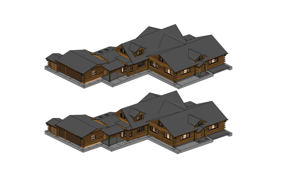
For a residential timber frame house in Warwick, New York, ScanM2 completed interior and exterior 3D laser scanning as part of a detailed restoration documentation project. The building’s natural timber structure, irregular geometry, cracks, deformations, and damaged finishes required significantly more detail than a standard residential survey.
Approximately 5,500 sq ft were captured during a single day of fieldwork, with on-site scanning completed in about eight hours. The colorized scan data was then used to create a detailed digital record of the property’s existing condition.
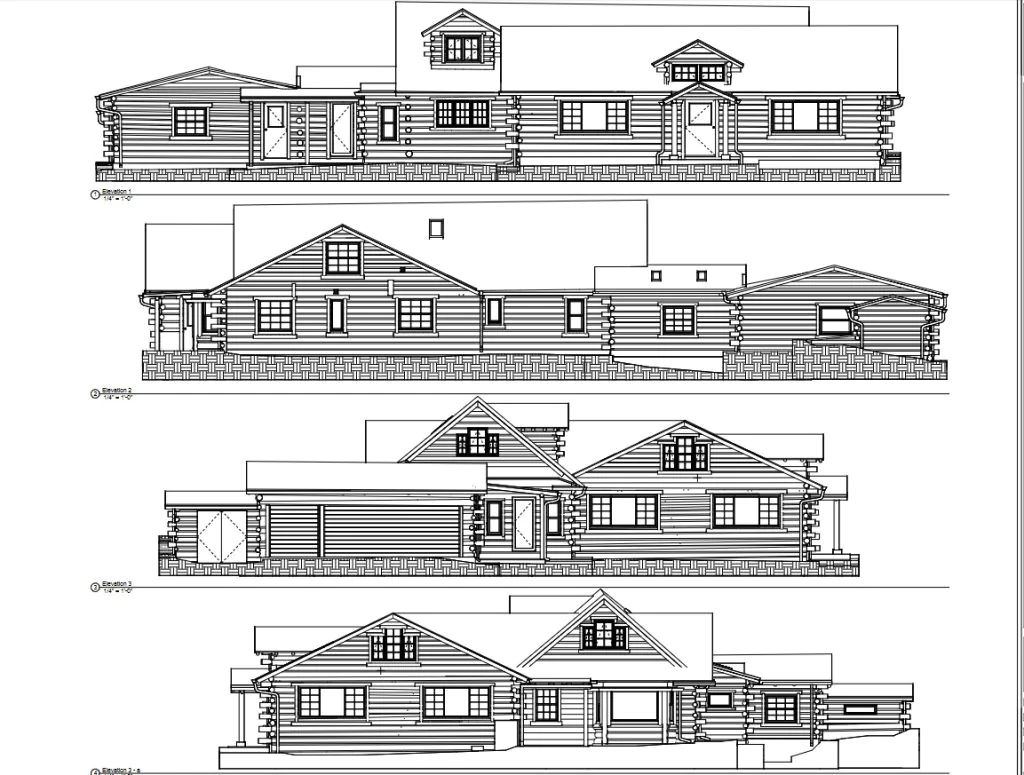
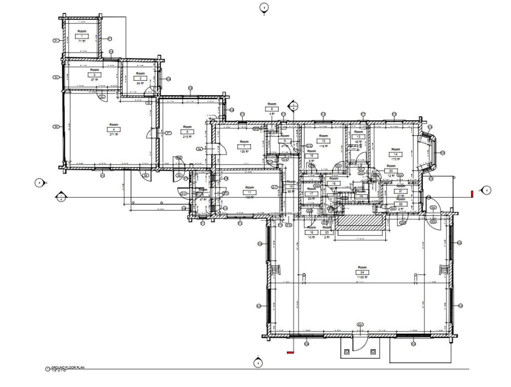
Deliverables: RCP/RCS point cloud, DWG/PDF documentation, LOD 500 Revit and DWG model, and an interactive 3D tour.
View the full Warwick, New York project →
Residential House in Jericho, New York
Approximately 5,000 sq ft · Interior scanning · Approximately 6 hours of field scanning
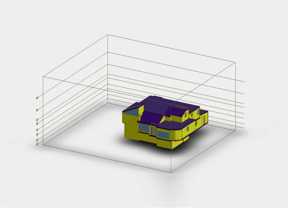
Another New York project involved a private residential house in Jericho with non-standard architectural geometry. The client needed accurate existing-condition documentation quickly, making conventional manual measurement less practical for the required schedule and building configuration.
ScanM2 captured approximately 5,000 sq ft of interior space in about six hours. After registration and processing of the point cloud, the data was used to prepare 2D floor plans and a 3D model reflecting the actual geometry of the house. The complete project package was delivered within the agreed one-week timeframe.
Deliverables: RCP/RCS point cloud, DWG/PDF floor plans, and a 3D model.
View the full Jericho, New York project →
3D Scanning Across New York City
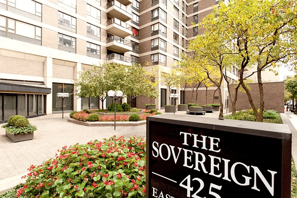
Building conditions in New York City can make accurate existing-condition documentation particularly important. Renovation projects may involve older structures, occupied spaces, complex layouts, limited access, undocumented alterations, or multiple building systems within a relatively compact area.
Our 3D scanning services in NYC can support architects, engineers, contractors, and property teams working on residential, commercial, construction, and renovation projects. Field data can be captured once and then used for multiple outputs, including point clouds, floor plans, sections, elevations, CAD documentation, and BIM models.
ScanM2 also provides dedicated 3D scanning services in Manhattan and 3D scanning services in Brooklyn for projects requiring localized building documentation and digital survey workflows.
The required survey strategy is determined by the property itself rather than by location alone. Building size, access, occupancy, geometry, required coverage, and final deliverables are considered before fieldwork begins.
LiDAR and 3D Laser Scanning in NYC
LiDAR and terrestrial laser scanning are closely related technologies used to capture spatial information by measuring distances with laser light. For building documentation, the appropriate capture method depends on the scale of the site, required detail, accessibility, and intended use of the resulting data.
For many architectural and existing-building projects, terrestrial laser scanners provide dense point cloud data that can be processed into CAD drawings and BIM models. Other projects may require different LiDAR-based workflows or a combination of capture methods.
For projects specifically requiring LiDAR-based data capture, see our LiDAR services in New York City.
How Much Does 3D Laser Scanning Cost in New York?
3D scanning cost in New York depends on the scope of the survey and the type of information required after fieldwork. There is no single 3D scanning price that applies to every building: scanning an accessible interior and delivering a registered point cloud is a different scope from documenting a complex property and producing detailed CAD drawings or a BIM model.
The main factors affecting 3D laser scanning cost and project pricing include:
- total area and number of spaces to be scanned;
- building geometry and complexity;
- interior-only versus interior and exterior scanning;
- site accessibility and occupancy conditions;
- required coverage and level of detail;
- type and complexity of final deliverables;
- CAD, as-built, or BIM modeling requirements;
- project schedule and required delivery timeframe.
For example, a project requiring only registered point cloud data will typically involve less post-processing than a project where the same scan data must be converted into floor plans, elevations, sections, and a detailed Revit model. For this reason, 3D scanning services cost should be evaluated together with the required deliverables rather than field scanning alone.
| Pricing Factor | How It Affects the Project |
|---|---|
| Property size | Larger or multi-level properties generally require more scanner positions and fieldwork |
| Geometry and complexity | Irregular layouts, dense building systems, and complex geometry may require additional capture and processing |
| Scanning scope | Interior, exterior, facade, roof, or combined coverage changes the amount of field data required |
| Deliverables | A registered point cloud requires a different production scope than CAD drawings, as-built documentation, or BIM |
| Level of detail | More detailed documentation or modeling requires additional production and quality-control time |
| Schedule | Accelerated delivery may require additional project resources and production planning |
Our Warwick and Jericho projects also illustrate why pricing is scope-dependent. Both residential properties were similar in overall area, but the Warwick project required facade scanning, an LOD 500 model, detailed representation of existing damage, and an interactive 3D tour, while the Jericho project focused on interior scanning, floor plans, and a 3D model.
To receive an accurate 3D laser scanning quote in New York, send us the project location, approximate area, available drawings or plans, required deliverables, and preferred schedule. We can then define the scanning and processing scope based on the actual project requirements.
Request a 3D Laser Scanning Quote in New York
Tell us what needs to be scanned and what you need to receive after the survey. ScanM2 will review the project requirements and prepare a scope and quote for the required 3D scanning, point cloud processing, CAD, or BIM work.
Why ScanM2 for 3D Scanning in New York?
A successful 3D scanning project depends on more than collecting measurements on site. The fieldwork, point cloud processing, documentation, and modeling must all be planned around how the data will ultimately be used.
ScanM2 provides an integrated workflow for 3D scanning projects in New York, from field capture through point cloud processing and the preparation of CAD, as-built, and BIM deliverables.
Our approach includes:
- project-specific planning before fieldwork begins;
- high-precision 3D laser scanning of existing conditions;
- point cloud registration, cleaning, and processing;
- CAD, as-built, and BIM production from the same measured dataset;
- deliverables prepared according to the client’s actual design or construction workflow;
- experience documenting buildings with complex and irregular geometry;
- the ability to support detailed modeling requirements, including high-LOD projects;
- accelerated workflows when project schedules require fast field capture and delivery.
Our completed projects in Warwick and Jericho demonstrate two different workflows in New York: one requiring detailed LOD 500 modeling and restoration documentation, and another focused on rapid capture and as-built documentation of a house with non-standard geometry.
3D Scanning for Existing Buildings, Renovation, and Construction
One of the main advantages of 3D laser scanning is the ability to create a measurable record of existing conditions before design or construction decisions are made. This can be particularly useful when original drawings are unavailable, incomplete, or no longer correspond to the current building.
Existing Buildings
Existing buildings often contain conditions that are difficult to understand from legacy drawings alone. Previous renovations, undocumented modifications, structural irregularities, and changes to building systems can all affect the reliability of the available documentation.
3D laser scanning provides a current geometric reference that can be used to create point clouds, floor plans, elevations, sections, as-built drawings, and BIM models based on measured conditions.
Renovation and Adaptive Reuse
Renovation and adaptive reuse projects require design teams to work around an existing building rather than an idealized design model. Accurate information about walls, openings, floor levels, structural elements, ceilings, facades, and visible building systems helps establish a more reliable base for new design work.
Once the property has been scanned, the same dataset can support multiple disciplines without requiring each team to repeat the initial measurement process.
Construction and Verification
3D laser scanning in construction can be used to document installed conditions, record work at key stages, and provide measurable data for comparison with project drawings or BIM models.
This creates a digital record that can support coordination, documentation, and later as-built production. The U.S. General Services Administration (GSA) also identifies 3D laser scanning as a technology that can improve the documentation of as-built drawings and existing conditions within BIM workflows.
U.S. General Services Administration — BIM Guide Series 01: 3D-4D-BIM Overview
Frequently Asked Questions About 3D Scanning in New York
How much does 3D scanning cost in New York?
How long does it take to scan a building?
How accurate is 3D laser scanning?
What files can I receive after 3D scanning?
Can you scan occupied buildings in NYC?
Can 3D scanning be used for renovation and as-built documentation?
Do you provide Scan to BIM services in New York?
Need 3D Scanning Services in New York?
If you are planning a renovation, building survey, construction project, as-built documentation package, or Scan to BIM project, send us the available information about your property and required deliverables.
Provide the project location, approximate area, available drawings, required outputs, and preferred schedule. Our team will review the information, define the appropriate 3D scanning scope in New York, and prepare a project-specific proposal.

