

3D Laser Scanning and Revit Modeling of a Residential House in New Jersey
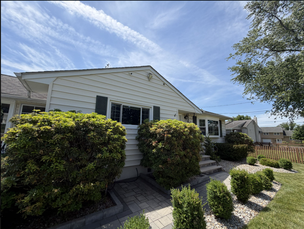
We completed a comprehensive 3D laser scanning survey of a residential house in New Jersey with a total area of approximately 2,500 sq ft. The project included both interior and exterior data capture, followed by the development of a highly accurate Revit model representing the property’s existing conditions.
The primary objective was to provide the client with reliable digital documentation for future architectural design and renovation planning. Using terrestrial laser scanning allowed us to capture the complete geometry of the building in a single site visit while significantly reducing traditional survey time and minimizing measurement errors.
The entire on-site survey was completed in 6 hours, while the complete documentation package—including the point cloud, Revit model, and supporting files — was delivered within one week.
Project Overview
Project Type: Existing conditions survey using 3D laser scanning and Revit modeling
Location: New Jersey, USA
Property Type: Residential house
Area: Approximately 2,500 sq ft
Project Objective
To create a complete digital representation of the residential property for architectural design, renovation planning, and future building modifications.
Scope of Work
- terrestrial 3D laser scanning of the interior and exterior
- point cloud registration
- detailed Revit model
- site modeling
- visible MEP modeling
- built-in millwork modeling
- photographic documentation
- existing-condition documentation
Project Challenges
Tight Project Schedule
The client required complete documentation within a very short timeframe. Efficient planning of fieldwork, processing, and BIM modeling enabled delivery of the entire project in only one week.
Existing Conditions Accuracy
Every visible architectural and engineering element had to be captured precisely to ensure that the Revit model accurately represented the existing building geometry.
Comprehensive Building Documentation
The project required much more than a standard building survey. Besides architectural geometry, the model included visible MEP systems, custom millwork, and the surrounding site, providing architects with a complete digital foundation for future work.
Technical Data and Accuracy
Survey Method
High-precision terrestrial 3D laser scanning.
Equipment
FARO laser scanner.
Measurement Accuracy
Approximately ±2–3 mm.
Data Produced
- registered point cloud
- detailed Revit model
- existing site model
- photographic documentation
Methodology
1. On-site Laser Scanning
The entire interior and exterior of the property were scanned in approximately six hours. Multiple scan positions ensured complete coverage and eliminated blind areas.
2. Point Cloud Processing
Individual scans were registered, aligned, and cleaned to create one accurate point cloud representing the building and surrounding site.
3. Revit Modeling
Using the registered point cloud, our BIM specialists created a detailed Revit model including:
- architectural elements
- site model
- visible MEP systems
- built-in millwork
- existing wall geometry
4. Quality Control
Every model component was verified against the point cloud before final delivery to ensure maximum accuracy.
5. Project Delivery
All files were exported in the required formats and delivered to the client within one week.
Deliverables
The client received a complete package of digital deliverables ready for architectural design, renovation planning, and BIM coordination.
Project Deliverables and Revit Model


Point Cloud
- RCP
- RCS
BIM Model
- Revit (.RVT)
Site Model
Existing terrain and surrounding property conditions.
Existing Building Documentation
- architectural geometry
- visible MEP elements
- built-in millwork
Photo Documentation
High-resolution photographs supporting project verification and future coordination.
Key Benefits for the Client
Faster Project Delivery
Laser scanning significantly reduced survey time while maintaining exceptional accuracy.
Reliable Existing Conditions
The Revit model accurately reflects the building’s current condition, providing architects with dependable information for design and renovation.
Reduced Site Visits
The point cloud enables remote measurements and project coordination without returning to the property.
Complete BIM Foundation
The delivered model can be immediately used for renovation planning, BIM coordination, quantity takeoffs, and future facility upgrades.
Cost Optimization
Accurate digital documentation minimizes redesign, reduces field verification, and lowers overall project costs.

