

3D Laser Scanning of a Residence in New Jersey
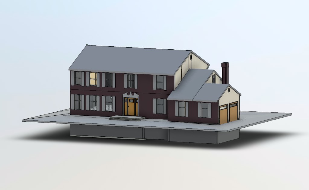
We performed comprehensive 3D laser scanning of a private residence in New Jersey with a total area of approximately 4,600 sq ft. The project included both interior and exterior scanning, detailed facade capture, structure modeling, and built-in millwork documentation.
The main objective was to provide the client with an accurate digital representation of the existing building condition within a very short timeframe. Using high-precision laser scanning technology allowed us to significantly reduce field measurement time and minimize on-site surveying costs while maintaining a high level of geometric accuracy.
The complete point cloud, Revit model, and photo documentation were delivered within one and a half weeks after the fieldwork was completed.
Project Overview
Project Type: 3D laser scanning and measurement survey
Location: New Jersey, USA
Object Type: Private residence
Area: approximately 4,600 sq ft
Goal:
Preparation of a complete digital data package including point cloud, photo documentation, and a detailed 3D Revit model.
Key Requirement:
Accurate geometry capture combined with reasonable facade detailing, structural modeling, and built-in millwork representation.
Project Challenges
Tight Delivery Schedule
One of the key project requirements was the extremely short delivery timeline. The client needed the final model within approximately one and a half weeks, which required optimized coordination between scanning, processing, and modeling stages.
Accurate Geometry Capture
The project required precise replication of all interior and exterior dimensions, including facade geometry, openings, architectural elements, and visible structural components.
Facade and Millwork Detailing
In addition to the general building geometry, the client requested reasonable LOD facade detailing and modeling of built-in millwork elements, which increased the complexity of the modeling phase.
Cost Optimization
By using 3D laser scanning instead of traditional manual measurements, the project reduced both fieldwork duration and overall surveying costs for the client.
Technical Data and Accuracy
Method: high-precision 3D laser scanning
Equipment: FARO laser scanner
The scan data was processed into a registered point cloud and used as the basis for the Revit model development.
Methodology
1. On-Site Scanning
Efficient fieldwork was completed in approximately 7 hours and covered all exterior facades, interior spaces, and architectural elements of the residence.
2. Point Cloud Processing
The collected scan data was registered, aligned, cleaned, and prepared for modeling during the following processing stage.
3. 3D Revit Modeling
A detailed 3D model was created based on the point cloud data. The model included facade geometry, structural elements, room layouts, and built-in millwork components.
4. Quality Control and Delivery
The final deliverables were checked against the point cloud data and exported in the required formats before delivery to the client.
Deliverables
Point Cloud
- RCP
- RCS
3D Model
- RVT
- DWG
Additional Materials
- photo documentation
Results and Client Value
The client received a reliable and accurate digital representation of the residence without the need for repeated site visits or additional measurements.
Project Documentation and Revit Model


The final Revit model can now be used for renovation planning, architectural coordination, visualization, and future design work. Laser scanning significantly accelerated the survey process while maintaining a high level of detail and measurement accuracy.

