

Point Cloud Processing Services for Monuments of Architecture and Archaeology
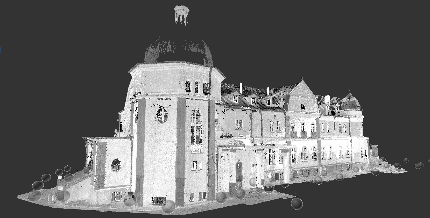
Historic monuments and archaeological sites generate massive amounts of laser scan data that require careful processing before they can be used for restoration, BIM modeling, or architectural documentation. Multiple scan positions, irregular geometry, decorative details, and challenging site conditions make point cloud processing a critical stage of every heritage documentation project.
At ScanM2, we provide Point Cloud Processing Services for Monuments of Architecture and Archaeology, transforming raw laser scan data into clean, registered, and reliable point clouds ready for design, restoration, engineering analysis, and digital preservation. Our specialists ensure that every dataset accurately represents existing conditions while preserving the smallest architectural details.
Contact Us Now for a Free Consultation!
Whether supporting restoration of museums, churches, castles, archaeological monuments, or protected historic buildings, our processed point clouds provide the reliable foundation required for successful heritage projects.
Common Challenges in Heritage Point Cloud Processing
Processing laser scan data for historical monuments is significantly more complex than working with modern buildings. Heritage projects often involve irregular geometry, decorative architectural features, restricted access, and large datasets collected over multiple scanning sessions.
Our specialists carefully process every dataset to eliminate errors while preserving valuable historical information. Accurate registration and quality control ensure that architects, engineers, and conservation specialists can confidently use the data throughout the restoration process.
What Our Point Cloud Processing Includes
Point Cloud Registration
Individual scans are accurately aligned into a unified coordinate system to create a complete representation of the monument.
Point Cloud Cleaning
Temporary objects, visitors, vehicles, vegetation, and unwanted scan noise are removed while preserving historical architectural elements.
Scan Alignment Verification
Every registration is checked to ensure consistent accuracy across the entire dataset.
Colorized Point Clouds
When required, point clouds are colorized using photographic information to improve visualization and documentation.
Quality Control
Each dataset is verified before delivery to ensure reliable geometry for downstream applications, including Scan to BIM Services for Monuments of Architecture and Archaeology and restoration documentation.
Deliverables for Heritage Point Cloud Projects
Depending on project requirements, we provide:
- Registered point clouds
- Clean point cloud datasets
- Colorized point clouds
- RCP files
- E57 files
- LAS files
- XYZ files
- PTS files
- BIM-ready datasets
- CAD-ready point clouds
Project Example: National Museum of Ethnography
For the restoration of the National Museum of Ethnography, ScanM2 processed extensive laser scan datasets collected throughout the historic building. Multiple interior and exterior scans were accurately registered, cleaned, and verified to create a unified point cloud representing the museum’s existing condition.
The processed dataset preserved intricate architectural details, façades, stained-glass windows, structural elements, and decorative features while maintaining millimeter-level accuracy. This verified point cloud became the foundation for BIM modeling, architectural documentation, and restoration planning, allowing the project team to work from a single reliable source of existing conditions.
National Museum of Ethnography Project Gallery


Explore examples of processed point cloud datasets prepared for restoration, conservation, and heritage documentation projects.
Explore Our Complete Heritage Project Portfolio →
Where Processed Point Clouds Are Used
Accurate point cloud data supports multiple stages of heritage documentation and restoration.
BIM Modeling
Processed point clouds provide the geometric foundation for intelligent building models developed through our BIM Modeling Services for Monuments of Architecture and Archaeology.
As-Built Documentation
Verified scan data enables the production of precise floor plans, elevations, and sections using our As-Built Drawings Services for Monuments of Architecture and Archaeology.
Restoration Planning
Architects and conservation specialists rely on clean datasets to develop restoration strategies while preserving historical accuracy.
Structural Assessment
Engineers use processed point clouds to evaluate structural deformation and existing conditions before intervention.
Digital Heritage Preservation
Registered point clouds create permanent digital records of historically significant monuments for future generations.
Why Choose ScanM2 for Heritage Point Cloud Processing
Point cloud processing requires more than powerful software — it demands experience with complex historical geometry and restoration workflows.
ScanM2 combines advanced processing techniques with rigorous quality control to deliver accurate, reliable datasets ready for BIM modeling, engineering documentation, restoration planning, and long-term digital preservation.

