

3D Laser Scanning and Archicad Modeling of a 7,000 sq ft Mansion in Chicago, Illinois
Project Overview
We performed comprehensive 3D laser scanning of the interior and exterior of a 7,000 sq ft residential mansion in Chicago, Illinois. The on-site data capture was completed in a single business day, and all project deliverables were provided within two weeks.
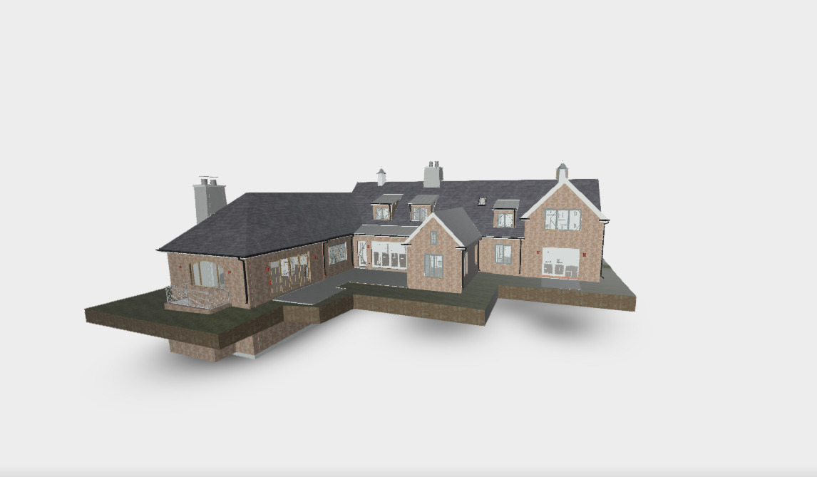
The survey included detailed measurements of the existing conditions, accurately capturing all visible geometry, dimensions, MEP elements, built-in millwork, site features, and elevation details. The collected data was used to create a highly accurate 3D Archicad model at LOD 400, including all visible MEP components, railings, built-in millwork, and exterior elements.
The client required a precise digital representation of the existing property. By utilizing high-precision 3D laser scanning technology, we significantly reduced the time required for traditional field measurements while minimizing on-site surveying costs. The complete Archicad model and documentation package were delivered within just two weeks, providing the architect with reliable existing-condition information for design and renovation planning.
Project Details
Project Type: Existing conditions survey using 3D laser scanning
Location: Chicago, Illinois, USA
Building Area: Approximately 7,000 sq ft
Objective: Deliver a complete documentation package, including point cloud data, a detailed LOD 400 Archicad model with all visible MEP elements, railings, built-in millwork, and photographic documentation.
Key Requirements
- Accurate LOD 400 modeling of the mansion
- Modeling of all visible MEP elements
- Modeling of built-in millwork
- Precise representation of existing conditions
Key Project Challenges
Timeline and Cost Optimization
The project required an efficient workflow to minimize project duration and optimize costs while meeting the client’s schedule and budget.
Measurement Accuracy
All interior and exterior dimensions had to be captured with a high level of precision to ensure the reliability of the final model.
Project Complexity
The project was completed within a tight timeframe, requiring efficient coordination between fieldwork, point cloud processing, and BIM modeling for a property of this size.
Technical Data
Survey Method: High-precision 3D laser scanning
Equipment: FARO laser scanner for accurate data capture and measurement verification
Methodology and Project Timeline
Day 1 – On-Site Laser Scanning
Efficient fieldwork was carried out to capture all interior and exterior areas of the mansion.
Days 2–3 – Point Cloud Processing
Scan registration, alignment, and cleaning were completed to prepare the point cloud for BIM modeling.
Days 4–10 – 3D Archicad Modeling
A detailed Archicad model was developed, including the building structure, surrounding site, visible MEP components, railings, built-in millwork, and exterior elevations.
Days 11–14 – Quality Assurance and Delivery
The final model and documentation package underwent comprehensive quality control before being delivered to the client.
Deliverables


- Registered point cloud data in E57 and RCP formats
- Detailed LOD 400 Archicad model (.PLN and .PLA)
- Modeling of visible MEP elements and built-in millwork
- Photographic documentation
- Accurate existing-condition documentation for architectural design and renovation
Project Benefits
By utilizing high-precision 3D laser scanning technology, the client received reliable and accurate existing-condition documentation without the need for repeated site visits. The delivered point cloud and Archicad model provide a solid foundation for architectural design, while significantly reducing survey time, minimizing fieldwork, and lowering overall project costs.

