

3D Laser Scanning Accuracy: What Level of Accuracy Does Your Project Need?
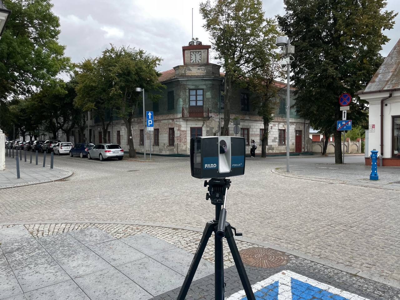

3D laser scanning can capture millions of measurements across a building, industrial facility, or individual piece of equipment. But a large number of points does not automatically mean that every project requires the highest possible measurement accuracy.
The accuracy needed for documenting an existing building may differ significantly from the requirements of MEP coordination, construction quality control, or reverse engineering. Specifying unnecessarily strict tolerances can increase survey and processing requirements without adding practical value. At the same time, insufficient accuracy can make the resulting point cloud unsuitable for design or engineering tasks.
For this reason, 3D laser scanning accuracy should be defined according to the intended use of the data rather than treated as a single universal specification.
What Does 3D Laser Scanning Accuracy Mean?
In practical terms, accuracy describes how closely a measured point represents its actual position in the real world.
However, the accuracy stated in a scanner specification is only one part of the picture. A completed laser scanning survey usually combines data captured from multiple scanner positions. These individual scans must be registered into a common coordinate system before they form a usable point cloud.
As a result, the accuracy of the final dataset can depend on several stages:
- individual scanner measurements;
- scanner position and distance from the measured surface;
- scan geometry and angle of incidence;
- surface material and reflectivity;
- environmental conditions;
- registration of multiple scans;
- georeferencing and survey control;
- processing and quality control.
The complete process from field measurement to a registered dataset is described in more detail in our article about the laser scanning workflow from site to point cloud.
This distinction is important. A scanner capable of high accuracy under controlled conditions does not automatically guarantee the same accuracy throughout a large completed point cloud.
Accuracy, Precision, Resolution, and Point Density Are Not the Same
Several terms are often used interchangeably when discussing laser scanning, even though they describe different characteristics of the data.
| Term | What It Describes | Why It Matters |
|---|---|---|
| Accuracy | How close a measurement is to the actual position or dimension | Determines whether the dataset can reliably support the required measurements and deliverables |
| Precision | How consistently measurements can be repeated | Helps evaluate measurement repeatability |
| Resolution | The level of spatial detail captured by the scanner | Influences the ability to represent small features |
| Point density | The number and spacing of measured points on a surface | Affects how completely surfaces and smaller objects are represented |
A dense point cloud is therefore not necessarily an accurate point cloud. Increasing scan resolution can provide more points on an object, but it does not by itself eliminate registration errors, poor scan geometry, or inaccuracies caused by unsuitable survey conditions.
Accuracy is also only one aspect of whether captured data can be used effectively for downstream modeling. Our guide to a BIM-ready point cloud explains other characteristics that should be considered before BIM production begins.
What Determines the Accuracy of 3D Laser Scanning?
Scanner Performance
Every laser scanner has technical specifications that define its measurement performance under particular conditions.
These specifications are useful when selecting equipment, but they should not be interpreted as a guaranteed accuracy value for an entire project. A real survey introduces additional variables that do not exist in controlled equipment testing.
Distance from the Scanner
Measurement conditions change as the distance between the scanner and the target surface increases.
For projects where small details or tight dimensional tolerances are important, scanner locations should therefore be planned with the required deliverable in mind rather than simply attempting to cover the largest possible area from each position.
Angle of Incidence
The angle at which the laser reaches a surface can influence measurement quality.
Surfaces observed at unfavorable angles may be represented less reliably than surfaces captured under better scanning geometry. Scanner positioning is therefore an important part of obtaining consistent data.
Surface Properties
Dark, reflective, transparent, or highly polished materials can behave differently when measured with a laser scanner.
This becomes particularly relevant in industrial environments where equipment, pipes, metal structures, glazing, and other difficult surfaces may all occur within the same project.
Environmental Conditions
The scanning environment can also affect data acquisition. Outdoor surveys may involve changing weather and atmospheric conditions, while active industrial facilities can contain moving equipment, workers, vehicles, vibration, dust, or temporary obstructions.
Accuracy requirements therefore need to be considered together with the conditions under which the survey will actually be performed.
Why Point Cloud Registration Matters

A building or industrial facility normally cannot be captured from a single scanner position. Multiple scans are required to cover rooms, corridors, floors, façades, equipment, structural elements, and areas hidden from individual viewpoints.
These scans must then be aligned through point cloud registration. Our article on how point cloud registration works explains this stage of the workflow in more detail.
Registration quality has a direct effect on the consistency of the final dataset. Even when individual scanner measurements are highly accurate, poor alignment between scan positions can reduce the reliability of the complete point cloud.
This becomes particularly important on large projects, multi-story buildings, long corridors, industrial facilities, and other environments requiring many scanner positions.
Scanner accuracy ≠ registration accuracy ≠ overall project accuracy
All three need to be considered when defining the quality requirements for a survey.
How Accurate Does 3D Laser Scanning Need to Be?
There is no single accuracy requirement suitable for every project.
The appropriate tolerance depends primarily on what will be produced from the point cloud and what decisions will be made using that information.
A survey intended to document the general geometry of an existing building does not necessarily need the same level of accuracy as a survey used to reproduce a mechanical component.
| Project Type | Accuracy Priority | What Usually Drives the Requirement |
|---|---|---|
| Existing building documentation | Moderate to high | Reliable dimensions, geometry, floor levels, walls, openings and structural elements |
| Scan to BIM | Depends on model purpose | Required model tolerance, LOD/LOI, element type and design use |
| Renovation and retrofit | High in critical areas | Interfaces between existing and proposed construction |
| MEP coordination | High | Pipework, ducts, equipment, clearances and connection points |
| Construction verification | Project-specific | Comparison between installed conditions and design tolerances |
| Industrial facilities | High in selected areas | Equipment, structural interfaces, piping and installation constraints |
| Reverse engineering | Often very high | Size and complexity of the component and required manufacturing geometry |
These categories should not be interpreted as universal numerical specifications. The correct tolerance should be established for the particular project.
Accuracy Requirements for Existing Building Documentation
When documenting an existing building, the objective is usually to establish reliable information about its current geometry.
This may include walls and partitions, floor and ceiling levels, columns and beams, doors and windows, façades, roof geometry, visible structural elements, and accessible building services.
For many such projects, capturing the building consistently is more important than pursuing the maximum theoretical accuracy of the scanner. The survey should provide enough accuracy for the intended drawings, models, measurements, or design work.
For projects where measured information needs to be converted into drawings or models, existing building documentation services can combine reality capture with the required technical deliverables.
For example, documentation used for preliminary architectural planning may have different requirements from measurements needed to design a new steel structure that must connect precisely to existing construction.
Accuracy Requirements for Scan to BIM

In a Scan to BIM workflow, laser scanning accuracy is only the beginning.
3D Laser Scanning → Registration → Point Cloud → BIM Modeling → Model Verification
The resulting BIM model does not automatically reproduce every point in the point cloud. Elements are interpreted and modeled according to the agreed scope, required detail, modeling rules, and project tolerances.
This creates an important distinction between measurement accuracy and modeling accuracy.
A highly accurate point cloud can still produce an unsuitable BIM model if the modeling requirements are poorly defined. Conversely, modeling every small deviation in an existing building may add unnecessary complexity when the project does not require it.
For this reason, the required tolerance should be coordinated with the intended Scan to BIM deliverable before fieldwork begins.
The relationship between captured geometry and modeling decisions is discussed further in our guide to Revit modeling from point cloud data.
Accuracy Requirements for Renovation and Retrofit
Renovation projects often require different levels of accuracy within the same building.
General room geometry may be needed for architectural documentation, while much tighter control may be required where new construction must connect to existing elements.
Critical areas can include:
- new openings in existing structures;
- façade interfaces;
- structural connections;
- equipment replacement;
- prefabricated components;
- MEP penetrations;
- shafts and technical rooms;
- areas with limited installation clearance.
Instead of applying the highest accuracy requirement to the entire property, it can be more efficient to identify these critical interfaces before scanning.
The survey strategy can then prioritize the areas where dimensional reliability has the greatest impact on design and construction.
Accuracy Requirements for MEP Coordination
MEP environments can be particularly demanding because many systems occupy limited space.
Pipes, ducts, cable trays, valves, equipment, structural members, and other elements may be located close together.
In these conditions, relatively small positional differences can affect clearance analysis, routing of new services, equipment replacement, prefabrication, clash detection, and connection planning.
Point density also becomes important because smaller pipes and components need sufficient surface coverage to be identified and modeled reliably.
This demonstrates why accuracy and point density should be considered together but not confused with one another.
Accuracy Requirements for Industrial Facilities
Industrial scanning frequently combines large survey areas with localized areas requiring much greater dimensional control.
A facility may need general documentation of the building and structural framework while also requiring detailed information around production equipment, process piping, steel structures, equipment foundations, connection points, conveyor systems, and installation zones.
Applying one tolerance indiscriminately to the entire facility may therefore be inefficient. A better approach is to define the project according to zones, objects, and downstream engineering requirements.
For complex production environments, ScanM2 combines industrial 3D laser scanning and BIM workflows with deliverables selected according to the engineering requirements of the facility.
Accuracy Requirements for Reverse Engineering
Reverse engineering can place significantly greater demands on measurement data than general building documentation.
The purpose may be to reconstruct the geometry of an existing component, equipment item, fabricated assembly, or complex surface for further engineering.
In these projects, requirements depend on factors such as component dimensions, surface complexity, manufacturing tolerances, required output format, intended use of the reconstructed model, and whether critical interfaces must be reproduced.
The role of reality capture in this workflow is explained in more detail in our article on 3D laser scanning for reverse engineering.
Terrestrial building scanners are not automatically the right instrument for every reverse-engineering task. Smaller components or very tight tolerances may require other metrology technologies.
The measurement method should therefore be selected according to the required tolerance rather than simply according to the availability of a particular scanner.
How Registration Errors Can Accumulate
Large scanning projects deserve particular attention because errors can propagate through a network of scanner positions.
If individual scans are successively connected without adequate control, small alignment discrepancies can accumulate across long distances or multiple floors.
For building surveys, registration strategy matters particularly for high-rise buildings, long corridors, multi-story facilities, tunnels, large industrial sites, and complex interconnected spaces.
The quality of a point cloud should therefore not be judged only by how well two neighboring scans appear to overlap.
How Is Point Cloud Accuracy Verified?
Registration Quality
Registration software provides information about how individual scans align with one another.
These values are useful for quality control, but they should be interpreted in context rather than treated as the sole measure of project accuracy.
Control Points
Known survey control can be used to verify or constrain the point cloud within a defined coordinate system.
Independent control is particularly useful when the project requires georeferencing or when dimensional consistency across a large site is important.
Comparison with Independent Measurements
Critical dimensions or control locations can also be checked against measurements obtained using other surveying instruments.
This provides an independent way to evaluate whether the completed dataset satisfies the required project tolerance.
Visual Inspection
Visual inspection remains useful for detecting obvious registration problems such as doubled surfaces, misaligned walls, or displaced structural elements.
However, visual inspection alone cannot confirm measurement accuracy. A dataset can appear visually consistent while still containing systematic or accumulated discrepancies.
Should You Always Request the Highest Possible Accuracy?
Not necessarily.
Higher accuracy can require more carefully planned scanner positions, additional control, shorter measurement distances, more scans, longer field time, additional registration work, and more extensive quality control.
If the final deliverable does not require this level of accuracy, those additional requirements may provide little practical benefit.
The better question is not “What is the highest accuracy the scanner can achieve?” but “What accuracy does the project actually require?”
The answer should come from the intended use of the data.
How to Define Accuracy Requirements Before Scanning
Before a survey begins, several questions should be answered:
- What will be produced from the point cloud?
- Which objects or building elements are important?
- What measurements will be taken from the data?
- Will the point cloud be converted into CAD or BIM?
- Are there critical interfaces where new construction must fit existing conditions?
- Does the project require a local or global coordinate system?
- Are there areas requiring tighter tolerances than the rest of the site?
- How will the completed dataset be verified?
Defining these requirements early allows the scanning methodology to be designed around the actual project rather than around a generic scanner specification.
Choosing the Right Accuracy for the Deliverable
The required accuracy should ultimately follow the deliverable.
Project Purpose → Required Deliverable → Required Tolerance → Survey Method → Quality Control
For example, an architect preparing an early renovation concept, an MEP engineer designing new pipework, and an engineer reverse-engineering a machine component may all use 3D scanning, but they do not necessarily need the same type of data.
This is why a project specification should describe not only what needs to be scanned, but also what the resulting measurements will be used for.
For projects requiring measured spatial data of existing buildings, infrastructure, or industrial facilities, ScanM2 provides 3D laser scanning services in the USA with the survey scope and deliverables defined around the intended project use.
Conclusion
3D laser scanning can provide highly detailed and accurate spatial data, but there is no universal accuracy value that is appropriate for every project.
The final quality of a point cloud depends on more than the scanner itself. Survey geometry, distance, surface properties, environmental conditions, registration, georeferencing, and quality-control procedures can all influence the resulting dataset.
Most importantly, accuracy should be defined according to the intended application.
Existing building documentation, Scan to BIM, renovation, MEP coordination, industrial surveys, construction verification, and reverse engineering each place different demands on measurement data.
Instead of specifying the highest possible accuracy by default, the more effective approach is to determine what level of accuracy is necessary for the decisions, models, drawings, or engineering work that will follow the survey.
Frequently Asked Questions
What is 3D laser scanning accuracy?
How accurate is 3D laser scanning?
Is point cloud density the same as accuracy?
Does Scan to BIM require high scanning accuracy?
Can registration affect point cloud accuracy?
Is the highest possible scanning accuracy always necessary?

ScanM2 Launches ScanTrack: Manage Tasks Directly in a 3D Virtual Tour
18.10.2026
How integrating as-built documentation using advanced 3D scanning and laser scanning technology can revolutionize your real estate marketing strategy. Learn the benefits for agents and ...

Which 3D Laser Scanner Should Architects Choose, and When Is Outsourcing Better?
17.10.2026
How integrating as-built documentation using advanced 3D scanning and laser scanning technology can revolutionize your real estate marketing strategy. Learn the benefits for agents and ...

INTERGEO: How Laser Scanning Is Becoming a Foundation for Management and Decision-Making
24.09.2026
ScanM2 once again took part in INTERGEO, which was held in Munich this year. For us, the event is an opportunity to meet with partners, ...

How 3D Laser Scanning Measures Floor Flatness and Levelness
22.09.2026
Floor flatness and levelness can directly affect equipment installation, racking systems, automated material handling, production lines, flooring systems, and other construction activities that depend on ...

