

3D Laser Scanning for Nuclear power plant
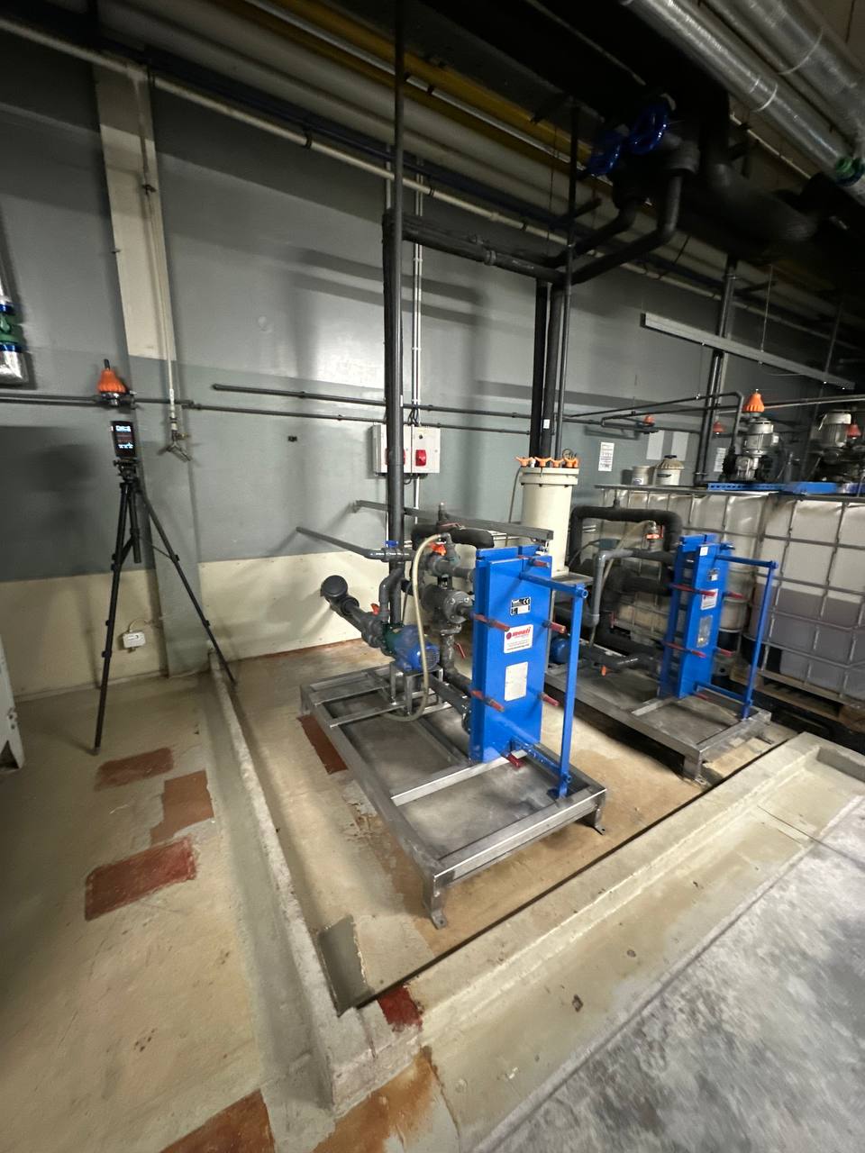
Modernization at a nuclear power plant requires reliable information about existing buildings, equipment arrangements, structural interfaces, and engineering systems. Historical drawings may not fully reflect modifications made during years of operation, while restricted access and complex industrial layouts can make conventional measurements difficult.
ScanM2 provides 3D Laser Scanning Services for Nuclear Power Plants, helping engineering teams document accessible facility geometry through high-density spatial measurements. Laser scanning can support refurbishment planning, equipment replacement, dimensional verification, and the development of accurate as-built documentation for permitted plant areas.
Contact Us Now for a Free Consultation!
Modernization Starts with Understanding the Existing Facility
Nuclear power plants contain interconnected buildings and technical systems that may have undergone multiple maintenance and modernization programs. Equipment replacement, structural modifications, new cable routes, and changes to auxiliary installations can create differences between the original design and the current physical arrangement.
Before developing new engineering solutions, project teams need to understand the space available around existing installations. Incorrect assumptions about equipment positions, floor elevations, structural members, or pipe routes can complicate subsequent design coordination.
3D laser scanning captures the visible geometry of the surveyed environment, creating a measurable spatial reference for engineers working with existing facilities.
Where 3D Scanning Can Support Nuclear Power Plant Projects
The appropriate survey scope depends on plant-specific access permissions, operational restrictions, project requirements, and applicable safety procedures. Laser scanning may be used in accessible conventional and auxiliary areas, as well as other authorized locations where the survey method is permitted.
Turbine Halls and Generator Buildings
Turbine-generator areas contain large equipment assemblies, foundations, overhead crane structures, service platforms, and extensive piping networks. Their geometry is important when planning machinery replacement, refurbishment, or changes to supporting installations.
Laser scanning can document accessible building structures, equipment envelopes, floor levels, and spatial relationships within these industrial spaces.
Auxiliary Buildings and Technical Rooms
Auxiliary facilities may contain pumps, heat exchangers, ventilation equipment, cable infrastructure, and other technical installations. These systems are often arranged within confined rooms or multi-level service areas.
Measured point clouds can help establish existing equipment locations, available clearances, and the geometry of accessible structural and mechanical elements.
Piping Galleries and Service Corridors
Long corridors and densely arranged piping networks can be difficult to document using isolated manual measurements. Laser scanning captures visible pipe routes, supports, adjacent structures, and equipment connections within the defined survey area.
The resulting spatial data can support routing studies and the coordination of proposed modifications. It does not independently establish pipe contents, operating conditions, or concealed technical characteristics.
Survey Planning Around Access and Operational Restrictions
Unlike a conventional industrial building, a nuclear power plant may have strict controls governing personnel access, equipment use, photography, digital data collection, and the movement of survey instruments.
These requirements influence how a scanning project is organized. Survey activities must be planned in coordination with the facility operator and carried out only within authorized areas under applicable site procedures.
Before measurements begin, the project team should establish the permitted survey boundaries, access conditions, equipment restrictions, and requirements for handling the collected data.
Where radiological protection requirements apply, scanning activities must follow the operator’s approved controls and qualified personnel procedures. Laser scanning does not replace radiological assessment or authorize entry into restricted areas.
Five Questions That Define the Survey Scope
The effectiveness of a 3D scanning project depends on defining the engineering objective before data acquisition. For nuclear power plant facilities, several questions are particularly important.
- Which areas require measurement? Identify the specific buildings, rooms, equipment zones, or structural interfaces needed for the project.
- What decisions will use the data? Determine whether the survey supports reconstruction, equipment replacement, clearance assessment, or technical documentation.
- What accuracy is required? Establish dimensional requirements for the relevant geometry rather than applying one assumption to every feature.
- Which surfaces are accessible? Review operational restrictions, physical obstructions, and permitted scanner positions.
- How will the data be delivered and controlled? Agree on coordinate references, file formats, data handling, and authorized recipients.
Clear answers help prevent unnecessary scanning and ensure that the resulting measurements are appropriate for the intended engineering work.
Capturing Complex Geometry Without Physical Contact
Terrestrial laser scanners measure distances to visible surfaces and record their positions in three-dimensional space. Multiple scanner positions can be combined to document larger environments and reduce gaps caused by equipment or structural obstructions.
Because the measurement process is generally non-contact, it can be useful for documenting accessible industrial installations where direct manual measurement would be difficult.
However, non-contact measurement does not mean that all areas can be surveyed remotely or without restrictions. Scanner placement, line of sight, equipment suitability, and site authorization remain essential considerations.
Laser scanning captures visible surface geometry. It does not reveal internal machinery components, concealed pipe sections, material properties, or structural capacity.
What Determines the Accuracy of a Nuclear Facility Survey?
Accuracy depends on more than the technical specifications of the scanner. The final quality of the measured dataset is influenced by instrument performance, scanner positioning, survey control, registration methods, surface conditions, and the geometry of the surveyed environment.
For large technical facilities, individual scans must be aligned within a consistent spatial framework. When the survey extends across multiple rooms, levels, or buildings, appropriate registration constraints and verification procedures become especially important.
| Survey factor | Why it matters | Planning consideration |
|---|---|---|
| Scanner positioning | Determines visibility and measurement coverage | Provide sufficient views of critical surfaces |
| Survey control | Supports coordinate consistency across larger areas | Use suitable reference information where required |
| Scan registration | Combines individual measurements into a coordinated dataset | Check alignment and registration quality |
| Surface properties | Can influence measurement quality and completeness | Consider reflective, dark, or obstructed surfaces |
| Required detail | Determines whether relevant features can be represented | Define feature size and accuracy requirements |
| Site restrictions | May limit available measurement positions | Identify coverage limitations before surveying |
For critical equipment interfaces, additional dimensional checks may be required. A registered point cloud should not automatically be treated as verification of every engineering tolerance.
Using Scan Data for Equipment Replacement Planning
Equipment modernization often requires new machinery to fit within an existing installation environment. Surrounding structures, maintenance platforms, pipe connections, and access routes can impose significant geometric constraints.
A 3D scan provides measured information about the accessible existing arrangement. Engineers can use this reference to examine proposed equipment envelopes, review installation space, and identify locations where further detailed measurements are necessary.
For example, a turbine hall modernization may require information about existing foundations, structural columns, nearby piping, and overhead equipment. Capturing these elements within a coordinated dataset can support design development and spatial coordination.
The survey itself does not establish whether a proposed installation meets structural, mechanical, nuclear safety, or operational requirements. Those decisions require the appropriate engineering analyses and approvals.
From Survey Measurements to Engineering Documentation
Laser scanning produces spatial measurements that can be processed and used as the geometric basis for additional documentation.
Depending on the project, downstream services may include:
- Point Cloud Processing to register, organize, clean, and prepare the measurement dataset.
- Scan to BIM to reconstruct agreed existing structures and engineering systems as structured digital elements.
- As-Built Drawings to prepare measured plans, sections, elevations, and technical layouts.
- BIM Modeling to support coordinated digital representation of relevant facility systems.
Each output requires its own scope and verification requirements. A point cloud is not automatically a completed BIM model, engineering drawing, or approved design record.
Surveying During Maintenance and Modernization Windows
Some plant areas may be accessible only during approved maintenance periods or scheduled outages. Survey planning must account for these conditions without interfering with operational or safety procedures.
Where access is authorized, scanning may be scheduled to document equipment before removal, after modification, or following installation. These datasets can provide geometric references for different stages of a modernization project.
When measurements are collected at different times, the survey dates and represented equipment configurations should be clearly distinguished. A combined dataset must not obscure physical changes that occurred between measurement campaigns.
Data Security and Controlled Information Exchange
Detailed three-dimensional measurements of nuclear facilities may be subject to site-specific information security and confidentiality requirements. The permitted collection, storage, transfer, and use of scan data must be established with the facility operator.
Project requirements may define which areas can be recorded, what data may leave the site, which software environments are permitted, and who is authorized to access the deliverables.
These requirements should be addressed during project planning rather than after the measurements have been collected. The exact arrangements depend on the facility, jurisdiction, contractual obligations, and applicable regulations.
Typical 3D Scanning Deliverables
The deliverable package depends on the approved survey scope and intended engineering applications. It may include:
- Registered point cloud datasets for authorized survey areas
- Coordinate-aligned measurements where suitable references are available
- Point cloud files in agreed compatible formats
- Available scan registration and quality-control information
- Organized datasets for selected buildings or technical zones
- Documentation of relevant coverage limitations
- Additional agreed geometric outputs for engineering review
All deliverables must comply with the agreed data handling, confidentiality, and site authorization requirements.
Our Approach to Nuclear Power Plant Survey Projects
Every nuclear facility has specific operational, access, and documentation requirements. The measurement methodology must therefore be developed around the approved project conditions.
Our proposed workflow begins with reviewing the engineering objective, available source information, permitted survey areas, and required deliverables. We then establish an appropriate measurement plan, coordinate access requirements, and define the registration and verification approach.
Following authorized data acquisition, the measurements are processed and reviewed against the agreed requirements before delivery in the specified formats.
Any work within controlled nuclear facility areas is subject to operator approval, applicable safety requirements, personnel qualifications, equipment restrictions, and the availability of suitable authorized arrangements. Service availability for a particular facility must be confirmed during project assessment.
3D Laser Scanning for Nuclear Facility Modernization
Reliable geometric information can help engineering teams reduce uncertainty when planning modifications to complex existing facilities. For nuclear power plant projects, the value of laser scanning lies in capturing accessible physical conditions within a clearly defined and controlled survey scope.
ScanM2 provides industrial 3D measurement and digital documentation services. Contact our team to discuss the facility type, permitted survey areas, project objectives, and technical requirements. We can assess the proposed scope and determine whether suitable scanning and documentation services can be arranged.

