

Point Cloud Processing for Nuclear power plant
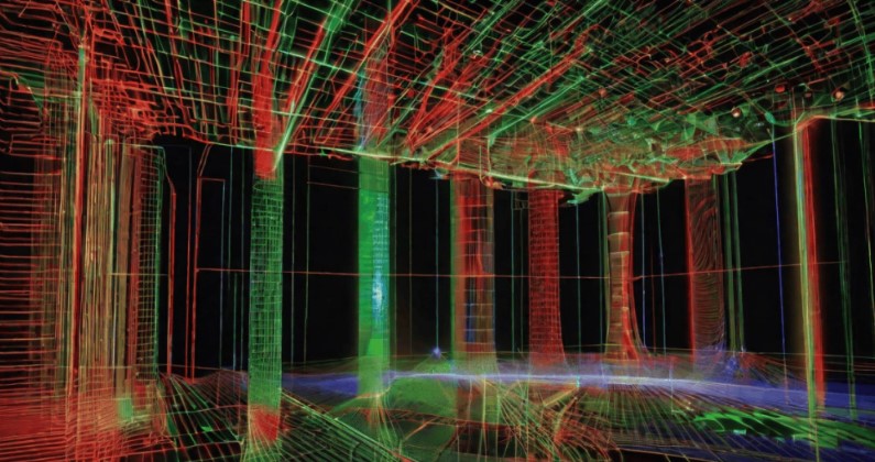
A 3D scanning survey of a nuclear power plant can generate substantial volumes of spatial data from turbine buildings, auxiliary facilities, equipment rooms, and technical corridors. These measurements may be collected across different levels, during separate access periods, and under strict operational restrictions. Before engineers can use them, the individual scans must be brought into a consistent spatial framework and prepared for the intended applications.
ScanM2 provides Point Cloud Processing Services for Nuclear Power Plants, including registration, alignment, cleaning, organization, and optimization of suitable 3D scanning datasets. Our processing workflows help prepare measured facility geometry for authorized engineering coordination, modernization planning, and digital documentation.
Contact Us Now for a Free Consultation!
The Challenge Is Not Collecting More Points – It Is Making Them Usable
Raw laser scanning data contains measurements of visible surfaces, but the presence of millions of points does not guarantee that a dataset is ready for engineering work. Individual scans may use different local coordinate systems, overlap imperfectly, contain unwanted measurements, or include areas that were only partially captured.
Point cloud processing addresses these issues by transforming separate measurements into organized datasets with an agreed spatial reference and documented limitations.
For nuclear facility projects, the objective is to preserve the information needed by authorized engineering teams without introducing misleading geometry through inappropriate filtering, alignment, or interpretation.
From Separate Scans to a Consistent Facility Dataset
A survey may include dozens or hundreds of scanner positions, depending on the size of the permitted area and the complexity of its installations. Each scan records geometry from a particular location, often with partial visibility of adjacent equipment and structures.
Registration establishes the spatial relationships between these measurements. Overlapping geometry, suitable targets, and available survey control can help align the scans within a coordinated reference system.
The resulting dataset can represent interconnected rooms, technical levels, and selected building areas, provided that the original survey contains sufficient geometric information and registration constraints.
Why Local Alignment Is Not Enough
Two neighboring scans may appear correctly aligned while a larger network of measurements contains accumulated inconsistencies. This can become particularly important when processing long technical corridors or measurements connecting several buildings.
Registration quality should therefore be evaluated across the relevant dataset, not only between individual scanner positions.
Processing Data from Different Survey Campaigns
Nuclear power plant projects may involve measurements collected during separate maintenance periods or authorized access windows. A turbine building might be surveyed before equipment replacement, while an adjacent technical area is documented during a later project stage.
These datasets can potentially be aligned using suitable common references, but their relationship requires careful evaluation.
Changes between survey dates may include removed equipment, modified pipe routes, temporary installations, or new structural elements. Such differences must not automatically be treated as registration errors.
Where multiple campaigns are involved, the processing workflow should preserve information about survey dates, coordinate references, and the physical configuration represented by each dataset.
Organizing Point Clouds by Engineering Purpose
Different engineering teams may require different parts of the same scanning dataset. A structural engineer may focus on foundations and supporting frames, while a mechanical designer may need the geometry surrounding equipment connections.
Processing can organize the available data into coordinated subsets rather than requiring every specialist to work with the complete facility point cloud.
| Engineering application | Relevant point cloud content | Processing priority |
|---|---|---|
| Turbine equipment modernization | Equipment envelopes, foundations, adjacent structures | Preserve geometry around installation interfaces |
| Auxiliary building reconstruction | Rooms, structural elements, mechanical installations | Maintain consistent building geometry |
| Piping coordination | Accessible pipe routes, supports, nearby equipment | Preserve routing detail and coordinate relationships |
| Structural documentation | Columns, beams, floors, platforms | Support reliable geometric interpretation |
| Technical drawing production | Selected plans, elevations and section areas | Prepare manageable drafting references |
| BIM reconstruction | Coordinated existing-condition measurements | Support model development and verification |
Segmentation must preserve the agreed coordinate relationships so that separate datasets remain usable within a common engineering environment.
Removing Unwanted Measurements Without Losing Important Detail
Industrial point clouds may contain isolated points, transient objects, reflections, and measurements affected by surface conditions. These can complicate visualization and subsequent modeling.
Cleaning helps reduce unwanted data, but it must be performed carefully. A small mechanical support, cable tray, or connection bracket may be relevant to an engineering task even if it appears insignificant within a large dataset.
Filtering parameters should therefore reflect the intended application and the required feature detail.
Removing unwanted points does not reconstruct surfaces that were never measured. If equipment or structural elements obstruct the scanner’s view, the resulting gaps remain a limitation of the source data.
Data Density: More Is Not Always Better
High-density measurements can preserve detailed surface information, but very large datasets may be difficult to manage in CAD, BIM, and visualization software.
Optimization can reduce data volume through appropriate segmentation, point density adjustment, and preparation of working files for specific applications.
However, excessive reduction may remove important geometric features. A dataset prepared for general spatial coordination may have different density requirements from one used to examine a critical equipment interface.
Where practical and permitted, retaining suitable original measurement data allows engineers to return to higher-detail information when additional verification is required.
What Can Be Verified During Point Cloud Quality Control?
Quality control should evaluate whether the processed data meets the agreed requirements for the intended engineering application.
Depending on the available survey information, checks may include:
- Registration residuals and alignment consistency
- Correspondence between overlapping measured surfaces
- Consistency with available survey control
- Coordinate references and elevation relationships
- Completeness of the agreed survey areas
- Presence of unwanted points or processing artifacts
- Preservation of relevant geometric features after optimization
- Compatibility of exported files with the intended software
Registration statistics alone do not establish the accuracy of every individual feature. Where critical dimensions are involved, additional measurement verification may be necessary.
Restricted Access and Incomplete Survey Coverage
Nuclear facilities may impose strict requirements on personnel access, survey equipment, digital data collection, and information handling. Some areas may be inaccessible during normal operation or available only under specific approved conditions.
Point cloud processing must respect these limitations rather than attempting to conceal missing measurements through unsupported geometric assumptions.
Where a survey does not cover a required surface, the limitation should be identified. Additional measurements may be necessary if authorized access becomes available.
Processing cannot determine concealed machinery geometry, internal pipe characteristics, or other information that was not captured by the original measurement method.
Preserving Traceability of Digital Measurements
For complex facility documentation, it may be important to understand which source measurements contributed to a processed dataset and which operations were performed before delivery.
Depending on the project requirements, processing records can identify source files, survey stages, coordinate references, registration information, and relevant transformations.
This information helps authorized project participants interpret the data and distinguish measured geometry from subsequent digital modifications.
The specific documentation and retention requirements must be established with the responsible project stakeholders. A processing record is not a substitute for an approved nuclear facility configuration management system.
Preparing Data for BIM, CAD and Technical Documentation
A processed point cloud can support several engineering workflows, but the point cloud itself remains a measurement dataset rather than a completed design model.
For example, registered scan data may be used as the geometric reference for Scan to BIM Services for Nuclear Power Plants, where selected existing structures and installations are reconstructed as structured digital elements.
The same source data can support As-Built Drawings Services for Nuclear Power Plants, providing measured references for plans, sections, elevations, and technical layouts.
Where projects require coordinated existing and proposed digital models, BIM Modeling Services for Nuclear Power Plants can use suitable measurement information as part of a broader engineering modeling workflow.
Point Cloud File Formats and Software Compatibility
The appropriate output format depends on the original measurement files, target engineering software, required attributes, and permitted information exchange procedures.
Depending on the project, processed data may be prepared in formats such as E57, LAS, LAZ, RCP, RCS, PTS, or PTX, subject to source compatibility and software requirements.
File conversion should preserve the agreed coordinate framework and required data attributes wherever supported. Compatibility should be checked against the actual software environment rather than assumed from a file extension alone.
Information Security During Processing and Delivery
Detailed three-dimensional data describing nuclear facility layouts may be subject to specific information security, confidentiality, and access restrictions.
Before processing begins, the project must establish which data can be transferred, where it may be stored, what software environments are permitted, and who is authorized to receive the results.
Processing and delivery arrangements must comply with the facility operator’s requirements, applicable regulations, and contractual obligations.
The availability of processing services for a particular nuclear facility depends on the permitted data scope and applicable project conditions.
Our Point Cloud Processing Workflow
We adapt the processing sequence to the source measurements, project requirements, and intended engineering applications.
- Source data review. Evaluate available scans, existing registrations, coordinate information, and permitted processing requirements.
- Registration planning. Determine how individual scans and survey zones can be aligned within the agreed spatial framework.
- Alignment and verification. Register suitable measurements and assess relevant geometric consistency.
- Cleaning and segmentation. Remove identified unwanted points and organize the dataset into useful engineering areas.
- Optimization. Prepare working datasets while preserving the detail required for the intended application.
- Export and quality review. Produce agreed file formats and check relevant delivery requirements.
- Controlled delivery. Transfer authorized datasets according to the established information handling procedures.
Can Existing Nuclear Facility Point Clouds Be Reprocessed?
Existing scan datasets can often be reprocessed for new engineering applications when the source files contain sufficient usable information and their permitted use has been established.
For example, measurements originally collected for general facility documentation may later need to be segmented into equipment-specific datasets or converted for another compatible engineering platform.
Re-registration, filtering, organization, and file conversion may be possible without collecting new measurements.
However, processing cannot recover geometry that was never captured. If additional coverage is required, 3D Laser Scanning Services for Nuclear Power Plants may provide new source measurements where authorized and technically feasible.
Reliable Point Cloud Data for Nuclear Facility Engineering
Point cloud processing transforms raw measurements into organized spatial information that can support technical documentation and engineering coordination. Registration quality, controlled filtering, appropriate data density, and clear source limitations determine how effectively the results can be used.
ScanM2 provides industrial point cloud processing and digital documentation services. Contact our team to discuss the available source data, facility areas, required formats, coordinate references, and information handling restrictions. We can assess the proposed processing scope and suitable deliverables.

