

3D Laser Scanning for Open-type switchgears
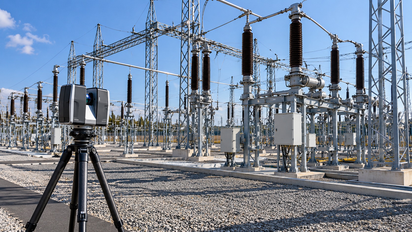
Modernization of an outdoor switchyard requires reliable information about the actual position of electrical equipment, steel structures, foundations, and supporting infrastructure. Original drawings may no longer reflect modifications introduced during previous reconstruction projects, while conventional measurements can be difficult to organize across large outdoor installations.
ScanM2 provides 3D Laser Scanning Services for Open-Type Switchgears, capturing the visible geometry of outdoor high-voltage electrical installations for reconstruction planning, equipment arrangement studies, and as-built documentation. Our measurement workflows are developed around the authorized survey scope, site conditions, and applicable electrical safety requirements.
Contact Us Now for a Free Consultation!
Why Outdoor Switchyards Require a Different Survey Approach
Unlike enclosed industrial facilities, open-type switchgears are distributed across outdoor areas containing equipment bays, steel support structures, busbar arrangements, cable infrastructure, and access routes. These installations can occupy substantial areas and include objects at different elevations.
Surveying such facilities involves more than measuring individual equipment positions. The engineering team may need a consistent spatial reference covering several bays, structural rows, and interconnected technical installations.
Terrestrial laser scanning can capture dense measurements of accessible surfaces from multiple scanner positions. When properly registered, the resulting point cloud provides a coordinated geometric reference for selected parts of the switchyard.
However, high-voltage installations introduce additional restrictions. Survey planning must account for the operator’s electrical safety procedures, permitted working areas, equipment clearances, and operational conditions.
What Can Be Captured During a 3D Switchyard Survey?
The survey scope depends on the facility configuration and the engineering objectives. For reconstruction projects, measurements may focus on existing structures, equipment arrangements, foundations, and the geometry of accessible infrastructure.
| Switchyard element | Measured information | Potential engineering use |
|---|---|---|
| Steel gantries and portals | Visible structural geometry, elevations, relative positions | Reconstruction and structural coordination |
| Circuit breakers and disconnectors | External equipment envelopes and accessible mounting positions | Equipment arrangement and replacement planning |
| Instrument transformers | External geometry, support locations and spatial relationships | Layout documentation and modernization studies |
| Busbar support structures | Visible supporting elements and equipment positions | Spatial coordination of electrical installations |
| Equipment foundations | Accessible foundation surfaces, elevations and mounting geometry | Equipment installation planning |
| Cable trenches and channels | Visible openings, covers and accessible structural geometry | Infrastructure documentation |
| Access roads and technical areas | Surface geometry and spatial relationships | Site layout and reconstruction planning |
Measurement of an equipment envelope does not establish its electrical characteristics, operational status, insulation performance, or technical suitability. These properties require verified equipment documentation and specialized engineering assessment.
Survey Planning Around Energized Equipment
Open-type switchgears may remain partially or fully energized during maintenance and modernization planning. This affects where personnel and measurement equipment can be positioned.
Before any on-site survey, the facility operator must define the permitted access conditions, applicable safety procedures, and required authorizations.
Laser scanning is a non-contact measurement method, but non-contact operation does not eliminate electrical hazards. Scanner placement, tripod movement, personnel access, and any supporting equipment must comply with the site’s electrical safety requirements.
Where an area cannot be accessed safely or legally, measurements must be limited to authorized positions. Additional data collection may be considered only under approved conditions.
Capturing Steel Portals, Gantries and Equipment Supports
Steel support structures establish important geometric relationships throughout an outdoor switchyard. Their positions and elevations influence the arrangement of electrical equipment and associated infrastructure.
For modernization projects, 3D laser scanning can document the visible geometry of portals, columns, beams, support frames, and accessible connection areas.
The resulting measurements may help engineers assess existing spatial arrangements and identify geometric differences from historical drawings.
However, scanning cannot independently determine structural capacity, material condition, connection strength, or suitability for additional loads. These questions require separate structural investigation and engineering calculations.
Equipment Replacement: Understanding the Available Space
Replacing circuit breakers, disconnectors, instrument transformers, or other switchyard equipment may require changes to mounting arrangements, supporting structures, and adjacent infrastructure.
Existing documentation may not fully reflect the installed configuration, particularly where previous modifications have altered equipment positions or foundations.
A registered point cloud can provide measured references for evaluating the physical arrangement of selected equipment bays.
For example, engineers may use the survey data to examine the relative positions of existing foundations, support structures, and equipment envelopes before developing a proposed replacement layout.
Final equipment selection, electrical clearances, insulation coordination, and operational safety requirements must be established through the applicable electrical engineering design and approval processes.
Large Outdoor Areas and Coordinate Consistency
Outdoor switchyards often require measurements across long distances. Multiple scanner positions may be necessary to capture the relevant equipment bays and supporting infrastructure.
Maintaining a consistent coordinate framework is important when the data will be used for site reconstruction, equipment positioning, or integration with existing engineering drawings.
Depending on the project requirements, survey control and registration verification may be used to establish and evaluate the spatial relationships between individual scans.
Where measurements are collected during separate site visits, common coordinate references and survey dates should be documented.
Subsequent registration, cleaning, and optimization can be addressed through Point Cloud Processing Services for Open-Type Switchgears.
How Weather and Outdoor Conditions Affect Scanning
Outdoor measurement conditions differ from those in enclosed buildings. Rain, fog, strong wind, changing illumination, vegetation, and surface reflectivity can affect data collection and the quality of the resulting measurements.
Highly reflective or partially transparent surfaces may introduce measurement artifacts. Moving vegetation and temporary objects can also complicate the interpretation of the point cloud.
Survey planning should consider weather conditions, equipment specifications, required measurement accuracy, and the accessibility of the target structures.
Where necessary, additional scanner positions or complementary measurement methods may be used to improve coverage within the permitted work area.
Overhead Conductors and Busbars: Important Measurement Limitations
Overhead conductors and busbar systems are important elements of an outdoor switchyard, but they can be challenging to capture accurately using terrestrial laser scanning.
Thin conductors, long distances, partial visibility, and reflective surfaces may reduce measurement completeness. Conductors can also change position with temperature, wind, and mechanical loading.
Consequently, a point cloud should not be treated as sufficient evidence of conductor sag, required electrical clearances, or safe operating conditions without appropriate engineering verification.
Where such information is critical, specialized surveying and electrical engineering methods may be required.
Using Point Clouds for Switchyard Reconstruction
Modernization of an existing switchyard may involve replacing equipment, modifying support structures, reconstructing foundations, or reorganizing selected technical areas.
Measured spatial data helps engineering teams understand the existing configuration before proposed modifications are developed.
Depending on the project, processed point clouds can support several subsequent documentation workflows:
- Scan to BIM: reconstruction of selected existing structures and equipment arrangements as digital model elements.
- BIM Modeling: coordination of existing geometry with proposed reconstruction elements.
- As-Built Drawings: preparation of measured plans, elevations, sections and equipment layouts.
- Reverse Engineering: geometric reconstruction of selected existing components and equipment interfaces.
The appropriate workflow depends on the intended engineering use, available measurements, and required level of detail.
What Accuracy Is Required for a Switchyard Survey?
The required measurement accuracy depends on the engineering objective. General site documentation and detailed equipment interface verification may require different tolerances and measurement methods.
Before surveying begins, the project team should establish which dimensions are critical and how the resulting data will be used.
For example, a general geometric survey may document the relative positions of equipment bays and structural supports. Verification of specific mounting points or connection interfaces may require additional direct measurements or specialized metrology.
Scanner specifications alone do not establish the overall accuracy of a registered facility dataset. Survey control, registration quality, measurement geometry, and site conditions must also be considered.
Survey Deliverables for Open-Type Switchgears
The deliverable package depends on the project scope, required engineering software, and agreed information requirements.
| Deliverable | Typical application |
|---|---|
| Registered 3D point cloud | Geometric reference for selected switchyard areas |
| Organized survey zones | Review of individual equipment bays and technical areas |
| Coordinate information | Integration with agreed project reference systems |
| Selected measurement views | Visual review of existing structures and installations |
| Registration and quality information | Assessment of relevant measurement consistency |
| Compatible point cloud files | Further processing, CAD drafting and BIM reconstruction |
Depending on source compatibility and project requirements, suitable point cloud formats may include E57, LAS, LAZ, RCP, RCS, PTS, or PTX.
Our Approach to Outdoor Switchyard Surveys
Each survey is planned according to the permitted work areas, the existing facility arrangement, and the required engineering outputs.
- Define the survey scope. Identify equipment bays, structures, foundations, technical areas, and required geometric information.
- Confirm access conditions. Establish permitted working areas, operator requirements, and applicable electrical safety procedures.
- Plan measurement coverage. Determine suitable scanner positions and coordinate references within the authorized scope.
- Collect spatial measurements. Capture accessible equipment and structural geometry using appropriate survey methods.
- Register and verify scans. Align the measurements and evaluate relevant geometric consistency.
- Prepare engineering datasets. Clean, organize, and export the agreed point cloud information.
- Document limitations. Identify inaccessible areas, incomplete coverage, and features requiring further verification.
3D Laser Scanning for Switchyard Modernization Projects
Reliable geometric information can improve the planning of reconstruction work at existing outdoor switchyards. Registered point clouds provide a spatial reference for documenting structures, equipment positions, foundations, and other accessible infrastructure.
ScanM2 provides industrial 3D laser scanning and digital measurement services. Contact our team to discuss the switchyard configuration, required survey areas, expected accuracy, available access conditions, and intended deliverables. We can assess the proposed measurement scope and suitable technical approach.

