

Point Cloud Processing for Open-type switchgears
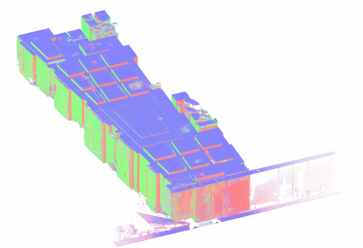
A large outdoor switchyard can generate millions or billions of measured points during a 3D laser scanning survey. These measurements may cover electrical equipment bays, steel gantries, foundations, busbar supports, cable infrastructure, and surrounding technical areas. However, individual scans are not immediately suitable for engineering work. They must be aligned, verified, organized, and prepared for the intended applications.
ScanM2 provides Point Cloud Processing Services for Open-Type Switchgears, transforming raw terrestrial laser scanning data into coordinated, structured datasets for outdoor high-voltage facilities. Our workflows include scan registration, coordinate alignment, noise filtering, quality assessment, and preparation of point clouds for CAD, BIM, and reconstruction projects.
The objective is to preserve the geometric information needed by engineers while making complex survey datasets more reliable, manageable, and compatible with downstream software.
Contact Us Now for a Free Consultation!
The Challenge of Processing Outdoor Switchyard Scans
Outdoor electrical switchyards differ significantly from enclosed buildings and conventional industrial facilities. Equipment is distributed across large areas, steel structures extend to different elevations, and numerous narrow components may be partially hidden behind other installations.
Scanning an individual equipment bay may require several measurement positions. Larger projects can involve multiple bays, structural rows, access roads, and technical zones captured during separate survey sessions.
These conditions create specific processing challenges. Individual scans must be combined into a consistent coordinate framework, overlapping measurements must be checked, and unwanted data must be separated from the physical structures relevant to the project.
Without systematic processing, the dataset may contain duplicated surfaces, registration inconsistencies, excessive noise, and large quantities of information that complicate engineering interpretation.
Registration Across Multiple Equipment Bays
Terrestrial laser scanners collect measurements from individual instrument positions. Each scan initially represents geometry within its own measurement reference frame unless external positioning information has been applied.
Scan registration establishes the spatial relationships between these positions, allowing measurements from different locations to be combined into a coordinated point cloud.
For an outdoor switchyard, registration may involve scans collected around equipment foundations, steel portals, transformer connections, and adjacent technical areas.
Depending on the source data and project requirements, registration can use suitable targets, surveyed control points, geometric overlap, or a combination of methods.
The resulting alignment must be verified rather than accepted solely because the processing software reports successful registration.
Maintaining Coordinate Consistency Across Large Sites
Coordinate consistency is particularly important when a switchyard survey extends across substantial distances or when the point cloud will be integrated with existing site plans and engineering models.
A local scan registration may produce an internally consistent dataset, but that does not automatically establish its position within the coordinate system used by the engineering project.
Where suitable survey control is available, the registered point cloud can be transformed into an agreed project coordinate framework.
Control information should be reviewed for consistency, and transformations should be documented so that subsequent CAD and BIM users can correctly interpret the data.
For projects involving multiple survey campaigns, a stable reference framework helps maintain consistency between datasets collected at different times.
Removing Noise Without Losing Important Geometry
Outdoor scanning data may contain unwanted measurements caused by environmental conditions, reflective surfaces, moving objects, and other factors.
Point cloud cleaning aims to reduce these artifacts while preserving the geometry needed for engineering applications.
Typical sources of unwanted data include:
- Moving vegetation near fences, foundations, and access roads.
- Temporary vehicles or equipment present during scanning.
- Atmospheric interference caused by rain, fog, or airborne particles.
- Measurement artifacts from reflective or difficult-to-scan surfaces.
- Isolated points unrelated to the surveyed installation.
- Unnecessary surrounding geometry outside the agreed project scope.
Filtering must be applied carefully. Aggressive cleaning can remove legitimate measurements of thin steel members, small fittings, cable supports, or other components important to the engineering task.
For this reason, processing parameters should reflect the geometry of the installation and the intended use of the final dataset.
Thin Conductors, Busbars and Insulators: Special Processing Considerations
Outdoor high-voltage installations contain components that are more difficult to represent in point clouds than large foundations or steel support structures.
Overhead conductors may produce sparse or discontinuous measurements because of their small diameter, distance from the scanner, surface properties, and environmental movement.
Insulators and complex equipment assemblies can also contain narrow surfaces, repeated geometric features, and partially concealed components.
Processing software may incorrectly classify some of these measurements as noise if generic filtering settings are applied without reviewing the source geometry.
Where these elements are important to the project, they should receive additional attention during cleaning and quality assessment.
Nevertheless, point cloud processing cannot recover surfaces that were never captured. It also cannot establish conductor sag, electrical clearances, or equipment performance without appropriate specialized measurements and engineering verification.
Separating Point Clouds into Functional Switchyard Zones
A single point cloud covering an entire outdoor switchyard may be difficult to navigate and unnecessarily demanding for engineering software.
Dividing the dataset into logical areas can make it easier to work with the relevant information while maintaining the agreed coordinate reference.
For example, the processed dataset may be organized into separate equipment bays, structural zones, foundation areas, or other project-defined sections.
This organization is especially useful when different engineering teams are responsible for separate parts of the reconstruction project.
| Dataset organization | Engineering purpose |
|---|---|
| Equipment bay datasets | Focused review of existing electrical apparatus and adjacent structures |
| Steel gantry zones | Structural geometry review and reconstruction modeling |
| Foundation areas | Equipment installation planning and civil documentation |
| Site infrastructure | Coordination of access areas, cable channels, and surrounding facilities |
| Full registered site cloud | Overall spatial reference and multidisciplinary coordination |
Separate datasets should retain consistent coordinates and sufficient context for their intended use. Dividing a project into zones must not introduce independent local alignments that make subsequent integration unreliable.
Point Density and Data Optimization
High-resolution scanning can produce very large files, but retaining every measured point is not always necessary for every engineering application.
Point cloud optimization may include controlled subsampling, cropping, indexing, and format conversion to improve software performance.
The appropriate point density depends on the size of the measured objects and the required geometric detail.
Large foundations and broad structural surfaces may remain interpretable at a lower density than small mounting components or narrow steel elements.
For this reason, a uniform reduction strategy is not always suitable for complex switchyard datasets. Where practical, different processing settings can be applied to areas with different engineering requirements.
Any optimized dataset should be checked to ensure that important geometric information has not been lost.
Quality Control: More Than a Registration Report
Registration statistics provide useful information, but a low reported alignment error does not guarantee that every part of a large switchyard has been captured or positioned correctly.
Quality control should consider the distribution of survey control, the geometry of overlapping scans, and the areas most important to the engineering project.
Depending on the agreed requirements, verification may include:
- Registration review: checking the alignment of overlapping scan positions.
- Control verification: evaluating consistency with available survey reference points.
- Geometric inspection: reviewing critical structures and equipment areas for duplicated or misaligned surfaces.
- Coverage assessment: identifying incomplete areas, occlusions, and inaccessible features.
- Filtering assessment: confirming that cleaning has not removed required geometry.
- Export validation: checking that the delivered files retain the intended coordinates and usable point cloud information.
Where critical dimensions are required for equipment installation or structural interfaces, additional field verification may be necessary. A processed point cloud should not be treated as a substitute for all specialized dimensional measurements.
Combining Data from Different Survey Campaigns
Outdoor switchyards are often reconstructed in stages. Measurements may be collected before equipment removal, during construction, or after installation of new components.
Combining datasets from separate survey campaigns can help document changes in the physical arrangement of the facility.
However, reliable comparison requires consistent coordinate references, suitable measurement quality, and an understanding of which equipment or structures changed between survey dates.
Where common reference points remain stable, separate datasets may be aligned and compared within an agreed coordinate framework.
Changes should be interpreted carefully. Apparent differences can result from registration uncertainty, incomplete coverage, different scanner positions, or environmental conditions rather than actual modifications.
Preparing Data for Revit and CAD Workflows
Processed point clouds are often used as a geometric reference for further engineering documentation.
For example, a coordinated dataset may support Scan to BIM Services for Open-Type Switchgears, where selected existing structures and equipment are reconstructed as digital model elements.
For modernization projects, the resulting models may then be incorporated into BIM Modeling Services for Open-Type Switchgears to coordinate existing and proposed geometry.
Point clouds can also support As-Built Drawings Services for Open-Type Switchgears, providing measured references for plans, elevations, sections, and equipment arrangement documentation.
Each workflow may require different file formats, coordinate settings, and data organization. These requirements should be established before the final processing and export stages.
Point Cloud File Formats and Deliverables
Deliverable formats depend on the source data, intended software, and project requirements. Common options include:
- E57: a widely supported exchange format for structured or unstructured 3D scan data.
- RCP and RCS: Autodesk point cloud project and indexed scan formats used in compatible Revit and AutoCAD workflows.
- LAS and LAZ: point cloud formats suitable for compatible spatial data applications.
- PTS and PTX: text-based point cloud exchange formats supported by selected processing and modeling tools.
- Project-specific exports: organized datasets prepared according to the agreed engineering workflow.
Where required, deliverables may also include registration summaries, coordinate reference information, dataset organization notes, and documentation of significant measurement limitations.
Why Processing Requirements Should Be Defined Early
Point cloud processing is most effective when the intended engineering application is understood before the dataset is finalized.
A project focused on general switchyard documentation may prioritize complete site coverage and consistent coordinates. An equipment replacement project may require additional attention to specific foundations, mounting positions, and nearby structural geometry.
These differences influence registration verification, filtering decisions, point density, dataset segmentation, and export settings.
Where new measurements are needed, 3D Laser Scanning Services for Open-Type Switchgears can provide the source survey data under the approved site access conditions.
For selected components requiring detailed geometric reconstruction, processed point clouds may also support Reverse Engineering Services for Open-Type Switchgears.
Request Point Cloud Processing for Your Switchyard
Reliable point cloud processing provides a practical foundation for using laser scanning data in switchyard reconstruction and technical documentation projects.
ScanM2 supports the preparation of coordinated 3D datasets for industrial and energy infrastructure, helping engineering teams work with complex survey information in compatible CAD and BIM environments.
Contact our team to discuss your source scan files, coordinate requirements, project software, processing scope, and expected deliverables.

