

Point Cloud Processing for Condensation Electric Power Plant
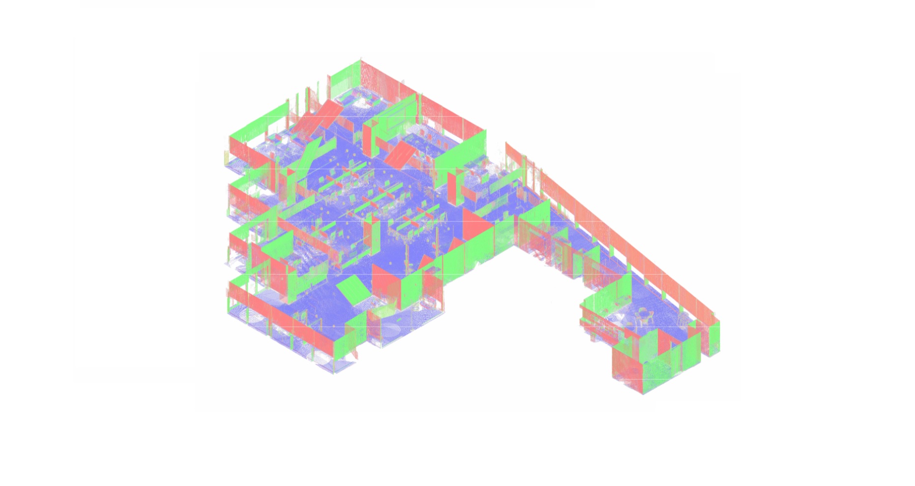
A 3D laser scanning survey of a condensing power plant can produce hundreds of individual scans and an extensive volume of spatial data. Turbine halls, condenser installations, boiler buildings, steam pipelines, and auxiliary systems are captured from multiple positions, but the raw measurements are not yet a coordinated engineering dataset.
ScanM2 provides Point Cloud Processing Services for Condensing Power Plants, transforming raw laser scanning measurements into registered, organized, and quality-checked point cloud datasets. The resulting data supports plant modernization, existing-condition verification, CAD documentation, BIM modeling, and engineering coordination.
Contact Us Now for a Free Consultation!
Why Raw Scan Data Is Not Ready for Engineering Use
Individual laser scans capture surfaces from different scanner positions. Each scan initially describes geometry relative to its own measurement location, and the dataset may contain overlapping observations, unwanted points, moving objects, or incomplete coverage.
In a condensing power plant, these challenges become more significant because of dense equipment arrangements, multi-level structures, long pipe corridors, and restricted technical spaces.
Before engineers can reliably use the measurements, the scans must be aligned, checked, organized, and prepared in formats suitable for the intended software environment.
From Individual Scans to a Coordinated Plant Dataset
Point cloud processing involves several technical operations. The exact sequence depends on the scanner, source data, survey control, and required deliverables.
| Processing operation | Purpose | Engineering result |
|---|---|---|
| Scan registration | Align measurements captured from different scanner positions | Consistent geometry across surveyed areas |
| Coordinate alignment | Relate scan data to an agreed reference system | Compatible spatial references for engineering work |
| Noise filtering | Identify and remove selected unwanted measurements | Cleaner representation of existing surfaces |
| Data segmentation | Organize relevant areas or technical systems | More manageable engineering datasets |
| Optimization | Reduce unnecessary data volume while preserving required detail | Improved handling in compatible software |
| Quality control | Evaluate registration consistency and processing limitations | Documented basis for downstream use |
Registration Across Turbine Halls and Boiler Buildings
Condensing power plants frequently contain large industrial spaces connected by technical galleries, piping corridors, and multiple floor levels. Scans collected in these areas must be registered within a consistent spatial framework.
Registration establishes the relative positions and orientations of individual scans. Depending on the survey method, this may involve common targets, overlapping geometry, survey control, or a combination of techniques.
For large facilities, particular attention is required where measurements extend through long corridors or connect separate buildings. Small alignment errors can accumulate if the registration network is not adequately constrained and verified.
Maintaining Consistent Coordinates Between Plant Areas
When turbine halls, boiler units, condenser areas, and auxiliary buildings are processed separately, their datasets may still need to be combined for engineering coordination.
Using an agreed coordinate reference allows different scan groups to be reviewed together. Where reliable survey control is available, it can support consistent positioning across the facility.
Processing Dense Equipment and Piping Geometry
Mechanical areas inside condensing power plants contain complex combinations of pipes, valves, equipment housings, cable supports, platforms, and structural members.
These environments create substantial geometric overlap. Multiple scans may capture the same surface from different directions, while other features remain partially hidden behind nearby installations.
Point cloud processing must preserve the detail required for engineering interpretation without introducing artificial geometry or removing relevant features.
For example, aggressive data reduction may make a large turbine hall easier to navigate but can also remove small connection details that are important for equipment replacement planning.
Noise Filtering Without Losing Critical Measurements
Industrial scanning environments may produce unwanted measurements associated with moving personnel, temporary objects, reflective surfaces, airborne particles, or other site conditions.
Filtering can improve the usability of the dataset, but it must be performed carefully. A narrow pipe, small support, or equipment connection should not be removed simply because it appears isolated within a local group of points.
The filtering strategy should reflect the intended use of the data. A dataset prepared for general building documentation may have different requirements from one used to assess mechanical interfaces around a turbine or condenser.
Large Point Clouds: Managing Data Volume and Performance
A comprehensive survey of a power generation facility can produce a dataset that is difficult to handle as a single file. Large point clouds may require substantial computing resources and can slow down engineering applications.
Instead of applying the same processing settings to the entire facility, data can be organized by generating unit, building, floor, or technical system.
Depending on the project, processing may include:
- Dividing large datasets into logical plant areas
- Creating separate files for turbine, condenser, and boiler zones
- Removing confirmed duplicate or irrelevant measurements
- Applying controlled point density reduction where appropriate
- Preparing compatible indexed datasets for downstream software
- Preserving higher detail around critical equipment interfaces
The objective is to make the data practical to use without compromising the geometric information required for the engineering task.
Point Cloud Quality Control for Power Plant Projects
A visually convincing point cloud does not automatically indicate reliable geometric accuracy. Registration quality, measurement coverage, coordinate consistency, and local alignment must be evaluated before the dataset is used for critical design decisions.
Quality control may include reviewing registration residuals, checking overlapping scan areas, comparing measurements with independent control information, and identifying sections with insufficient coverage.
The appropriate checks depend on the survey method and agreed accuracy requirements.
What Registration Statistics Do Not Tell You
A low registration residual alone does not prove that every dimension in a large power plant dataset is accurate. Local measurement quality, control network geometry, scanner performance, and site conditions also influence the final result.
For critical equipment interfaces, additional verification may be necessary even when the overall registration appears consistent.
Preparing Point Clouds for Turbine and Condenser Modernization
Equipment replacement projects often require detailed spatial information around specific machinery rather than a uniformly detailed dataset of the entire facility.
For a turbine-generator modernization, processing can prioritize the relevant foundation area, surrounding structures, equipment envelopes, and accessible connection locations.
For condenser replacement, the focus may shift to condenser housings, cooling-water piping, condensate systems, supports, and restricted installation spaces.
These focused datasets help engineering teams review existing conditions and provide source geometry for subsequent technical documentation.
Working with Scans Collected at Different Times
Modernization projects may use survey data collected during separate site visits or operational outages. In some cases, different plant areas are scanned months apart.
Combining such datasets requires attention to coordinate consistency, registration references, and physical changes that may have occurred between surveys.
Where equipment has been replaced or structures modified, the datasets should not be treated as a single representation of the same physical condition without reviewing those changes.
Clear organization of survey dates and source files helps downstream engineering teams understand which plant configuration the measurements represent.
Can Existing Point Cloud Data Be Reprocessed?
Yes. Existing laser scanning data may be suitable for re-registration, filtering, optimization, conversion, or preparation for a different engineering workflow.
Before reprocessing, the source files should be evaluated to determine which operations are possible. Raw scan projects generally provide more processing flexibility than heavily reduced or exported datasets.
Reprocessing cannot recover geometry that was never captured or reliably reconstruct concealed surfaces without additional information.
Point Cloud Formats for CAD and BIM Applications
Processed point clouds can be delivered in formats selected for the project’s software environment. Different applications support different file structures, coordinate information, color attributes, and indexing methods.
| Format | Typical application |
|---|---|
| E57 | Exchange of 3D scanning data between compatible software platforms |
| LAS / LAZ | Storage and exchange of point cloud coordinates and supported attributes |
| RCP / RCS | Point cloud workflows in compatible Autodesk applications |
| PTS / PTX | Text-based point cloud exchange in supported processing workflows |
| Native scan project files | Continued work in the original scanning or registration software |
Format availability depends on the original data, software compatibility, and contracted deliverables. Conversion should be checked to ensure that coordinates and required attributes are preserved.
From Processed Point Clouds to BIM and As-Built Drawings
A processed point cloud is an important engineering reference, but it is not the same as a structured BIM model or a finished technical drawing.
When engineers need organized building and equipment elements, the data can support Scan to BIM Services for Condensing Power Plants.
When the required output is a conventional plan, section, elevation, or equipment layout, processed scan data can provide the measured geometry for As-Built Drawings for Condensing Power Plants.
Both workflows depend on suitable measurement coverage and an understanding of the point cloud’s geometric limitations.
Our Point Cloud Processing Workflow
We adapt the processing sequence to the source measurements, size of the facility, and intended engineering use.
- Source data review. Examine available scan files, project metadata, coordinate information, and processing requirements.
- Registration and alignment. Combine compatible scans and establish the required coordinate framework.
- Data cleaning. Remove identified unwanted measurements while protecting relevant geometric details.
- Organization and optimization. Structure the dataset by relevant plant areas and prepare it for efficient downstream use.
- Quality verification. Review registration consistency, relevant coverage, and processing limitations.
- Export and handover. Prepare the agreed file formats and supporting processing information.
What Does the Client Receive?
The deliverable package is defined according to the project requirements and may include:
- Registered point cloud datasets of the agreed plant areas
- Cleaned and organized point cloud files
- Coordinate-aligned scan data where suitable references are available
- Optimized datasets for compatible CAD and BIM applications
- Separate point cloud packages for selected generating units or technical zones
- Agreed exchange formats and available native project files
- Relevant registration and quality-control information
When Point Cloud Processing Should Be Planned Separately
Point cloud processing is sometimes included within a complete laser scanning project. However, it can also be commissioned as a separate service when measurements have already been collected or when existing data must be prepared for a new engineering application.
Separate processing is particularly relevant when multiple survey contractors have supplied data, the original files require conversion, or a large dataset must be divided into manageable engineering work packages.
Where additional site measurements are necessary, our 3D Laser Scanning Services for Condensing Power Plants can provide new source data.
Reliable Point Cloud Data for Condensing Power Plant Engineering
Effective modernization depends on the quality of the geometric information used by engineering teams. Properly registered, cleaned, and organized point clouds help turn extensive laser scanning measurements into practical technical references.
ScanM2 processes 3D scanning data for complex industrial and energy facilities, preparing datasets for equipment coordination, reconstruction planning, as-built documentation, and digital modeling.

