

How 3D Laser Scanning Supports Construction Claims and Dispute Resolution
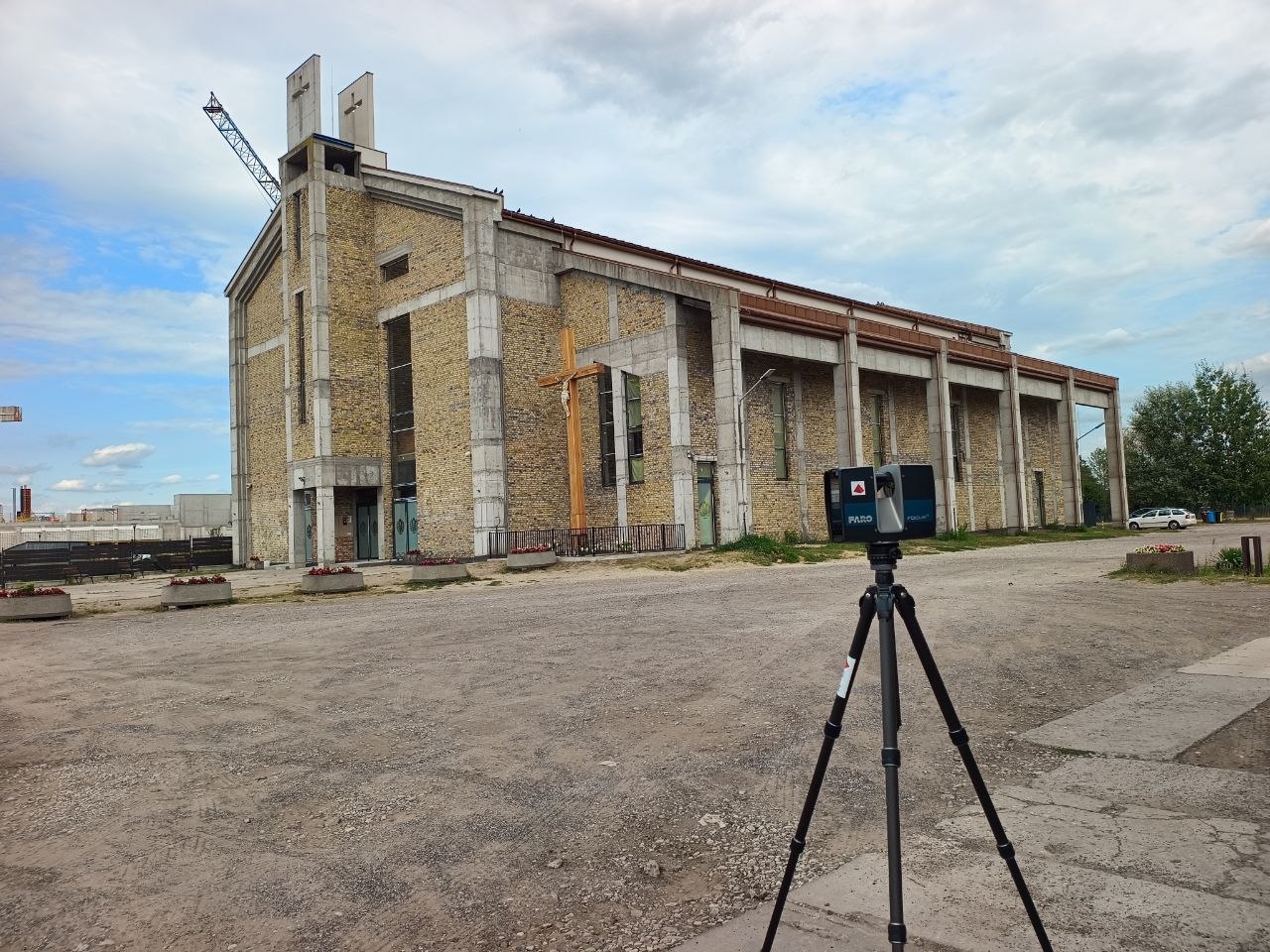

Construction claims and disputes often arise when project participants disagree about what was actually built, when specific work was completed, whether installed elements match the design, or what condition existed before construction or renovation began.
Traditional construction claims documentation usually relies on photographs, drawings, site reports, inspection records, and written notes. These sources remain important, but they may not provide enough geometric information to reconstruct site conditions after the work has progressed.
3D laser scanning provides another layer of documentation by capturing the measurable geometry of a construction site at a specific point in time. The resulting point cloud can be reviewed later, measured, compared with design documentation, and used to develop CAD drawings or BIM models.
For complex projects, this creates a detailed digital record that can support technical analysis when construction claims or disputes arise.
Why Accurate Documentation Matters in Construction Claims
Many construction disputes ultimately depend on establishing what conditions existed at a particular stage of the project.
Questions may include:
- Was an element installed in the correct location?
- Did the completed work correspond to the design documentation?
- What was the condition of the building before renovation?
- When did a particular deviation appear?
- What work had been completed by a specific date?
- Were clearances and dimensions consistent with project requirements?
- Was existing damage present before construction began?
If these questions arise months after the relevant work was completed, collecting reliable information can be difficult.
Elements may already be concealed behind finishes, equipment may have been installed, spaces may have changed, and subsequent construction activities may have altered the original conditions.
This is why accurate construction claim documentation should ideally be created while the relevant conditions are still accessible.
3D laser scanning allows those conditions to be captured spatially rather than relying exclusively on selected photographs and manual measurements.
Common Causes of Construction Disputes
Construction disputes can develop for many contractual, financial, scheduling, or technical reasons. Laser scanning is primarily useful when a disagreement involves the physical condition or geometry of the project.
Typical situations include:
- deviations from design documentation;
- dimensional discrepancies;
- incorrect positioning of structural elements;
- conflicts between architectural, structural, and MEP systems;
- questions regarding completed quantities or installed elements;
- existing-condition disagreements;
- damage discovered during renovation;
- differences between as-designed and as-built conditions;
- disagreements regarding construction progress.
In these situations, reliable construction dispute documentation can help engineers, contractors, owners, consultants, and other specialists understand the actual physical conditions of the project.
Laser scanning does not determine contractual responsibility or resolve a dispute by itself. Its role is to provide measurable technical information that can support further analysis.
How 3D Laser Scanning Creates an Objective Record of Site Conditions

A terrestrial laser scanner records large numbers of spatial measurements from the surfaces visible from each scanning position.
Multiple scans can then be registered into a common coordinate system, creating a three-dimensional point cloud of the captured area.
This is fundamentally different from relying only on conventional site photography.
A photograph records a selected view of the site. A point cloud records spatial coordinates that can later be inspected and measured.
Depending on the scanning conditions and project requirements, specialists can use the resulting dataset to examine:
- distances between elements;
- elevations;
- positions of walls and columns;
- floor and ceiling geometry;
- equipment locations;
- pipe and duct routes;
- openings;
- clearances;
- spatial relationships between different building components.
This makes reality capture particularly useful when construction claims evidence requires technical evaluation of physical conditions rather than only a visual record.
What Information Can Be Captured?
The information available from laser scanning depends on what was visible and accessible when the survey was performed.
For a building or construction site, captured geometry may include:
- walls and partitions;
- columns and beams;
- floor slabs;
- ceilings and roofs;
- doors and openings;
- stairs;
- façades;
- pipes and ducts;
- cable trays;
- mechanical equipment;
- structural connections;
- production equipment;
- other visible components.
The resulting point cloud preserves the spatial relationships between these elements.
This can become particularly valuable when the original condition no longer exists. If subsequent work changes the site, the previously captured point cloud still provides a digital record of the geometry visible at the time of scanning.
Using Point Clouds as Construction Documentation
A point cloud is one of the primary outputs generated from 3D laser scanning.
Individual scanning positions first need to be registered into a consistent coordinate system. The dataset can then undergo point cloud processing, including cleaning, organization, quality control, and preparation for further use.
Unlike a set of individual manual measurements, a point cloud contains extensive spatial information about the captured environment.
This means that measurements may be taken from the dataset after the field survey has been completed, provided the required surfaces were successfully captured and the data quality is sufficient for the intended task.
For construction site documentation, this provides an important advantage: specialists can revisit the digital dataset when a question arises later instead of relying solely on measurements that someone anticipated would be necessary during the original site visit.
Comparing As-Designed and As-Built Conditions

One of the most useful applications of 3D laser scanning in construction documentation is comparing the design intent with actual installed conditions.
The workflow can be represented as:
Design CAD/BIM → 3D Laser Scanning → Registered Point Cloud → Comparison → Deviation Analysis
The point cloud represents measured site conditions, while the design model or drawings represent the intended geometry.
By comparing the two datasets, specialists can identify potential differences in:
- element positions;
- elevations;
- dimensions;
- alignment;
- openings;
- structural geometry;
- MEP routing;
- equipment placement.
This approach is useful not only after a dispute has arisen. The same comparison can be performed during construction as part of quality control and as-built documentation, allowing discrepancies to be identified before subsequent work makes them more difficult or expensive to address.
Documenting Construction Progress Over Time
A single scan captures site conditions at one stage of a project. Repeated scanning creates a sequence of measurable records.
For example:
Initial Scan → Construction Stage → Progress Scan → Further Work → Final Scan
These datasets can help document how the physical project changed over time.
Repeated construction progress documentation may be useful for recording:
- completed installations;
- structural progress;
- MEP installation;
- equipment placement;
- changes between construction stages;
- conditions before work becomes concealed;
- final as-built geometry.
If questions later arise regarding when certain work was present or how the geometry changed between documented stages, the captured datasets can provide additional technical information for analysis.
The effectiveness of this approach depends on having scans from the relevant dates and sufficient coverage of the areas in question.
3D Laser Scanning for Existing Condition Claims
Existing conditions are especially important in renovation, retrofit, tenant improvement, and modernization projects.
Before construction begins, an existing building may already contain:
- cracks or visible damage;
- uneven surfaces;
- previous modifications;
- dimensional deviations;
- aging structural components;
- undocumented MEP installations;
- equipment and infrastructure installed by previous occupants.
If these conditions are not adequately documented before work starts, it can later become difficult to establish whether a particular condition existed beforehand or appeared during the project.
Pre-construction laser scanning creates a measurable record of visible existing geometry before major work begins.
The workflow may look like:
Existing Building → Pre-Construction Scan → Point Cloud → Construction / Renovation → Subsequent Survey
When appropriate datasets are available, conditions captured at different stages can then be compared.
For renovation projects, this is another reason why accurate existing building documentation can be valuable beyond the initial design phase.
Laser Scanning vs Traditional Site Documentation
3D laser scanning should not necessarily replace conventional photographs, reports, inspections, or written records. These methods capture different types of information and can complement one another.
| Traditional documentation | 3D laser scanning |
|---|---|
| Records selected views and observations | Captures extensive spatial geometry |
| Manual measurements are taken where anticipated | Additional measurements may be taken from captured geometry later |
| Photographs provide strong visual context | Point clouds preserve measurable spatial relationships |
| Coverage depends on selected photographs and measurements | Dense scanning can document large areas systematically |
| Well suited to notes, conditions and visual evidence | Well suited to geometry, dimensions and spatial comparison |
For important project milestones, combining photographs, written records, drawings, and reality capture can provide a more comprehensive record than relying on a single documentation method.
From Laser Scanning to CAD and BIM Documentation
Raw scan data is often only the beginning of the documentation process.
Depending on the purpose of the project, the workflow may continue through several stages:
Site Capture → Point Cloud Registration → Point Cloud Processing → CAD / BIM Documentation → Comparison and Technical Analysis
Processed point clouds can be used to create:
- floor plans;
- elevations;
- sections;
- as-built drawings;
- Revit models;
- BIM models;
- IFC models;
- other existing-condition documentation.
For some construction disputes, the point cloud itself may contain the required geometric information. In other situations, CAD drawings or BIM models can make the captured conditions easier to communicate and compare with project documentation.
The appropriate deliverable therefore depends on the technical question that needs to be answered.
When Should a Construction Site Be Scanned?
For documentation purposes, timing can be just as important as scanning accuracy.
Once an element has been covered, removed, modified, or replaced, its previous condition cannot necessarily be reconstructed from a later scan.
Laser scanning may therefore be useful:
- before construction begins;
- before renovation or demolition;
- before existing conditions are altered;
- before walls, ceilings, or other finishes conceal work;
- after installation of critical systems;
- at important construction milestones;
- when potential deviations are discovered;
- after completion of construction;
- before project handover.
For long or complex projects, scanning at several predefined milestones can create a more useful record than performing only a final as-built survey.
Benefits of 3D Laser Scanning for Construction Claims
When construction claims involve physical conditions, laser scanning can provide several practical advantages.
Measurable Site Records
Captured geometry can be measured and analyzed after fieldwork is complete.
Documentation of Existing Conditions
Pre-construction scanning can preserve information about visible conditions before renovation, demolition, or other modifications begin.
Design-to-As-Built Comparison
Point clouds can be compared with CAD drawings or BIM models to identify differences between intended and actual geometry.
Progress Documentation
Repeated surveys can create records of the project at different construction stages.
Extensive Spatial Context
Instead of recording only isolated measurements, laser scanning captures the relationships between many visible elements within the surveyed area.
Multiple Deliverable Options
The same reality-capture dataset can support point clouds, CAD documentation, BIM models, IFC models, and other project-specific outputs.
3D Laser Scanning and Construction Documentation at ScanM2
ScanM2 provides 3D laser scanning and digital documentation services for existing buildings, construction sites, industrial facilities, and other complex environments.
Depending on project requirements, the workflow can include field scanning, point cloud registration and processing, CAD drafting, Scan to BIM, BIM modeling, and preparation of as-built documentation.
Deliverables can be adapted to the intended use of the data and may include registered point clouds, drawings, BIM models, IFC files, and other technical documentation.
For projects where accurate records of existing or completed conditions are important, reality capture provides a measurable digital foundation that can be used by architects, engineers, contractors, owners, and technical consultants.
Conclusion
Construction disputes often become more difficult when reliable information about previous site conditions is unavailable.
3D laser scanning helps address this problem by creating a detailed spatial record of visible conditions at a specific stage of a project. The resulting point cloud can be measured, processed, compared with design documentation, and converted into CAD or BIM deliverables.
For construction claims documentation, the main value of laser scanning is not that it determines responsibility. It provides accurate technical data that can help qualified project participants evaluate what was physically present, how it was positioned, and how documented conditions changed over time.
When scanning is performed at the right project milestones, reality capture can also support construction progress documentation, as-built verification, existing-condition records, and more informed technical analysis.
FAQ
Can 3D laser scanning be used for construction claims?
Can measurements be taken from a point cloud after the site visit?
Can laser scans be compared with BIM models or CAD drawings?
When should a construction site be scanned?
Can laser scanning document construction progress?
Does 3D laser scanning replace site photography?
What deliverables can be produced from construction scanning?

How 3D Laser Scanning Measures Floor Flatness and Levelness
22.09.2026
Floor flatness and levelness can directly affect equipment installation, racking systems, automated material handling, production lines, flooring systems, and other construction activities that depend on ...

Point Cloud Cleaning Explained: How Scan Data Is Prepared for CAD and BIM
19.08.2026
3D laser scanning can capture millions or even billions of measurement points across an existing building, industrial facility, or construction site. However, the raw dataset ...

What Makes a Point Cloud Ready for BIM Modeling
08.06.2026
Many project teams assume that once a building has been scanned, the data is immediately ready for BIM modeling. In reality, the quality of the ...

What Architects Should Check Before Ordering a Scan-to-BIM Model
25.05.2026
Why Good Scan-to-BIM Projects Start Before Scanning Many architects approach Scan-to-BIM workflows expecting that laser scanning automatically produces a fully coordinated BIM model ready for ...

